
Dirt Bike Trails
Near Spring Valley, California
Explore All Dirt Bike Trails Near Spring Valley, California
Dirt Bike Trails Near Spring Valley, California
Discover the best dirt bike trails near you. Browse trail maps, check difficulty ratings, and find your next adventure — whether you're looking for a quick ride or an all-day expedition.
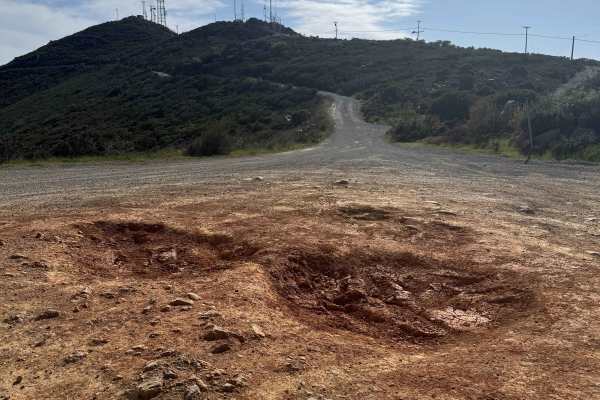
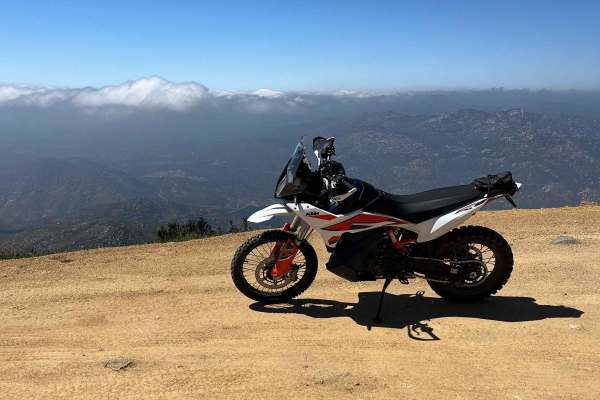
Otay Mountain Truck Trail West
This scenic route explores the western portion of the Otay Mountain Truck Trail, passing below Otay Mountain (3,501 feet) with sweeping views of the valleys and hills of Tijuana, Mexico. The drive follows mostly double-wide gravel roads with some single-lane sections around tight turns, many equippe...
Learn more about Otay Mountain Truck Trail West
Donohoe Loop-Mocogo Ranch Trail
Donohoe Loop-Mocogo Ranch Trail is an 8.2-mile point-to-point trail rated 4 of 10 located in San Diego County. The Donohoe Loop is located entirely within BLM-managed Open Space that can be utilized for OHV driving, camping, backpacking, horseback riding, and mountain biking. The loop can be accesse...
Learn more about Donohoe Loop-Mocogo Ranch Trail
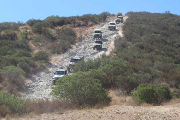
Otay Mountain Truck Trail
This route goes up and over Otay Mountain with sweeping views over the San Ysidro Mountains, and a little bit of San Diego in the distance. The road is made up entirely of dirt and gravel and stays relatively even throughout. This is a great trail on hazy/foggy days as it is well above the marine la...
Learn more about Otay Mountain Truck Trail
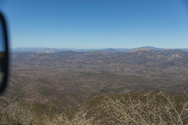
Otay Mountain Truck Trail (Upper Trail)
This is a well-maintained road that needs high clearance just for potholes and washouts. It has some beautiful views of the Otay mountains with a lot of little offshoots to explore, given you have the right vehicle and gear. You will see border patrol vehicles on this trail since you are so close to...
Learn more about Otay Mountain Truck Trail (Upper Trail)

Otay Mountain Truck Trail (Lower Trail)
This is a well-maintained road that needs high clearance just for potholes and washouts. It has some beautiful views of the Otay mountains with a lot of little offshoots to explore, given you have the right vehicle and gear. You will see border patrol vehicles on this trail since you are so close to...
Learn more about Otay Mountain Truck Trail (Lower Trail)
Tecate Peak
This is a pretty mellow 2-track road leading to the top of Tecate Peak. The lower part of the trail is a grave road. If there has been a lot of rain, expect ruts! There are some small rocks and chunky sections but nothing really difficult. There are some tight switchbacks to negotiate and you can ex...
Learn more about Tecate Peak
Peacemaker
Exciting challenge for intermediate off-roaders. The trail starts with a dirt path that takes you past desert shrubs and sparse trees, guiding you into the heart of the trail. As you progress, you'll encounter a series of minor rocky climbs that demand some flexing and careful tire placement, testin...
Learn more about Peacemaker
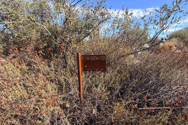
Diamond Back Loop
Winchester is one of the more technical and scenic routes in Corral Canyon. it has a mix of granite obstacles, tight switchbacks, and flexible climbs. The terrain varies between slickrock, decomposed granite, and loose sand
Mile 0.0 – Trailhead (Four Corners):
Access from the staging area; the ent...
Learn more about Diamond Back Loop
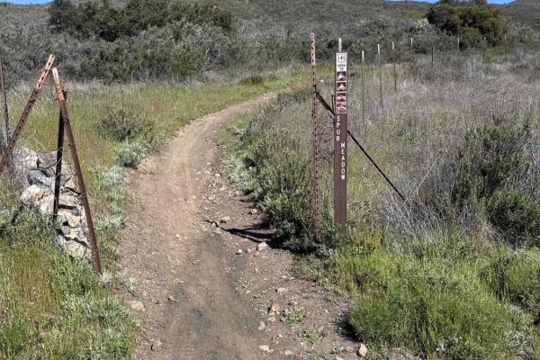
Spur Meadow
Spur Meadow is an out-and-back single-track trail. It features hard-packed dirt with rocks and a few tight switchback turns. Be mindful that this trail travels in both directions. There are a few rocky sections with multiple line options depending on your skill level. ATVs might have a harder time s...
Learn more about Spur Meadow
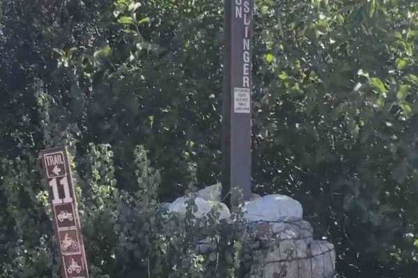
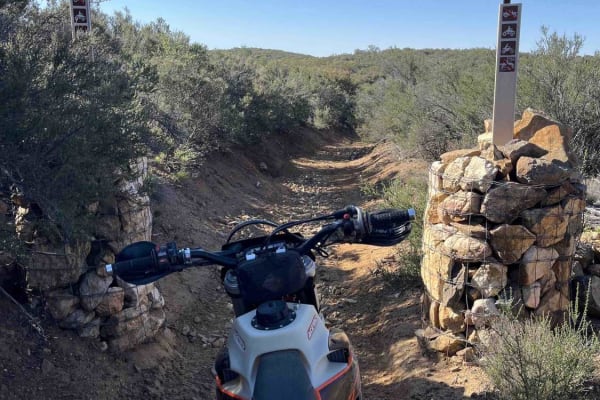
Gunslinger Trail #11
Gunslinger Trail #11 is a 1.8-mile point-to-point trail rated 3 of 10 located in the Corral Canyon OHV recreation area. Corral Canyon OHV is located roughly 30 miles east of San Diego and it offers trails for all types of offroad vehicles, including dirtbike single track, narrow ATV track, and full-...
Learn more about Gunslinger Trail #11
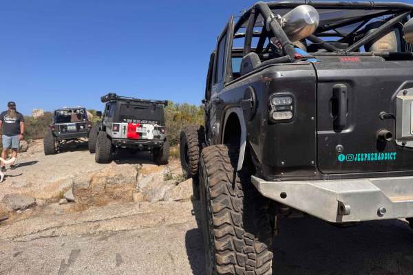
Corral Canyon Road
This is the main east-west connector inside the Corral Canyon OHV area and can be run in either direction. There are some gentle obstacles as this is a poorly maintained forest service road, and can be used to bypass the long way around Los Pinos Mountain Loop, especially the newly created waterfall...
Learn more about Corral Canyon Road
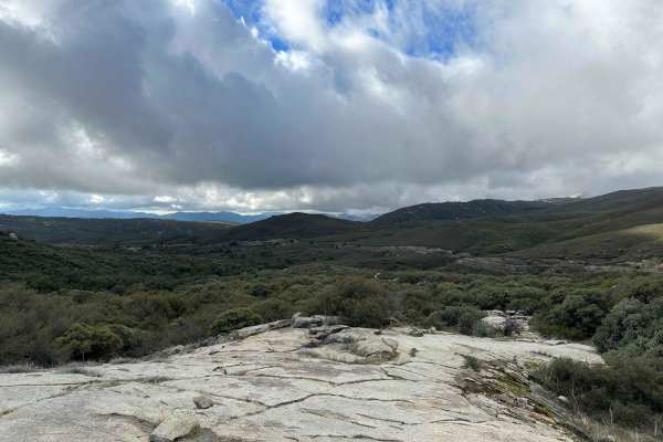
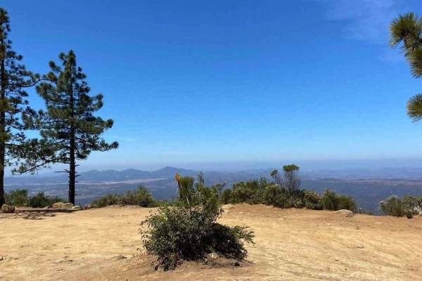
Los Pinos Mtn. Loop
Since our last visit in 2002, the first part of this loop-to the fire lookout tower-has been paved. ATVs are not allowed on this portion. The remainder of the loop is all dirt as it circles south around the outside of Corral Canyon OHV Area, which is open all year to green-sticker vehicles. Great vi...
Learn more about Los Pinos Mtn. Loop
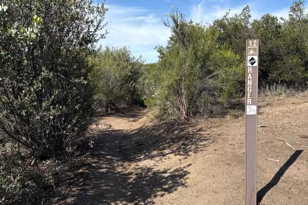
Ranger - Trail 12
Ranger Trail is rated as a black diamond and likely the hardest trail in the Corral Canyon OHV area. It features lots of rock slabs to navigate and climb, loose and often dusty exposure, and tight singletrack. The eastern portion of the trail is technically more demanding. Once you cross over the Br...
Learn more about Ranger - Trail 12
Wrangler Trail (901)
Wrangler Trail is part of the Corral Canyon OHV Area in the Laguna Mountains of San Diego County. Corral Canyon is one of the only remaining OHV areas in San Diego, which attracts offroaders of many different types. From technical 4x4 trails to singletrack, there is something for everyone at Corral ...
Learn more about Wrangler Trail (901)
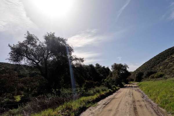
Orosco Ridge Truck Trail 12S02
This trail winds its way through the Cleveland Forest from Pamo Road to the Guejito Truck Trail. The trail is not very well maintained. It is very rutted. The trail takes you up and over some good hills in Pamo Valley. Parts of the trail are very scenic and beautiful.
Learn more about Orosco Ridge Truck Trail 12S02
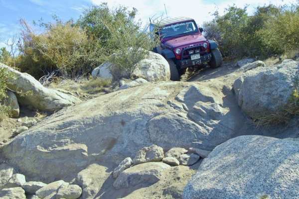
Bronco Peak
If you are exploring the Corral Canyon OHV Area, this is the main 4-wheel-drive trail. Most of the trails are specifically for ATVs and dirt bikes, but this one is open to 4X4 vehicles and is often combined with Sidewinder, Trail #90. Climb the trail to the top of Bronco Peak and follow the steep 80...
Learn more about Bronco Peak
Bear Valley Road
This out-and-back OHV trail is open to all types, from 4X4s down to dirt bikes. A small parking lot is at the beginning of the trail, right off the freeway. A displayed adventure pass is required. The trail itself offers a little bit of everything from rocky sections to ruts, puddle (water) crossing...
Learn more about Bear Valley Road
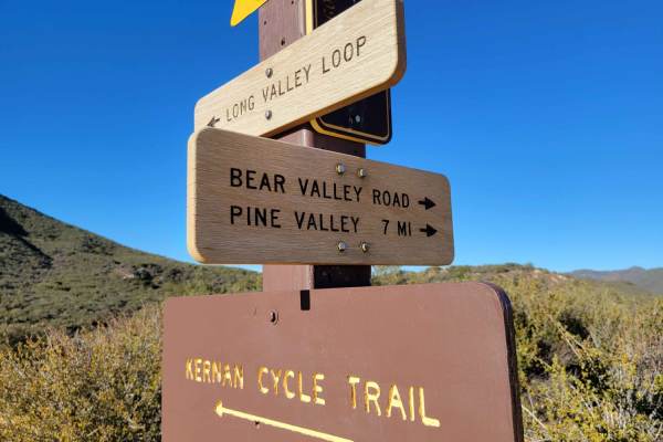
Kernan
This mostly single-track trail is hard-packed with some rock gardens and bigger boulders that you can ride around. Starting at the top from the eastern side off of Long Valley Road, the trail begins with some great flowy turns. You're treated to some great views of Lake Morena on your way down. The ...
Learn more about Kernan
11S04 Black Mountain
11S04 Black Mountain is a 10.8-mile out-and-back located in the Cleveland National Forest, Palomar Ranger District. This is a limited-use trail restricted to street-legal vehicles. The trail is rated 3 of 10 but has the potential to be worse during and right after seasonal weather and is subject to ...
Learn more about 11S04 Black Mountain
ATV trails near Spring Valley, California
Explore ATV-friendly trails near you. These trails are accessible for vehicles up to 50 inches wide, perfect for ATVs and smaller off-road machines.
Otay Mountain Truck Trail West
This scenic route explores the western portion of the Otay Mountain Truck Trail, passing below Otay Mountain (3,501 feet) with sweeping views of the valleys and hills of Tijuana, Mexico. The drive follows mostly double-wide gravel roads with some single-lane sections around tight turns, many equippe...
Learn more about Otay Mountain Truck Trail West
Donohoe Loop-Mocogo Ranch Trail
Donohoe Loop-Mocogo Ranch Trail is an 8.2-mile point-to-point trail rated 4 of 10 located in San Diego County. The Donohoe Loop is located entirely within BLM-managed Open Space that can be utilized for OHV driving, camping, backpacking, horseback riding, and mountain biking. The loop can be accesse...
Learn more about Donohoe Loop-Mocogo Ranch Trail
Otay Mountain Truck Trail
This route goes up and over Otay Mountain with sweeping views over the San Ysidro Mountains, and a little bit of San Diego in the distance. The road is made up entirely of dirt and gravel and stays relatively even throughout. This is a great trail on hazy/foggy days as it is well above the marine la...
Learn more about Otay Mountain Truck Trail
Tecate Peak
This is a pretty mellow 2-track road leading to the top of Tecate Peak. The lower part of the trail is a grave road. If there has been a lot of rain, expect ruts! There are some small rocks and chunky sections but nothing really difficult. There are some tight switchbacks to negotiate and you can ex...
Learn more about Tecate Peak
UTV/side-by-side trails near Spring Valley, California
Find UTV and side-by-side trails near you. These trails accommodate vehicles up to 60 inches wide, ideal for UTVs, side-by-sides, and wider off-road rigs.
Otay Mountain Truck Trail West
This scenic route explores the western portion of the Otay Mountain Truck Trail, passing below Otay Mountain (3,501 feet) with sweeping views of the valleys and hills of Tijuana, Mexico. The drive follows mostly double-wide gravel roads with some single-lane sections around tight turns, many equippe...
Learn more about Otay Mountain Truck Trail West
Donohoe Loop-Mocogo Ranch Trail
Donohoe Loop-Mocogo Ranch Trail is an 8.2-mile point-to-point trail rated 4 of 10 located in San Diego County. The Donohoe Loop is located entirely within BLM-managed Open Space that can be utilized for OHV driving, camping, backpacking, horseback riding, and mountain biking. The loop can be accesse...
Learn more about Donohoe Loop-Mocogo Ranch Trail
Otay Mountain Truck Trail
This route goes up and over Otay Mountain with sweeping views over the San Ysidro Mountains, and a little bit of San Diego in the distance. The road is made up entirely of dirt and gravel and stays relatively even throughout. This is a great trail on hazy/foggy days as it is well above the marine la...
Learn more about Otay Mountain Truck Trail
Tecate Peak
This is a pretty mellow 2-track road leading to the top of Tecate Peak. The lower part of the trail is a grave road. If there has been a lot of rain, expect ruts! There are some small rocks and chunky sections but nothing really difficult. There are some tight switchbacks to negotiate and you can ex...
Learn more about Tecate Peak
The onX Offroad Difference
onX Offroad combines trail photos, descriptions, difficulty ratings, width restrictions, seasonality, and more in a user-friendly interface. Available on all devices, with offline access and full compatibility with CarPlay and Android Auto. Discover what you're missing today!
Open Trail Map