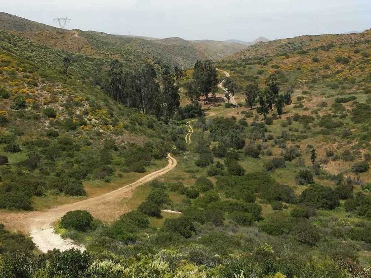
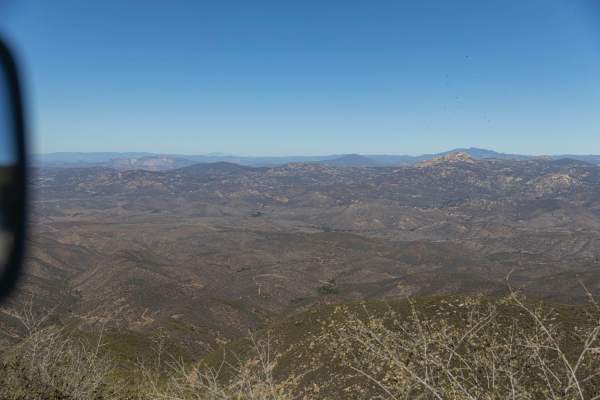
Donohoe Loop-Mocogo Ranch Trail

Total Miles 8.3
Technical Rating
4 Moderate
Best Time Spring, Summer, Winter, Fall
Trail Type Full-Width Road
Accessible By
Open Trail Map

Trail Overview

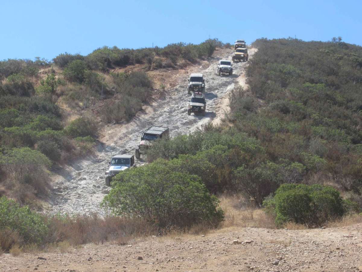
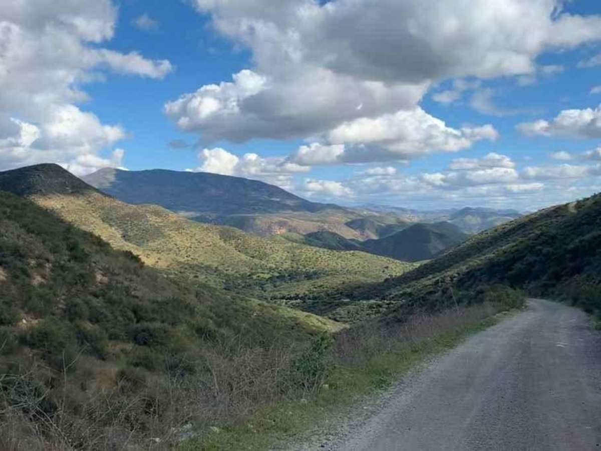
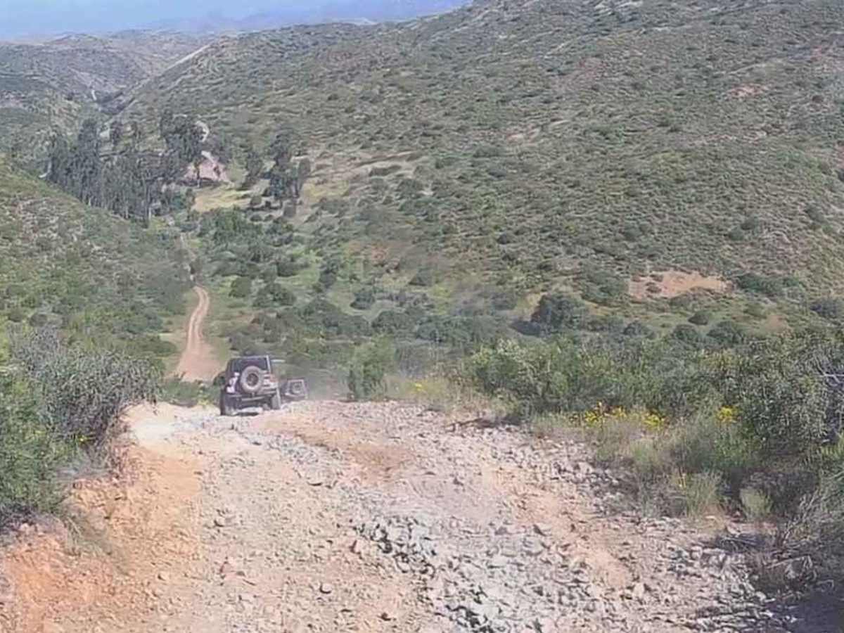
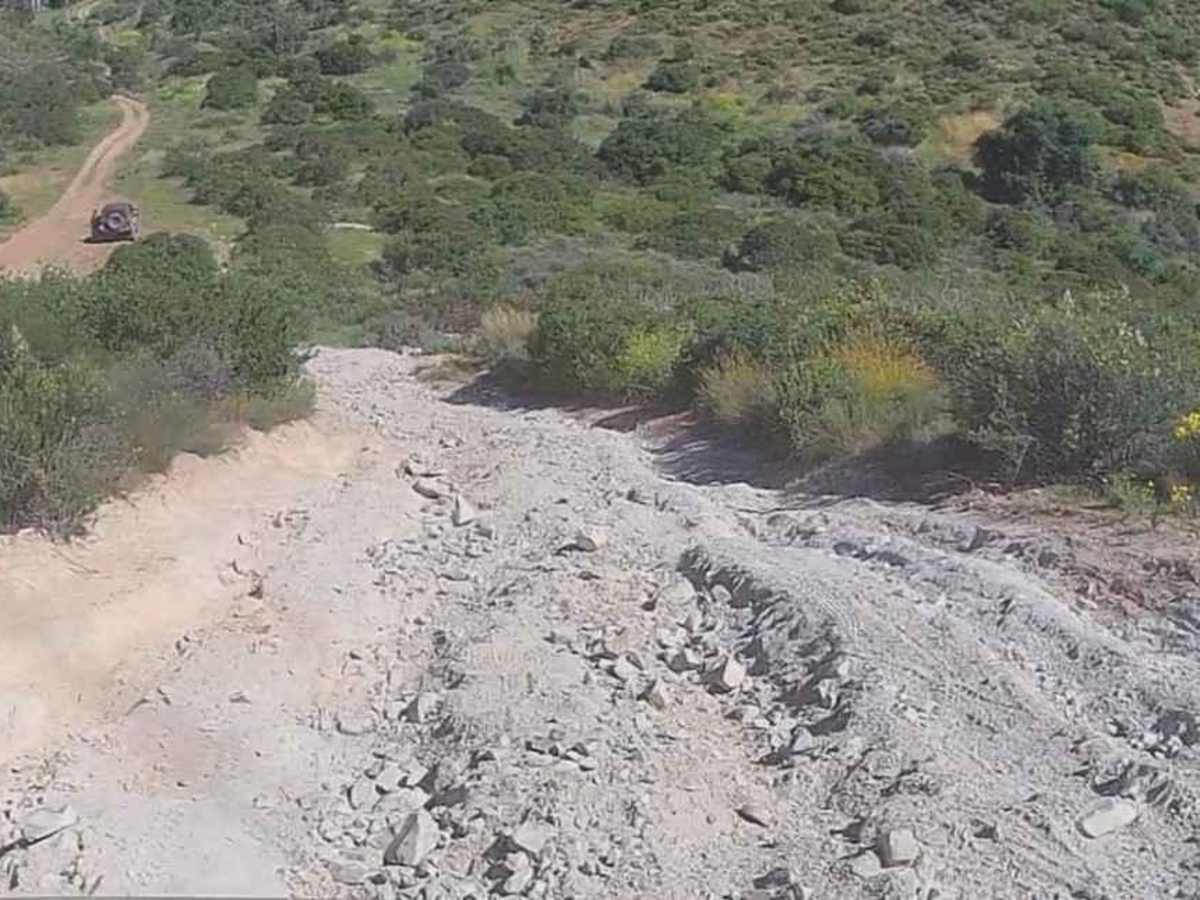
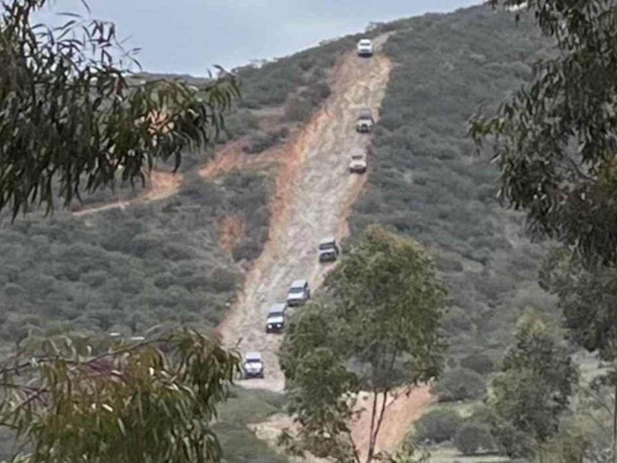
Donohoe Loop-Mocogo Ranch Trail is an 8.2-mile point-to-point trail rated 4 of 10 located in San Diego County. The Donohoe Loop is located entirely within BLM-managed Open Space that can be utilized for OHV driving, camping, backpacking, horseback riding, and mountain biking. The loop can be accessed from the Otay Mountain Truck Trail or Marion Road. This scenic loop is best run in late spring when the wildflowers are in bloom, but it is accessible year-round. The trail includes three major features;"The Steep", the rock garden, and the Mocogo Ranch House. There is a long steep rocky drop that is known by locals by several names: "The Steep", "Mocogo Slide", or "Mocogo Waterfall." The slide is a relatively straight trail that drops about 300 feet in roughly 1,000 horizontal feet. It has multiple cross-cut washouts that can pull a vehicle sideways if the driver is not careful. The Rock Garden is a 1,000-foot-long rocky trail, with rocks up to 18-20 inches in size. The ruins of the Mocogo Ranch House are located at the intersection of the loop. Rancho Mocogo is located in Sycamore Canyon about a half mile west of Donohoe Mountain. The stone cabin was built in 1928. The cabin burned in a fire and the property is now part of the open space maintained by the Bureau of Land Management. Cell phone service is intermittent. The nearest services are located to the west in the suburbs of San Diego.

Photos of Donohoe Loop-Mocogo Ranch Trail

Difficulty

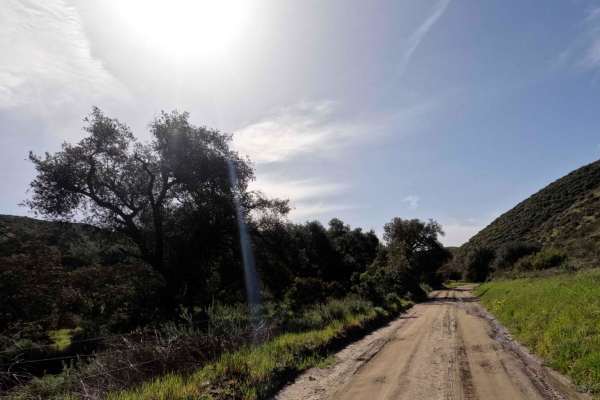
The rail consists of loose rock, dirt, and sand with some slickrock surfaces. There is some erosion, washes, gulches, and rock steps no higher than 18 inches. Tall tires (33+ inches) and limited slip are a plus. 4WD is required. Enhanced suspension travel and good ground clearance are helpful. Good driving skills are a plus.

Technical Rating

4

Status Reports

Add Status Report
Erik Santillan
Dec 07, 2025
Open
Aiden Ross
Nov 30, 2025
Open
Doug Varley
Nov 29, 2025
Open
When I pulled up the gate was locked to vehicles. The pedestrian gate was open for hiking and carts. People were also parked on the road when I was leaving around 10am.
brandon russell
Nov 29, 2025
Open
Trail was fine and doable in my 2023 Tacoma trd offroad 4x4, but be forewarned, when entering via where the San Diego rod and gun club is, there is a pretty gnarly downhill rock garden. My Tacoma has 265/75/16 BFG K03’s and it made it, but I tagged a rock pretty good and it bent the second part of my skid plate pretty bad. Going to take it off tomorrow and try to bend it back into shape. I was pretty sketched out about underside damage. Would 100% recommend 33” tires or more for this section.
Paul V.
Jul 26, 2025
Open
josh d
Jul 13, 2025
Open
Only 4-5 section is the hill. Its steep enough its hard to walk down and covered in silt. The rock garden after the old stone house like a 3-4. My buddy wifes did it in a 2wd prerunner 4runner with a locker and 35s. So all the good stuff is withing a 1/2 mile at the otay truck trail side. You can enter off 94 hole in fence 120ft east of gate. Rest of the actual loop is just fire road
JB Cope
Jul 06, 2025
Open
Edward Solomon
Jun 10, 2025
Open
Matthew saacks
May 27, 2025
Open
Jim Mack
May 25, 2025
Open
Great trail. The slide was waaaay more than we were expecting. Made it down on the alternative route but attempted to take same route back up but got stuck at the switch back. Was in a stock Sasquatch Bronco but I’m not super experienced so likely user error. Ended up having to back down and find another route out. For those who get in the same pickle, we looked on google maps and found a way back to the ruck trail by heading north after the rock garden (which was a breeze compared to the steep). Anyway, if you’re looking for a chill Sunday ramble with your kids, just know that this IS mostly it. Until either a) you hit the steep or b) you fully know what you’re doing.
Nick C
May 10, 2025
Open
Most of the trail was recently bulldozed and smoothed out. The loop part of Donohoe loop was VERY overgrown, you will get pin stripping on a Tacoma. I went through with a new Tundra….lol. There are a couple areas that will need 4WD as a must. The straight section of Donohoe loop trail has a section that a full size truck can’t fit through, you can see where I turned around. Fun trail overall.
Jayden Rivera
May 04, 2025
Open
Trail is open but you have to enter through Marron Valley Rd to access as the other entrance is closed. Definitely recommend 10+ inches of clearance minimum especially if you are attempting “Suicide Hill”. Saw a Jeep get stuck up there. Lockers are nice to have but probably not required, only used them on a flat part of the trail with rough tall rocks.
Mike Memmel
Apr 12, 2025
Open
The trail was great. The “steep” seems intimidating on the way down, but I didn’t have any problems crawling back out. The rest of the trail was more of a beautiful drive with a rocky flat section.
Cameron Hillis
Apr 05, 2025
Open
Lots of reports of almost tipping over the trail is in dire need of maintenance. Don’t recommend with minimum of 37s and spotters
Anthony Apacible
Apr 02, 2025
Open

Donohoe Loop-Mocogo Ranch Trail Trail can be accessed by the following ride types:

  • Single Track
  • 50 Inch
  • 60 Inch
  • High Clearance
  • Full Width

Donohoe Loop-Mocogo Ranch Trail Map

The onX Offroad Difference

onX Offroad combines trail photos, descriptions, difficulty ratings, width restrictions, seasonality, and more in a user-friendly interface. Available on all devices, with offline access and full compatibility with CarPlay and Android Auto. Discover what you're missing today!

Open Trail Map