
Dirt Bike Trails
Near Snowville, Utah
Explore All Dirt Bike Trails Near Snowville, Utah
Dirt Bike Trails Near Snowville, Utah
Discover the best dirt bike trails near you. Browse trail maps, check difficulty ratings, and find your next adventure — whether you're looking for a quick ride or an all-day expedition.
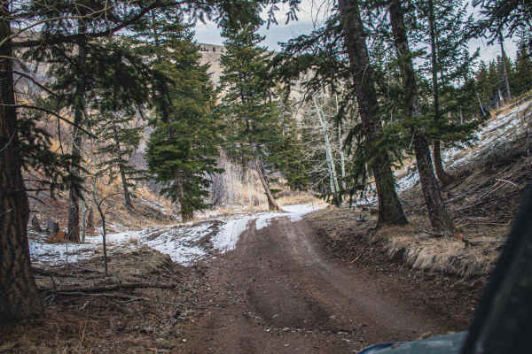
Black Pine Canyon
This road is just beautiful. You can see incredible views from the desert, high mountains, thick forests, and open valleys. As for difficulty, this road can be done by pretty much any AWD or 4WD, although there are some steep inclines to be aware of if the road is wet or icy.
Learn more about Black Pine Canyon
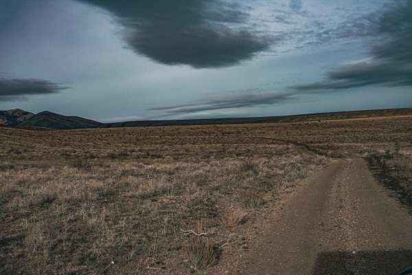
East Dry Pole Canyon
Although short, this road is not short of great views. Enjoy the mountains in the distance and wide-open views as you twist and turn around the canyon road. This road is very easy and can be done by any AWD or 4WD vehicle, even 2WD in dry seasons;high clearance is not needed. The road can become mud...
Learn more about East Dry Pole Canyon
Formation Canyon
This route splits off of Black Pine Canyon. It is a decent climb to start out if running north to south, then after that it just winds through the cedar trees and you will likely see flowers and wildlife if there in the springtime. It then meets back up with Black Pine Canyon at the southernmost poi...
Learn more about Formation Canyon

Wildcat Hills
The Wildcat Hills loop is an ideal route for novice offroaders and families looking for an approachable yet scenic desert ride in western Box Elder County, Utah. Spanning approximately 15 miles, this loop features rolling dirt trails with gentle elevation changes ranging from 4,414 to nearly 4,900 f...
Learn more about Wildcat Hills

Black Pine Spring
This route follows War Eagle, then branches off to the south. It goes down a little bit of an incline, and then follows a spring through the valley and eventually meets back up with Black Pine Canyon Trail. There are a couple of "water crossings" throughout the trail, but it's just crossing the very...
Learn more about Black Pine Spring
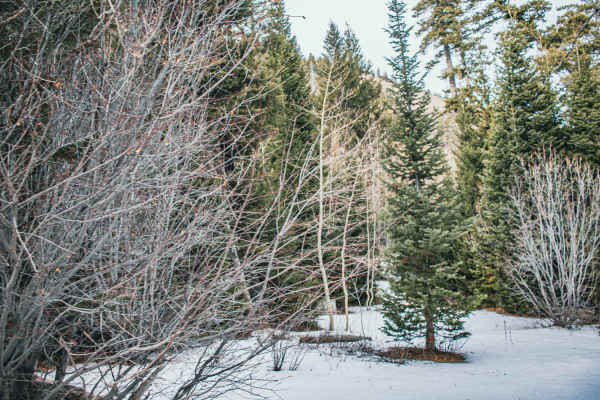
Pole Canyon Road
Pole Canyon Road is an easy, beginner-friendly dirt route in southern Idaho near the Black Pine Mountains, ideal for high-clearance all-wheel-drive or four-wheel-drive vehicles, SxSs, and dirt bikes looking for a scenic drive. The trail begins near Interstate 84 in Juniper Valley, starting along 900...
Learn more about Pole Canyon Road
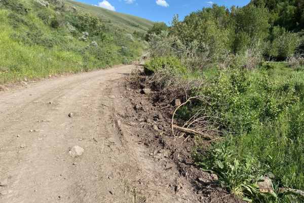
Indian Springs
From the frontage road, you head up into the Sawtooth National Forest on a well-maintained gravel road. The road will become narrower and a little more washed out, but it is still very passable with a 4x4. In the spring, water can run down the road as a small stream and overflow from the banks. The ...
Learn more about Indian Springs
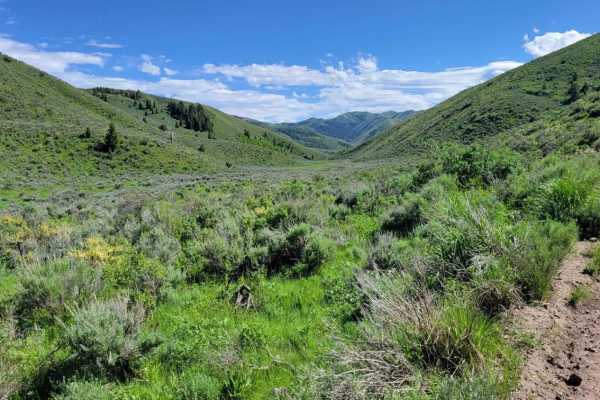
Heglar Canyon
This section of trail connects to a handful of other trails in the area. The northern half is more mountainous terrain as it winds its way up/down. There are mud ruts, erosion spots, and rocky patches here and there. Caution in the early seasons. The southern half is a wide-open, easy dirt road that...
Learn more about Heglar Canyon
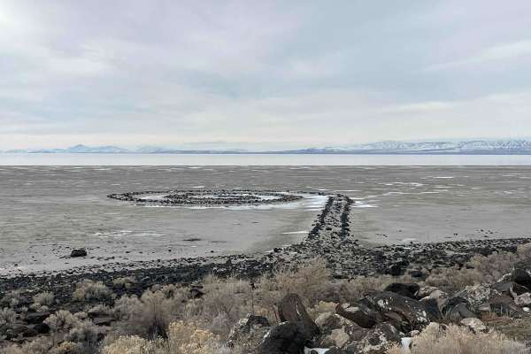
Spiral Jetty Lookout
Take this route from the Golden Spike Auto Tour Trail, and it will lead you to the Spiral Jetty. Not much of a challenge, but a great afternoon cruise with some great views of the surrounding mountains and the Great Salt Lake. There is a visitor center on the way, but this is a remote trail. Cell Se...
Learn more about Spiral Jetty Lookout
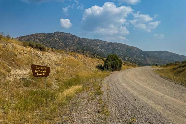
Two-Mile Canyon
Nestled near Malad, Idaho, this scenic pass offers a smooth and enjoyable drive from Malad to Weston and vice versa. The trail is a well-maintained dirt road, making it accessible to most vehicles, including those with less rugged capabilities. Along the journey, intermittent phone service is availa...
Learn more about Two-Mile Canyon
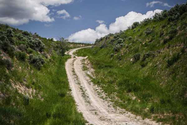
Maple Hollow
This short ATV trail starts as a steep road-width trail off of Old Highway 191 near Malad, Idaho. The entrance is unmarked and across from a small dirt pull-off on the side of the paved road that can be used as a staging area. The trail is very dusty with some washed-out sections and ruts, but still...
Learn more about Maple Hollow
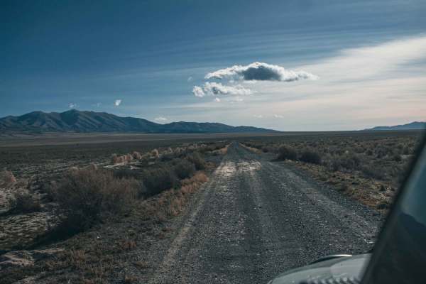
Railroad Grade
Looking for a good bypass instead of taking the freeway? Well, this road is for you! Wake yourself up with a short drive through farmland, enjoy open views of the valley, and pass through cow gates and cow pies. The road can be very muddy when wet; some small sections have overgrown bush.
Learn more about Railroad Grade
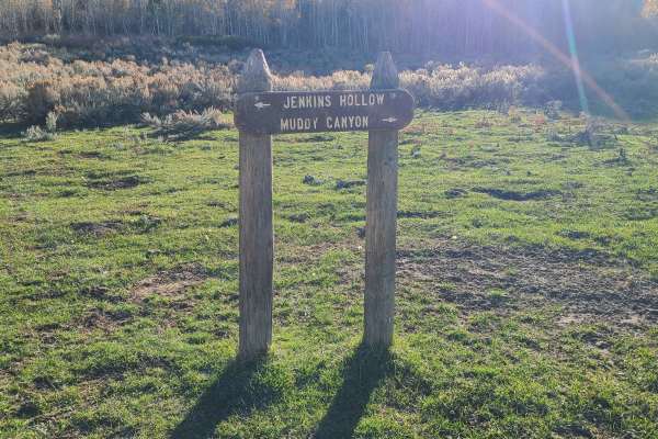
Jenkin's Hollow
Jenkin's Hollow is a fun 50" ATV trail in the Malad range just west of Weston, ID. You can access the trail on the north from Dry Canyon campground. On the south side, you can access from Black Canyon Road. This trail connects Black Canyon to Dry Canyon.
Even though the map shows this as a road for...
Learn more about Jenkin's Hollow
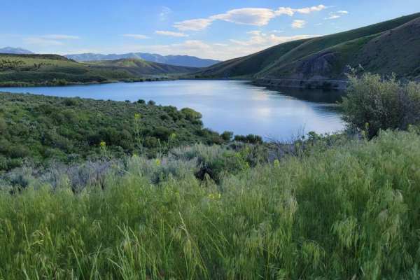
Sublett
This easy dirt road starts at Sublett Reservoir, taking you around the Northern section of the lake, and leads to Sublett Campground. Other trails continue past that point. Beautiful views overlooking the reservoir. There are primitive camp spots along the shore of the reservoir, as well as towards ...
Learn more about Sublett
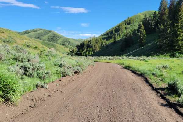
Lake Fork
If you're looking for an easy, scenic drive through the Sawtooth National Forest, then this trail is for you. As you drive through the little valley, beautiful views of the hills and ridges surround you. Time to complete depends if you take any of the connecting trails from off this one or simply go...
Learn more about Lake Fork

East Hogup Road
This road runs down the eastern side of the Hogup Mountain Range. This is a well-maintained gravel road passable by most vehicles. It provides access to BLM, State, and private land in the area. This is a very remote area, with no gas or other services nearby, so be sure to come prepared with fuel a...
Learn more about East Hogup Road
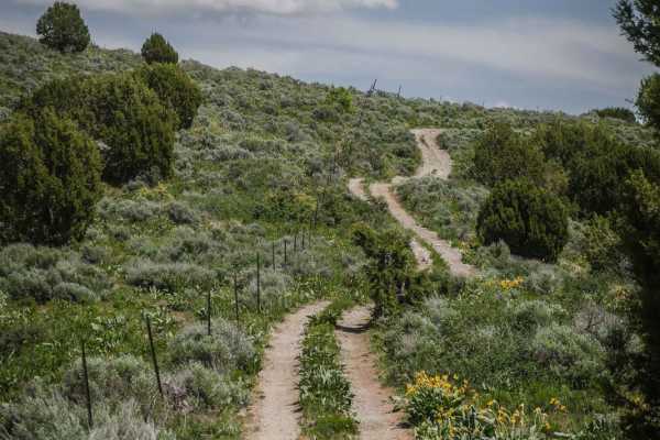
Trail Hollow to Maple Hollow
This ATV trail starts at a cattle gate at the intersection with Deep Creek/White Canyon. Depart from the gate to the left, and follow the two-track through the grassy rolling hills of the Caribou National Forest. The trail has some loose small rocks but is mostly smooth dirt. There are some small ea...
Learn more about Trail Hollow to Maple Hollow
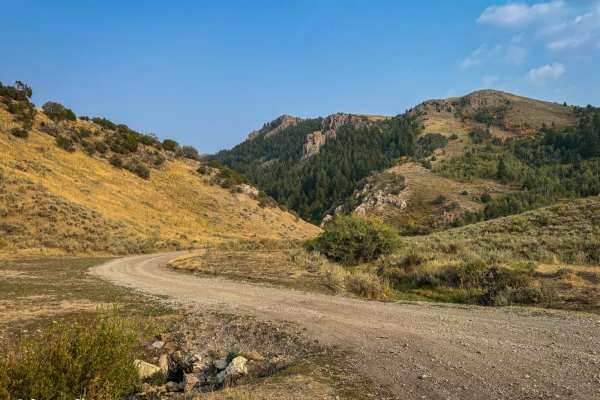
Sky Line
This 9-mile trail, winding along the ridge of the Bannock Mountain Range within the Caribou National Forest, offers an enjoyable drive. Starting near Malad and finishing near Weston (or vice versa), the route features mostly easy-to-navigate dirt roads. Although occasional minor ruts may appear, a s...
Learn more about Sky Line
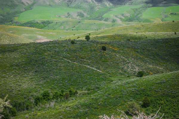
Trail Hollow (Malad)
This is a short ATV trail in the Caribou National Forest that can be explored in combination with several other easy ATV trails near Malad, Idaho. The trail is two-track width and flows over several rolling green wide open hills overlooking the rural town of Malad. It's absolutely full of stunning w...
Learn more about Trail Hollow (Malad)
Deep Creek/White Canyon
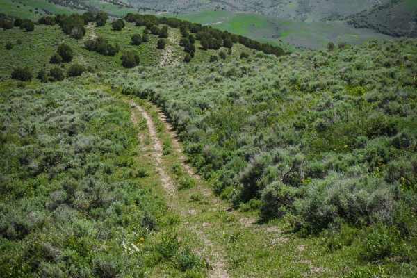
This is an easy ATV trail in the Caribou National Forest near Malad, Idaho. The south end of the trail connects to the Trail Hollow to Maple Hollow ATV trail, and it crosses Maple Hollow about halfway through. The north end of the trail is fainter and starts to peter out before it ends at private pr...
Learn more about Deep Creek/White Canyon
ATV trails near Snowville, Utah
Explore ATV-friendly trails near you. These trails are accessible for vehicles up to 50 inches wide, perfect for ATVs and smaller off-road machines.
Black Pine Canyon
This road is just beautiful. You can see incredible views from the desert, high mountains, thick forests, and open valleys. As for difficulty, this road can be done by pretty much any AWD or 4WD, although there are some steep inclines to be aware of if the road is wet or icy.
Learn more about Black Pine Canyon
East Dry Pole Canyon
Although short, this road is not short of great views. Enjoy the mountains in the distance and wide-open views as you twist and turn around the canyon road. This road is very easy and can be done by any AWD or 4WD vehicle, even 2WD in dry seasons;high clearance is not needed. The road can become mud...
Learn more about East Dry Pole Canyon
Formation Canyon
This route splits off of Black Pine Canyon. It is a decent climb to start out if running north to south, then after that it just winds through the cedar trees and you will likely see flowers and wildlife if there in the springtime. It then meets back up with Black Pine Canyon at the southernmost poi...
Learn more about Formation Canyon
Wildcat Hills
The Wildcat Hills loop is an ideal route for novice offroaders and families looking for an approachable yet scenic desert ride in western Box Elder County, Utah. Spanning approximately 15 miles, this loop features rolling dirt trails with gentle elevation changes ranging from 4,414 to nearly 4,900 f...
Learn more about Wildcat Hills
UTV/side-by-side trails near Snowville, Utah
Find UTV and side-by-side trails near you. These trails accommodate vehicles up to 60 inches wide, ideal for UTVs, side-by-sides, and wider off-road rigs.
Black Pine Canyon
This road is just beautiful. You can see incredible views from the desert, high mountains, thick forests, and open valleys. As for difficulty, this road can be done by pretty much any AWD or 4WD, although there are some steep inclines to be aware of if the road is wet or icy.
Learn more about Black Pine Canyon
East Dry Pole Canyon
Although short, this road is not short of great views. Enjoy the mountains in the distance and wide-open views as you twist and turn around the canyon road. This road is very easy and can be done by any AWD or 4WD vehicle, even 2WD in dry seasons;high clearance is not needed. The road can become mud...
Learn more about East Dry Pole Canyon
Formation Canyon
This route splits off of Black Pine Canyon. It is a decent climb to start out if running north to south, then after that it just winds through the cedar trees and you will likely see flowers and wildlife if there in the springtime. It then meets back up with Black Pine Canyon at the southernmost poi...
Learn more about Formation Canyon
Wildcat Hills
The Wildcat Hills loop is an ideal route for novice offroaders and families looking for an approachable yet scenic desert ride in western Box Elder County, Utah. Spanning approximately 15 miles, this loop features rolling dirt trails with gentle elevation changes ranging from 4,414 to nearly 4,900 f...
Learn more about Wildcat Hills
The onX Offroad Difference
onX Offroad combines trail photos, descriptions, difficulty ratings, width restrictions, seasonality, and more in a user-friendly interface. Available on all devices, with offline access and full compatibility with CarPlay and Android Auto. Discover what you're missing today!
Open Trail Map