
Dirt Bike Trails
Near Rye, Colorado
Explore All Dirt Bike Trails Near Rye, Colorado
Dirt Bike Trails Near Rye, Colorado
Discover the best dirt bike trails near you. Browse trail maps, check difficulty ratings, and find your next adventure — whether you're looking for a quick ride or an all-day expedition.
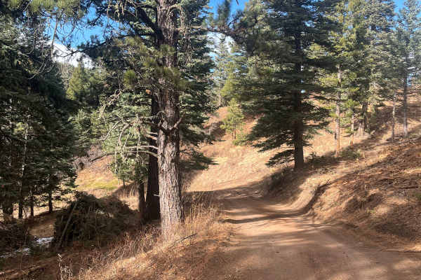
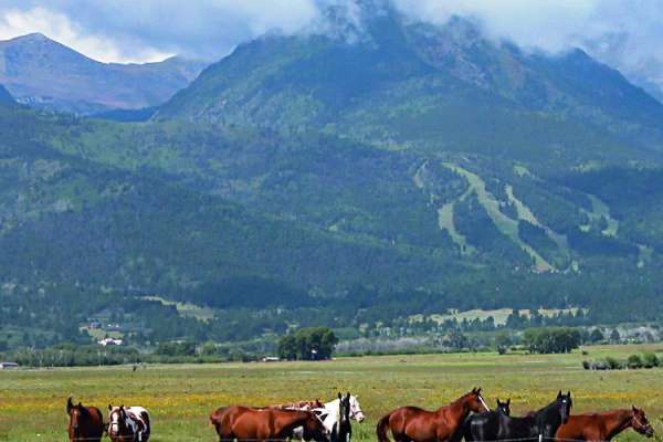
San Carlos Road
This trail is a short, easy out-and-back route that winds through the small elevation changes of the Wet Mountain foothills and offers a good chance of isolation. It contains no major obstacles or water crossings, making it approachable for most users. Ongoing timber work in 2025 has cleared underbr...
Learn more about San Carlos Road
Meade Road
Easy-to-moderate, out-and-back dirt road located outside the town of Beulah, Colorado. The trail is off Colorado Route 78 and winds through scenic forest terrain within the San Isabel National Forest. The route is generally suitable for most offroad vehicles and provides access to dispersed recreati...
Learn more about Meade Road
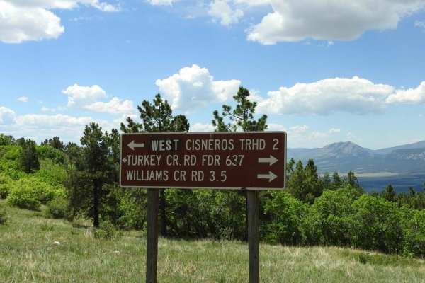
Turkey Creek Forest Road 637
This is an easy winding road that has a few rocky spots that are easy to get around. The road takes you through open meadows and then through forest areas. It has nice views across the Wet Mountain Valley and of the Sangre de Cristo mountain range. During the summer months, there are a lot of cows g...
Learn more about Turkey Creek Forest Road 637
Salt Creek Forest Road 409
At this point, the road changes from an east road to more of a 4x4 road. It becomes steeper, narrower, and more rocky at the beginning. As you get higher up, it levels out some and is less rocky. You will travel through forested areas and some open areas. Towards the top, you will get into a firewoo...
Learn more about Salt Creek Forest Road 409
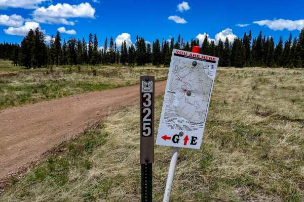
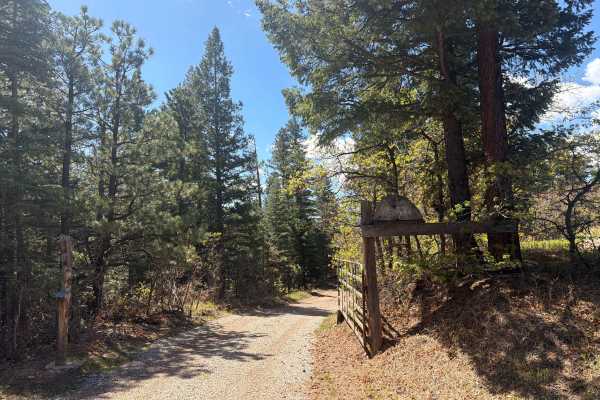
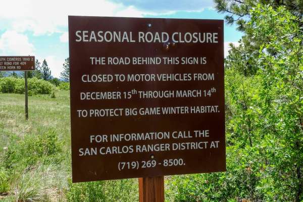
Meadow Divide Road- FSR 325
This is an easy trail that takes you through areas of meadows at the top and bottom with forested areas in the middle. There are spots where there is some logging operation in progress. At the lower meadows in the summer, you will run into cattle grazing. There is a seasonal closure from December 15...
Learn more about Meadow Divide Road- FSR 325
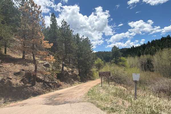
Davenport Campground Gulch Road
Easy dirt road located near San Isabel National Forest off Colorado Highway 165 near the historic Bishop Castle area. Davenport Campground Gulch Road travels through dense forest, open mountain meadows, and peaceful backcountry terrain, providing access to the historic Davenport Campground and sever...
Learn more about Davenport Campground Gulch Road
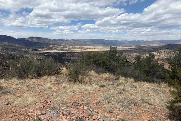
Roundtop Mountain Road - 321
This is a USFS road in the San Carlos Ranger District. The road is accessed off of CO-165 via Ditch Creek Rd. The road is an out-and-back trail that offers access to multiple dispersed camping sites and great views. Snow drifts can last long into spring and be very deep, making passage difficult.
Learn more about Roundtop Mountain Road - 321
Old La Veta Pass
This trail is an old train route that connected the east and west sides of the Sangre de Cristo mountains until the 1960s when the highway was put in. It is now an unmaintained road with no obstacles. There are several spots where you will traverse over the old paved road that has become little more...
Learn more about Old La Veta Pass

Second Newlins SO. Road
This road gets rocky in places, requiring 4WD. At the National Forest boundary, there is a sign that calls the road Willow Creek Road 274. Once you get on top of the ridge, the road is fairly easy. You will pass through areas of aspens, pines, and open meadows.
Learn more about Second Newlins SO. Road
Music Pass Road
This out-and-back trail features moderate elevation gain and travels through a remote area that remains conveniently close to town. The route winds through groves of aspens and old-growth pines, offering scenic forest views. Recently graded, it includes numerous water breaks that may cause undercarr...
Learn more about Music Pass Road
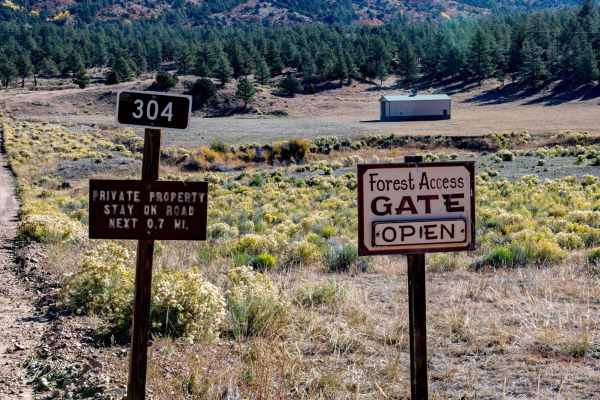
Bear Gulch Road FR 304
The first mile runs through private property. At the 2 mile mark, the road starts climbing and gets more rocky and will require four-wheel drive. The first marked camping spot is large enough for a RV trailer up to 20 feet, or the area could be used for staging.
Learn more about Bear Gulch Road FR 304
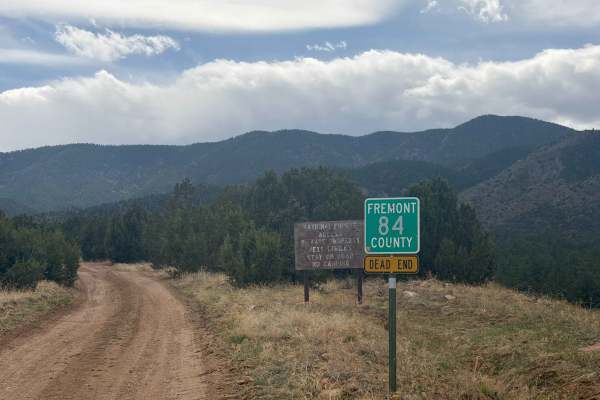
Fremont County 84
Easy access road (FS 84) reached via County Road 84 outside Florence, CO. The route primarily crosses private property before entering the San Isabel National Forest. At the end, there’s a small turnaround loop with limited parking (one vehicle), and camping is not permitted. This road serves as a c...
Learn more about Fremont County 84

East Bear Trail
East Bear Trailhead is the beginning point. It is shared trail with hiking, motorcycles, bikes, and horses. Spring to fall is a decent time to be on the trail, as the area doesn't get a lot of snow and stays warmer. Making the way through the tight single-track trail, it has loose rocks, flowy secti...
Learn more about East Bear Trail
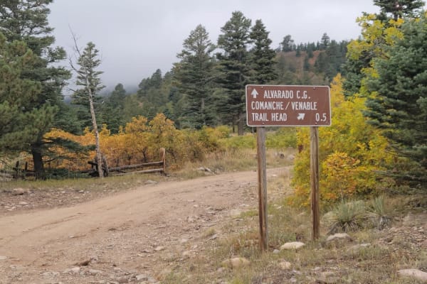
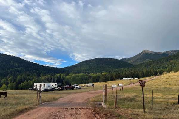
Alvarado Road - CR 140
Located just outside the town of Westcliffe, Colorado, this overland-style trail offers spectacular views of the Sangre de Cristo Mountain Range. Alvarado Road- CR 140 is a maintained, dirt and rock trail that offers access to numerous Hiking, Equestrian, and ATV trails including the Rainbow, Comanc...
Learn more about Alvarado Road - CR 140
Hermit Pass
This is a long, slow ascent full of switchbacks and beautiful views once you get above the timberline. The Middle Taylor Creek Campground is a great place to camp, and there are some fantastic fishing lakes in the area. Hike to a waterfall from the campground, and bring your camera. ATVs and dirtbik...
Learn more about Hermit Pass
BLM 6181
Easy-to-moderate trail located near Cañon City, CO, off Temple Canyon Road, offering a mix of off-camber sections, rocky obstacles, and tight stretches without bypasses that can challenge less experienced drivers. The trail winds through rugged terrain and rewards you at the end with panoramic, brea...
Learn more about BLM 6181
BLM 6182
Easy-to-moderate dirt trail located off Temple Canyon Road just outside Cañon City. This narrow route winds through tight trees, making it better suited for smaller vehicles rather than full-size rigs. Along the way, it offers a scenic overlook of Temple Canyon with Grape Creek flowing below, and pr...
Learn more about BLM 6182

Penrose Commons (BLM #1602)
Penrose Commons OHV Trail# 6102 is the main trail that connects other trails in the area. Enjoy panoramic views including the Sangre De Cristo Mountain Range. The trail traverses through Pinon and Juniper Trees as well as the occasional deer sighting. There are a couple of steep ledges up to 12"-18"...
Learn more about Penrose Commons (BLM #1602)

Penrose Commons BLM#6102A
Penrose Commons OHV Trail# 6102A is the trail that overlooks a narrow valley where the famous Patriot trails traverse (Independence Trail, Patriot Trail, and Liberty Trail). Although this trail connects the well-known extreme 4x4 trail, 6102A is a moderate trail consisting of mostly rocks and surrou...
Learn more about Penrose Commons BLM#6102A
Liberty
Part of the legendary Independence Off-Road Trail System, Liberty Trail is the longest and also the easiest, but it still provides a technical rock-crawling challenge. Expect scattered rock gardens leading to larger and more challenging obstacles littered throughout the canyon floor. Similar to the ...
Learn more about Liberty
ATV trails near Rye, Colorado
Explore ATV-friendly trails near you. These trails are accessible for vehicles up to 50 inches wide, perfect for ATVs and smaller off-road machines.
San Carlos Road
This trail is a short, easy out-and-back route that winds through the small elevation changes of the Wet Mountain foothills and offers a good chance of isolation. It contains no major obstacles or water crossings, making it approachable for most users. Ongoing timber work in 2025 has cleared underbr...
Learn more about San Carlos Road
Meade Road
Easy-to-moderate, out-and-back dirt road located outside the town of Beulah, Colorado. The trail is off Colorado Route 78 and winds through scenic forest terrain within the San Isabel National Forest. The route is generally suitable for most offroad vehicles and provides access to dispersed recreati...
Learn more about Meade Road
Turkey Creek Forest Road 637
This is an easy winding road that has a few rocky spots that are easy to get around. The road takes you through open meadows and then through forest areas. It has nice views across the Wet Mountain Valley and of the Sangre de Cristo mountain range. During the summer months, there are a lot of cows g...
Learn more about Turkey Creek Forest Road 637
Salt Creek Forest Road 409
At this point, the road changes from an east road to more of a 4x4 road. It becomes steeper, narrower, and more rocky at the beginning. As you get higher up, it levels out some and is less rocky. You will travel through forested areas and some open areas. Towards the top, you will get into a firewoo...
Learn more about Salt Creek Forest Road 409
UTV/side-by-side trails near Rye, Colorado
Find UTV and side-by-side trails near you. These trails accommodate vehicles up to 60 inches wide, ideal for UTVs, side-by-sides, and wider off-road rigs.
San Carlos Road
This trail is a short, easy out-and-back route that winds through the small elevation changes of the Wet Mountain foothills and offers a good chance of isolation. It contains no major obstacles or water crossings, making it approachable for most users. Ongoing timber work in 2025 has cleared underbr...
Learn more about San Carlos Road
Meade Road
Easy-to-moderate, out-and-back dirt road located outside the town of Beulah, Colorado. The trail is off Colorado Route 78 and winds through scenic forest terrain within the San Isabel National Forest. The route is generally suitable for most offroad vehicles and provides access to dispersed recreati...
Learn more about Meade Road
Turkey Creek Forest Road 637
This is an easy winding road that has a few rocky spots that are easy to get around. The road takes you through open meadows and then through forest areas. It has nice views across the Wet Mountain Valley and of the Sangre de Cristo mountain range. During the summer months, there are a lot of cows g...
Learn more about Turkey Creek Forest Road 637
Salt Creek Forest Road 409
At this point, the road changes from an east road to more of a 4x4 road. It becomes steeper, narrower, and more rocky at the beginning. As you get higher up, it levels out some and is less rocky. You will travel through forested areas and some open areas. Towards the top, you will get into a firewoo...
Learn more about Salt Creek Forest Road 409
The onX Offroad Difference
onX Offroad combines trail photos, descriptions, difficulty ratings, width restrictions, seasonality, and more in a user-friendly interface. Available on all devices, with offline access and full compatibility with CarPlay and Android Auto. Discover what you're missing today!
Open Trail Map