
Dirt Bike Trails
Near Rubidoux, California
Explore All Dirt Bike Trails Near Rubidoux, California
Dirt Bike Trails Near Rubidoux, California
Discover the best dirt bike trails near you. Browse trail maps, check difficulty ratings, and find your next adventure — whether you're looking for a quick ride or an all-day expedition.
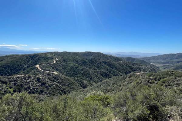
Lower Lytle Creek Divide - 3N31
The easiest way to start this trail is off the 15 Freeway and Glen Helen Parkway Road to Lower Lytle Creek Divide - 3N31. There are a couple of residences on the right-hand side of the road just before the trail begins, so please be mindful of this when airing down/airing up. The trail begins shortl...
Learn more about Lower Lytle Creek Divide - 3N31
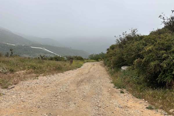
Dusty Spur
This is a fantastic little offshoot that clings to the mountainside, offering a scenic mix of dense tree coverage and a great water crossing. The trail treats you to a cool, shaded environment as it winds across the slope, with a few sections of loose rocks to keep you honest. It eventually brings y...
Learn more about Dusty Spur
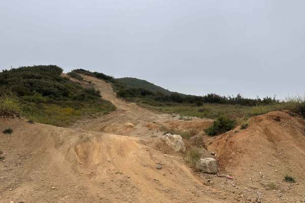
Tumbleweed Run
This is a super fun ridge trail that throws a little bit of everything at you, combining awesome views with some seriously technical riding. It’s got a solid mix of deep ruts and rough whoops that’ll definitely keep your attention and work your suspension. Just keep your head on a swivel regarding h...
Learn more about Tumbleweed Run

Marshall Peak Summit
This offshoot from Cloudland Truck Trail takes you right up to Marshall Peak, and the views from the top are absolutely epic. The main access is just a straightforward, easy-riding dirt road, making it an awesome spot for anyone to head up and soak in the scenery. But if you’re looking to spice thin...
Learn more about Marshall Peak Summit

Split Rock Trek
This one is a total blast if you're looking to test your skills—it’s scenic, technical, and definitely on the rough side. It packs a solid punch with some steep climbs and big, loose rocks that’ll keep you on your toes the whole time. Luckily, you get some killer tree coverage to keep things cool wh...
Learn more about Split Rock Trek
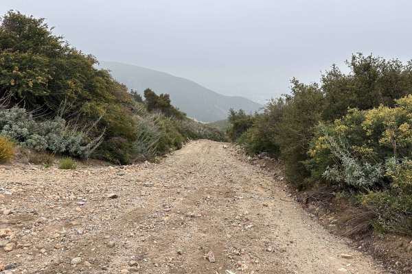
Wagon Track Trail
This is a cool, wide-open trail that gives you plenty of breathing room and some killer views to match. It runs pretty close to some utility piping, but don't let that fool you—it’s still a rad little spot to poke around and explore. The wide tracks make it super easy to cruise, so you can kick back...
Learn more about Wagon Track Trail

Old Cc Spur - 2N57
This is a 1.4-mile, well-maintained, easy gravel spur road that connects Lytle Creek Road and Lower Lytle Creek Divide - 3N31. This spur road is a convenient way to access Lower Lytle Creek Divide - 3N31, which is an 8.5-mile fun, scenic ridgeline trail above Lytle Creek.
Learn more about Old Cc Spur - 2N57
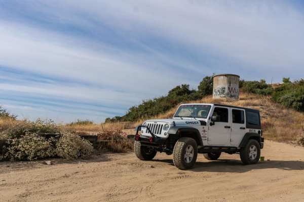
2N40 Cloudland Truck Trail
2N40 Cloudland is a short but beautiful trail with great views of San Bernardino and the mountains beyond. It is doable in 2WD during dry conditions, but 4WD may be required when wet. Closures can occur during winter months for safety reasons. This is a great starter trail with plenty of changing te...
Learn more about 2N40 Cloudland Truck Trail
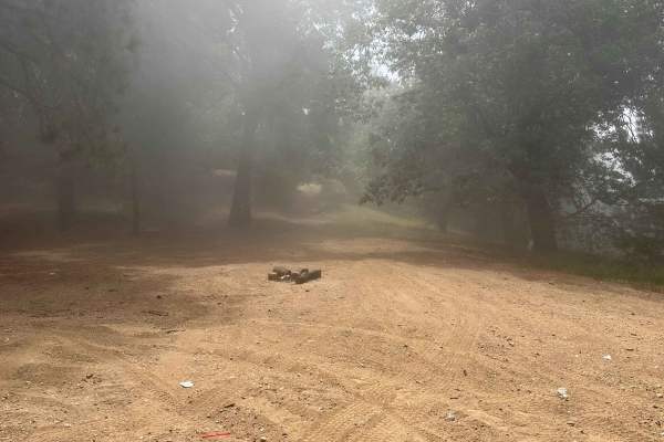
Copper Canyon Trail
This spot has an awesome lookout with killer views up top, but the real fun starts if you decide to push past the ledge. The trail keeps dropping down the mountain, throwing some seriously technical sections at you along the way. It’s definitely a test of nerve, and you’ve got to have the guts to ke...
Learn more about Copper Canyon Trail
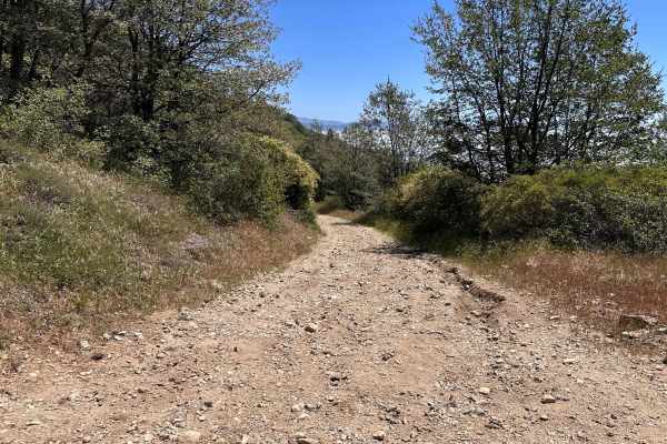
Windcarved Ridge
This is a great, straightforward dirt road that treats you to some amazing tree coverage and a rad forest vibe. It acts as a perfect, scenic shortcut right into the Crestline area, making it the go-to route if you need to quickly jump into town for gas, food, or supplies. The path is wide and clear,...
Learn more about Windcarved Ridge
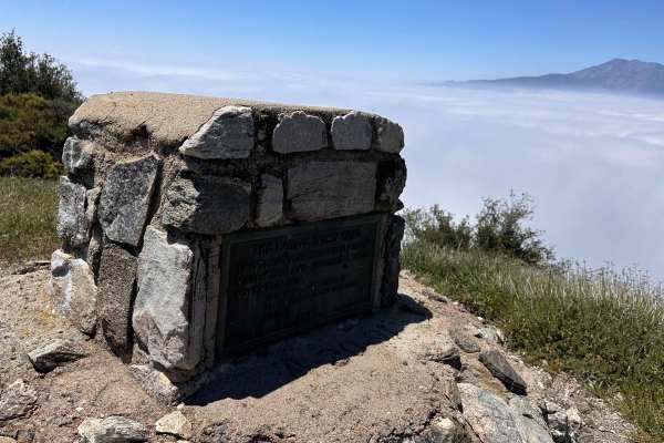
Mohave Indian Trail
This is a really cool historic spot to check out, featuring an awesome monument right at the top of the lookout. Getting onto the trail is super easy, though you will have to tackle a bit of a climb to reach the summit. It’s the perfect destination if you want to stretch your legs, check out a piece...
Learn more about Mohave Indian Trail

Alder Creek Road - FSR 1n16
Starting in Highland, 1n16 is a fairly easy dirt road with some parts rutted out, but any 4x4 can make it through the trail easily. Many parts of the trail are single-vehicle wide, but there are plenty of places to pass along the way. Coming from Highland, the trail ends on 1n16, giving you the choi...
Learn more about Alder Creek Road - FSR 1n16
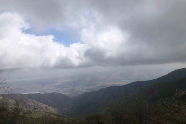
FS 4S03
Scenic trail from the 15 Freeway to Santiago Peak. The dirt road is hard-packed and easy to navigate, but does have a few sections with sharp rocks and a few ruts. The road has multiple stop locations for great views towards Riverside. This area is also popular with dirt bikes and hikers.
Learn more about FS 4S03
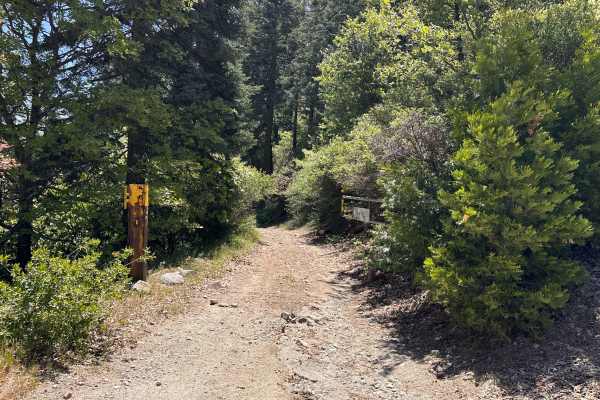
TLD Chainsaw
This is a beautiful, scenic route that offers a great contrast in views, looking out over Silverwood Lake on one side and the vast high desert on the other. The trail has a fun, natural flow and takes you through some nicely wooded areas that provide plenty of cool shade—a welcome break from the sun...
Learn more about TLD Chainsaw
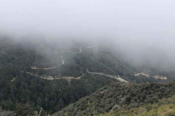
Maple Spring Road
Maple Springs road offers a fun, relatively easy route with scenic views of the Cleveland National Forest. Vehicles should have some ground clearance. At the end of the trail is an elevated patch of asphalt that appears to be a helicopter pad. The trail is shared with dirt bikes, hikers and riders o...
Learn more about Maple Spring Road
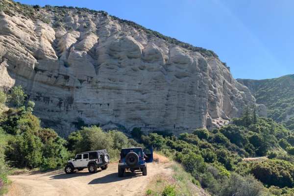
1N09 City Creek Trail
A long overland trail with plenty of recreational activities such as site-specific shooting areas, yellow post campsites and creek crossings. This is a well-maintained dirt road with some minor ruts, rocks and shallow creek crossings. It makes for a great day in the mountains South of Big Bear near ...
Learn more about 1N09 City Creek Trail
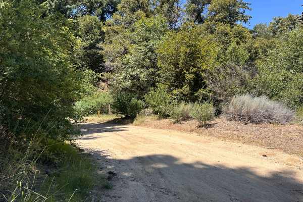
Firebreak Trail
This is a really cool, heavily wooded trail that runs right through the Crestline area, delivering some of the most amazing trees and forest scenery around. The thick canopy keeps the ride nice and shaded, while the breaks in the timber open up to some truly killer views of the surrounding mountains...
Learn more about Firebreak Trail

Shale Ridge
This is a super fun dirt road that winds right through the trees, giving you a killer mix of shaded forest riding and some awesome, peeking views of Silverwood Lake down below. It’s a great, scenic cruise, but you definitely want to keep your eyes on the dirt—there are some deep ruts cut into the ro...
Learn more about Shale Ridge
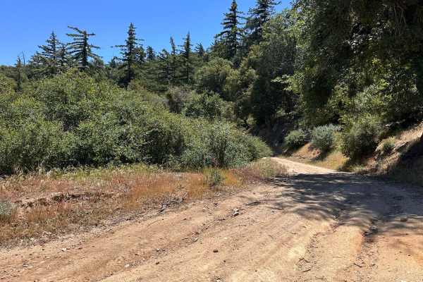
Suncrest Trail
This is a really fun, flowy trail wrapped in great tree coverage to keep you nice and shaded. It acts as a perfect connector, easily linking you up with several other main trail roads in the network. The dirt here is super compacted, which means it can get pretty slick and slippery, especially when ...
Learn more about Suncrest Trail

Cleghorn Technical Access Road
This trail is full of technical surprises that keep you on your toes. It’s not very well maintained, so some 4x4s will struggle, and dual sport or dirt bikes are definitely the safer bet. You’ll hit 2 or 3 steep uphill climbs that demand careful throttle control, and the downhill sections are washed...
Learn more about Cleghorn Technical Access Road
ATV trails near Rubidoux, California
Explore ATV-friendly trails near you. These trails are accessible for vehicles up to 50 inches wide, perfect for ATVs and smaller off-road machines.
Lower Lytle Creek Divide - 3N31
The easiest way to start this trail is off the 15 Freeway and Glen Helen Parkway Road to Lower Lytle Creek Divide - 3N31. There are a couple of residences on the right-hand side of the road just before the trail begins, so please be mindful of this when airing down/airing up. The trail begins shortl...
Learn more about Lower Lytle Creek Divide - 3N31
Old Cc Spur - 2N57
This is a 1.4-mile, well-maintained, easy gravel spur road that connects Lytle Creek Road and Lower Lytle Creek Divide - 3N31. This spur road is a convenient way to access Lower Lytle Creek Divide - 3N31, which is an 8.5-mile fun, scenic ridgeline trail above Lytle Creek.
Learn more about Old Cc Spur - 2N57
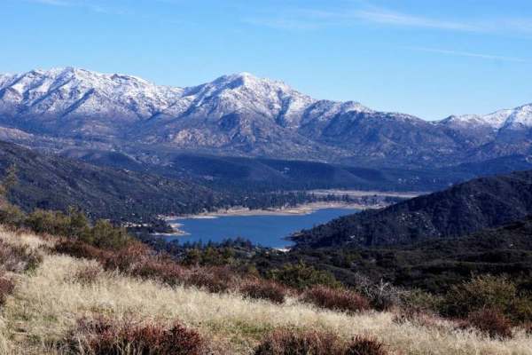
Rainbow Trail - FS 2N59
Rainbow Trail (FS 2N59) begins inside the Silverwood Lake State Park area, where pavement gives way to dirt as you transition from the park roads onto the Forest Service route. The west-to-east run starts out relatively smooth, with a decomposed granite base, light washboarding in spots, and scatter...
Learn more about Rainbow Trail - FS 2N59

Pilot Fuelbreak OHV to Pilot Rock Trail
This is a challenging option out of the Pilot Fuelbreak OHV staging area. This route is not for the novice or faint of heart. Mother Nature has made every hill climb of this route a challenge with ruts, rocks, and washouts. You will be rewarded with amazing views of Silverwood Lake as you ascend you...
Learn more about Pilot Fuelbreak OHV to Pilot Rock Trail
UTV/side-by-side trails near Rubidoux, California
Find UTV and side-by-side trails near you. These trails accommodate vehicles up to 60 inches wide, ideal for UTVs, side-by-sides, and wider off-road rigs.
Lower Lytle Creek Divide - 3N31
The easiest way to start this trail is off the 15 Freeway and Glen Helen Parkway Road to Lower Lytle Creek Divide - 3N31. There are a couple of residences on the right-hand side of the road just before the trail begins, so please be mindful of this when airing down/airing up. The trail begins shortl...
Learn more about Lower Lytle Creek Divide - 3N31
Old Cc Spur - 2N57
This is a 1.4-mile, well-maintained, easy gravel spur road that connects Lytle Creek Road and Lower Lytle Creek Divide - 3N31. This spur road is a convenient way to access Lower Lytle Creek Divide - 3N31, which is an 8.5-mile fun, scenic ridgeline trail above Lytle Creek.
Learn more about Old Cc Spur - 2N57
Rainbow Trail - FS 2N59
Rainbow Trail (FS 2N59) begins inside the Silverwood Lake State Park area, where pavement gives way to dirt as you transition from the park roads onto the Forest Service route. The west-to-east run starts out relatively smooth, with a decomposed granite base, light washboarding in spots, and scatter...
Learn more about Rainbow Trail - FS 2N59
Pilot Fuelbreak OHV to Pilot Rock Trail
This is a challenging option out of the Pilot Fuelbreak OHV staging area. This route is not for the novice or faint of heart. Mother Nature has made every hill climb of this route a challenge with ruts, rocks, and washouts. You will be rewarded with amazing views of Silverwood Lake as you ascend you...
Learn more about Pilot Fuelbreak OHV to Pilot Rock Trail
The onX Offroad Difference
onX Offroad combines trail photos, descriptions, difficulty ratings, width restrictions, seasonality, and more in a user-friendly interface. Available on all devices, with offline access and full compatibility with CarPlay and Android Auto. Discover what you're missing today!
Open Trail Map