
Dirt Bike Trails
Near River Road, Washington
Explore All Dirt Bike Trails Near River Road, Washington
Dirt Bike Trails Near River Road, Washington
Discover the best dirt bike trails near you. Browse trail maps, check difficulty ratings, and find your next adventure — whether you're looking for a quick ride or an all-day expedition.
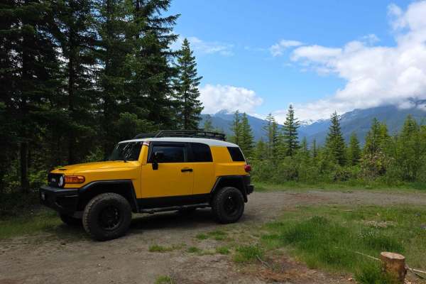
Salmon Creek
This is an easy, wide-open gravel road suitable for all vehicle types. While there are some potholes, numerous offshoots offer great opportunities for exploration. The route connects Bon Jon Pass road to NF2850, Blyn, and the Puddlejumper. Keep an eye out for bears and other wildlife along the way.
Learn more about Salmon Creek

NF 2581 - Puddlejumper
This is a fun, casual trail through serene forests. The route starts on well-graded forest roads off Snow Creek Road before quickly narrowing after leaving the main track. An out-and-back trail to a secluded alder grove, you'll encounter tight squeezes through underbrush and large flooded washouts, ...
Learn more about NF 2581 - Puddlejumper
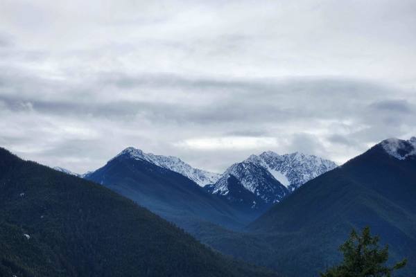
Dungeness Fork Run
This is a short but scenic out-and-back trail into the edge of the Olympic Range, ending just outside the Buckhorn Wilderness area. Drop from the main road on a steep, slick, rutted path, winding sharply down the canyon wall to a bridge across the Gray Wolf River. The lower portion of the trail foll...
Learn more about Dungeness Fork Run
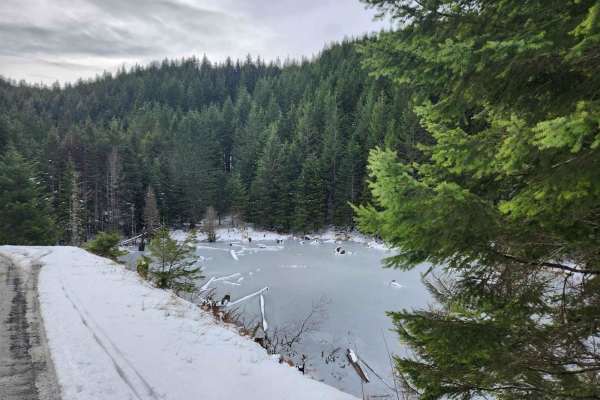
BonJon Pass
A smooth, well maintained grade skirting the edge of the Olympic Mountains, BonJon Pass climbs up from Lord's Lake to just below the peak of Mt. Zion, offering peek-a-boo views through the trees of distant peaks and steep valleys. Accessible to most vehicles in summer, winter offers a patchwork of m...
Learn more about BonJon Pass

Overlook of Seattle Campsite
This trail is hardly a trail but more of some backwoods exploring through an old logging and quarry site. The best part of this loop is the campsite; it is well worth the short trek. Due note the trail is a skinny one-lane road up, so say goodbye to that scratch-less paint job you are rocking, and h...
Learn more about Overlook of Seattle Campsite
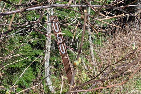
Buck Mountain Ridge Rd - FS 2060060
Single-lane route off Rocky Brook Rd on the ridge of Buck Mountain. Features a couple rock slide areas, pullouts, easy incline and nice northwest views toward Quilcene. Ends in 2.66 miles at a small camp/lunch spot with distant views of Mount Baker on clear days. Stock rig friendly with Verizon cell...
Learn more about Buck Mountain Ridge Rd - FS 2060060
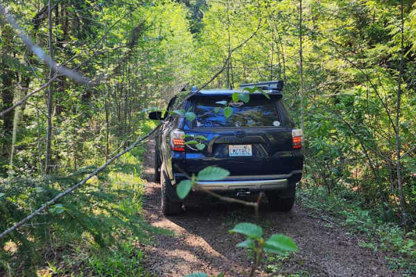
Jackson Creek Comm Bypass
Embark on an off-road adventure on the beautiful Jackson Creek Comm Bypass off Rocky Brook Road. This route features a single lane with multiple pullout spots--some are perfect for camping. The road is heavily canopied, with the northern section slightly overgrown in places, providing a challenge fo...
Learn more about Jackson Creek Comm Bypass
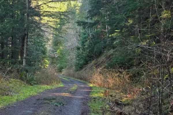
FS 2630
This single-lane offroad trail branches off Rocky Brook Road and winds through dense forest with some hairpin turns and dramatic shelf road sections. Expect a mix of forested canopy driving and exposed shelf sections where the road clings to the hillside. Some areas show signs of recent rock movemen...
Learn more about FS 2630
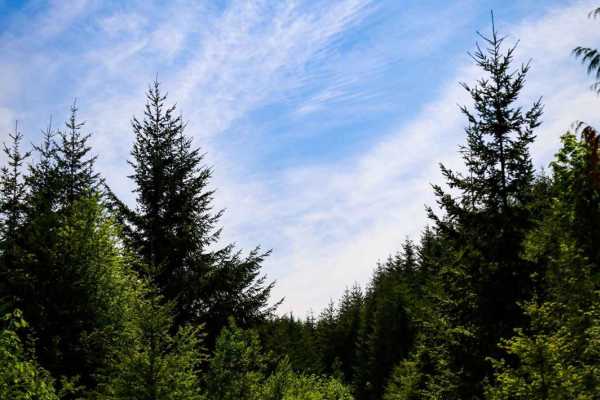
Fulton Creek Road to Murhut Falls
This is a nice dirt/gravel road that eventually leads to Murhut Falls Trailhead. Once you've hiked up to the falls you can come back the same way or take Duckabush Collins CG road back to 101. This is a narrow trail that is not maintained and has a few washouts to navigate. One of which is on a hair...
Learn more about Fulton Creek Road to Murhut Falls
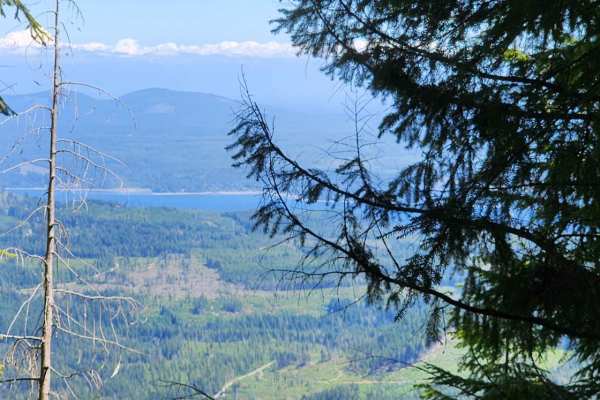
Jefferson Ridge Road
This trail will give you epic views and a long steep climb up the ridgeline, which means even better views coming back down. The road has loose rock through most of it as well as deep cross-wash along most of the trail. The views are great, but there is a long 2-mile climb that will make squeamish p...
Learn more about Jefferson Ridge Road
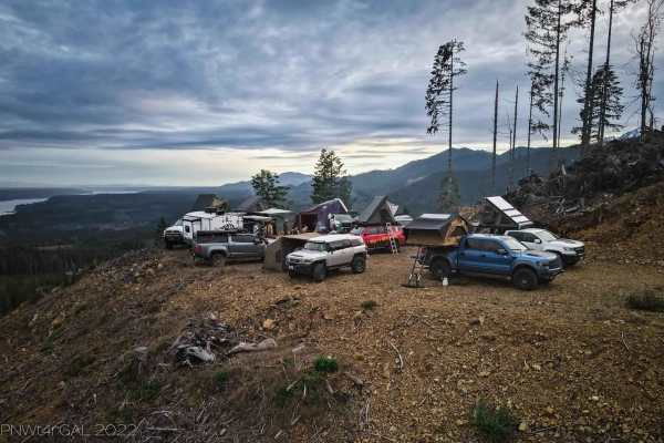
Hamma Hamma lookout #1 (251000)
This is a section of the 2510000 trail to the first big lookout/camp area. The primary trail is gravel and dirt based. There are some occasional potholes but primarily just dirt and loose gravel. Once you take the left turn to go to the lookout, you will proceed on a steady elevation incline. This t...
Learn more about Hamma Hamma lookout #1 (251000)
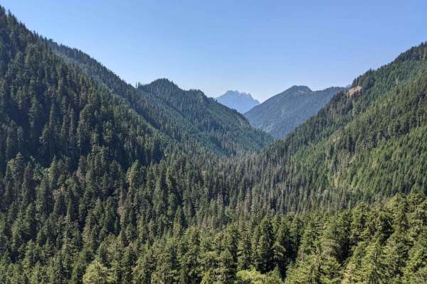
Hamma Hamma Trail with View of The Brothers
This is a non-technical drive through the forest up to a viewpoint overlooking the valley and The Brothers. Viewpoint has space for about 5 rigs to pull over and take a lunch break. There a numerous drainage channels dug diagonally into the trail, which is about the most challenging part of this tra...
Learn more about Hamma Hamma Trail with View of The Brothers
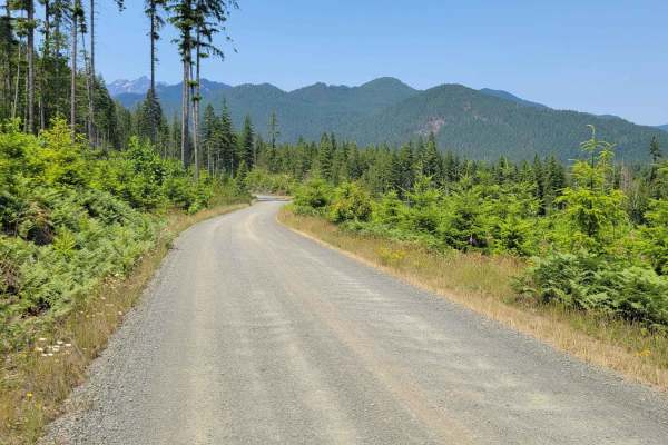
Jefferson Lake
This trail combines NF - 2480, 2441, 2401. This route passes by Elk Lake Lower Trailhead and leads up to Jefferson Lake and Jefferson Lake Trailhead. There are several offshoot trails from this route. The road is a typical mountain dirt road: nice and wide enough for vehicles to pass, with washboard...
Learn more about Jefferson Lake
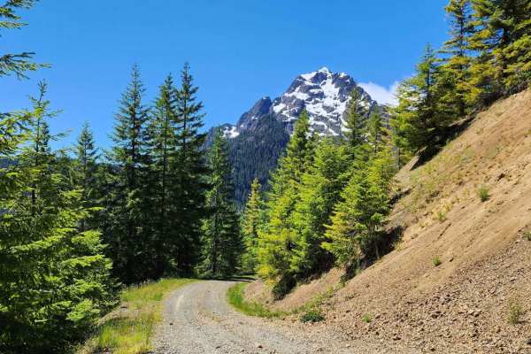
Jefferson Creek Trail
This trail is fairly easy up to the turn-off to Goober Pond. There's only one area that 4WD is suggested, and that is a loose rock washout that goes down a very long steep drop. Other than that one spot, the beautiful scenic trail can be done in 2WD. After the turn-off for Goober Pond, the trail ge...
Learn more about Jefferson Creek Trail
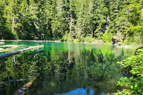
Goober Pond
This is an easy spur trail off the Jefferson Creek Trail to get to the pond and campsite. There are multiple places to camp near the pond. The pond itself is crystal clear and cold. It makes for a nice refreshing dip in hot weather or after a long dusty day on the trails.
Learn more about Goober Pond
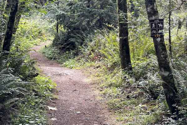
230
Trail 230 is one of several short motorcycle trails in the Whistle Lake Area. It's a wide dirt path with a few embedded rock surfaces, embedded boulders, and big roots, but it is overall a very easy trail. It goes between tall skinny red alder trees, sword ferns, and thick cedar trees in a really sc...
Learn more about 230
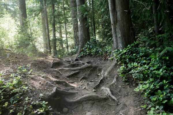
Beaver Pond
Beaver Pond Trail is a 2.5-mile dirt bike route that serves as an alternate path to Wildcat Trail, allowing dirt bikers to create a loop between the two. The trail alternates between narrow and wider sections as it winds through dense forest and a logged area with young tree growth. Terrain includes...
Learn more about Beaver Pond
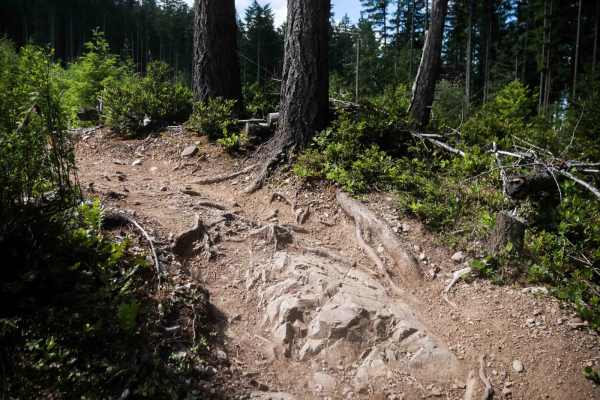
Plummer
Plummer Trail is a 1.1-mile dirt bike route connecting Beaver Pond Trail to Gold Creek Trail, forming a loop option for riders in the Green Mountain trail system. This narrow alpine trail winds along forested hillsides and through a logged area with young pines. The terrain includes embedded root ba...
Learn more about Plummer
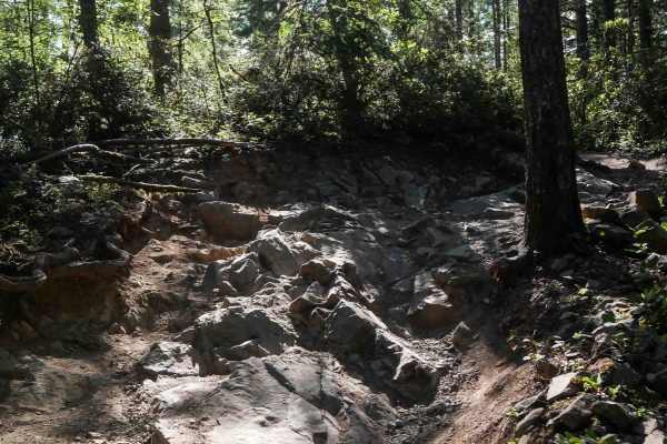
Vista
Vista Trail is a moderately challenging ATV route beginning at the end of Gold Creek Trail. It starts out wide due to frequent use by hikers and horses, then transitions into a more technical two-track path. Riders will encounter embedded roots, foot-tall rock ledges, multiple stair-step formations,...
Learn more about Vista
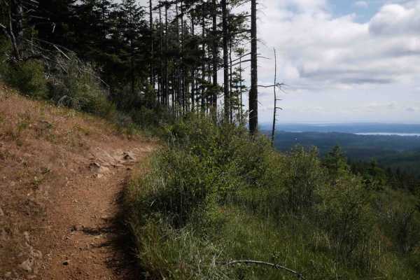
Wildcat
Wildcat Trail is a moderately challenging ATV route that begins at an intersection with Vista and crosses several roads on a narrow forest path just wide enough for ATVs. The trail climbs steeply through the woods with embedded rocks, ledges, chunky rock outcroppings, and large tree roots, sometimes...
Learn more about Wildcat
ATV trails near River Road, Washington
Explore ATV-friendly trails near you. These trails are accessible for vehicles up to 50 inches wide, perfect for ATVs and smaller off-road machines.
Salmon Creek
This is an easy, wide-open gravel road suitable for all vehicle types. While there are some potholes, numerous offshoots offer great opportunities for exploration. The route connects Bon Jon Pass road to NF2850, Blyn, and the Puddlejumper. Keep an eye out for bears and other wildlife along the way.
Learn more about Salmon Creek
NF 2581 - Puddlejumper
This is a fun, casual trail through serene forests. The route starts on well-graded forest roads off Snow Creek Road before quickly narrowing after leaving the main track. An out-and-back trail to a secluded alder grove, you'll encounter tight squeezes through underbrush and large flooded washouts, ...
Learn more about NF 2581 - Puddlejumper
Dungeness Fork Run
This is a short but scenic out-and-back trail into the edge of the Olympic Range, ending just outside the Buckhorn Wilderness area. Drop from the main road on a steep, slick, rutted path, winding sharply down the canyon wall to a bridge across the Gray Wolf River. The lower portion of the trail foll...
Learn more about Dungeness Fork Run
BonJon Pass
A smooth, well maintained grade skirting the edge of the Olympic Mountains, BonJon Pass climbs up from Lord's Lake to just below the peak of Mt. Zion, offering peek-a-boo views through the trees of distant peaks and steep valleys. Accessible to most vehicles in summer, winter offers a patchwork of m...
Learn more about BonJon Pass
UTV/side-by-side trails near River Road, Washington
Find UTV and side-by-side trails near you. These trails accommodate vehicles up to 60 inches wide, ideal for UTVs, side-by-sides, and wider off-road rigs.
Salmon Creek
This is an easy, wide-open gravel road suitable for all vehicle types. While there are some potholes, numerous offshoots offer great opportunities for exploration. The route connects Bon Jon Pass road to NF2850, Blyn, and the Puddlejumper. Keep an eye out for bears and other wildlife along the way.
Learn more about Salmon Creek
NF 2581 - Puddlejumper
This is a fun, casual trail through serene forests. The route starts on well-graded forest roads off Snow Creek Road before quickly narrowing after leaving the main track. An out-and-back trail to a secluded alder grove, you'll encounter tight squeezes through underbrush and large flooded washouts, ...
Learn more about NF 2581 - Puddlejumper
Dungeness Fork Run
This is a short but scenic out-and-back trail into the edge of the Olympic Range, ending just outside the Buckhorn Wilderness area. Drop from the main road on a steep, slick, rutted path, winding sharply down the canyon wall to a bridge across the Gray Wolf River. The lower portion of the trail foll...
Learn more about Dungeness Fork Run
BonJon Pass
A smooth, well maintained grade skirting the edge of the Olympic Mountains, BonJon Pass climbs up from Lord's Lake to just below the peak of Mt. Zion, offering peek-a-boo views through the trees of distant peaks and steep valleys. Accessible to most vehicles in summer, winter offers a patchwork of m...
Learn more about BonJon Pass
The onX Offroad Difference
onX Offroad combines trail photos, descriptions, difficulty ratings, width restrictions, seasonality, and more in a user-friendly interface. Available on all devices, with offline access and full compatibility with CarPlay and Android Auto. Discover what you're missing today!
Open Trail Map