
Dirt Bike Trails
Near Richfield, Idaho
Explore All Dirt Bike Trails Near Richfield, Idaho
Dirt Bike Trails Near Richfield, Idaho
Discover the best dirt bike trails near you. Browse trail maps, check difficulty ratings, and find your next adventure — whether you're looking for a quick ride or an all-day expedition.
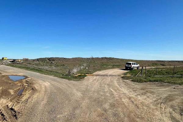
Wilson Butte
Expect a fairly easy trail here in the southern Idaho desert. This trail opens up with a few options to discover. As you head out, the road is fairly level, packed dirt and pretty dusty. You will not find many people out at the same time as you, so you can take your time or bring out some dirt bikes...
Learn more about Wilson Butte
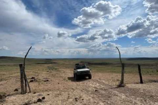
Dead Horse and Tea Kettle Caves with Connector
This short route takes you through south-central Idaho's interesting and diverse lava flow region. This trail can be done both directions, but the easier sections begin closer to Gooding and the Tea Kettle and Dead Horse caves. This section brings you directly to the locally famous Tea Kettle and De...
Learn more about Dead Horse and Tea Kettle Caves with Connector
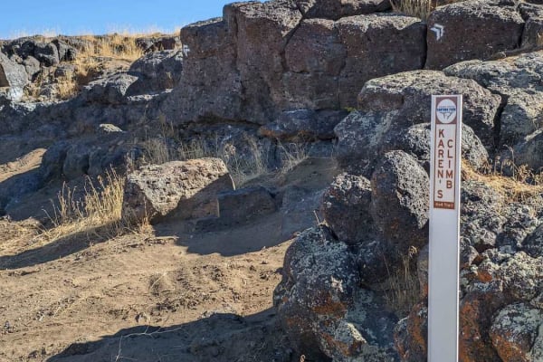
Rough and Tumble
Rough and Tumble is a rock-crawling 4x4 trail located within the Snake River Canyons Park just North of the beautiful Snake River Canyon in Twin Falls, Idaho. This trail was a collaboration of the Southern Idaho Offroad Association, and the Snake River Canyons Park and is part 1 of 2 connected trail...
Learn more about Rough and Tumble
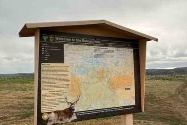
Little City of Rocks Access
This short route takes you through south-central Idaho's interesting and diverse lava flow region. When you begin to near the City of Rocks formations and canyons the trail becomes rugged, rocky, and rutted leading to the difficulty rating. This trail can be linked to many others in the area. There ...
Learn more about Little City of Rocks Access
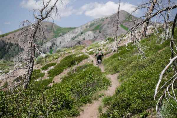
Wolftone - Curran
This is a really great single track on the south end of the Greenhorn Trail system near Ketchum, Idaho. The south end of the trail starts from a saddle with a loose downhill onto a narrow and epic side hill where you'll feel like you are on the edge of the world. It's a different terrain on this mou...
Learn more about Wolftone - Curran
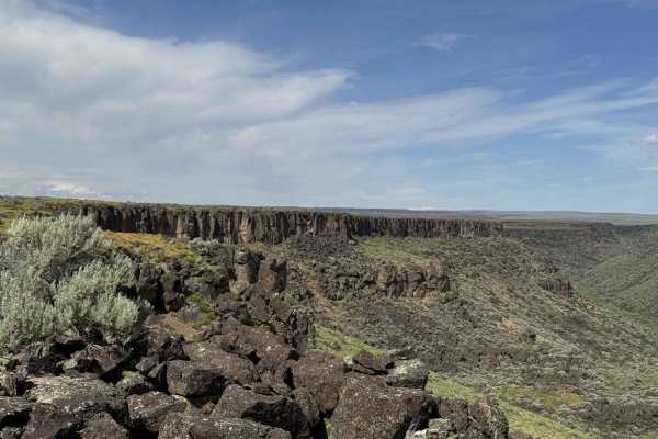
Canyon View Corkscrew
Take a short adventurous trip along the edge of a plateau, leading you to an incredible, nearly hidden canyon. The longer you drive, the more amazing the views become. Pack some food and a couple of chairs and take in the amazing views of the canyon and the high desert down below. Several short spur...
Learn more about Canyon View Corkscrew
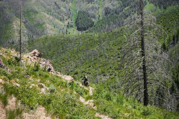
Kinsey Curran Connector
This is a connector trail between the Kinsey Creek ATV trail and Wolftone-Curran that's very rutted. The west side entrance to the trail is at a small creek crossing, but it's a bit difficult because the bushes are overgrown and there are small branches in the creek, it has a steep exit on loose dir...
Learn more about Kinsey Curran Connector
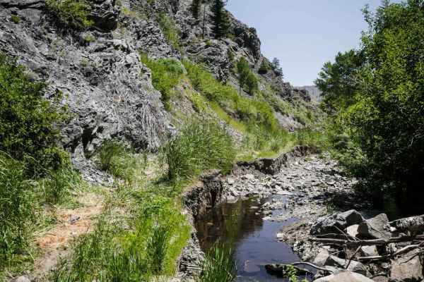
Kinsey Creek ATV Trail
The Kinsey Creek ATV trail is a rocky two-track down by a creek that starts at the Deer Creek Trailhead and climbs up to a saddle via a shelfy path. There are a couple of logs and washouts that might make this difficult for an ATV but would be easy for a dirt bike. Right after the trailhead, there i...
Learn more about Kinsey Creek ATV Trail
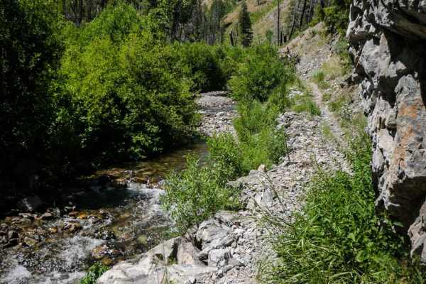
Deer Creek
Deer Creek is a more challenging intermediate single track that is very rocky all throughout the trail. It starts elevated above a creek on a narrow trail covered in scree at the bottom of an exposed hillside. It goes through some really tall grass by the creek and it's hot and muggy and hard to se...
Learn more about Deer Creek
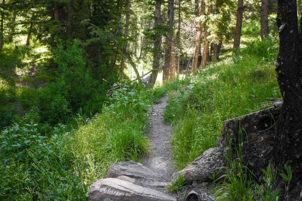
North Fork Deer Creek
The North Fork Deer Creek Trail starts in a gulch above a stream on a wide single track. It switchbacks up a hillside to get into a burn area of tall thick burnt trees. It's mostly a smooth dirt trail, but a few sections have embedded rock and boulders, including one small rock obstacle made of boul...
Learn more about North Fork Deer Creek
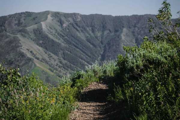
Howard's Trail
Howard's Trail is a top-tier single track in the Greenhorn Trail System near Ketchum Idaho that has incredible mountain views. Most of the route is a really narrow trail that side-hills across an exposed grassy hillside with moderate exposure. In the middle of the summer, these hillsides are full of...
Learn more about Howard's Trail
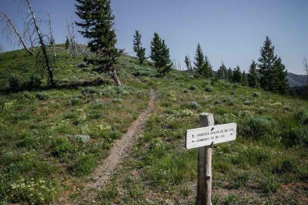
Panther Gulch - Imperial Connect
This short but moderately challenging connector trail starts on a saddle at the intersection with Howard's Trail and goes along an exposed spine with no trees on a narrow trail with lots of loose rock. It goes up and over several rolling hillsides as a ridge line trail, with several climbs and desce...
Learn more about Panther Gulch - Imperial Connect
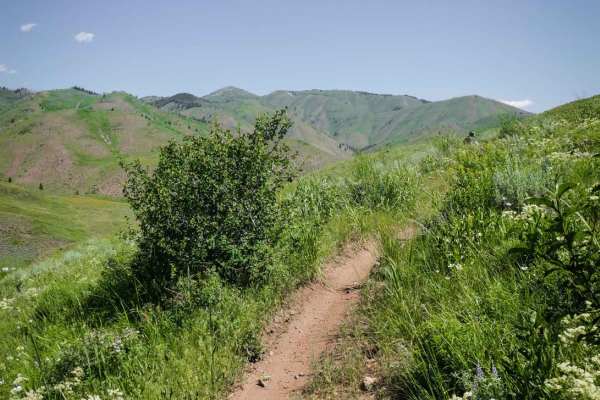
Imperial Gulch
Imperial Gulch is an epic top-tier single track for incredible views and a smooth fast and flowy trail through meadows full of wildflowers. There are only a couple of sections with some embedded small rocks and a couple roots, but it's mostly smooth dirt the whole way. It's a narrow trail with wide ...
Learn more about Imperial Gulch
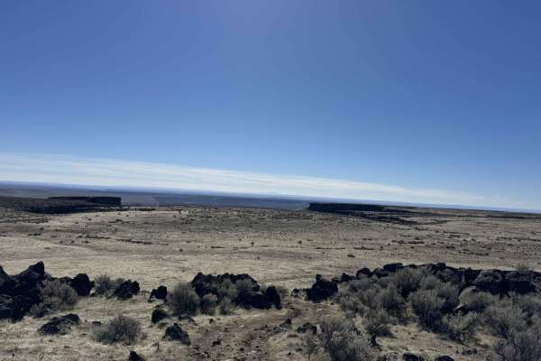
Squeeze Chute Crawl
Enjoy a slow, crawling, winding route along the west canyon rim overlooking the desert floor. Plateaus and hills decorate the desolate landscape below and all around. While not a technical trail, it is very rough with protruding and loose rocks, deep ruts, and a narrow slot to pass through. Lots of ...
Learn more about Squeeze Chute Crawl
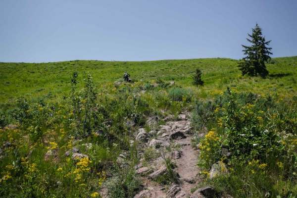
Cow Creek
Cow Creek starts directly from the Greenhorn Staging Area. The beginning is a series of wide sweeping switchbacks up a beautiful green hillside on a very rocky trail. There are big round or jagged boulders in the center of the trail and lots of two-foot wide rocks embedded in the trail that you have...
Learn more about Cow Creek
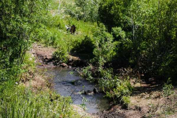
Greenhorn - Imperial Connector
The Greenhorn - Imperial Connector is likely the first trail most riders will take out of the Greenhorn staging area for this trail system. It's a short connector trail that starts directly from the trailhead and is how you access most of the trail system. The hardest and rockiest section is right i...
Learn more about Greenhorn - Imperial Connector
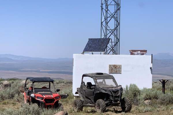
Davis Mtn. Loop
Leaving from Bliss, ID, head north on Hill City Road. Turn onto Davis Mountain Road. There are many roads and trails to explore from this location. It is very easy driving with plenty of wildlife to see. Be on the lookout for grazing cattle, as it is very popular for grazing. From Davis Mountain you...
Learn more about Davis Mtn. Loop
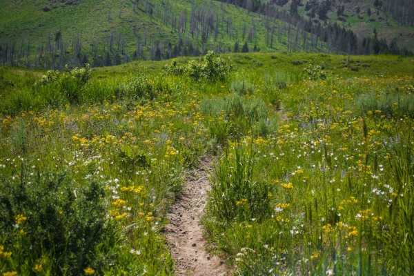
Mahoney Ridge
This is a fun trail in the Greenhorn trail system mostly made up of hard pack dirt with sections of embedded cobble. It has smooth sections and rocky sections, and a couple of wide easy switchbacks, making it a mix of fast and technical. It goes through a small burn area and has awesome views the wh...
Learn more about Mahoney Ridge
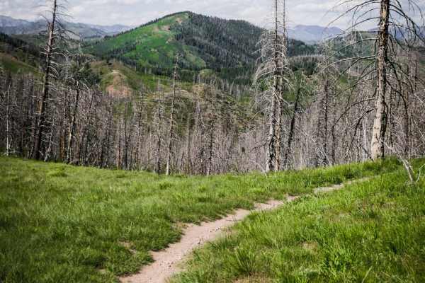
Mahoney Butte
Mahoney Butte is a 5-mile long trail that is mostly elevated above a creek, side-hilling on a narrow trail, sometimes with loose rock or embedded surface rock. The beginning and ending are the smoothest, fastest parts. There's some embedded small cobble in parts, a rocky hill, a couple of scree sect...
Learn more about Mahoney Butte
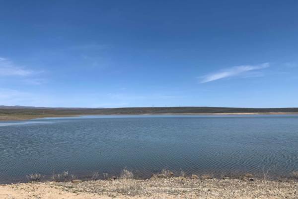
Bliss High Country Scenic Track
Explore the high desert north of Bliss! From the unmaintained dirt roads to Bray Lake to all the canyons, draws, and gullies, there is no shortage of terrain changes and obstacles. Expect dirt roads, deep ruts, lots of loose rock, washouts, moderate depth creek crossings, dust, and spots of mud. Oth...
Learn more about Bliss High Country Scenic Track
ATV trails near Richfield, Idaho
Explore ATV-friendly trails near you. These trails are accessible for vehicles up to 50 inches wide, perfect for ATVs and smaller off-road machines.
Wilson Butte
Expect a fairly easy trail here in the southern Idaho desert. This trail opens up with a few options to discover. As you head out, the road is fairly level, packed dirt and pretty dusty. You will not find many people out at the same time as you, so you can take your time or bring out some dirt bikes...
Learn more about Wilson Butte
Dead Horse and Tea Kettle Caves with Connector
This short route takes you through south-central Idaho's interesting and diverse lava flow region. This trail can be done both directions, but the easier sections begin closer to Gooding and the Tea Kettle and Dead Horse caves. This section brings you directly to the locally famous Tea Kettle and De...
Learn more about Dead Horse and Tea Kettle Caves with Connector
Rough and Tumble
Rough and Tumble is a rock-crawling 4x4 trail located within the Snake River Canyons Park just North of the beautiful Snake River Canyon in Twin Falls, Idaho. This trail was a collaboration of the Southern Idaho Offroad Association, and the Snake River Canyons Park and is part 1 of 2 connected trail...
Learn more about Rough and Tumble
Little City of Rocks Access
This short route takes you through south-central Idaho's interesting and diverse lava flow region. When you begin to near the City of Rocks formations and canyons the trail becomes rugged, rocky, and rutted leading to the difficulty rating. This trail can be linked to many others in the area. There ...
Learn more about Little City of Rocks Access
UTV/side-by-side trails near Richfield, Idaho
Find UTV and side-by-side trails near you. These trails accommodate vehicles up to 60 inches wide, ideal for UTVs, side-by-sides, and wider off-road rigs.
Wilson Butte
Expect a fairly easy trail here in the southern Idaho desert. This trail opens up with a few options to discover. As you head out, the road is fairly level, packed dirt and pretty dusty. You will not find many people out at the same time as you, so you can take your time or bring out some dirt bikes...
Learn more about Wilson Butte
Dead Horse and Tea Kettle Caves with Connector
This short route takes you through south-central Idaho's interesting and diverse lava flow region. This trail can be done both directions, but the easier sections begin closer to Gooding and the Tea Kettle and Dead Horse caves. This section brings you directly to the locally famous Tea Kettle and De...
Learn more about Dead Horse and Tea Kettle Caves with Connector
Rough and Tumble
Rough and Tumble is a rock-crawling 4x4 trail located within the Snake River Canyons Park just North of the beautiful Snake River Canyon in Twin Falls, Idaho. This trail was a collaboration of the Southern Idaho Offroad Association, and the Snake River Canyons Park and is part 1 of 2 connected trail...
Learn more about Rough and Tumble
Little City of Rocks Access
This short route takes you through south-central Idaho's interesting and diverse lava flow region. When you begin to near the City of Rocks formations and canyons the trail becomes rugged, rocky, and rutted leading to the difficulty rating. This trail can be linked to many others in the area. There ...
Learn more about Little City of Rocks Access
The onX Offroad Difference
onX Offroad combines trail photos, descriptions, difficulty ratings, width restrictions, seasonality, and more in a user-friendly interface. Available on all devices, with offline access and full compatibility with CarPlay and Android Auto. Discover what you're missing today!
Open Trail Map