
Dirt Bike Trails
Near Reacomodo Río Colorado, Baja California
Explore All Dirt Bike Trails Near Reacomodo Río Colorado, Baja California
Dirt Bike Trails Near Reacomodo Río Colorado, Baja California
Discover the best dirt bike trails near you. Browse trail maps, check difficulty ratings, and find your next adventure — whether you're looking for a quick ride or an all-day expedition.

La Rumorosa Trail
Historic road through the Sierra Juarez that connects the town of La Rumorosa down to the desert below. The 25-mile route contains a dozen tight switchbacks (a couple requiring three-point turns), a couple of tight spots for full-size rigs, and lots of exposure. It pays off with spectacular views an...
Learn more about La Rumorosa Trail
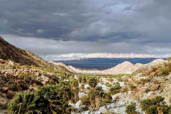
Canyon de Guadalupe High Road
When this road through the lake bed is wet and muddy, this is the safe route to access the Canyon de Guadalupe Hot Springs. It is long and bumpy, so it's wise to air down for comfort and to ease wear and tear on your gear. Watch for and follow the handmade signs. On the last couple of miles, the cor...
Learn more about Canyon de Guadalupe High Road
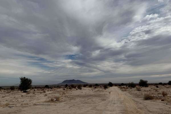
Mexicali 1
This trail provides access to the 'W' route on the racecourse and offers an enjoyable off-road experience just outside of Mexicali. During the rainy season and winter months, the trail may become impassable at its endpoint due to blind water crossings, so plan accordingly. Despite these challenges, ...
Learn more about Mexicali 1
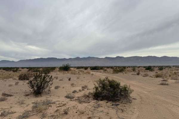
Race Course Route W
Mexicali Race Course W R is an exhilarating off-road adventure immediately after crossing the border into Mexicali. This trail offers a dynamic mix of long, flowing whoops, tight corners, and rocky washes, providing a comprehensive off-roading experience. The route aligns with sections of the renown...
Learn more about Race Course Route W
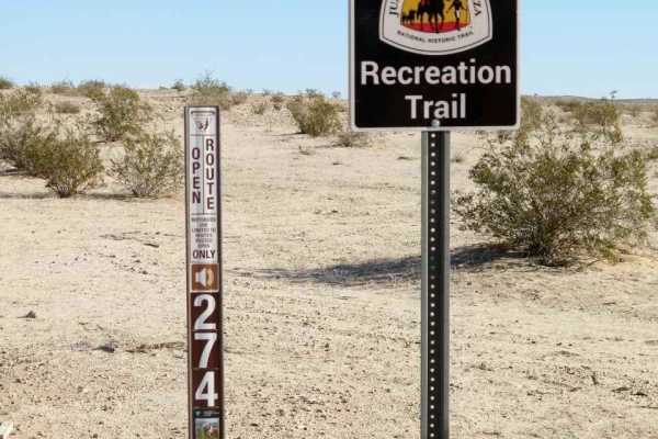
EC 274 Yuha Desert
EC 274 Yuha Desert is a 10.7-mile point-to-point trail rated 3 of 10 in Imperial County. This is a BLM-designated "Open" trail and can be used by all vehicles. The trail can be accessed from Highway 98 on the west and Interstate 8 exit 101 south on Dunaway Road on the east end. EC 274 is primarily h...
Learn more about EC 274 Yuha Desert
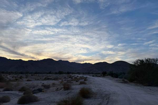
Mexicali Orange
This rocky wash trail starts with a moderate difficulty level (rated 3) and progressively becomes more challenging, reaching a difficulty level of 5 or 6. The route offers a serene and beautiful setting, making it an excellent choice for those seeking a quiet camping spot after crossing the border l...
Learn more about Mexicali Orange

EC 285 Yuha Desert
EC 285 Yuha Desert is a 2-mile point-to-point trail rated 3 of 10 in Imperial County. EC 285 is a BLM-designated "Open" trail and may be used by all types of vehicles. EC 285 is primarily a hard-packed track that runs along the edge of the Jacumba Wilderness Area and ends at the U.S. border. The hig...
Learn more about EC 285 Yuha Desert
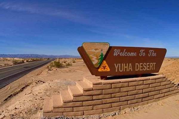
EC 346 Yuha Desert
EC 346 Yuha Desert is a 7.4-mile point-to-point trail rated 3 of 10 in Imperial County. EC346 is a BLM-designated "Open" route and is accessible by all types of vehicles. Both the east and west ends of the trail can be accessed from EC 274. The highlights along EC 346 are the Oyster Shell Beds and t...
Learn more about EC 346 Yuha Desert
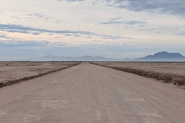
Wheeler Road
This is another main east-to-west trail in the Superstition Mountain OHV Open Riding Area. The surface is a mix of soft sand and hard-pack sand, creating varying traction conditions. The trail follows a power line for easy reference and navigation. The route features a lot of washboards and some who...
Learn more about Wheeler Road
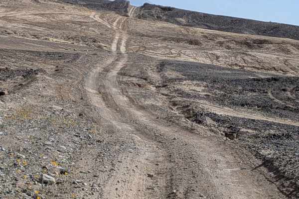
BLM 079
This long trail starts off Highway 80 and ends at BLM 189, featuring hard pack sand with lots of small rocks throughout. The surface slowly takes you through a rocky, bumpy trail with small ruts, off-camber sections, and lots of whoops, creating constant challenges. You'll climb a few steep hills al...
Learn more about BLM 079

Painted Gorge Road - BLM 236
This trail starts at Highway 2 and is a graded two vehicle-wide sandy trail in the beginning, providing comfortable navigation. The route serves as a main artery for the area, with lots of dispersed camping opportunities along the way. This trail is located in the Plaster City OHV open riding area a...
Learn more about Painted Gorge Road - BLM 236
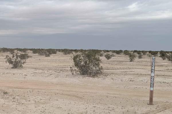
BLM 343
This trail features a soft sand surface that is wet on the east side in the open area, creating unusual traction conditions. The area is relatively flat with some whoops scattered throughout, creating a bouncing ride. The trail is lined with creosote bushes on both sides. You'll enjoy views of mount...
Learn more about BLM 343
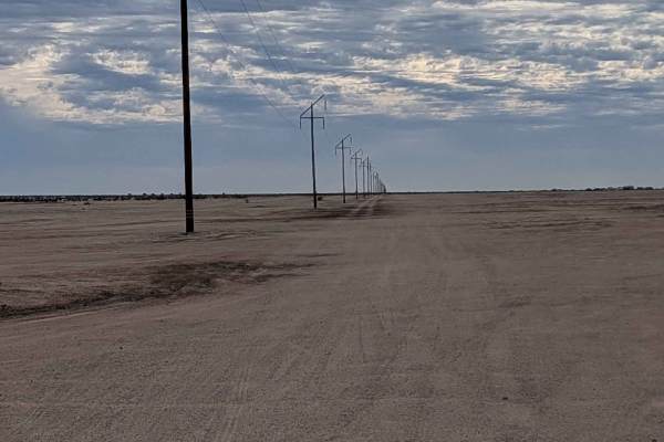
BLM 075 East
This is another main east-to-west trail in the Superstition Mountain OHV Open Riding Area. The surface is a mix of soft sand and hard-pack sand, creating varying traction conditions. The trail follows a power line for easy reference and navigation. The route features a lot of washboards and some who...
Learn more about BLM 075 East
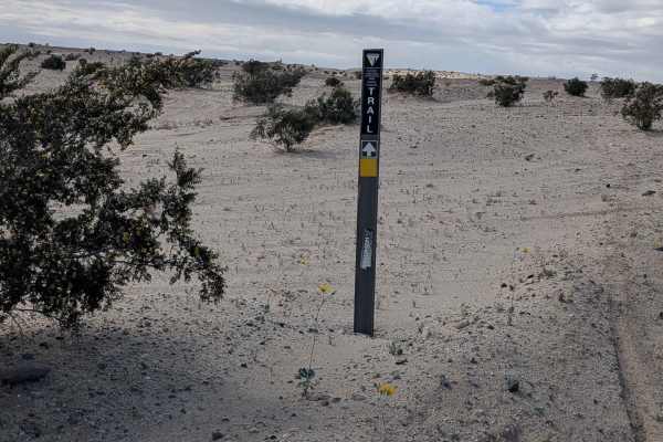
Imler Road
This trail starts off at Superstition Mountain South and begins at mile 9.5 of the El Centro BLM Backcountry Trail. The surface is fine sand and is two vehicles wide, lined with creosote bushes throughout. This trail connects the north side of Superstition Mountain to the south side without having t...
Learn more about Imler Road

Dirt Road - BLM 232
This trail starts on Painted Gorge Road and follows a small power line for reference, making navigation straightforward. The first half mile is adjacent to private land, but this is the access road to the public land that lies beyond, so stay on the designated route. The surface is mostly gravel and...
Learn more about Dirt Road - BLM 232
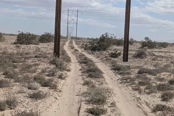
BLM 326 SE
This trail is fairly smooth compared to others in the area, making it a more comfortable route through the region. The surface is soft sand throughout, requiring momentum management. The trail continues down the power line leading toward the water aqueduct, but ends just past Edgar Road, providing c...
Learn more about BLM 326 SE

BLM 237
This one-and-a-half-vehicle-wide trail starts at BLM 245 and Coyote Wash. The surface is sand and gravel but relatively smooth, making for comfortable navigation. You'll encounter some whoops and washboards scattered along the way. The route cuts along the edge of all the hills, following the terrai...
Learn more about BLM 237
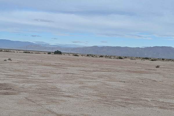
BLM 342
This trail is part of the BLM Back Country Discovery Trail system, adding significance to this route. The very beginning on the north side can be hard to find because winds and dust have reset the surface, requiring careful attention to trail markers. The entrance off BLM 075 is very steep with soft...
Learn more about BLM 342

BLM 137
This trail starts on BLM 236 and runs east to west, following the large electrical lines for easy reference throughout. The surface is sand and gravel that alternates between hard pack and loose sand, keeping you adjusting your driving approach. You'll encounter lots of ruts and off-camber sections ...
Learn more about BLM 137
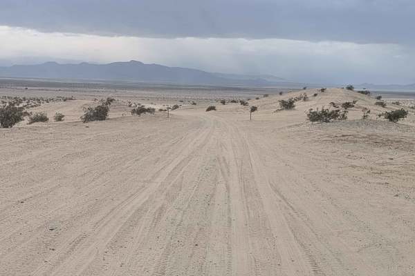
Superstition Mountain - BLM 341
This out-and-back trail serves as a main artery going from Wheeler Road to the southeast side of Superstition Mountain. The surface is fine sand and is 2 to 3 vehicles wide, providing excellent room for navigation and passing. The route is lined with lots of creosote bushes throughout. You'll encoun...
Learn more about Superstition Mountain - BLM 341
ATV trails near Reacomodo Río Colorado, Baja California
Explore ATV-friendly trails near you. These trails are accessible for vehicles up to 50 inches wide, perfect for ATVs and smaller off-road machines.
La Rumorosa Trail
Historic road through the Sierra Juarez that connects the town of La Rumorosa down to the desert below. The 25-mile route contains a dozen tight switchbacks (a couple requiring three-point turns), a couple of tight spots for full-size rigs, and lots of exposure. It pays off with spectacular views an...
Learn more about La Rumorosa Trail
Canyon de Guadalupe High Road
When this road through the lake bed is wet and muddy, this is the safe route to access the Canyon de Guadalupe Hot Springs. It is long and bumpy, so it's wise to air down for comfort and to ease wear and tear on your gear. Watch for and follow the handmade signs. On the last couple of miles, the cor...
Learn more about Canyon de Guadalupe High Road
Race Course Route W
Mexicali Race Course W R is an exhilarating off-road adventure immediately after crossing the border into Mexicali. This trail offers a dynamic mix of long, flowing whoops, tight corners, and rocky washes, providing a comprehensive off-roading experience. The route aligns with sections of the renown...
Learn more about Race Course Route W
EC 274 Yuha Desert
EC 274 Yuha Desert is a 10.7-mile point-to-point trail rated 3 of 10 in Imperial County. This is a BLM-designated "Open" trail and can be used by all vehicles. The trail can be accessed from Highway 98 on the west and Interstate 8 exit 101 south on Dunaway Road on the east end. EC 274 is primarily h...
Learn more about EC 274 Yuha Desert
UTV/side-by-side trails near Reacomodo Río Colorado, Baja California
Find UTV and side-by-side trails near you. These trails accommodate vehicles up to 60 inches wide, ideal for UTVs, side-by-sides, and wider off-road rigs.
La Rumorosa Trail
Historic road through the Sierra Juarez that connects the town of La Rumorosa down to the desert below. The 25-mile route contains a dozen tight switchbacks (a couple requiring three-point turns), a couple of tight spots for full-size rigs, and lots of exposure. It pays off with spectacular views an...
Learn more about La Rumorosa Trail
Canyon de Guadalupe High Road
When this road through the lake bed is wet and muddy, this is the safe route to access the Canyon de Guadalupe Hot Springs. It is long and bumpy, so it's wise to air down for comfort and to ease wear and tear on your gear. Watch for and follow the handmade signs. On the last couple of miles, the cor...
Learn more about Canyon de Guadalupe High Road
Race Course Route W
Mexicali Race Course W R is an exhilarating off-road adventure immediately after crossing the border into Mexicali. This trail offers a dynamic mix of long, flowing whoops, tight corners, and rocky washes, providing a comprehensive off-roading experience. The route aligns with sections of the renown...
Learn more about Race Course Route W
EC 274 Yuha Desert
EC 274 Yuha Desert is a 10.7-mile point-to-point trail rated 3 of 10 in Imperial County. This is a BLM-designated "Open" trail and can be used by all vehicles. The trail can be accessed from Highway 98 on the west and Interstate 8 exit 101 south on Dunaway Road on the east end. EC 274 is primarily h...
Learn more about EC 274 Yuha Desert
The onX Offroad Difference
onX Offroad combines trail photos, descriptions, difficulty ratings, width restrictions, seasonality, and more in a user-friendly interface. Available on all devices, with offline access and full compatibility with CarPlay and Android Auto. Discover what you're missing today!
Open Trail Map