
Dirt Bike Trails
Near Qui-nai-elt Village, Washington
Explore All Dirt Bike Trails Near Qui-nai-elt Village, Washington
Dirt Bike Trails Near Qui-nai-elt Village, Washington
Discover the best dirt bike trails near you. Browse trail maps, check difficulty ratings, and find your next adventure — whether you're looking for a quick ride or an all-day expedition.
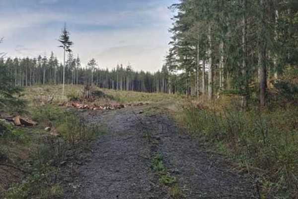
The Small Getaway Amongst Locked Gates
The Small Getaway Amongst Locked Gates is a short but highly enjoyable off-road route ideal for beginners, SxSs, and four-wheel-drive vehicles looking to explore a quick series of dirt paths and scenic lookouts near the Washington coast. Spanning roughly 2.2 miles with a technical rating of 4, this ...
Learn more about The Small Getaway Amongst Locked Gates
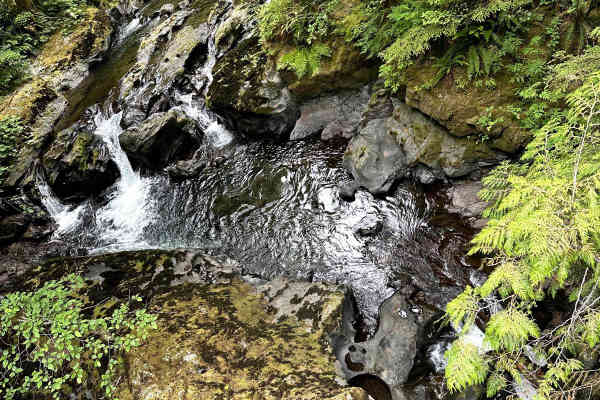
Newberry Creek Road
This 8.2-mile point-to-point trail gives access from Highway 101 to the West Fork Humptulips River Valley. The trail crosses over Newberry Creek and then follows along the West Fork Humptulips River. This is an enjoyable ride through the Olympic National Forest. This trail is predominantly single-ve...
Learn more about Newberry Creek Road

Ocean Shores Beach Highway
This is an original beach highway that is typically no longer used as such. Please pay attention to posted signs as there are time periods (generally spring/summer) when motor vehicles are not allowed in some sections. This trail-esq highway is solely a beach with minimal rocks. There are spots of h...
Learn more about Ocean Shores Beach Highway
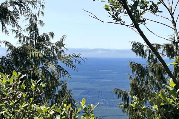
Ocean Coast Overlook Trail
This 13.5 mile point-to-point trail goes up to an excellent overlook which has great views of the Washington coast line. Take this trail in the evening for some great sunset views. The west portion of the trail is better maintained and traveled more than the east portion. There is a portion of the e...
Learn more about Ocean Coast Overlook Trail
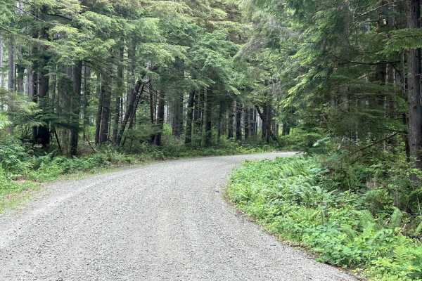
Horse Camp Trail
This 4.9-mile point-to-point trail takes you up the east side of the valley to a Horse Camp area. A pleasant and easy drive through the Olympic National Forest to access more trails. This trail is a well-maintained forest service road that any stock 4WD, AWD, and 2WD vehicles can travel.
Learn more about Horse Camp Trail
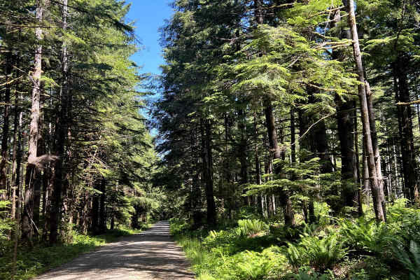
Pete's Creek Trail
This 11.1 mile point-to-point trail follows up the West Fork Humptulips River Valley to the Pete's Creek Trailhead and ends at the Campbell Tree Grove Campground. This is a very relaxing drive with some great views. Stop on the bridge at the beginning of the trail for a great view of the river below...
Learn more about Pete's Creek Trail
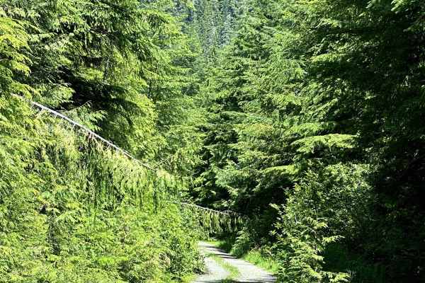
West Side East Fork Humptulips Valley Trail
This 9.1-mile point-to-point trail runs along the west side of the East Fork of Humptulips River Valley. The trail starts from Donkey Creek Road and crosses the Ridgeline of the East Fork Humptulips River Valley into the West Fork Humptulips River Valley. This trail is easily passable by stock 4WD o...
Learn more about West Side East Fork Humptulips Valley Trail
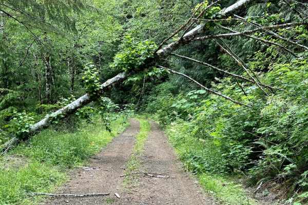
Cougar Mountain Trail
This 13.1-mile out-and-back trail takes you up to Cougar Mountain. The first part of the trail runs along a small creek, then goes along the mountainside up to the top of Cougar Mountain. There is a small parking area at the trail end, you can take a short hike up to the top of Cougar Mountain and t...
Learn more about Cougar Mountain Trail
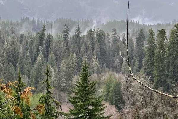
Donkey Creek Cutoff
The Donkey Creek Road cutoff is a way to quickly get from Highway 101 at Humptulips to Wynoochee Lake. This route is the unpaved section of Donkey Creek Road, with little to no cell reception in this area. In early and late winter there can be numerous downed trees blocking the road.
Learn more about Donkey Creek Cutoff
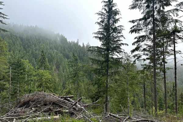
Humptulips Ridgeline Trail
This 12.9-mile point-to-point trail runs along the ridge line between the valleys of West Fork and East Fork Humptulips River. This trail gives beautiful views of the two valleys as you head back to Donkey Creek Road. This trail is a single-vehicle trail and is passable by stock 4WD vehicles.
Learn more about Humptulips Ridgeline Trail

East Fork Humptulips Trail
This 10.4-mile point-to-point trail takes you along the east side of the east fork Humptulips River Valley. This trail is mostly single-vehicle with multiple areas for turn-outs. There are several dispersed camping locations along this trail. There are many fallen trees that have been cleared off th...
Learn more about East Fork Humptulips Trail
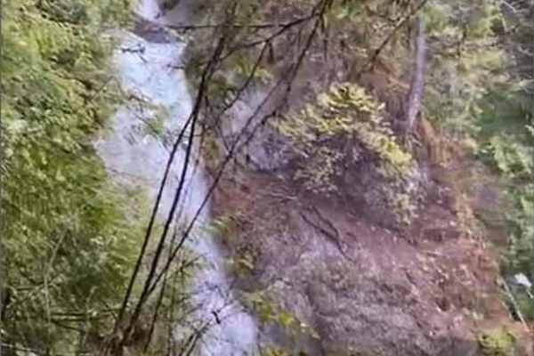
Spoon Creek Falls Adventure
This short adventure takes you up FSR 23 on a short hike that leads to the amazing 100' roaring waterfall of Spoon Creek. This route is a great launching point for many Olympic National Forest adventures, including Spider Lake, Satsop Logging Camp, and of course Wynoochee Lake and river. There is ze...
Learn more about Spoon Creek Falls Adventure

East Wynoochee Lake Trail
This 5.9-mile point-to-point trail goes along the east side of Wynoochee Lake with access to several other trails. This trail is a maintained forest service road that is easily passable by any 2WD, AWD, or 4WD vehicles. There are several dispersed camping areas and the trail ends at a large area for...
Learn more about East Wynoochee Lake Trail
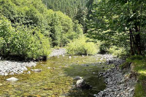
West Wynoochee Lake Trail
This 10.2 out-and-back trail takes you along the west side of Lake Wynoochee and ends where the road was washed out several years ago and is now a dispersed camping site. The last part of the trail has some overgrowth which may cause pinstriping on vehicles--an excellent trail for getting away on a ...
Learn more about West Wynoochee Lake Trail
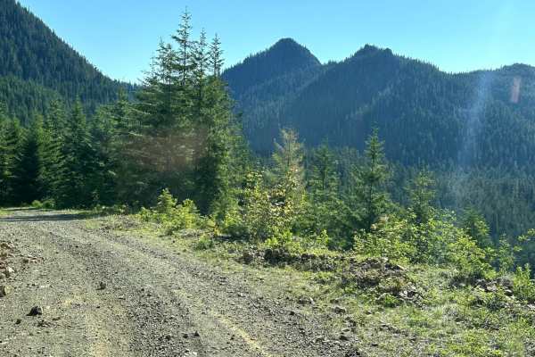
Church Creek Area Trail
This 12.8-mile trail passes through the Church Creek area. One can start from the East Wynoochee Lake trail or from the Spoon Creek Falls Adventure trail. The trail passes over the ridge line and gives excellent views of the Olympic National Forest. This trail connects to miles of other trails for e...
Learn more about Church Creek Area Trail
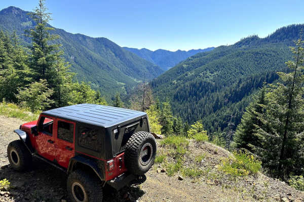
Three Peaks Loop
This 19.1-mile loop trail takes you deep into the Olympic National Forest backcountry. This is my favorite trail in the Olympic National Forest. Many waterfalls along the trail and amazing views of the Wynoochee River valley. Most of this trail is a 2-rated trail, between 5.4 and 10 miles the trail ...
Learn more about Three Peaks Loop
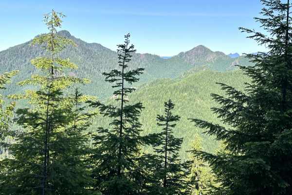
Dusk Point Trail
This 20.1 mile point-to-point trial goes past Dusky Point (trail to top is very overgrown and difficult to pass) and ends at Spoon Creek Falls. This trail gives amazing views of the valleys in Olympic National Forest. Easily passable by 4WD and AWD vehicles, some 2WD vehicles with higher clearance c...
Learn more about Dusk Point Trail
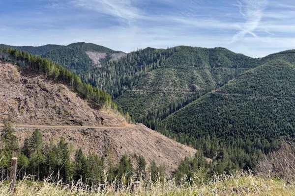
FS 2341 Lower
Forest Road 2341 Lower in the Olympic National Forest, is a classic Washington backroad climb, an easygoing but scenic route that winds steadily uphill through dense evergreen forest before opening into sweeping views. The road surface is typical for the area: mostly compact dirt and gravel with occ...
Learn more about FS 2341 Lower
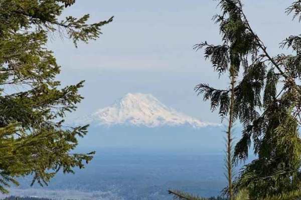
FS 2342
Forest Road 2342 in Olympic National Forest is a classic Pacific Northwest climb, starting as a narrow gravel road that quickly transitions into a mix of packed dirt, loose rock, and occasional ruts as you gain elevation. The road is generally moderate, with a few steeper, uneven sections that can g...
Learn more about FS 2342
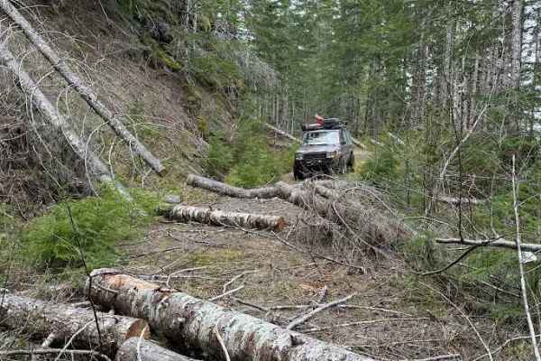
FS 2343
This road no longer goes all the way through. It ends at a washout with an 8-foot-deep stream channel. Just beyond the washout, Green Diamond Resource Company has deactivated the road at the property line. The entire route is overgrown with saplings and obstructed by blowdown and rockfall. Expect na...
Learn more about FS 2343
ATV trails near Qui-nai-elt Village, Washington
Explore ATV-friendly trails near you. These trails are accessible for vehicles up to 50 inches wide, perfect for ATVs and smaller off-road machines.
The Small Getaway Amongst Locked Gates
The Small Getaway Amongst Locked Gates is a short but highly enjoyable off-road route ideal for beginners, SxSs, and four-wheel-drive vehicles looking to explore a quick series of dirt paths and scenic lookouts near the Washington coast. Spanning roughly 2.2 miles with a technical rating of 4, this ...
Learn more about The Small Getaway Amongst Locked Gates
Newberry Creek Road
This 8.2-mile point-to-point trail gives access from Highway 101 to the West Fork Humptulips River Valley. The trail crosses over Newberry Creek and then follows along the West Fork Humptulips River. This is an enjoyable ride through the Olympic National Forest. This trail is predominantly single-ve...
Learn more about Newberry Creek Road
Ocean Shores Beach Highway
This is an original beach highway that is typically no longer used as such. Please pay attention to posted signs as there are time periods (generally spring/summer) when motor vehicles are not allowed in some sections. This trail-esq highway is solely a beach with minimal rocks. There are spots of h...
Learn more about Ocean Shores Beach Highway
Ocean Coast Overlook Trail
This 13.5 mile point-to-point trail goes up to an excellent overlook which has great views of the Washington coast line. Take this trail in the evening for some great sunset views. The west portion of the trail is better maintained and traveled more than the east portion. There is a portion of the e...
Learn more about Ocean Coast Overlook Trail
UTV/side-by-side trails near Qui-nai-elt Village, Washington
Find UTV and side-by-side trails near you. These trails accommodate vehicles up to 60 inches wide, ideal for UTVs, side-by-sides, and wider off-road rigs.
The Small Getaway Amongst Locked Gates
The Small Getaway Amongst Locked Gates is a short but highly enjoyable off-road route ideal for beginners, SxSs, and four-wheel-drive vehicles looking to explore a quick series of dirt paths and scenic lookouts near the Washington coast. Spanning roughly 2.2 miles with a technical rating of 4, this ...
Learn more about The Small Getaway Amongst Locked Gates
Newberry Creek Road
This 8.2-mile point-to-point trail gives access from Highway 101 to the West Fork Humptulips River Valley. The trail crosses over Newberry Creek and then follows along the West Fork Humptulips River. This is an enjoyable ride through the Olympic National Forest. This trail is predominantly single-ve...
Learn more about Newberry Creek Road
Ocean Shores Beach Highway
This is an original beach highway that is typically no longer used as such. Please pay attention to posted signs as there are time periods (generally spring/summer) when motor vehicles are not allowed in some sections. This trail-esq highway is solely a beach with minimal rocks. There are spots of h...
Learn more about Ocean Shores Beach Highway
Ocean Coast Overlook Trail
This 13.5 mile point-to-point trail goes up to an excellent overlook which has great views of the Washington coast line. Take this trail in the evening for some great sunset views. The west portion of the trail is better maintained and traveled more than the east portion. There is a portion of the e...
Learn more about Ocean Coast Overlook Trail
The onX Offroad Difference
onX Offroad combines trail photos, descriptions, difficulty ratings, width restrictions, seasonality, and more in a user-friendly interface. Available on all devices, with offline access and full compatibility with CarPlay and Android Auto. Discover what you're missing today!
Open Trail Map