Griffin Mann
Jun 27, 2026
Open
Muddy/Wet
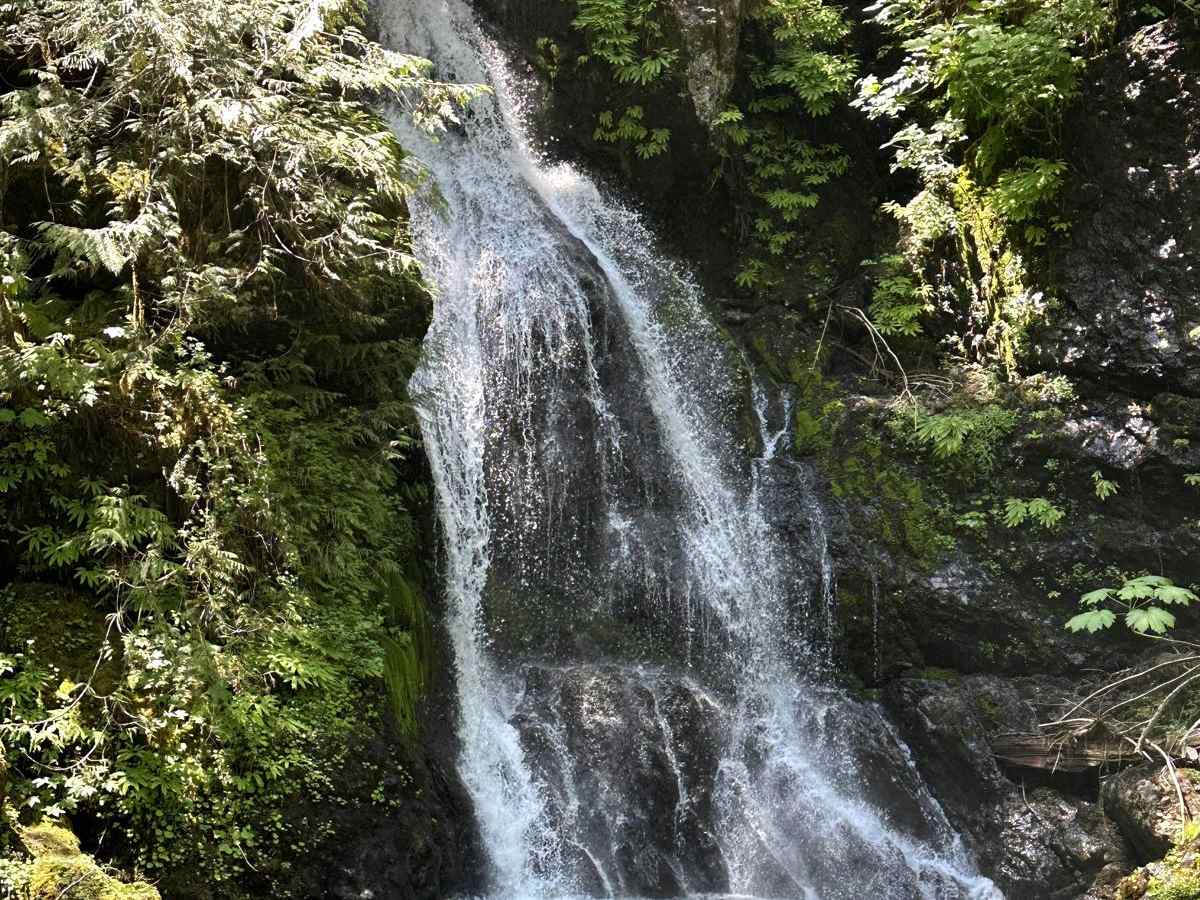
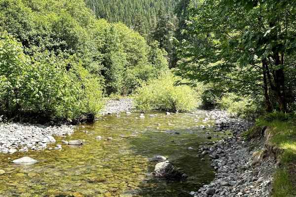
Lotta great views, waterfalls etc. Gets Narrow and washed out on back side, coming down from peak. Lot of fun on bikes for a laid back adventure.
Collin Taylor
May 23, 2026
Open
NormalDustyRough/Deteriorated
Really fun trail, couple of VERY tight gaps between either a wash out or tree stumps. I had to get out a couple times and move some of the bigger rocks out of the way, but if you’ve got a taller/lifted vehicle you should be fine. Definitely recommend 4x4 but you could probably get away with a 2 wheel and some momentum, good luck!
Brian Henries
May 03, 2026
2020 Nissan Frontier
Open
DustySnow/IceRough/Deteriorated
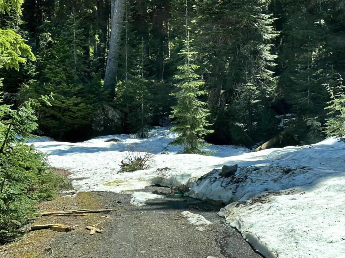
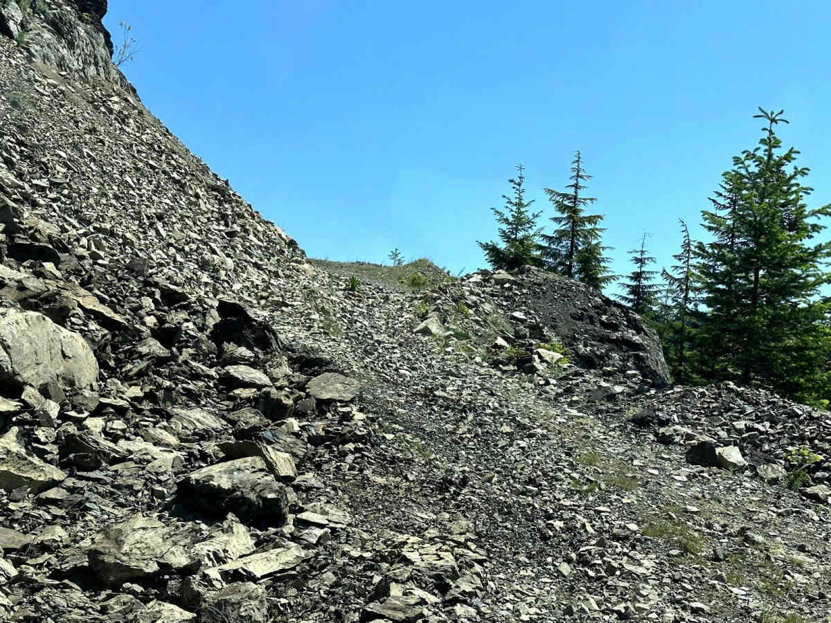
Started counter clockwise, trail is in great shape until near the summit, there is still quite a bit of slushy, spring snow. Didn’t get too far so decided to turn back and go clockwise. This way starts well groomed and nice new gravel until the switchback to climb. Snow melt has left some deeper washouts and ruts. Still manageable. We made it to the summit going this route, rock slides are present just before the top that made me real glad I was in a midsize pickup. Expect pinstripes, trail is tight in places.
Nick, L
May 02, 2026
2025 Jeep Gladiator
Open
Trail was good currently if you go counter clockwise you will deal with soft snow that packs into a slush and might not be able to cross the clockwise route is fine made it to the top and went back down the same way expect to drive against branches 3/4 of the way up. Recommend the trail a bone stock jeep Rubicon will do just fine on it.
Rohit Khanal
Dec 14, 2025
Temporarily Closed
Mike Ubezzi
Sep 20, 2025
2022 Ford F-Series
Open
DustyRough/DeterioratedNormal
Johann Mayer
Sep 03, 2025
2024 Toyota 4Runner
Open
NormalDustyRough/Deteriorated
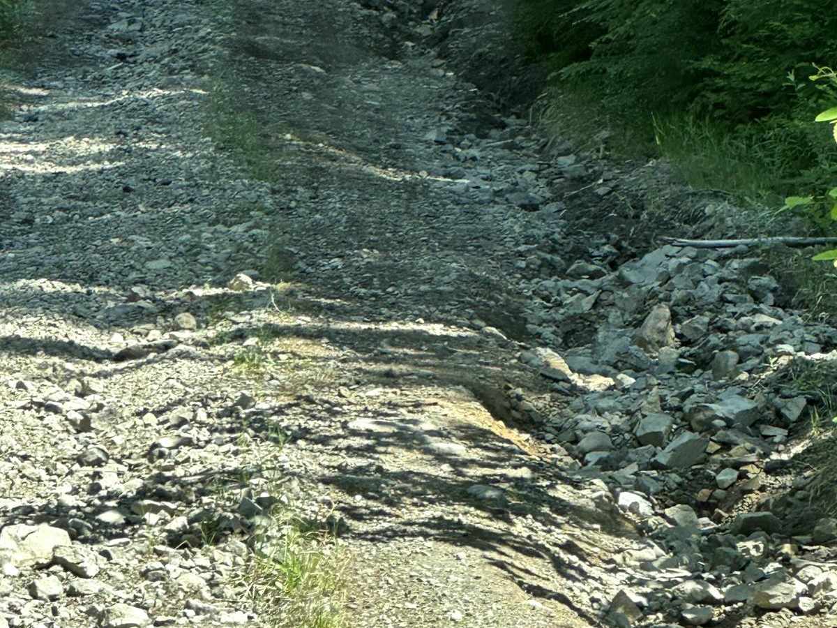
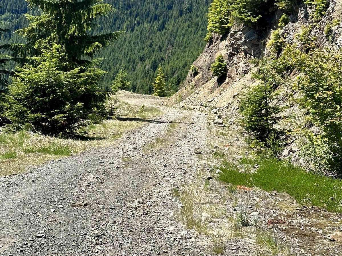
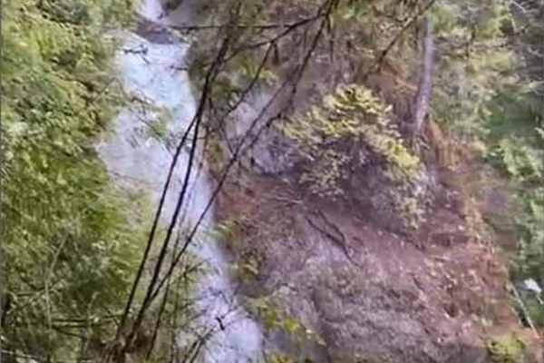
Went counterclockwise. Road up the east side was nice and easy and doable in any vehicle. Just to the west of the summit is the big slide and the road turns into mostly stable rocks and debris twisting around with a steep drop to one side. Past that, the rest of the west side has some good sized ruts to one side and gets pretty overgrown in places though people have been out trimming branches (thanks!). The rest is back to an easy gravel road.
Travis Watson
Aug 23, 2025
Open
Rough/DeterioratedNormal
Actual trip date mid 8/25
From two wheels perspective.
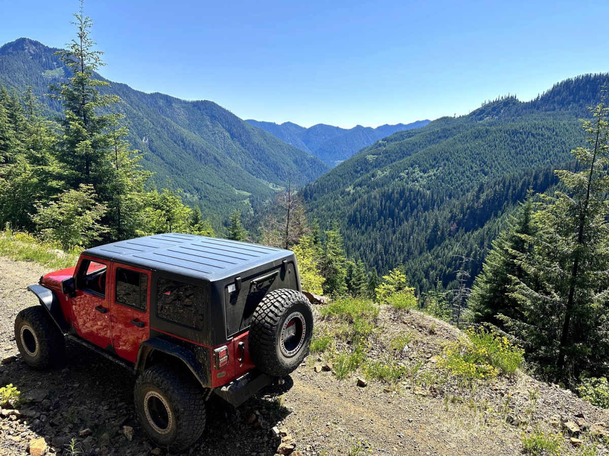
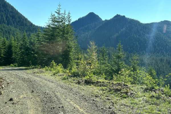
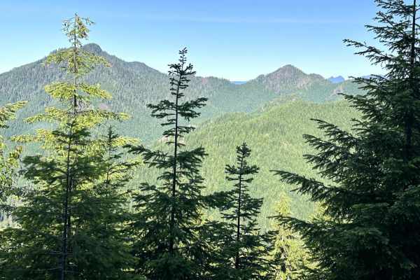
I went clockwise. Counter clockwise would be "easier," in my opinion. Had I been going clockwise I would have not likely got stuck in the big rockfall. Downhill momentum would have pushed me faster and through vs. going up too slow and digging my rear wheel into the deep rock. Took me 20 min. to finally get the big bike through after getting stuck. This was the only obstacle for me on two wheels. There are deep and wide ruts, also loose rock during the climb on the NE side. Plenty of exposure to shear cliff's. But leads to an amazing view of the 3 Peaks on a clear day. Going clockwise to the view point should be easy for most vehicles which is the best spot. You could heck it out and turn around? Past the view point, it does get much worse with not many turn arounds.
Maggie Romer
Aug 09, 2025
Open
Dusty
Trail was pretty open most of the way through, it wasn’t until coming down the mountain it got a little narrow, only 2 washouts that weren’t bad to navigate through
Ryan Douthit
Aug 07, 2025
2024 Ford Bronco Sport
Open
NormalRough/Deteriorated
This was a fun drive. We took it counter-clockwise. There was severe rutting after the cliffs, which scraped the underside of our Bronco Sport Badlands. Ruts were more than a foot deep in spots. We cleared out a lot of the overgrowth today, so most small vehicles should make it through unscathed for a couple weeks. The landslide section wasn’t a problem, but it certainly looked sketchy.
James Stark
Jul 11, 2025
Open
Dusty
Going counterclockwise, the east side of the loop is easy with any vehicle. Some dispersed camping, pictured is a neat one near the pinnacle. Continuing west there are a few narrow and rockslide spots that may be scary to some as they are next to steep drop offs, but only for a short stretch. Completing the loop to the west are very lengthy overgrown stretches sure to pinstripe vehicles. iWould recommend turning back instead as there isn’t much worth the drive there.
Shashank Bharadwaj
Jul 04, 2025
Open
DustyRough/Deteriorated
Very scenic and enjoyable trail, did the trail anti-clockwise. The section at the top over the rockslide is not hard by any means but definitely scary because of the steep drop on the left. There are also deep ruts which will cause issues for suvs without enough ground clearance. If you have decently tall off road tires and 4x4 low this trail is easily doable. There’s a lot of vegetation on some sections that will scratch your car. Had no issues in my stock 03 Ranger XLT with 265/70-R16 tires
Leo B
Jun 15, 2025
2018 Toyota Tacoma
Open
Rough/Deteriorated
Did this counter clockwise. A bit of snow at the top, easy to clear. Mostly an easy trail except for a scary tiny section at the top with rocks. Also, be careful on the way down, overgrown branches will scratch you.
Aaron Mogan
Jun 07, 2025
Obstructed
WashoutDeep Snow
Ran into snow going counter clockwise. Snow was deep. Deep washouts going clockwise.
Pavel Bocharnikov
May 31, 2025
Open
We were looking for snow and found some. Went through the whole loop. Snow wasnt bad (if your vehicle is built for it) did ran into washout and cleared it for vehicles to pass by. Drove down from peak, going down to the bridge trail is overgrown and you will scratch your car. Views are awesome!