
Dirt Bike Trails
Near Piñon Hills, California
Explore All Dirt Bike Trails Near Piñon Hills, California
Dirt Bike Trails Near Piñon Hills, California
Discover the best dirt bike trails near you. Browse trail maps, check difficulty ratings, and find your next adventure — whether you're looking for a quick ride or an all-day expedition.
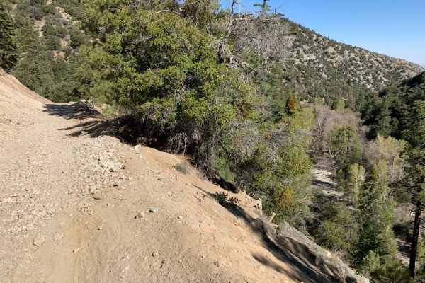
Mescal Canyon Road
Mescal Canyon Road is an ideal trail for beginner offroaders and scenic explorers looking for an accessible dirt route that transitions beautifully between the high desert and the pine-covered slopes near Wrightwood. Spanning approximately 3.1 miles through the San Gabriel Mountains, this point-to-p...
Learn more about Mescal Canyon Road
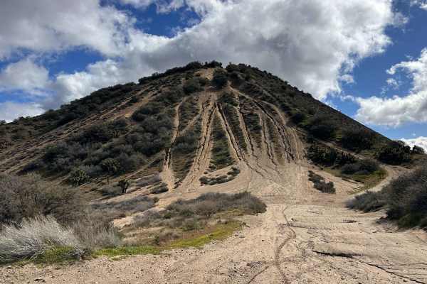
The Widow Maker
The legend of "The Widow Maker" precedes itself among local riders, standing as a rite of passage for those with enough grit to attempt the ascent. This iconic hill climb offers an adrenaline-pumping vertical challenge that rewards successful climbers with some of the most spectacular, high-altitude...
Learn more about The Widow Maker
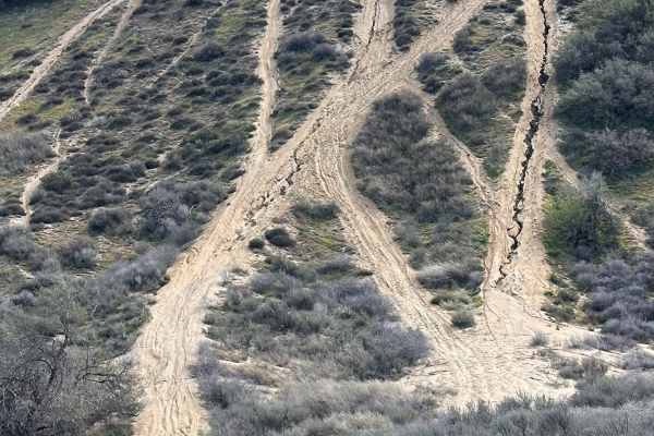
Chickens
This route serves as one of the primary bypass options for the more intimidating main line of the legendary Widow Maker hill climb. It is a fantastic alternative for riders who want to experience the thrill of the ascent without the "all-or-nothing" commitment of the most vertical face. Whether you ...
Learn more about Chickens
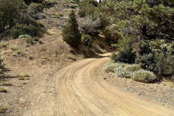
Pinyon Ridge Truck Trail
This is a mellow trail along Pinyon Ridge, which is just west of Vincent Gap and Blue Ridge. The trail itself is mellow and surrounded by - you guessed it - single-leaf/needle Pinyon pine trees, which are the namesake of the ridge and native to only the Western United States. There are no less than ...
Learn more about Pinyon Ridge Truck Trail
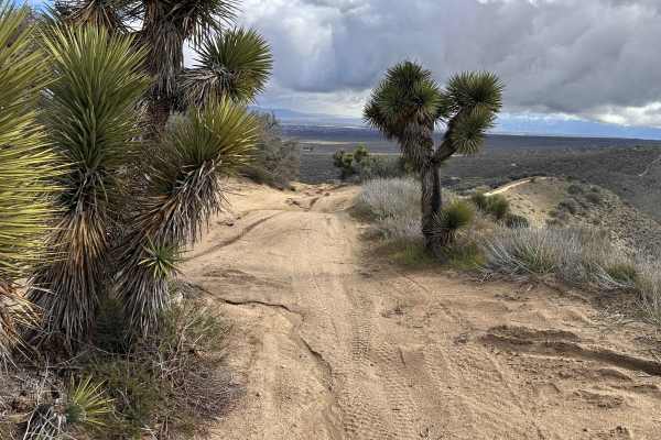
Tom's Kitchen
This technical offshoot trail is a local favorite for those who enjoy gaining elevation through a series of challenging, sandy whoop sections. As you climb, the terrain opens up to reveal some of the most scenic views in the region, making it an ideal spot to kill the engine and enjoy a cold drink. ...
Learn more about Tom's Kitchen
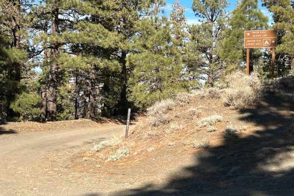
3N267 Fenner Saddle (4N12)
The trail starts at the third quarter into marked trail 3N26. There is shade for more than half of the trail from mature tree and a hillside for the majority of the trail. During certain times of year, there are shallow creek crossings and obstacles such as fallen trees and boulders from the hillsid...
Learn more about 3N267 Fenner Saddle (4N12)

3N26
Trail head starts on Angeles Crest Highway at the Vincent Gap Turnout. It is a very short trail that leads to a locked gate at Jackson Flat Camping Area. The scenery during this trail consists of mature trees providing plenty of shade throughout the trail, views of the Antelope Valley from above, an...
Learn more about 3N26
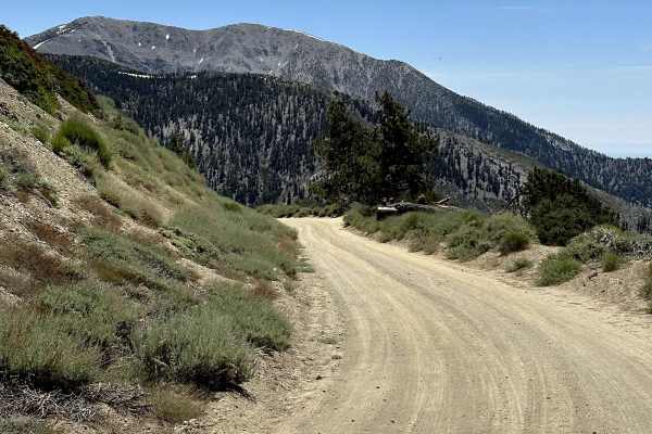
Blue Ridge Truck Trail
This trail is a pretty drive along Blue Ridge in the eastern San Gabriel Mountains. The trail overlooks Mount Baden-Powell, Vincent Gulch, Pine Mountain/Pine Mountain Ridge, the Mountain High ski resort, Wright Mountain, and of course, the towering Mount San Antonio. The trail begins along CA Highwa...
Learn more about Blue Ridge Truck Trail
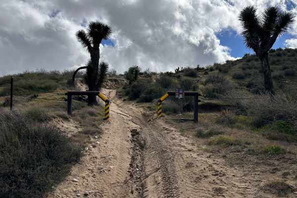
Packers Ridge
Trail Overview
This iconic technical offshoot is a true gauntlet designed to test the skills of even the most seasoned riders. Branching off from the primary dirt road, the trail carries a name bestowed upon it by the "Goggle Packers", an early, legendary group of local riders. While the lore sugges...
Learn more about Packers Ridge
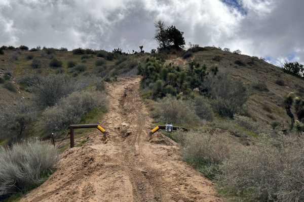
WLF Ridge
This technical offshoot is a step up from the standard access roads, offering a technical "wolf pack" style challenge for those who don't want to ride alone. It features a substantial technical section that transitions into demanding, off-clamber hill climbs where the ground seems to fall away benea...
Learn more about WLF Ridge
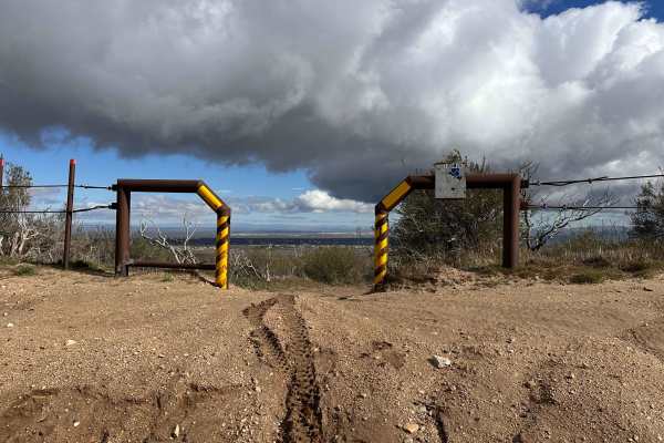
P-Town Loop Out
As a recent legal addition to the local OHV network, this trail represents the ongoing effort to provide sustainable and sanctioned riding opportunities in the area. It features a great variety of technical sections and numerous offshoots that allow you to customize your experience based on your ski...
Learn more about P-Town Loop Out

Sand Rip Loop
This fun little sand loop section is a treat for those who enjoy higher-speed desert riding and the unique sensation of floating over soft terrain. You have to access it via the Manzanita Trail, which keeps it tucked away from the more casual crowds and provides a more secluded feel. There is a dist...
Learn more about Sand Rip Loop

Baldy Bald Climb
This technical offshoot is designed as a "shortcut" for those who prefer to swap distance for difficulty. While it significantly cuts down the mileage compared to the main trail, it makes up for the shorter length with a concentrated series of obstacles. It is specifically placed to test your techni...
Learn more about Baldy Bald Climb
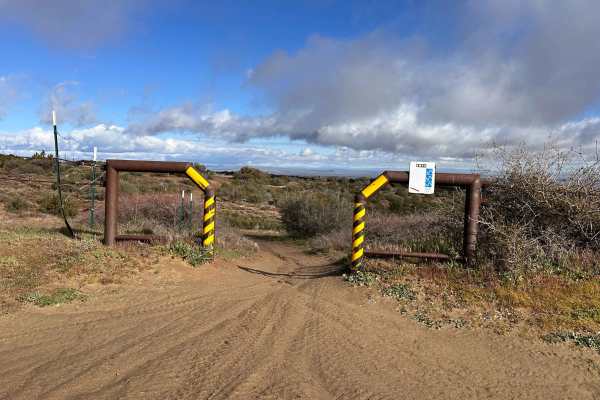
Manzanita Wash
This is a fairly recently added trail to the local system, and while it is great to see new options being developed, the design is noticeably wide. In many sections, the width feels more like a fire road than a traditional trail, which can take away from that tight, flowing rhythm many riders prefer...
Learn more about Manzanita Wash

Ruts & Roots
This out-and-back route offers a refreshing change of pace, featuring several fun water crossings that are rare in this high-desert environment. The trail winds through surprisingly lush vegetation, requiring some quick reflexes to dodge overhanging branches while maintaining your flow. Since there ...
Learn more about Ruts & Roots

Dori's Downhill
This cool little technical section is specifically designed to let you test your skills and see how your rig handles more precise maneuvers. It offers a concentrated dose of obstacles that will keep you on your toes, requiring steady throttle control and smart line choices to clear. Because it is a ...
Learn more about Dori's Downhill
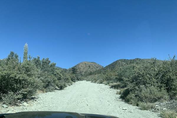
Slade Canyon
Slade Canyon is a short, scenic climb perfect for beginner offroaders looking to escape into the San Bernardino National Forest and enjoy panoramic mountain views above the Lytle Creek area. Stretching approximately 2.8 miles, this route begins near the creek bed at an elevation of 5,228 feet and cl...
Learn more about Slade Canyon

Dougies Dip
This section is a playground for riders who crave variety, as the area is densely packed with technical offshoot options. It serves as an official "skills test" cutoff, specifically designed to push you beyond the standard trail experience and challenge your technical precision. Depending on the cur...
Learn more about Dougies Dip

BM Bush Run
This cool little access trail serves as a vital connector, smoothly linking you to several other major OHV areas in the region. While it lacks heavy technical obstacles, it makes up for it with a fun series of elevation changes that keep the ride engaging from start to finish. You will find yourself...
Learn more about BM Bush Run
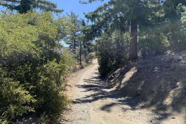
Gobblers Knob Spur A
This is a beautiful trail that leads you to the highest point within the little set of trails in this area. It also connects at the top with the Pacific Crest Trail (PCT). Be careful when you reach the top because it is possible for you to find hikers on the PCT at most times of the year. The road i...
Learn more about Gobblers Knob Spur A
ATV trails near Piñon Hills, California
Explore ATV-friendly trails near you. These trails are accessible for vehicles up to 50 inches wide, perfect for ATVs and smaller off-road machines.
The Widow Maker
The legend of "The Widow Maker" precedes itself among local riders, standing as a rite of passage for those with enough grit to attempt the ascent. This iconic hill climb offers an adrenaline-pumping vertical challenge that rewards successful climbers with some of the most spectacular, high-altitude...
Learn more about The Widow Maker
Chickens
This route serves as one of the primary bypass options for the more intimidating main line of the legendary Widow Maker hill climb. It is a fantastic alternative for riders who want to experience the thrill of the ascent without the "all-or-nothing" commitment of the most vertical face. Whether you ...
Learn more about Chickens
Pinyon Ridge Truck Trail
This is a mellow trail along Pinyon Ridge, which is just west of Vincent Gap and Blue Ridge. The trail itself is mellow and surrounded by - you guessed it - single-leaf/needle Pinyon pine trees, which are the namesake of the ridge and native to only the Western United States. There are no less than ...
Learn more about Pinyon Ridge Truck Trail
Tom's Kitchen
This technical offshoot trail is a local favorite for those who enjoy gaining elevation through a series of challenging, sandy whoop sections. As you climb, the terrain opens up to reveal some of the most scenic views in the region, making it an ideal spot to kill the engine and enjoy a cold drink. ...
Learn more about Tom's Kitchen
UTV/side-by-side trails near Piñon Hills, California
Find UTV and side-by-side trails near you. These trails accommodate vehicles up to 60 inches wide, ideal for UTVs, side-by-sides, and wider off-road rigs.
Chickens
This route serves as one of the primary bypass options for the more intimidating main line of the legendary Widow Maker hill climb. It is a fantastic alternative for riders who want to experience the thrill of the ascent without the "all-or-nothing" commitment of the most vertical face. Whether you ...
Learn more about Chickens
Pinyon Ridge Truck Trail
This is a mellow trail along Pinyon Ridge, which is just west of Vincent Gap and Blue Ridge. The trail itself is mellow and surrounded by - you guessed it - single-leaf/needle Pinyon pine trees, which are the namesake of the ridge and native to only the Western United States. There are no less than ...
Learn more about Pinyon Ridge Truck Trail
3N267 Fenner Saddle (4N12)
The trail starts at the third quarter into marked trail 3N26. There is shade for more than half of the trail from mature tree and a hillside for the majority of the trail. During certain times of year, there are shallow creek crossings and obstacles such as fallen trees and boulders from the hillsid...
Learn more about 3N267 Fenner Saddle (4N12)
3N26
Trail head starts on Angeles Crest Highway at the Vincent Gap Turnout. It is a very short trail that leads to a locked gate at Jackson Flat Camping Area. The scenery during this trail consists of mature trees providing plenty of shade throughout the trail, views of the Antelope Valley from above, an...
Learn more about 3N26
The onX Offroad Difference
onX Offroad combines trail photos, descriptions, difficulty ratings, width restrictions, seasonality, and more in a user-friendly interface. Available on all devices, with offline access and full compatibility with CarPlay and Android Auto. Discover what you're missing today!
Open Trail Map