
Dirt Bike Trails
Near Olathe, Colorado
Explore All Dirt Bike Trails Near Olathe, Colorado
Dirt Bike Trails Near Olathe, Colorado
Discover the best dirt bike trails near you. Browse trail maps, check difficulty ratings, and find your next adventure — whether you're looking for a quick ride or an all-day expedition.
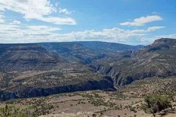
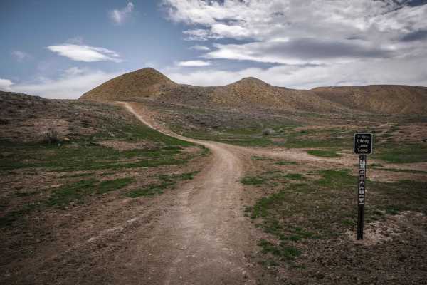
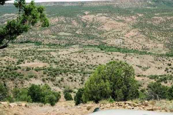
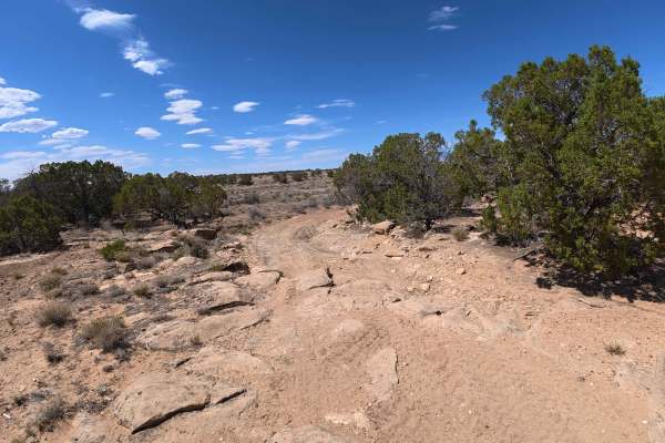
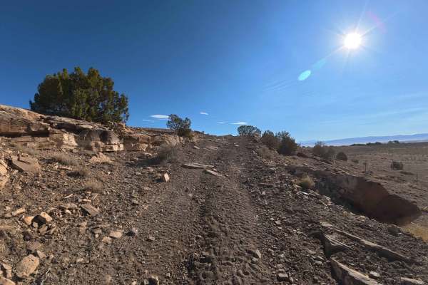
Smith Mountain
Smith Mountain is a fairly easy and enjoyable trail. BLM signs call it Smith Mountain Jeep Trail. Starting at the south end. this trail runs through the low country of Peach Valley then turns and climbs up to the west rim of the Gunnison Gorge. It then follows the rim for a distance then drops down...
Learn more about Smith Mountain
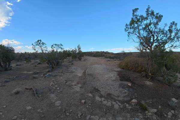
Wave-Eagle Loop
Wave-Eagle Loop is a short trail that begins in an ATV off-road area, climbs up, and follows a ridge with distant views of Gunnison Gorge, then returns to the ATV area. The Peach Valley Open OHV Area is part of the Gunnison Gorge National Conservation Area. Cross-country motorcycles and ATV riding a...
Learn more about Wave-Eagle Loop
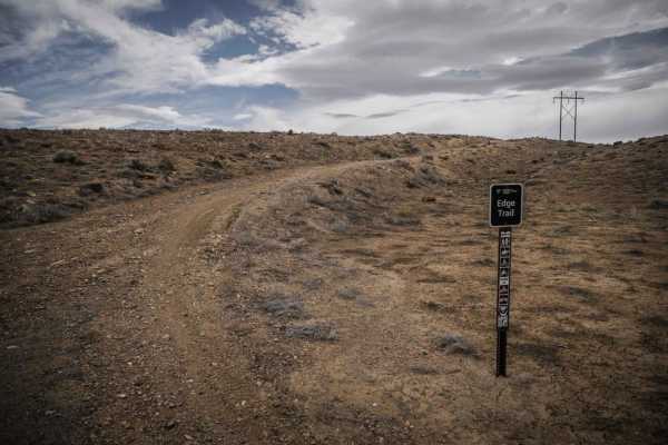
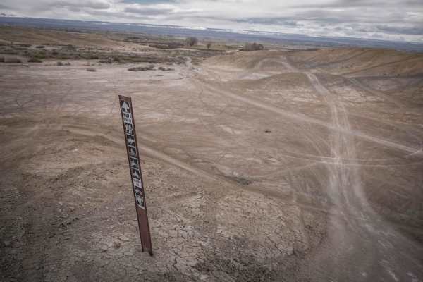
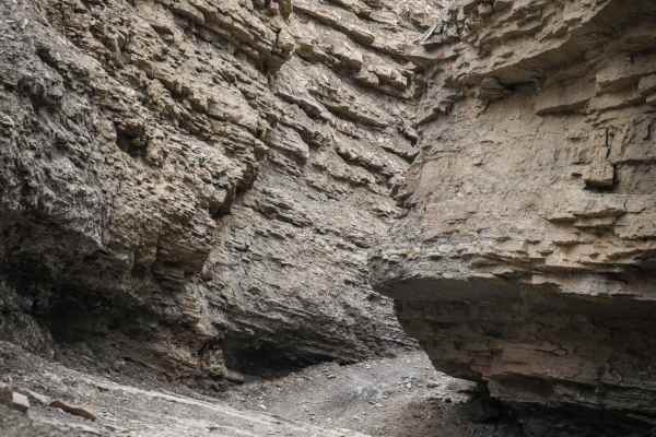
Edge Trail
The Edge Trail is an adobe ridgeline trail in the Peach Valley Recreation Area that goes through an adobe clay badlands landscape. Starting from the northern trailhead, it starts wide but narrows up on the first adobe ridge lines. While on the ridge, you can see straight down to the steep grey fins ...
Learn more about Edge Trail
Highway One (Part One)
Highway One is an ATV trail that is the main thoroughfare between the Peach Valley staging area and the Elephant Skin staging area. From the north trailhead, it drops down from Peach Valley staging area and becomes a wide major dirt trail on adobe clay soil. It is as wide as a highway in parts and v...
Learn more about Highway One (Part One)
Candy Cane Loop
Candy Cane Loop is an adobe ridge line loop for 50" vehicles in Peach Valley, but has some spots that may be quite narrow for an ATV. Going clockwise, it starts as a winding and whooped out two tracks that meanders on the tops of the adobe clay hills. It has several off camber banked corners in the ...
Learn more about Candy Cane Loop
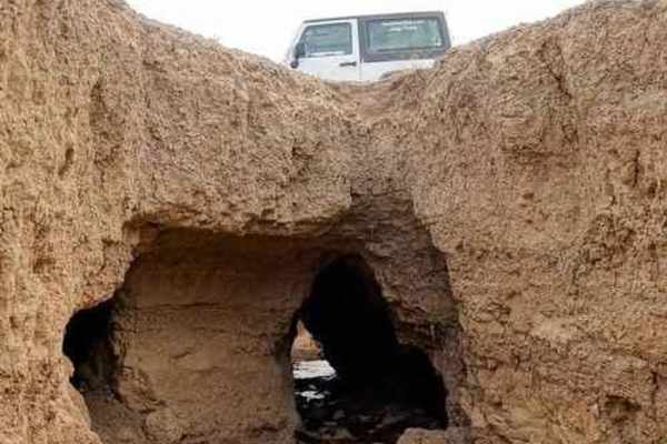
Elephant Skin Road
Elephant Skin Road is an easy Jeep trail between Montrose and Olathe. There are a few shallow gullies across the road, but can be done with any vehicle with a bit of clearance. There is a very strange occurrence in the middle of the trail. There is an area where gullies are joined by underground n...
Learn more about Elephant Skin Road
Snake ATV Trail
The Snake ATV trail is a fun ATV trail accessed from the Peach Valley Staging Area that winds at the bottom of the flat valley between the adobe hills. It mostly covers the flat ground and winds back and forth between two hills. There are two narrower sections, and it crosses the Highway One ATV tra...
Learn more about Snake ATV Trail
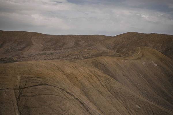
Peach Valley Loop
Peach Valley Loop is one of several ATV trails in the Peach Valley Recreation Area. It is an easy and wide two track making a loop on the adobe clay badlands that make up much of this trail system. It starts at the Peach Valley staging area and climbs up the adobe hills to the ridge lines on top. Th...
Learn more about Peach Valley Loop
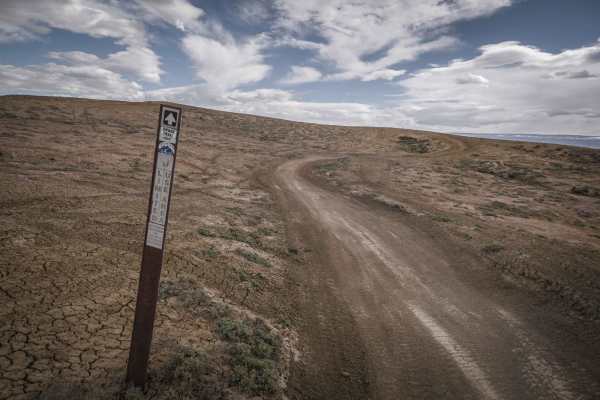
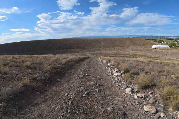
Rim Road
The primary purpose of this trail is to access six of the seven Dry Creek rock crawling trails. Rim Road runs from US 50 to Divide Road and occasionally approaches the "rim" above Shavano Valley and this may be how the name came to be. This road includes several very minor trails that lead to and f...
Learn more about Rim Road

Highway One (Part Two)
Highway One (Part Two) is a continuation of Highway One (Part One) ATV trail that is the main thoroughfare between the Peach Valley staging area and the Elephant Skin staging area. From the north trailhead, it drops down from Peach Valley staging area and becomes a wide major dirt trail on adobe cla...
Learn more about Highway One (Part Two)
Highway Ridge
This unmarked single track is part of the Peach Valley Recreation Area and is a fun ridge line trail along the adobe clay badlands that make up much of this trail system. This trail is relatively easy compared to some of the other ridge line trails in this trail system because the trail is pretty wi...
Learn more about Highway Ridge
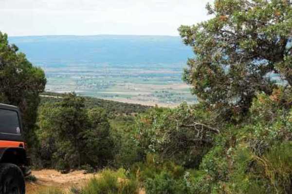
Eagle Valley
Eagle Valley is a highlight of visiting the Peach Valley riding area and shouldn't be missed if up for a rocky challenge. The trail is short, only 1 mile, but one of the more difficult trails in the trail system. It starts in a wash from the staging area on Chukar Road, and then quickly enters into ...
Learn more about Eagle Valley
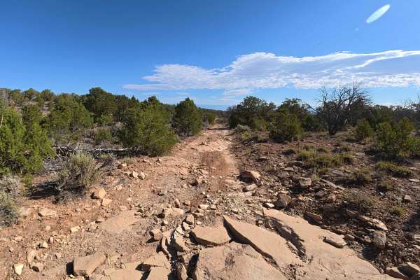
Sidewinder Trail
The Sidewinder Trail is a challenging 20-mile technical single-track route located on the western edge of the Gunnison Gorge National Conservation Area. This twisting trail winds through high-desert terrain, showcasing dry washes and rocky slopes adorned with resilient pinon pine and juniper trees. ...
Learn more about Sidewinder Trail

West Transfer Road
Branching smoothly off the main Tower Road, West Transfer Road provides an exceptionally expansive, wide-open valley transit. This 5.1-mile route initially features very mild surface imperfections, predominantly small 2-to-4-inch ruts and light obstacles easily negotiated by most vehicles. The journ...
Learn more about West Transfer Road
Coal Bank Loop
The Coal Bank Loop is a scenic and more forested route than the surrounding trails, beginning off Tower Road. Winding tightly through dense, verdant tree cover, it offers a distinctly engaging driving experience characterized by its intimate, lush atmosphere. The trail quickly introduces moderate ob...
Learn more about Coal Bank Loop
Little Buck Road
Little Buck Road offers a delightfully short, exceptionally relaxed 2.5-mile journey through some of the area's most picturesque high-desert terrain. This highly accessible route gently meanders over firm dirt tracks and light rocky surfaces, remaining remarkably free of severe technical challenges....
Learn more about Little Buck Road
Tower Road North
Tower Road North begins at a small, convenient staging area capable of accommodating roughly 4 to 6 vehicles, featuring an inviting, shaded campsite complete with a fire ring situated immediately off the entrance. The journey starts with relatively minor ruts and modest ledges, but quickly plunges i...
Learn more about Tower Road North
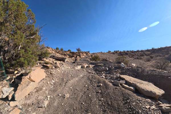
Roatcap Gulch Road
Roat Cap Road is a thrilling, highly dynamic 6.6-mile expedition that continuously evolves from a scenic valley transit into a rigorous, high-exposure mountain ascent. The journey begins by weaving through striking canyon corridors that offer alternating, expansive views of the lower valleys. Early ...
Learn more about Roatcap Gulch Road
Ben Lowe Road - BLM 860
Serving as a direct continuation immediately following the challenging Tower Road, the scenic Ben Lowe Road (BLM 860) offers a captivating 5.0-mile journey deep into rugged canyon territory. Because this isolated trail mandates the completion of Tower Road first, travelers are rewarded with profound...
Learn more about Ben Lowe Road - BLM 860
Roy's Junction Road
Roy's Junction Road provides a captivating, multi-faceted journey starting from a generous staging area capable of accommodating roughly 4–12 vehicles, located at the very onset of Rim Road. This 4.3-mile transit traverses dynamic canyon and rolling hill terrain adorned with consistent, sprawling sc...
Learn more about Roy's Junction Road
ATV trails near Olathe, Colorado
Explore ATV-friendly trails near you. These trails are accessible for vehicles up to 50 inches wide, perfect for ATVs and smaller off-road machines.
Smith Mountain
Smith Mountain is a fairly easy and enjoyable trail. BLM signs call it Smith Mountain Jeep Trail. Starting at the south end. this trail runs through the low country of Peach Valley then turns and climbs up to the west rim of the Gunnison Gorge. It then follows the rim for a distance then drops down...
Learn more about Smith Mountain
Wave-Eagle Loop
Wave-Eagle Loop is a short trail that begins in an ATV off-road area, climbs up, and follows a ridge with distant views of Gunnison Gorge, then returns to the ATV area. The Peach Valley Open OHV Area is part of the Gunnison Gorge National Conservation Area. Cross-country motorcycles and ATV riding a...
Learn more about Wave-Eagle Loop
Highway One (Part One)
Highway One is an ATV trail that is the main thoroughfare between the Peach Valley staging area and the Elephant Skin staging area. From the north trailhead, it drops down from Peach Valley staging area and becomes a wide major dirt trail on adobe clay soil. It is as wide as a highway in parts and v...
Learn more about Highway One (Part One)
Elephant Skin Road
Elephant Skin Road is an easy Jeep trail between Montrose and Olathe. There are a few shallow gullies across the road, but can be done with any vehicle with a bit of clearance. There is a very strange occurrence in the middle of the trail. There is an area where gullies are joined by underground n...
Learn more about Elephant Skin Road
UTV/side-by-side trails near Olathe, Colorado
Find UTV and side-by-side trails near you. These trails accommodate vehicles up to 60 inches wide, ideal for UTVs, side-by-sides, and wider off-road rigs.
Smith Mountain
Smith Mountain is a fairly easy and enjoyable trail. BLM signs call it Smith Mountain Jeep Trail. Starting at the south end. this trail runs through the low country of Peach Valley then turns and climbs up to the west rim of the Gunnison Gorge. It then follows the rim for a distance then drops down...
Learn more about Smith Mountain
Wave-Eagle Loop
Wave-Eagle Loop is a short trail that begins in an ATV off-road area, climbs up, and follows a ridge with distant views of Gunnison Gorge, then returns to the ATV area. The Peach Valley Open OHV Area is part of the Gunnison Gorge National Conservation Area. Cross-country motorcycles and ATV riding a...
Learn more about Wave-Eagle Loop
Elephant Skin Road
Elephant Skin Road is an easy Jeep trail between Montrose and Olathe. There are a few shallow gullies across the road, but can be done with any vehicle with a bit of clearance. There is a very strange occurrence in the middle of the trail. There is an area where gullies are joined by underground n...
Learn more about Elephant Skin Road
Rim Road
The primary purpose of this trail is to access six of the seven Dry Creek rock crawling trails. Rim Road runs from US 50 to Divide Road and occasionally approaches the "rim" above Shavano Valley and this may be how the name came to be. This road includes several very minor trails that lead to and f...
Learn more about Rim Road
The onX Offroad Difference
onX Offroad combines trail photos, descriptions, difficulty ratings, width restrictions, seasonality, and more in a user-friendly interface. Available on all devices, with offline access and full compatibility with CarPlay and Android Auto. Discover what you're missing today!
Open Trail Map