
Dirt Bike Trails
Near Mountain View Ranches, Arizona
Explore All Dirt Bike Trails Near Mountain View Ranches, Arizona
Dirt Bike Trails Near Mountain View Ranches, Arizona
Discover the best dirt bike trails near you. Browse trail maps, check difficulty ratings, and find your next adventure — whether you're looking for a quick ride or an all-day expedition.
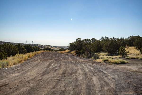
Two Guns Access
Listed as an access road to Two Guns, Arizona, this road does not go through. It runs along the I-40 Interstate in its entirety and has no obstacles on it. This trail is wide, with plenty of room to pass and/or turn around. It serves as an access point to the many trails that shoot off into the fore...
Learn more about Two Guns Access
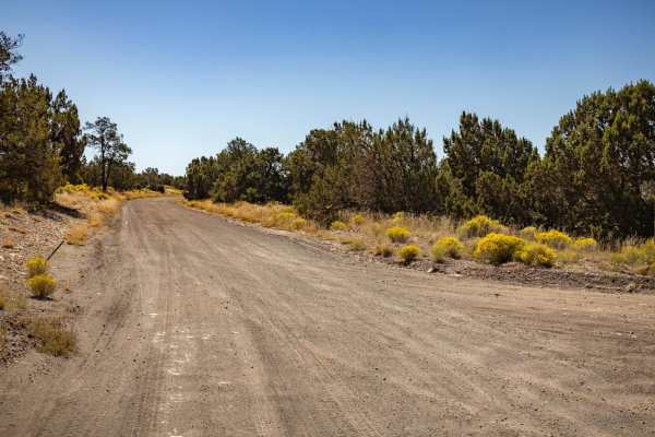
FS 82
FS 82 is a wide dirt road with no obstacles on it. This trail is a main artery that cuts through this area, there are many access points to head deeper into the forest on numerous intersecting trails. There are no obstacles on this trail, other than some mild ruts and erosion/water damage. This trai...
Learn more about FS 82
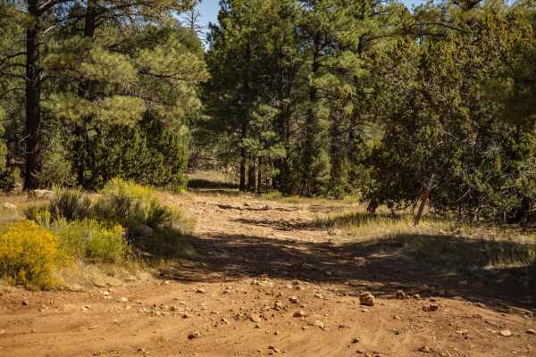
9484
The 9484 Trail is a rocky trail with numerous wash crossings. Some of these have steep entrances and exits, as well as off-camber sections. There are numerous spots along this trail that are affected by water, with erosion, water damage, and washouts. This trail ran North to South, and toward the So...
Learn more about 9484
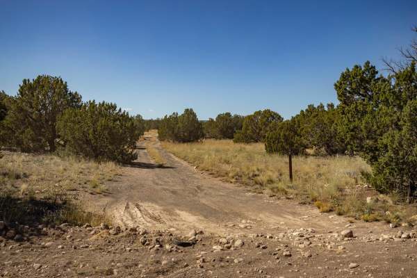
4B
The 4B trail is a mostly mellow trail, with no major obstacles on it. The trail sports erosion and water damage, as well as some wash crossings with off-camber, steep entrances and exits. Some of the water damage has left rock ledges, but nothing that a standard off-road vehicle can't handle. The tr...
Learn more about 4B
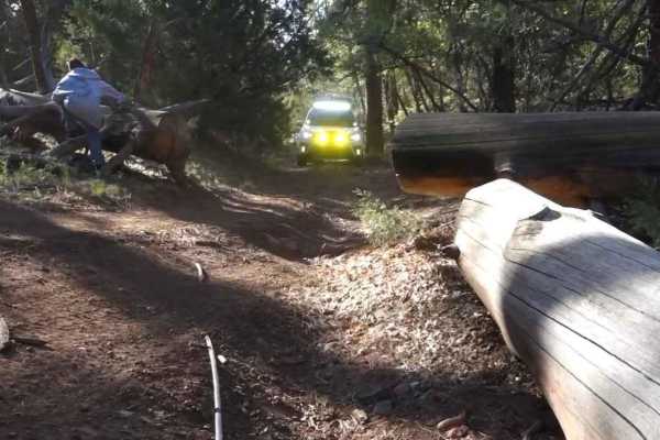
Breezy Tank FS 9849
This tight and winding trail, an offshoot of Marshall Lake Road, makes for a fun half-day challenge. Some deep ruts, small ledges, jutting tree roots, and sharp rocky sections lead you back to a beautiful and sprawling view of Marshall Lake and the surrounding areas.
Learn more about Breezy Tank FS 9849
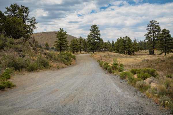
Cinder Hills OHV Area / 776
The Cinder Hills OHV Area is a unique off-road playground just northeast of Flagstaff, offering riders and drivers access to a surreal volcanic landscape covered in fine black cinder. Spread across thousands of acres, this area features open riding zones, hill climbs, and rolling terrain dotted with...
Learn more about Cinder Hills OHV Area / 776
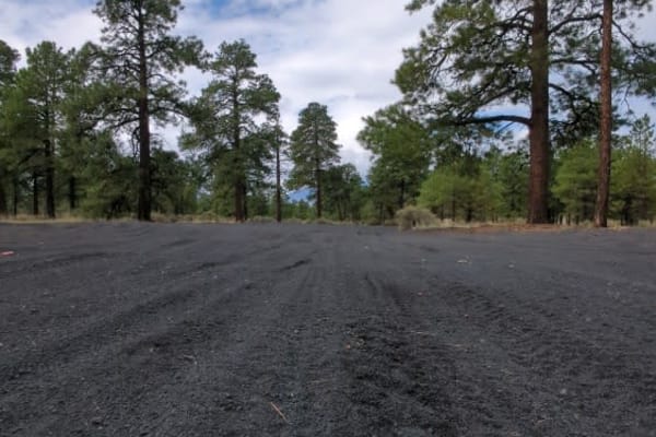
Cinder Hills OHV Area 777
This full-width, gently rolling, whoops-filled, cinder track winds between cinder cones and through the heart of Cinder Hills OHV. Aside from a sign at either end with mileage to Cinder Lake and the 776 intersections, there is no signage designating the official 777 route. Because this is an open ri...
Learn more about Cinder Hills OHV Area 777
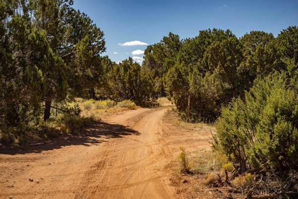
128 E
Trail 128E is a one-lane mostly dirt trail. At times this trail will cross rock gardens with many large and loose rocks. There are numerous wash crossings that have off-camber sections as well as steep entrances and exits. There are mud ruts, as well as erosion with significant damage/washouts along...
Learn more about 128 E
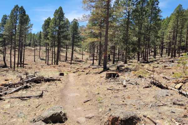
Secret
The Secret Trail is part of the Fort Valley Trail System in Coconino National Forest. The trail is most easily accessed from the Sunset Trailhead approximately 5 miles up Shultz Pass Road. The trail starts off as a nice single track with some fun switchbacks and short rocky sections. It then proceed...
Learn more about Secret
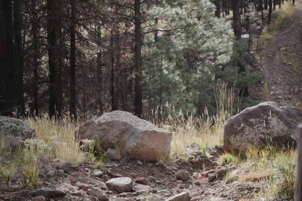
Pipeline
The Pipeline is an old pipeline road running east to west that has been closed to full-width vehicles and can be ridden to connect Secret and Rocky Moto single-track trails. It's pretty rocky with lots of washouts and ruts from rain. It has big ups and downs as it crosses the rolling hills, with hug...
Learn more about Pipeline
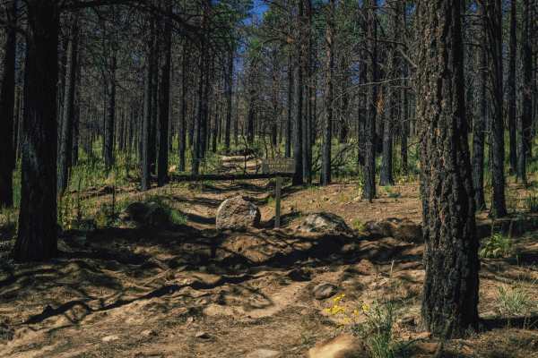
553
The 553 Trail starts as a wide dirt road that is mellow, with some erosion and water damage. NOTE* This trail is BLOCKED 2 miles in, and does not connect as it usually would with the Lockett Meadow Campground. As you come up into the beautiful Ponderosa Pines, you'll see sporadic campsites and pullo...
Learn more about 553
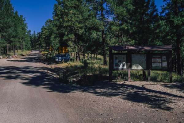
Schultz Pass
Schultz Pass is a beautiful road that cuts through the Coconino National Forest outside of Flagstaff, Arizona. This road is well traveled, with no obstacles on it. It's wide and gravel, and a popular spot for hikers and mountain bikers alike, with numerous named mountain bike and hiking trails that ...
Learn more about Schultz Pass
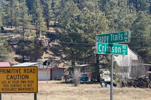
Crimson Road to FS 132 Junction
This is a short road that connects Crimson Road to FR 132. However, the last section that connects it is private access only. There is no public easement, so you must have permission from the home owner to crossover from Crimson Road to FS 132.
Learn more about Crimson Road to FS 132 Junction
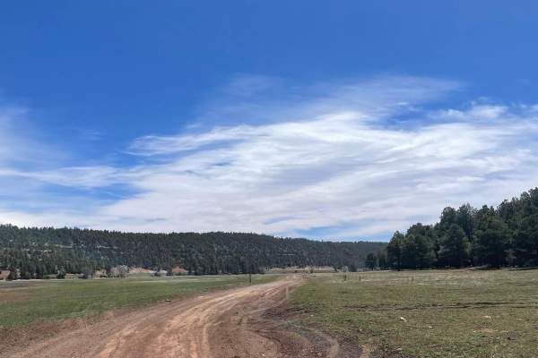
Lower Lake Mary Semi Loop
This trail clocks in at 3.4 miles long and provides access to the southwest side of Lower Lake Mary. The trail is a maintained dirt road that has some small rocky sections on the southern portion. Camping is only allowed on the first mile of the northwestern part of this road. In this area, there ar...
Learn more about Lower Lake Mary Semi Loop
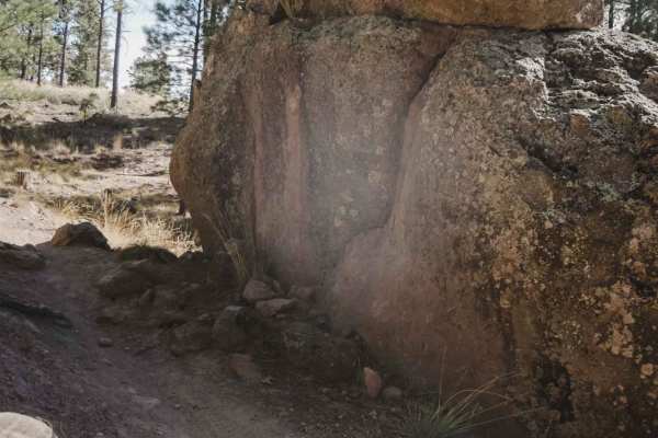
Chimney
Chimney is an easy and flowy single track in the trail system north of Flagstaff that goes through a dry pine tree forest. The trail has lots of easy curves, small rocks, and roots, and is mostly flat, making it great for a beginner rider. There is one tiny shelfy section with a small root ledge, ot...
Learn more about Chimney
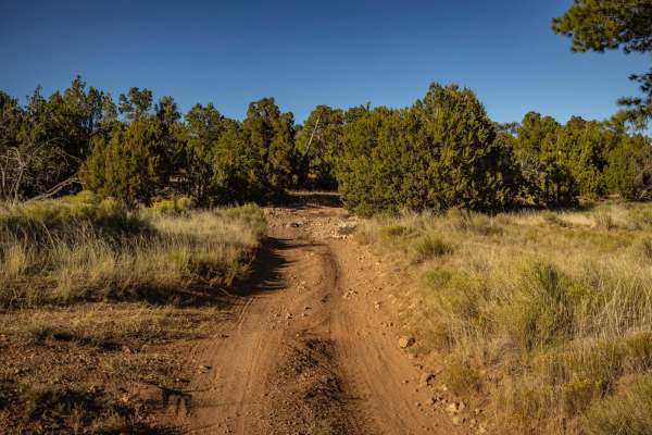
Power North
Power North is decidedly not as challenging as its counterpart to the South, but it does sport ledges of varying size, particularly on the uphills. There are wash crossings filled with large rocks, and these crossings have steep entrances and exits that could become challenging if attempted during m...
Learn more about Power North
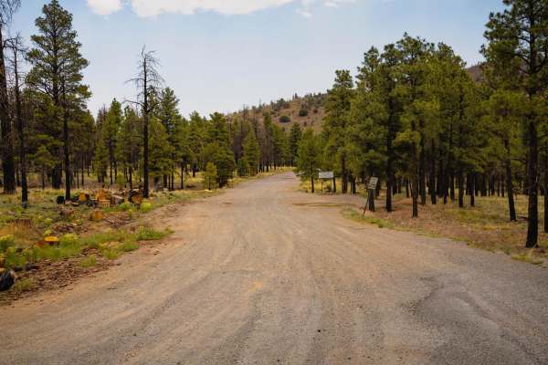
O'Leary Peak Loop
O'Leary Peak Loop offers a dynamic blend of terrain and scenery just northeast of Flagstaff, winding through the unique volcanic landscape of the Coconino National Forest. The route starts wide and easy, and then transitions into a two-track that gradually gains elevation as it wraps around the base...
Learn more about O'Leary Peak Loop
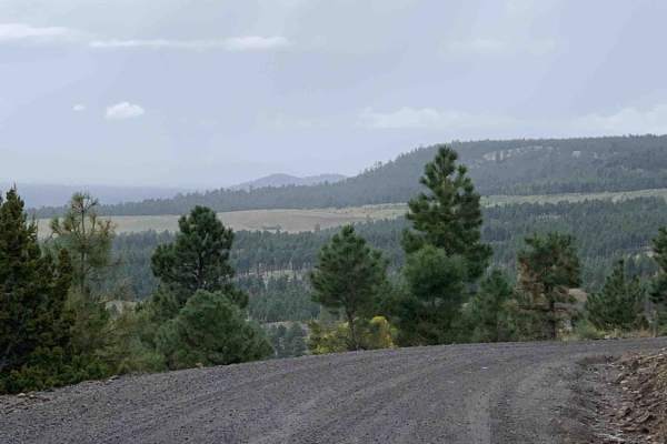
Lockett Meadow Trail
This is a simple Forest Service road but has great views and camp sites scattered around as well. The road is a sandy but with the washboard effect! If possible, air down, ride the trail and then explore the off shoot trails. Camp sites are all over the place.
Learn more about Lockett Meadow Trail
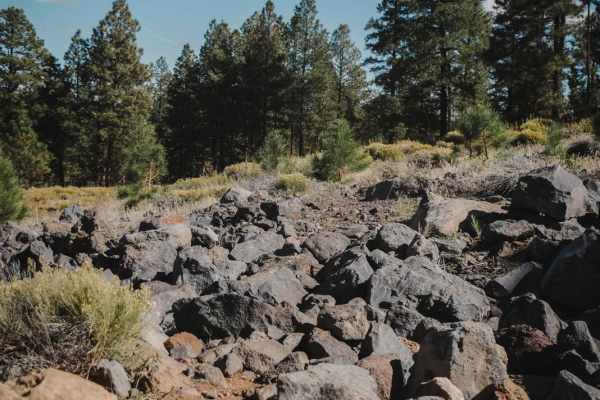
Mary's Dinner
Mary's Dinner is a 2-mile single-track offshoot from the Airport Trail that goes through a technical rock garden. It starts at the Fay Ridge Trailhead and is a completely optional trail since it spurs off of Airport in a lollipop shape and returns to the same spot. There is a small section of rocks ...
Learn more about Mary's Dinner
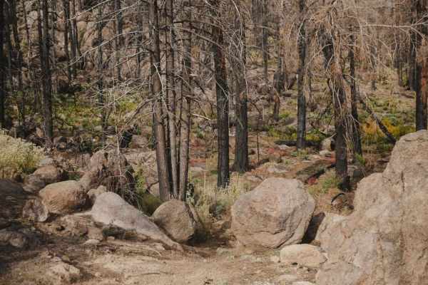
Newham
Newham is a short single track in the Fort Valley Trail System that connects Secret to Moto. The trail looks less ridden, but is slightly easier than both Secret and Moto, so it can be used as a shortcut to cut off small portions of the more difficult trails. Newham goes through a similar terrain as...
Learn more about Newham
ATV trails near Mountain View Ranches, Arizona
Explore ATV-friendly trails near you. These trails are accessible for vehicles up to 50 inches wide, perfect for ATVs and smaller off-road machines.
Two Guns Access
Listed as an access road to Two Guns, Arizona, this road does not go through. It runs along the I-40 Interstate in its entirety and has no obstacles on it. This trail is wide, with plenty of room to pass and/or turn around. It serves as an access point to the many trails that shoot off into the fore...
Learn more about Two Guns Access
FS 82
FS 82 is a wide dirt road with no obstacles on it. This trail is a main artery that cuts through this area, there are many access points to head deeper into the forest on numerous intersecting trails. There are no obstacles on this trail, other than some mild ruts and erosion/water damage. This trai...
Learn more about FS 82
9484
The 9484 Trail is a rocky trail with numerous wash crossings. Some of these have steep entrances and exits, as well as off-camber sections. There are numerous spots along this trail that are affected by water, with erosion, water damage, and washouts. This trail ran North to South, and toward the So...
Learn more about 9484
4B
The 4B trail is a mostly mellow trail, with no major obstacles on it. The trail sports erosion and water damage, as well as some wash crossings with off-camber, steep entrances and exits. Some of the water damage has left rock ledges, but nothing that a standard off-road vehicle can't handle. The tr...
Learn more about 4B
UTV/side-by-side trails near Mountain View Ranches, Arizona
Find UTV and side-by-side trails near you. These trails accommodate vehicles up to 60 inches wide, ideal for UTVs, side-by-sides, and wider off-road rigs.
Two Guns Access
Listed as an access road to Two Guns, Arizona, this road does not go through. It runs along the I-40 Interstate in its entirety and has no obstacles on it. This trail is wide, with plenty of room to pass and/or turn around. It serves as an access point to the many trails that shoot off into the fore...
Learn more about Two Guns Access
FS 82
FS 82 is a wide dirt road with no obstacles on it. This trail is a main artery that cuts through this area, there are many access points to head deeper into the forest on numerous intersecting trails. There are no obstacles on this trail, other than some mild ruts and erosion/water damage. This trai...
Learn more about FS 82
9484
The 9484 Trail is a rocky trail with numerous wash crossings. Some of these have steep entrances and exits, as well as off-camber sections. There are numerous spots along this trail that are affected by water, with erosion, water damage, and washouts. This trail ran North to South, and toward the So...
Learn more about 9484
4B
The 4B trail is a mostly mellow trail, with no major obstacles on it. The trail sports erosion and water damage, as well as some wash crossings with off-camber, steep entrances and exits. Some of the water damage has left rock ledges, but nothing that a standard off-road vehicle can't handle. The tr...
Learn more about 4B
The onX Offroad Difference
onX Offroad combines trail photos, descriptions, difficulty ratings, width restrictions, seasonality, and more in a user-friendly interface. Available on all devices, with offline access and full compatibility with CarPlay and Android Auto. Discover what you're missing today!
Open Trail Map