
Dirt Bike Trails
Near Mountain Home AFB, Idaho
Explore All Dirt Bike Trails Near Mountain Home AFB, Idaho
Dirt Bike Trails Near Mountain Home AFB, Idaho
Discover the best dirt bike trails near you. Browse trail maps, check difficulty ratings, and find your next adventure — whether you're looking for a quick ride or an all-day expedition.
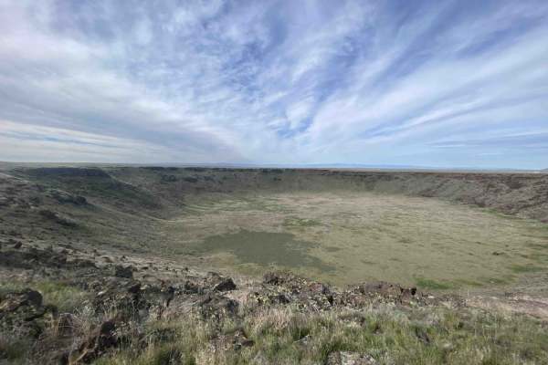
Crater Ring
While this is a relatively short trail, the terrain becomes significantly more demanding after the first mile and after you cross the cattle guard and reach the ridge overlooking the crater rings. The path is exceptionally rough due to the density and size of the embedded lava rocks, particularly as...
Learn more about Crater Ring

Access Route to Idaho Centennial Trail
This area has a lot of historic routes that seem not to exist anymore. After a great many private property access failures, this route from the tarmac was successful. This trail will lead through grassy cow pastures and stunning rolling hills. The surface is hard-packed sand but could be muddy when ...
Learn more about Access Route to Idaho Centennial Trail

Wickahoney Stage Stop from Bruneau
Wickahoney Stage Stop from Bruneau is an inviting 34.6-mile point-to-point offroad route that offers a perfect blend of historic exploration and desert cruising for four-wheel-drive vehicles, SxSs, and dirt bikes. Starting near the town of Bruneau, Idaho, the trail climbs from an elevation of 2,585 ...
Learn more about Wickahoney Stage Stop from Bruneau
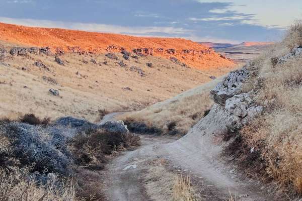
IWS Camp Trail
This unique little trail offers some fun challenges to get to stunning camping spots above the river. There are some steep off-camber, deep potholes, and tight turns to make it down. Once in the area by the river, there are lots to hike around and explore. Plus, the sounds of the river will lull eve...
Learn more about IWS Camp Trail
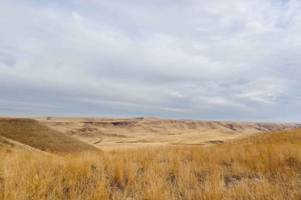
Idaho Centennial to Clover Three
This section connects the Idaho Centennial Trail to Clover Three Trail. With all the trails out here that no longer exist, it's a surefire way to end up at the access to the Bruneau Viewpoint Road. That begins as a narrow two-track in grasslands and ends up a rough wide washboard as it continues sou...
Learn more about Idaho Centennial to Clover Three
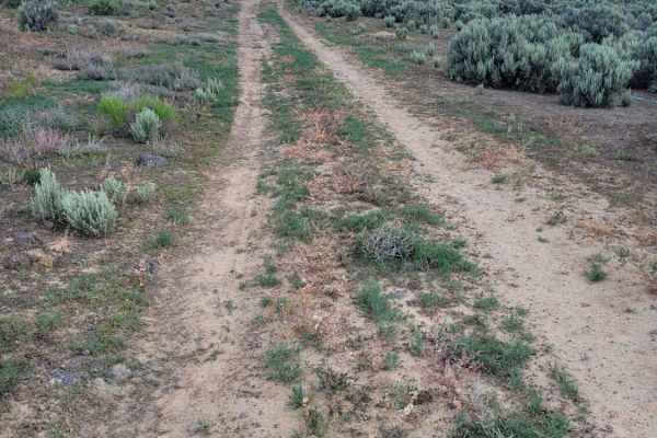
Along The Edge
Another connecting trail to many of the others in the area, this one leads right along the fence line and, at one point, along the edge of the railroad tracks. At times the trail becomes not as defined, assuming it doesn't get much traffic. It is uneven, rutted/eroded in places, and has some rocky p...
Learn more about Along The Edge
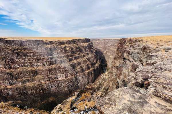
Idaho Centennial to Echo Trail
This section of trail follows along the cliff side briefly from the Bruneau lookout point with informational kiosks and a pit toilet. Almost immediately is a spur for The overlook rec site for great camping with stellar views and a few bars of Verizon cell service. Shortly after the spur, the trail ...
Learn more about Idaho Centennial to Echo Trail
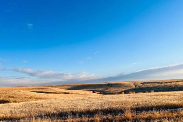
Idaho Centennial Trail 7
This scenic section of trail is one of the prettiest traveled. It offers some incredible scenery--rolling hills with fields of dried fluffy grass that blows in the wind. There are some interesting rock formations too. It gives the adventurer the feeling of being in the Saranghettii. A few challengin...
Learn more about Idaho Centennial Trail 7
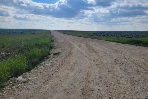
Standifer Road
This wide-open, easy dirt road connects to many of the side trails in the area. The Southern end of the trail brings you near and to the National Guard Training Area. Please respect all posted signs on both sides of the trail. Wide-open views of the surrounding terrain in every direction.
Learn more about Standifer Road
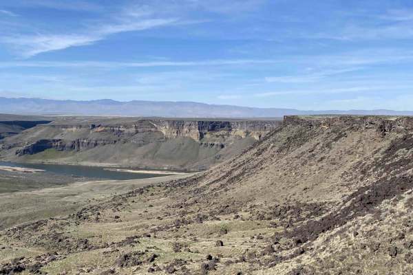
Snake River Overlooks
This trail offers a quick and rewarding escape from town, culminating in stunning panoramic views of the Snake River. Multiple spurs branch off the main track, each leading to the canyon rim for spectacular overlooks of the water below. Drivers are given plenty of variety with a choice between deep,...
Learn more about Snake River Overlooks
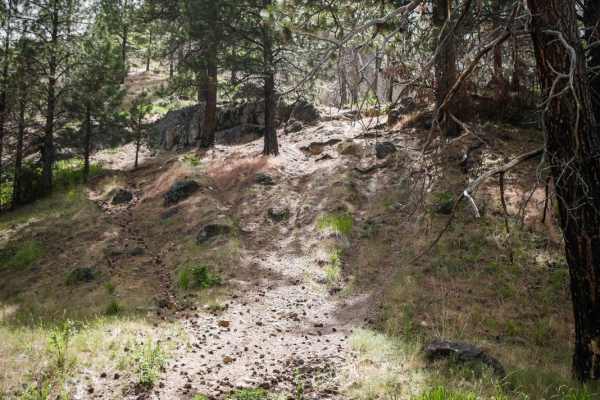
561
#561 in the Danskin Trail System is mostly an easy ridge line trail, but it starts with a more challenging steep and rocky climb with roots and boulders, thus making it a more challenging trail. From the intersection with #400, it starts with this difficult climb with very loose dirt. There are mult...
Learn more about 561
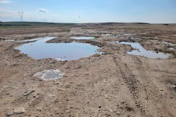
Prairie Dog Lane
Prairie Dog Lane is a 3.7-mile off-road trail on BLM land southwest of Boise, Idaho, connecting South Pleasant Valley Road to Standifer Road. Climbing gently from 2,930 feet to 3,059 feet, the route offers wide-open desert views across a network of desert tracks.
The terrain features uneven, rutted...
Learn more about Prairie Dog Lane

Robinson Trail Head
This bumpy little trail leads from the primary Echo trail system to the Robinson trail that drops down the cliffside providing access to the Bruneau river below. The site at the top is listed as a rec site, and camping is allowed as it is outside of the airforce range boundary. The views of the cany...
Learn more about Robinson Trail Head
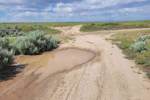
Giddy Up
Giddy Up is a moderately challenging, 2.9-mile offroad trail located east of South Pleasant Valley Road, ideal for drivers seeking a quick, bumpy connector with plenty of muddy play areas after a rainstorm. Starting at South Pleasant Valley Road, the route sits at an elevation of around 2,900 feet w...
Learn more about Giddy Up

550
ATV #550 is 2.6 miles of curvy trail zig-zagging up a mountain in the Boise National Forest, connecting ATV trails #300 and #500. It's full of constant wide-sweeping switchbacks and curves. It gains 800 feet throughout the length of the trail but is a very gradual ascent. Since there are so many tur...
Learn more about 550
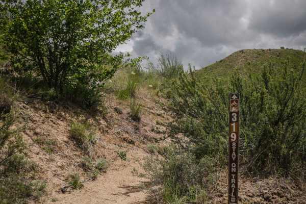
319
Single track #319 is a ridge line trail in the Danskin Mountain Range of the Boise National Forest with several steep hill climbs and descents. From the south end, it side-hills across the bottom of a grassy green meadow before climbing up to the top of a green grassy hill and descending back down. ...
Learn more about 319
Glenn's Grassy Ascent
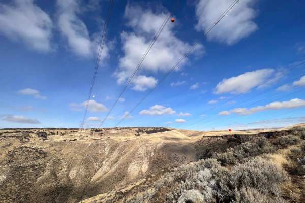
This fun little romp in the hills begins just outside the adorable town of Glenn's ferry. Well worth exploring its quaint downtown and waterfronts. There are cute shops and many historic buildings. Once on the trail, it passes a fair amount of trash that appears to be a local favorite spot to target...
Learn more about Glenn's Grassy Ascent

542
Single track #542 is very similar to the many ridge line trails in the Danskin Trail System. This trail system is full of short, narrow, and steep trails that traverse across the tops of the Danskin Mountains. This one in particular has several easy hill climbs and descents as it traverses several h...
Learn more about 542
560
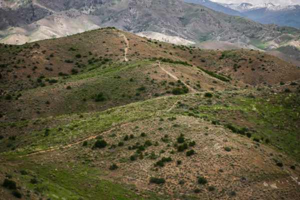
#560 in the Danskin Trail System is an easy ridgeline trail with steep hill climbs and descents. It is very similar to many of the other ridge line trails in this trail system, as it flows over a series of rolling green hillsides with expansive views of the Boise National Forest. There are very few ...
Learn more about 560
Danskins #317
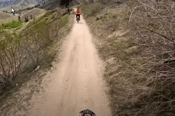
Danskins trail #317 is a fairly easy ATV and Motorcycle trail that leads out to spectacular views of the Boise River canyon on the far east side of the Danskins OHV area. It is two-track and composed of a lot of varying terrain, such as sand, dirt, rocks, stream crossings, exposed mountain sides, an...
Learn more about Danskins #317
ATV trails near Mountain Home AFB, Idaho
Explore ATV-friendly trails near you. These trails are accessible for vehicles up to 50 inches wide, perfect for ATVs and smaller off-road machines.
Crater Ring
While this is a relatively short trail, the terrain becomes significantly more demanding after the first mile and after you cross the cattle guard and reach the ridge overlooking the crater rings. The path is exceptionally rough due to the density and size of the embedded lava rocks, particularly as...
Learn more about Crater Ring
Access Route to Idaho Centennial Trail
This area has a lot of historic routes that seem not to exist anymore. After a great many private property access failures, this route from the tarmac was successful. This trail will lead through grassy cow pastures and stunning rolling hills. The surface is hard-packed sand but could be muddy when ...
Learn more about Access Route to Idaho Centennial Trail
Wickahoney Stage Stop from Bruneau
Wickahoney Stage Stop from Bruneau is an inviting 34.6-mile point-to-point offroad route that offers a perfect blend of historic exploration and desert cruising for four-wheel-drive vehicles, SxSs, and dirt bikes. Starting near the town of Bruneau, Idaho, the trail climbs from an elevation of 2,585 ...
Learn more about Wickahoney Stage Stop from Bruneau
IWS Camp Trail
This unique little trail offers some fun challenges to get to stunning camping spots above the river. There are some steep off-camber, deep potholes, and tight turns to make it down. Once in the area by the river, there are lots to hike around and explore. Plus, the sounds of the river will lull eve...
Learn more about IWS Camp Trail
UTV/side-by-side trails near Mountain Home AFB, Idaho
Find UTV and side-by-side trails near you. These trails accommodate vehicles up to 60 inches wide, ideal for UTVs, side-by-sides, and wider off-road rigs.
Crater Ring
While this is a relatively short trail, the terrain becomes significantly more demanding after the first mile and after you cross the cattle guard and reach the ridge overlooking the crater rings. The path is exceptionally rough due to the density and size of the embedded lava rocks, particularly as...
Learn more about Crater Ring
Access Route to Idaho Centennial Trail
This area has a lot of historic routes that seem not to exist anymore. After a great many private property access failures, this route from the tarmac was successful. This trail will lead through grassy cow pastures and stunning rolling hills. The surface is hard-packed sand but could be muddy when ...
Learn more about Access Route to Idaho Centennial Trail
IWS Camp Trail
This unique little trail offers some fun challenges to get to stunning camping spots above the river. There are some steep off-camber, deep potholes, and tight turns to make it down. Once in the area by the river, there are lots to hike around and explore. Plus, the sounds of the river will lull eve...
Learn more about IWS Camp Trail
Idaho Centennial to Clover Three
This section connects the Idaho Centennial Trail to Clover Three Trail. With all the trails out here that no longer exist, it's a surefire way to end up at the access to the Bruneau Viewpoint Road. That begins as a narrow two-track in grasslands and ends up a rough wide washboard as it continues sou...
Learn more about Idaho Centennial to Clover Three
The onX Offroad Difference
onX Offroad combines trail photos, descriptions, difficulty ratings, width restrictions, seasonality, and more in a user-friendly interface. Available on all devices, with offline access and full compatibility with CarPlay and Android Auto. Discover what you're missing today!
Open Trail Map