
Dirt Bike Trails
Near Morganfield, Kentucky
Explore All Dirt Bike Trails Near Morganfield, Kentucky
Dirt Bike Trails Near Morganfield, Kentucky
Discover the best dirt bike trails near you. Browse trail maps, check difficulty ratings, and find your next adventure — whether you're looking for a quick ride or an all-day expedition.
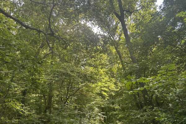
Kaskaskia Woods Trail
A fun, increasingly primitive forest trail that starts relatively easy with mild rock gardens, shallow muddy ruts, and occasional off-camber sections before steadily tightening as you travel deeper into the woods. Expect significant overgrowth and pinstriping throughout. About halfway in, the trail ...
Learn more about Kaskaskia Woods Trail
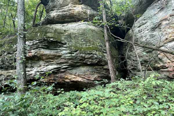
Golden Circle - FS 1621
Golden Circle Trail is a short, relatively easy route with beautiful scenery and plenty of reasons to slow down and explore. Near the entrance, striking layers of sandstone rise alongside the trail, softened by moss and vegetation, with several small caves and rock formations that are easily accessi...
Learn more about Golden Circle - FS 1621
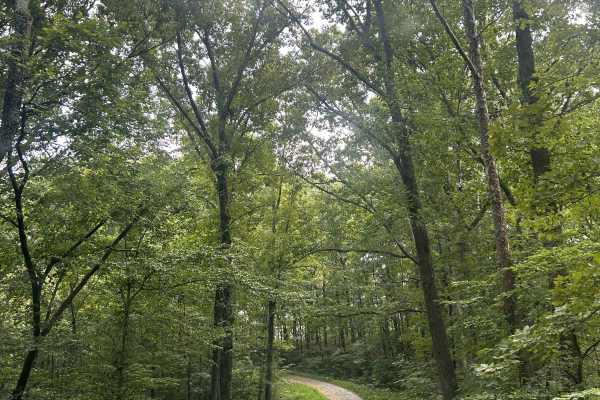
Richland Ridge Road
Richland Ridge Trail serves as a main north-to-south artery through this part of Shawnee National Forest, with several side trails branching off along the way that invite further exploration. The route travels through beautiful hardwood forest and is generally easygoing, making it more about enjoyin...
Learn more about Richland Ridge Road
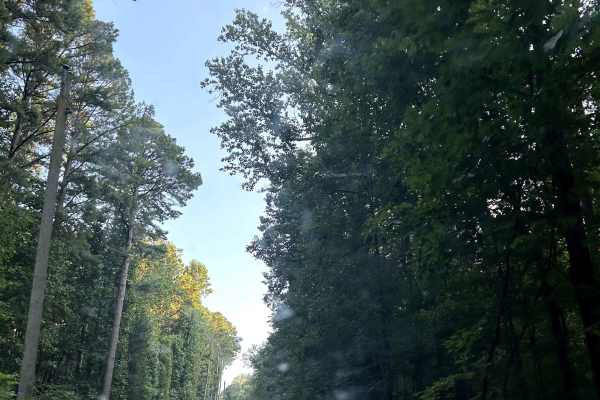
Glen Street
Glen Street Trail is a scenic main artery through this section of Shawnee National Forest, providing access to dispersed campsites, numerous side trails and the spectacular Jackson Falls area. The trail is somewhat rougher than other primary routes nearby, with deeper puddles, rainwater erosion, exp...
Learn more about Glen Street
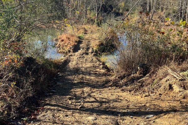
Open Ponds Trail
The Open Ponds trail can be accessed through the Blue Bird Trail or the east side of the Long Wall Access Trail. This trail traverses along ridges between a number of ponds, and through the valleys of strip hills. When approached from the north side, the Open Ponds Trail begins with a descent and cr...
Learn more about Open Ponds Trail

Rock Hill Loop
Rock Hill Loop is an enjoyable trail that features some fun, technical rocky climbs at the main hill area and a few deep mud holes to navigate through. If you prefer to avoid the tough spots, both obstacles have bypass routes available. Overall, it's a great option whether you want a challenge or an...
Learn more about Rock Hill Loop
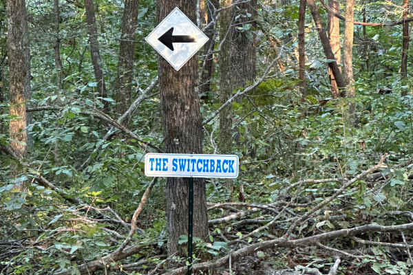
The Switchback
"The Switchback" (aka "Wooded Racetrack") is a 0.7-mile loop. You can access it from a few different trails, but the easiest is off of Old Highway 13. Once you see signs showing you where to enter, just follow the arrows. The most important part of this trail, since it is a loop, follow the arrows a...
Learn more about The Switchback
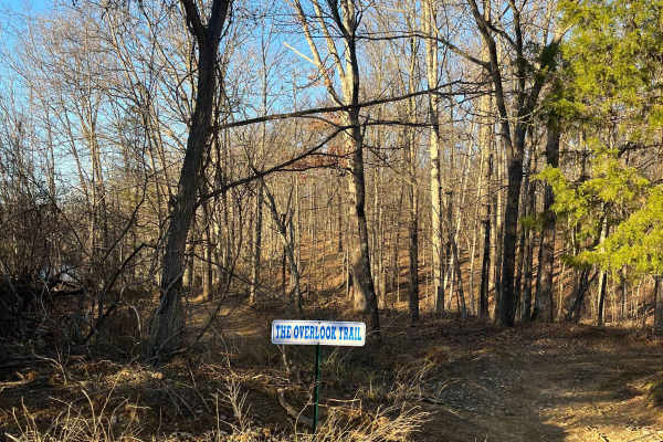
Overlook Trail
The Overlook Trail can be accessed from Old Route 13 beside the Powerline Trails or from the Amax Haul Road. This trail runs along the high wall of a strip pit and features a nice overlook with a bench at the top. Approached from the north side, the trail begins as an ascent up the high wall with a ...
Learn more about Overlook Trail

Amax Haul Road
The Amax Haul Road is the main north/south route at LEOR, delivering riders to several different trail adventures and other main routes throughout the park. The East Field Access Road reaches the north side of the Haul Road and can also be viewed from the overpass on Old Route 13 crossing it. From...
Learn more about Amax Haul Road
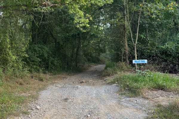
Pallet Trail
The Pallet Trail is one of the main routes through the south portion of the forest, and gives riders access to many secondary and tertiary routes. At the north side, this trail is accessed from Old Route 13 and begins with a mixture of gravel and dirt. The surface composition throughout the trail co...
Learn more about Pallet Trail
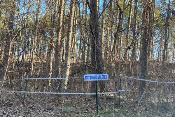
South Boundary Trail
The South Boundary Trail is one of the longest routes at the park. This trail can be accessed at the south end of the Rolling Hills trail and traverses along the park boundary to the east side of Old Highway 13. There is a large mixture of terrain, from small and large rocks to steep hills and deep ...
Learn more about South Boundary Trail

Rolling Hills Trail
The Rolling Hills Trail traverses through the pine forest to the south side of the park. This trail can be accessed by the Old Boundary Trail on the north side and the South Boundary Trail on the south side. Approached from the north, the terrain begins as mostly smooth rolling hills with mud holes ...
Learn more about Rolling Hills Trail
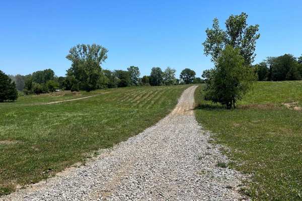
East Field Access Trail
The East Field access trail is the main route leading to the Haul Road. A few side trails are also accessible through this road, such as the Olive Trail, along with some short hill-climb crossover routes to Old Highway 13. The East Field trail is accessed through the east side of the campground, and...
Learn more about East Field Access Trail
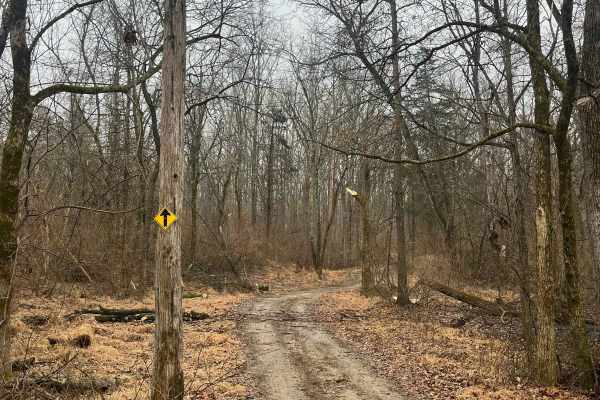
Family Trail
The Family Trail is a combination route of most of our main attractions in the park, without the extreme terrain on some of the tertiary routes. This route can be accessed at many locations but begins by our park entrance. The purpose of this trail is to provide a route for all ages of riders to enj...
Learn more about Family Trail
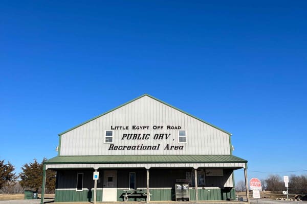
Little Egypt Off-Road OHV Park Entrance
Welcome to Little Egypt Off-Road OHV Park! Our hours of operation are 8 AM to 5 PM on Saturdays and Sundays, including most holidays. We offer over 50 miles of trails, from beginner access roads to challenging single-track, extending throughout our roughly 1000-acre park. Side-by-sides, ATVs, and d...
Learn more about Little Egypt Off-Road OHV Park Entrance
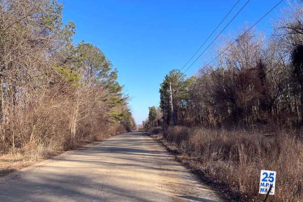
Old Highway 13
At Little Egypt Off Road, there's a 1.5-mile portion of the former Illinois Highway 13. This is one of the main access routes throughout the property, as it stretches the entire width of the park. The main feature of this route is the overpass across the Amax Haul Road. When following this road from...
Learn more about Old Highway 13
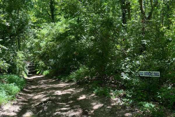
Old Boundary Trail
The Old Boundary Trail can be accessed through the Amax Trail, Roller Coaster Trail, Pallet Trail, and a few other tertiary routes. This trail was the former southern boundary of our park until the property expansion. It traverses through a portion of rolling hills, with some level spots periodicall...
Learn more about Old Boundary Trail
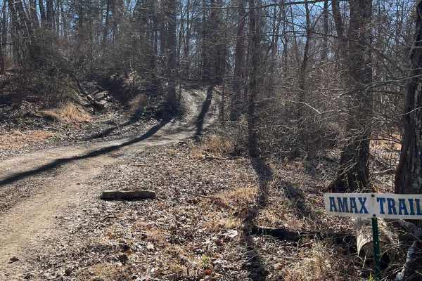
Amax Trail
The Amax Trail can be seen from the main gate to Little Egypt Off Road and is the westernmost main trail on the property. It traverses from alongside Old Route 13 to the Boundary Trail on the south end. The Amax Trail overlooks the creek bottoms that make up the southwest corner of the property, a g...
Learn more about Amax Trail

Stephens Chapel Road - FSR 415
Stephens Chapel Road--415 is an extremely historic route that navigates directly to one of the last original standing structures within Land Between the Lakes National Recreation Area. The Road is a mix of dirt and gravel and is somewhat maintained. The church remains despite the 2021 tornadoes rava...
Learn more about Stephens Chapel Road - FSR 415

FSR 119
Forest Service Road 119 is a semi-maintained dirt and gravel road that connects FSR 112 and FSR 117 within the Land Between the Lakes National Recreation Area. It is on the northern portion of the park in the area known as 'Tornado Valley' after two tornadoes hit the park in 2021. The road is easily...
Learn more about FSR 119
ATV trails near Morganfield, Kentucky
Explore ATV-friendly trails near you. These trails are accessible for vehicles up to 50 inches wide, perfect for ATVs and smaller off-road machines.
Kaskaskia Woods Trail
A fun, increasingly primitive forest trail that starts relatively easy with mild rock gardens, shallow muddy ruts, and occasional off-camber sections before steadily tightening as you travel deeper into the woods. Expect significant overgrowth and pinstriping throughout. About halfway in, the trail ...
Learn more about Kaskaskia Woods Trail
Golden Circle - FS 1621
Golden Circle Trail is a short, relatively easy route with beautiful scenery and plenty of reasons to slow down and explore. Near the entrance, striking layers of sandstone rise alongside the trail, softened by moss and vegetation, with several small caves and rock formations that are easily accessi...
Learn more about Golden Circle - FS 1621
Richland Ridge Road
Richland Ridge Trail serves as a main north-to-south artery through this part of Shawnee National Forest, with several side trails branching off along the way that invite further exploration. The route travels through beautiful hardwood forest and is generally easygoing, making it more about enjoyin...
Learn more about Richland Ridge Road
Glen Street
Glen Street Trail is a scenic main artery through this section of Shawnee National Forest, providing access to dispersed campsites, numerous side trails and the spectacular Jackson Falls area. The trail is somewhat rougher than other primary routes nearby, with deeper puddles, rainwater erosion, exp...
Learn more about Glen Street
UTV/side-by-side trails near Morganfield, Kentucky
Find UTV and side-by-side trails near you. These trails accommodate vehicles up to 60 inches wide, ideal for UTVs, side-by-sides, and wider off-road rigs.
Kaskaskia Woods Trail
A fun, increasingly primitive forest trail that starts relatively easy with mild rock gardens, shallow muddy ruts, and occasional off-camber sections before steadily tightening as you travel deeper into the woods. Expect significant overgrowth and pinstriping throughout. About halfway in, the trail ...
Learn more about Kaskaskia Woods Trail
Golden Circle - FS 1621
Golden Circle Trail is a short, relatively easy route with beautiful scenery and plenty of reasons to slow down and explore. Near the entrance, striking layers of sandstone rise alongside the trail, softened by moss and vegetation, with several small caves and rock formations that are easily accessi...
Learn more about Golden Circle - FS 1621
Richland Ridge Road
Richland Ridge Trail serves as a main north-to-south artery through this part of Shawnee National Forest, with several side trails branching off along the way that invite further exploration. The route travels through beautiful hardwood forest and is generally easygoing, making it more about enjoyin...
Learn more about Richland Ridge Road
Glen Street
Glen Street Trail is a scenic main artery through this section of Shawnee National Forest, providing access to dispersed campsites, numerous side trails and the spectacular Jackson Falls area. The trail is somewhat rougher than other primary routes nearby, with deeper puddles, rainwater erosion, exp...
Learn more about Glen Street
The onX Offroad Difference
onX Offroad combines trail photos, descriptions, difficulty ratings, width restrictions, seasonality, and more in a user-friendly interface. Available on all devices, with offline access and full compatibility with CarPlay and Android Auto. Discover what you're missing today!
Open Trail Map