
Dirt Bike Trails
Near Monroe, Utah
Explore All Dirt Bike Trails Near Monroe, Utah
Dirt Bike Trails Near Monroe, Utah
Discover the best dirt bike trails near you. Browse trail maps, check difficulty ratings, and find your next adventure — whether you're looking for a quick ride or an all-day expedition.
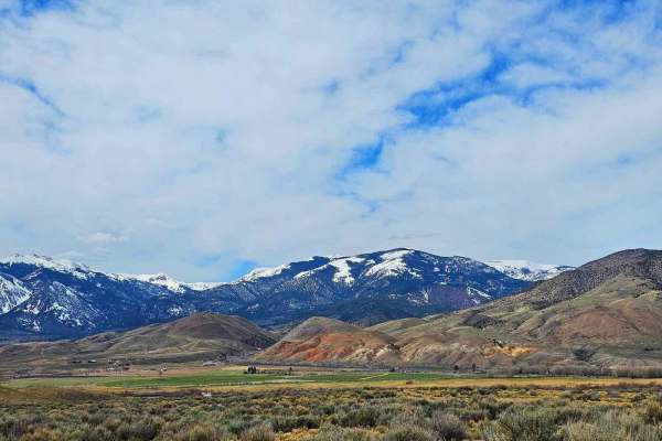
Poverty Flat Road
This is an easy road to travel on and has a breathtaking landscape to go with it. Nestled against Monroe Mountain, you will see all sorts of wildlife by the trail. There are also a bunch of old mines along the trail and you can see their tailing piles and the old portals. This area was known for ura...
Learn more about Poverty Flat Road
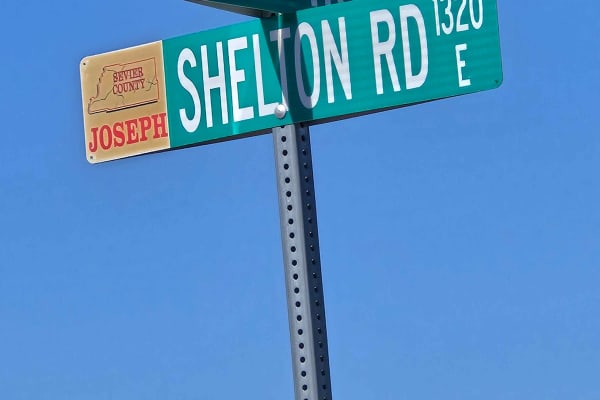
South Shelton Road
This is a scenic drive between farm fields and the South Bend Canal. This trail is a pretty ride along the canal. It is easy, with no climbs or obstacles along the way. Nice views of the fields and the mountains that surround the entire valley. It starts and ends at Highway 118.
Learn more about South Shelton Road
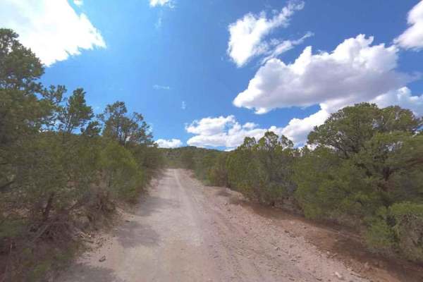
Albinus Canyon- Elsinore Mountain Road- FS 40105
Albinus Canyon-Elsinore Mountain Road is a 7.3-mile point-to-point trail rated 2 of 10 located in Sevier County. The trail starts on the western side of the community of Elsinore and is the gateway into the Fishlake National Forest, Fillmore Ranger District. This trail is also part of the Paiute Tra...
Learn more about Albinus Canyon- Elsinore Mountain Road- FS 40105
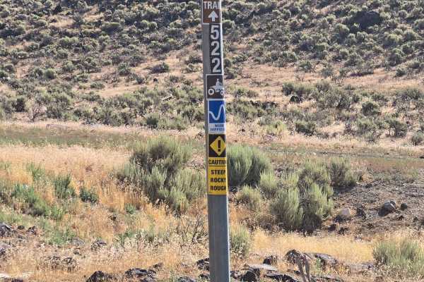
Hill Hopper
This trail consists of Trail 1522 and Trail 1515. This trail starts off looking meek and mild, then you encounter big rocks on either side of the trail, which is now off camber. An interesting start to a fun trail. It winds through lower hills, has native plants and trees. There is a narrow ridge pa...
Learn more about Hill Hopper
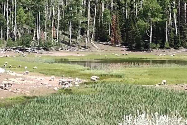
Hunts Lakes Loop - FS 40075
Hunts Lakes Loop (aka Hunts Lake) is a side trip off of Monroe Canyon Road (aka Old Sawmill Road). It's just over a mile, and at the end of FS# 40075 there are a couple of spurs that go out to each lake. You may find a sheepherder, his horses and dog, and a herd of sheep grazing in this beautiful ar...
Learn more about Hunts Lakes Loop - FS 40075
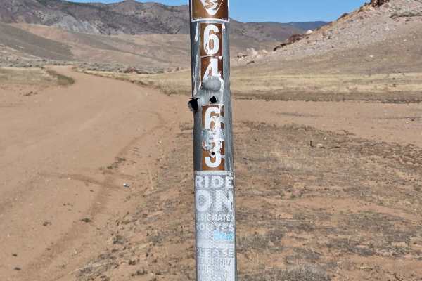
County Road 2220 - BLM 6463
This is an easy, mostly flat graded trail that will take you from Poverty Flat Road around to Highway 118. It's 5.93 miles with great views of the lowland plants as well as mountain views. You will see farm buildings in the meadow areas. You may see cows, birds, and desert critters as you drive.
Learn more about County Road 2220 - BLM 6463
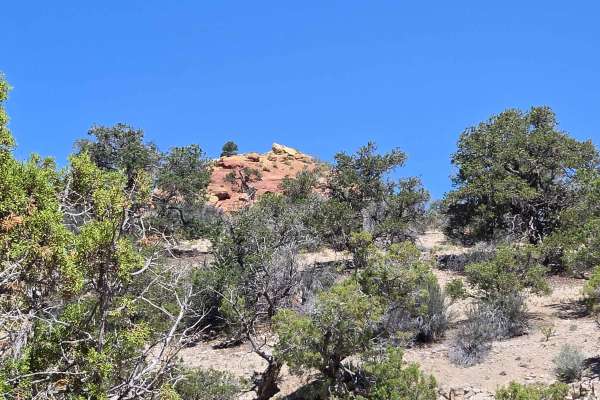
Wash and Dry
Wash and Dry consists of Trail 106, Flat Canyon Tie 1084, and 1084A. This trail starts in Flat Canyon wash and follows the wash back into the canyon. There are lots of interesting rock formations to look at as you go. You will gradually climb up in elevation as this trail goes in and out of the wash...
Learn more about Wash and Dry
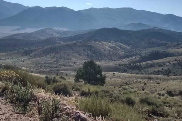
Joseph to Marysvale
This trail boasts spectacular scenery as you move north or south, from Marysvale to Joseph or the reverse. These roads connect the trails on either end of this trail for great riding in the fantastic mountains of southern Utah. Too early in the spring or too late in the fall, you may encounter snow,...
Learn more about Joseph to Marysvale
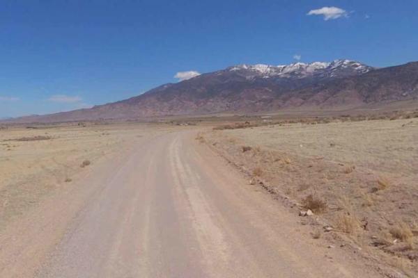
Rifle Range Road
Rifle Range Road is a 6.2-mile point-to-point trail rated 2 of 10 located in Sevier County. This road is also known as 1025d Poverty Flat Road. This east/west road provides the southern cross-connect between the communities of Monroe and Joseph, crossing both Bureau of Land Management and Utah State...
Learn more about Rifle Range Road
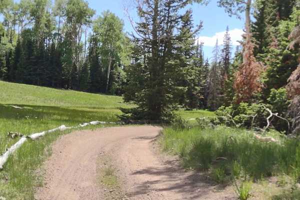
Fitzgerald's Park - FS 40182
Fitzgerald's Park is a spur trail off of Monroe Canyon Road, and it sits in the shadow of Monroe Peak. You move through the pine and aspen trees and find yourself at the trail's end in a meadow where a picnic table sits. The history of this trail is that it was a popular overnight stopping place on ...
Learn more about Fitzgerald's Park - FS 40182
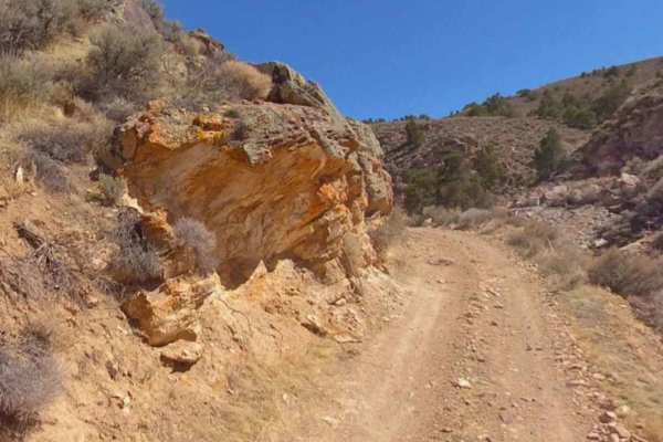
Poverty Flat Road
Poverty Flat Road is a 2.3-mile point-to-point trail rated 3 of 10 located in Sevier County. There are multiple roads in this area named Poverty Flat with different county or state designators. This trail is also identified as 1035da Poverty Flat Road by the State of Utah. This is a hard-packed dirt...
Learn more about Poverty Flat Road
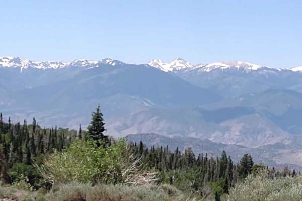
Monroe Canyon Road - PST 78
Monroe Canyon Road connects Monroe Peak where the cell/radio/satellite towers are to the town of Monroe, Utah. Our track ends where the pavement begins at the bottom of the canyon. You drop from 10,334 feet at the south end of the trail to 6365 feet at the north end. The historical name for this tra...
Learn more about Monroe Canyon Road - PST 78
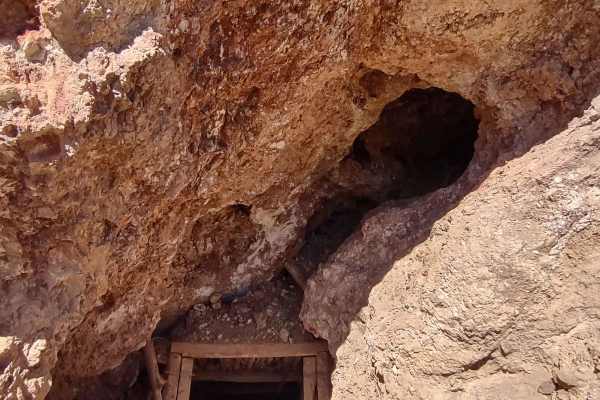
Antelope Range Mining Tour
The Antelope Range Mining Tour begins on the west end in an area called Poverty Flat on the BLM maps. Several trails in this area are also called Poverty Flat. This track takes you to the east and then turns south through Asarco and Crown Mines's private property. The trails are accessible as the mi...
Learn more about Antelope Range Mining Tour
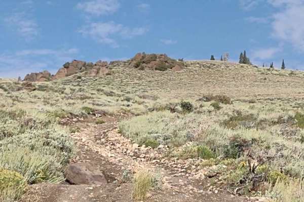
Bald Knolls
This 60" trail, high up on Monroe Mountain in the Fishlake National Forest, leaves the FS #41185 Extension (50" Trail) and goes up the steep climb to the top of Bald Knoll. There is a beautiful view up here of the Sevier River, Marysvale, the valley, and the Tushar Mountains across the valley. It is...
Learn more about Bald Knolls
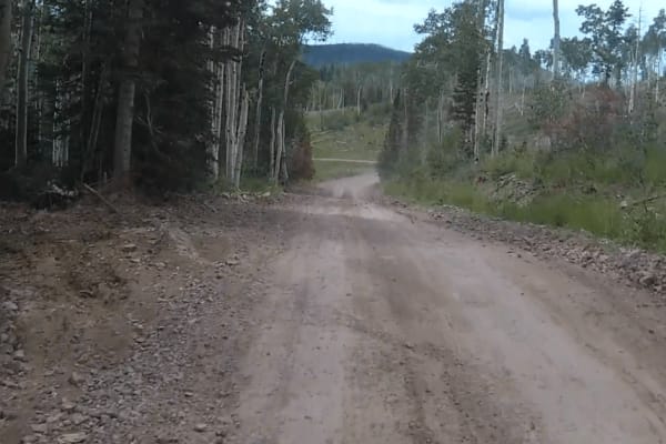
Paiute Side Trail
This is a side trail that shortens the ride from the P11 trail down into Joseph instead of taking the P11 trail all the way into Elsinore. It is mostly flat with some narrow twisting sections. You need to watch out for cows since they are all over and don't often move off the road.
Learn more about Paiute Side Trail
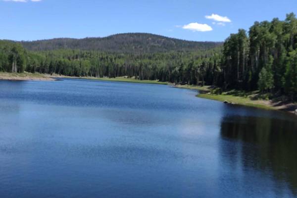
Annabella Reservoir/Deep Lake - FS 40080
Just 3 miles west of Big Lake in southern Sevier County, Utah, you find Annabella Reservoir and Deep Lake. The trail goes through private land, but access is permitted if one stays on the trail. This is a good road, with room for two vehicles to meet in most places, and it goes through some beautifu...
Learn more about Annabella Reservoir/Deep Lake - FS 40080
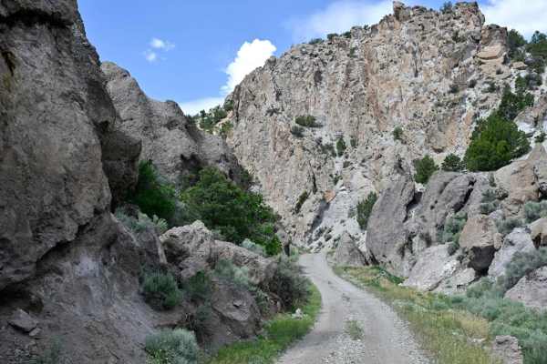
Cove Fort-Dry Creek/PST76
This trail offers an interesting mixed experience. The trail goes from gravel to rocky, to two tracks with grass in the middle, to two tracks with washed-out ruts in the middle, and back and forth. A couple of small ponds to break things up, and a few creek crossings. At the north end of the trail, ...
Learn more about Cove Fort-Dry Creek/PST76
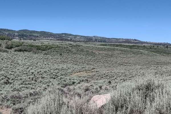
Glenwood Access to Fishlake Natl Forest - FS 40068
Fishlake Natl Forest access from Glenwood, Utah, is a good road in the summertime. It's dusty, and there is some traffic, but otherwise it's easy. We don't know when in the fall this road is closed, but we're certain it's not open year-round. There are indications along the road it's used as a snowm...
Learn more about Glenwood Access to Fishlake Natl Forest - FS 40068
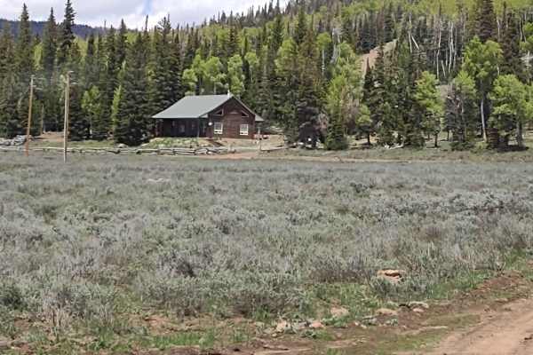
Koosharem Pasture Road Guard Station - PST44 FS41163
The Koosharem Pasture Road connects to the Koosharem Guard Station Road and linked together they're called Paiute Side Trail 44. They run across the top of the Sevier Plateau, rising to an elevation of just over 9800 feet. The north end of this track ends at the Forest Service Guard Station and the ...
Learn more about Koosharem Pasture Road Guard Station - PST44 FS41163
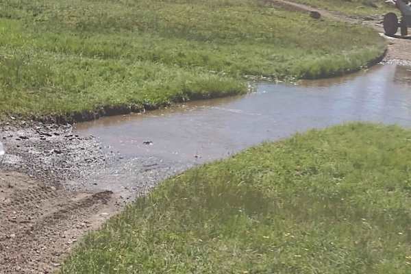
Water, Water Everywhere (FS 4817, 40081, 42421)
This trail combines several Forest Service trails and goes off the heavily traveled path, taking you back into the forest where water is plentiful, the grass is tall and green, and the wildlife and cattle are happy campers. The water crossings in late July 2023 were easy. Only one was soft underneat...
Learn more about Water, Water Everywhere (FS 4817, 40081, 42421)
ATV trails near Monroe, Utah
Explore ATV-friendly trails near you. These trails are accessible for vehicles up to 50 inches wide, perfect for ATVs and smaller off-road machines.
Poverty Flat Road
This is an easy road to travel on and has a breathtaking landscape to go with it. Nestled against Monroe Mountain, you will see all sorts of wildlife by the trail. There are also a bunch of old mines along the trail and you can see their tailing piles and the old portals. This area was known for ura...
Learn more about Poverty Flat Road
South Shelton Road
This is a scenic drive between farm fields and the South Bend Canal. This trail is a pretty ride along the canal. It is easy, with no climbs or obstacles along the way. Nice views of the fields and the mountains that surround the entire valley. It starts and ends at Highway 118.
Learn more about South Shelton Road
Albinus Canyon- Elsinore Mountain Road- FS 40105
Albinus Canyon-Elsinore Mountain Road is a 7.3-mile point-to-point trail rated 2 of 10 located in Sevier County. The trail starts on the western side of the community of Elsinore and is the gateway into the Fishlake National Forest, Fillmore Ranger District. This trail is also part of the Paiute Tra...
Learn more about Albinus Canyon- Elsinore Mountain Road- FS 40105
Hill Hopper
This trail consists of Trail 1522 and Trail 1515. This trail starts off looking meek and mild, then you encounter big rocks on either side of the trail, which is now off camber. An interesting start to a fun trail. It winds through lower hills, has native plants and trees. There is a narrow ridge pa...
Learn more about Hill Hopper
UTV/side-by-side trails near Monroe, Utah
Find UTV and side-by-side trails near you. These trails accommodate vehicles up to 60 inches wide, ideal for UTVs, side-by-sides, and wider off-road rigs.
Poverty Flat Road
This is an easy road to travel on and has a breathtaking landscape to go with it. Nestled against Monroe Mountain, you will see all sorts of wildlife by the trail. There are also a bunch of old mines along the trail and you can see their tailing piles and the old portals. This area was known for ura...
Learn more about Poverty Flat Road
South Shelton Road
This is a scenic drive between farm fields and the South Bend Canal. This trail is a pretty ride along the canal. It is easy, with no climbs or obstacles along the way. Nice views of the fields and the mountains that surround the entire valley. It starts and ends at Highway 118.
Learn more about South Shelton Road
Albinus Canyon- Elsinore Mountain Road- FS 40105
Albinus Canyon-Elsinore Mountain Road is a 7.3-mile point-to-point trail rated 2 of 10 located in Sevier County. The trail starts on the western side of the community of Elsinore and is the gateway into the Fishlake National Forest, Fillmore Ranger District. This trail is also part of the Paiute Tra...
Learn more about Albinus Canyon- Elsinore Mountain Road- FS 40105
Hill Hopper
This trail consists of Trail 1522 and Trail 1515. This trail starts off looking meek and mild, then you encounter big rocks on either side of the trail, which is now off camber. An interesting start to a fun trail. It winds through lower hills, has native plants and trees. There is a narrow ridge pa...
Learn more about Hill Hopper
The onX Offroad Difference
onX Offroad combines trail photos, descriptions, difficulty ratings, width restrictions, seasonality, and more in a user-friendly interface. Available on all devices, with offline access and full compatibility with CarPlay and Android Auto. Discover what you're missing today!
Open Trail Map