
Dirt Bike Trails
Near Mapleton, Utah
Explore All Dirt Bike Trails Near Mapleton, Utah
Dirt Bike Trails Near Mapleton, Utah
Discover the best dirt bike trails near you. Browse trail maps, check difficulty ratings, and find your next adventure — whether you're looking for a quick ride or an all-day expedition.
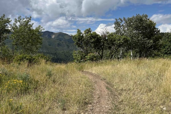
Left Fork Maple Canyon (8006)
Left Fork Maple Canyon branches from the Mapleton-Sawmill Hollow trail and travels west to the parking lot at Maple Diamond Fork. Riding this direction, the single-track trail is wide and primarily downhill. There's loose gravel and small rocks on the east side of the trail, which then turns into a ...
Learn more about Left Fork Maple Canyon (8006)
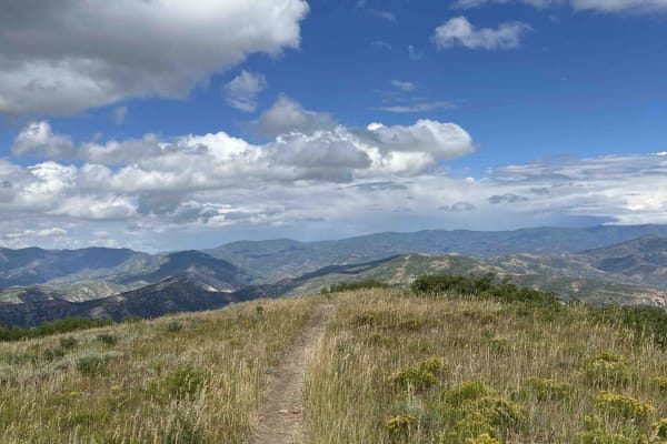
Little Diamond (8016)
Little Diamond Trail runs along a ridge south from the Mapleton-Sawmill Hollow Trail and eventually intersects with Diamond Fork Road. Heading towards the road, you'll drop ~2,300 feet in elevation. The beginning of the trail has a steep, washed-out section that would be difficult to ride up (north)...
Learn more about Little Diamond (8016)
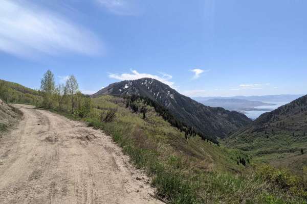
Kyhv Peak
From Provo Canyon, the road to Hope Campground is paved. From Hope Campground to Rock Canyon Campground, the road is easy and relatively smooth dirt. Beyond Rock Canyon Campground, the road becomes progressively more rocky and rutted until the final couple of miles, where the road becomes easier. ...
Learn more about Kyhv Peak
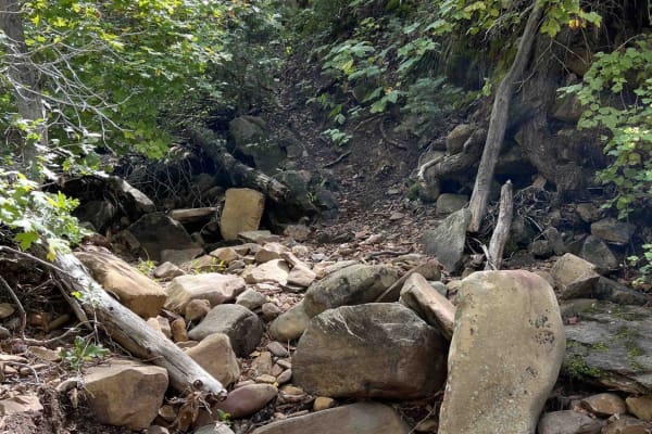
Right Fork Days Canyon (8004)
Right Fork Days Canyon splits off from Left Fork Days Canyon trail. This single-track trail dead ends after about a mile of riding. The entrance is easy to miss and doesn't have any signage. This route starts with a winding hill climb and then follows a stream. It is very difficult once in the strea...
Learn more about Right Fork Days Canyon (8004)
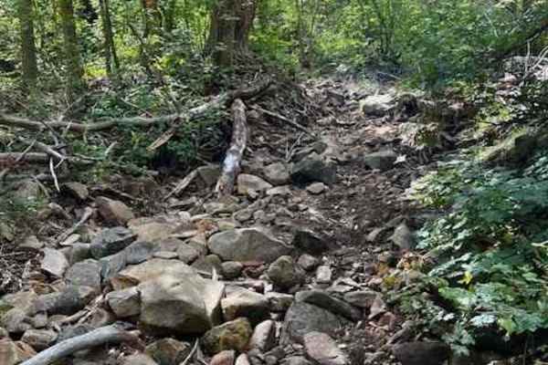
Left Fork Days Canyon (8011)
Left Fork Days Canyon is one of the entrances into the Hobble Creek trail system. It's a 3.6-mile trail that starts off Hobble Fork Canyon Road with a stream crossing. The stream here is surprisingly deep and the trail on the opposite side has almost been taken out by water and wheelspin erosion. Co...
Learn more about Left Fork Days Canyon (8011)
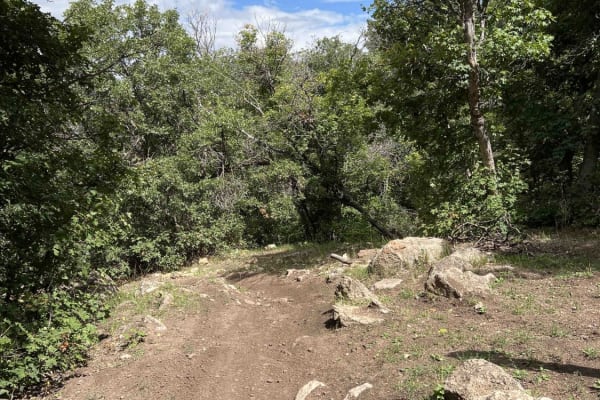
Kirkman Hollow (8012)
Kirkman Hollow begins at a parking lot off Hobble Fork Canyon Road and gains nearly 2,000 feet of elevation before intersecting with the Mapleton-Sawmill Hollow Trail. The single-track trail follows a ravine which is mostly smooth. There are some embedded boulders in a few areas, but they are easy t...
Learn more about Kirkman Hollow (8012)
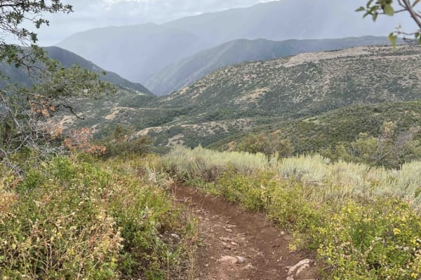
Mapleton-Sawmill Hollow (8013)
Mapleton-Sawmill Hollow runs along a ridgeline between Kirkman Hollow and Left Fork Maple Canyon trails. The trail is a mixture of flowy and loose-rock sections with multiple smaller hills thrown in. The rock sections range from gravel to baseball-sized and are usually loose. Riding southwest, about...
Learn more about Mapleton-Sawmill Hollow (8013)
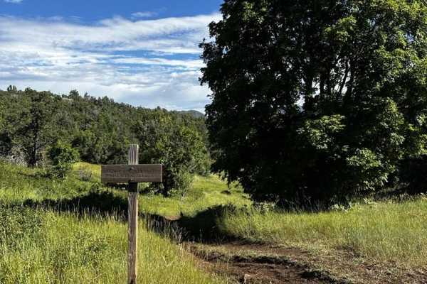
Upper Packard Canyon Trail
Ascending through the captivating Hobble Creek Canyon, the Upper Packard Canyon Trail is a formidable challenge for dirt bike enthusiasts seeking an exhilarating adventure. This single-track trail, boasting a level of difficulty that appeals to experienced riders, presents an electrifying journey ch...
Learn more about Upper Packard Canyon Trail
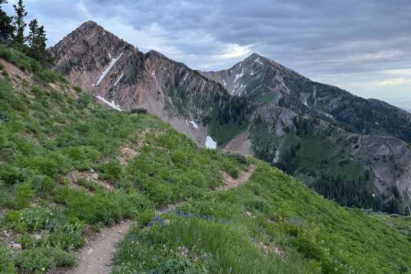
Rock Canyon - Dry Fork
This challenging singletrack starts immediately from Forest Road 70027, quickly narrowing with dense brush. As you climb through aspen groves, expect occasional sharp drops toward the creek. Higher up, you'll find flat open spaces before the final ascent. The steep northern slope of Freedom Peak, cr...
Learn more about Rock Canyon - Dry Fork
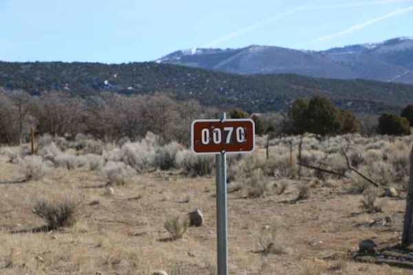
Lake Fork-Indianola - FS 50070
Easy, non-graded trail that travels through the Lake Fork Wildlife Management Area as well as the Manti La Sal Forest. This trail starts in Indianola and ends on Highway 89 or vice versa, depending on the direction of travel. The trail itself is easy going with no technical spots and is wide enough ...
Learn more about Lake Fork-Indianola - FS 50070
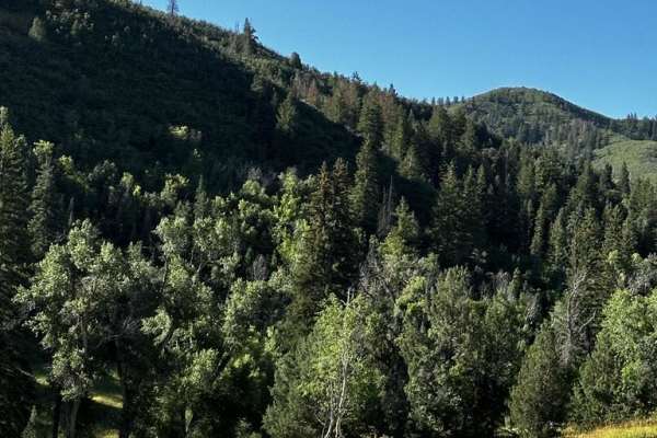
Packard Canyon Trail
Packard Canyon Trail, nestled within the picturesque Hobble Creek Canyon, offers dirt bike enthusiasts a thrilling yet accessible off-road adventure. This single-track trail, known for its moderate difficulty, provides a well-rounded experience for riders of various skill levels. The journey begins ...
Learn more about Packard Canyon Trail
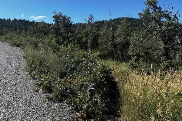
Packard Canyon Cutoff Trail
The Packard Canyon Cutoff Trail, an audacious dirt bike route ascending Hobble Creek Canyon, invites skilled riders to conquer its challenges with finesse and grit. This single-track trail presents a demanding gauntlet, characterized by the thick overgrowth of meadow fields that intermittently obscu...
Learn more about Packard Canyon Cutoff Trail
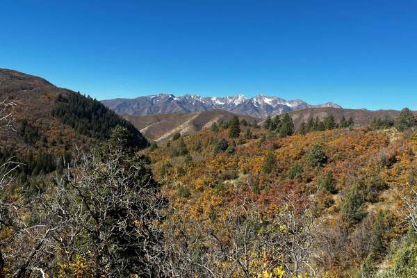
Right Fork Hobble Creek Road
Right Fork Hobble Creek Road crosses through the Uinta National Forest. While both end segments are pavement, this portion is rough gravel and very scenic. The road is pretty wooded and makes for a great drive during the fall months. There is nothing technical and neither 4WD nor high clearance are ...
Learn more about Right Fork Hobble Creek Road
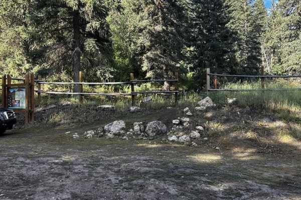
Packard Canyon Lower Trail
The Packard Canyon Lower Trail presents a short, easily accessible dirt biking route nestled in the scenic Wasatch Mountains. The trail is ideal for riders of all levels, offering a thrilling escape into the wilderness. Passing through a rustic cattle gate at the trailhead adds to the charm. The pat...
Learn more about Packard Canyon Lower Trail
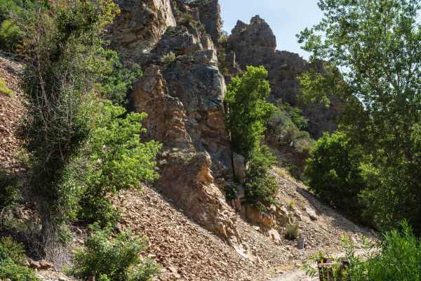
Left Fork Hobble Creek - FS 70132
Left Fork Hobble Creek (FS 70132) may share the same name as Forest Service Road 70147, but the two roads are quite different. Starting at the intersection where FS 70147, Wing Flat (FS 70619), and this meet up, Left Fork Hobble Creek (FR 70132) descends southwest to a narrow canyon surrounded by ta...
Learn more about Left Fork Hobble Creek - FS 70132
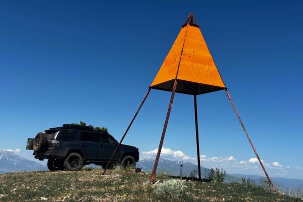
West Crest
The West Crest trail runs along the spine of West Mountain in southern Utah County. Hypothetically it can be done fully from the north to south (or vice versa) without having to do an out and back. Having tried this from various directions, logistically it is difficult to do due to a very steep sect...
Learn more about West Crest
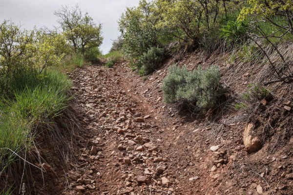
Monks Hollow Connector #318
Monks Hollow Connector is a 3.1-mile-long ATV trail for 50-inch vehicles in the Uinta National Forest. It goes from the Long Hollow ATV trail to near the top of Teat Mountain at 8,300 feet of elevation. The trail is an overgrown and narrow two-track that has a jarring and choppy surface full of loos...
Learn more about Monks Hollow Connector #318
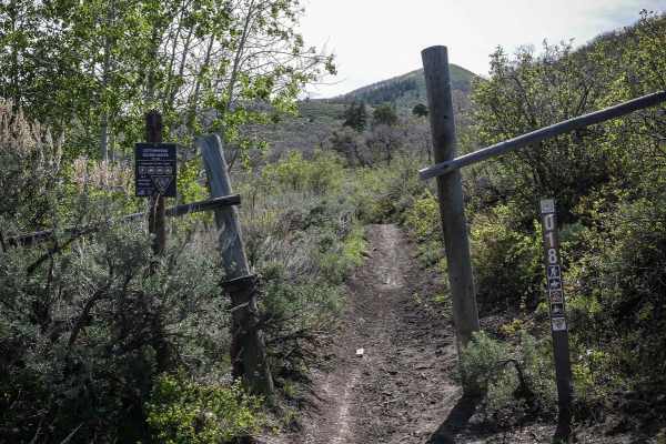
Cottonwood Second Water #018
Cottonwood Second Water is a 7.6-mile-long single track in the Uinta National Forest southeast of Provo, Utah. It goes between the Center Gwt single track and Diamond Fork Road, crossing Sheeps Creek-Rays Valley Road and First Water Road along the way. The trail parallels Second Water Creek the enti...
Learn more about Cottonwood Second Water #018
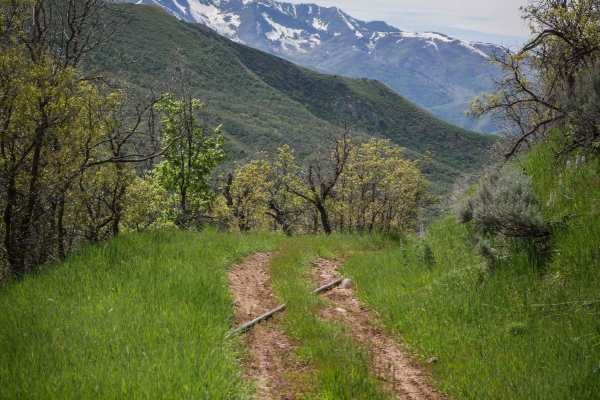
Long Hollow ATV
Long Hollow is a 7.3-mile-long ATV trail in the Uinta National Forest southeast of Provo, Utah. It connects to several other ATV trails in the area, including Teat Mountain, making for a fun day ride on quads. The south entrance is accessed from Long Hollow Road, which is a steep dirt turn-off from ...
Learn more about Long Hollow ATV
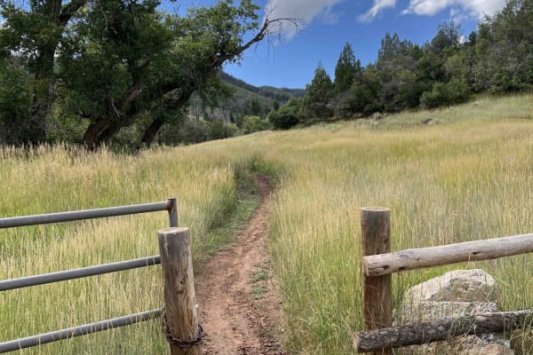
Mapleton-Sawmill Hollow (8013)
Mapleton-Sawmill Hollow connects Diamond Fork Road to Kirkman Hollow. As you ride west away from the road, the trail gains about 1,500 feet of elevation and then levels off. The bottom section runs through several fields with tall grass and whoops. The trail then enters the woods and becomes tight a...
Learn more about Mapleton-Sawmill Hollow (8013)
ATV trails near Mapleton, Utah
Explore ATV-friendly trails near you. These trails are accessible for vehicles up to 50 inches wide, perfect for ATVs and smaller off-road machines.
Lake Fork-Indianola - FS 50070
Easy, non-graded trail that travels through the Lake Fork Wildlife Management Area as well as the Manti La Sal Forest. This trail starts in Indianola and ends on Highway 89 or vice versa, depending on the direction of travel. The trail itself is easy going with no technical spots and is wide enough ...
Learn more about Lake Fork-Indianola - FS 50070
Right Fork Hobble Creek Road
Right Fork Hobble Creek Road crosses through the Uinta National Forest. While both end segments are pavement, this portion is rough gravel and very scenic. The road is pretty wooded and makes for a great drive during the fall months. There is nothing technical and neither 4WD nor high clearance are ...
Learn more about Right Fork Hobble Creek Road
Left Fork Hobble Creek - FS 70132
Left Fork Hobble Creek (FS 70132) may share the same name as Forest Service Road 70147, but the two roads are quite different. Starting at the intersection where FS 70147, Wing Flat (FS 70619), and this meet up, Left Fork Hobble Creek (FR 70132) descends southwest to a narrow canyon surrounded by ta...
Learn more about Left Fork Hobble Creek - FS 70132
West Crest
The West Crest trail runs along the spine of West Mountain in southern Utah County. Hypothetically it can be done fully from the north to south (or vice versa) without having to do an out and back. Having tried this from various directions, logistically it is difficult to do due to a very steep sect...
Learn more about West Crest
UTV/side-by-side trails near Mapleton, Utah
Find UTV and side-by-side trails near you. These trails accommodate vehicles up to 60 inches wide, ideal for UTVs, side-by-sides, and wider off-road rigs.
Kyhv Peak
From Provo Canyon, the road to Hope Campground is paved. From Hope Campground to Rock Canyon Campground, the road is easy and relatively smooth dirt. Beyond Rock Canyon Campground, the road becomes progressively more rocky and rutted until the final couple of miles, where the road becomes easier. ...
Learn more about Kyhv Peak
Lake Fork-Indianola - FS 50070
Easy, non-graded trail that travels through the Lake Fork Wildlife Management Area as well as the Manti La Sal Forest. This trail starts in Indianola and ends on Highway 89 or vice versa, depending on the direction of travel. The trail itself is easy going with no technical spots and is wide enough ...
Learn more about Lake Fork-Indianola - FS 50070
Right Fork Hobble Creek Road
Right Fork Hobble Creek Road crosses through the Uinta National Forest. While both end segments are pavement, this portion is rough gravel and very scenic. The road is pretty wooded and makes for a great drive during the fall months. There is nothing technical and neither 4WD nor high clearance are ...
Learn more about Right Fork Hobble Creek Road
Left Fork Hobble Creek - FS 70132
Left Fork Hobble Creek (FS 70132) may share the same name as Forest Service Road 70147, but the two roads are quite different. Starting at the intersection where FS 70147, Wing Flat (FS 70619), and this meet up, Left Fork Hobble Creek (FR 70132) descends southwest to a narrow canyon surrounded by ta...
Learn more about Left Fork Hobble Creek - FS 70132
The onX Offroad Difference
onX Offroad combines trail photos, descriptions, difficulty ratings, width restrictions, seasonality, and more in a user-friendly interface. Available on all devices, with offline access and full compatibility with CarPlay and Android Auto. Discover what you're missing today!
Open Trail Map