
Dirt Bike Trails
Near Maish Vaya, Arizona
Explore All Dirt Bike Trails Near Maish Vaya, Arizona
Dirt Bike Trails Near Maish Vaya, Arizona
Discover the best dirt bike trails near you. Browse trail maps, check difficulty ratings, and find your next adventure — whether you're looking for a quick ride or an all-day expedition.
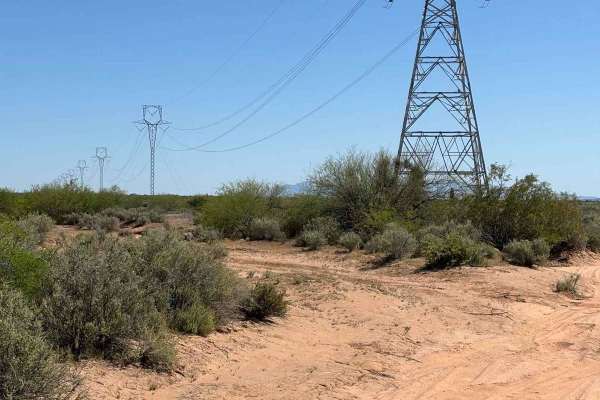
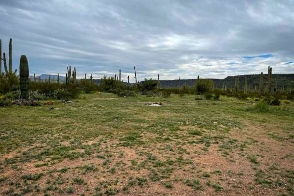
Sawtooth Powerline Trail
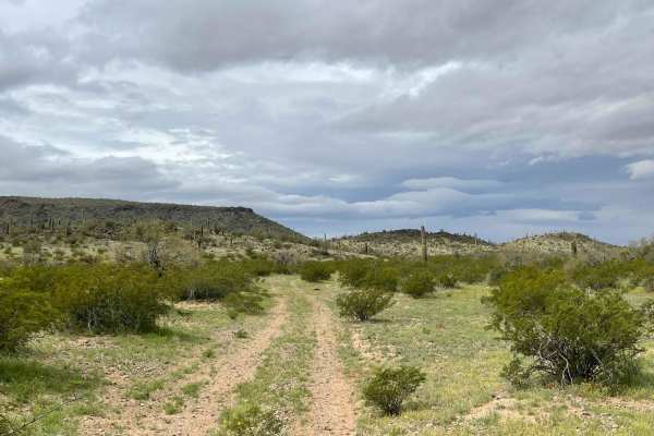
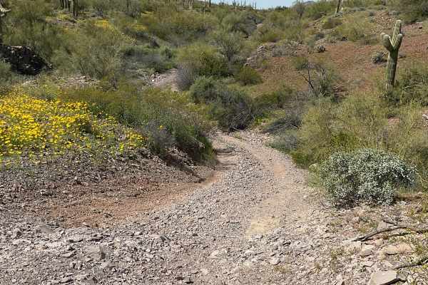
This powerline trail provides access to the West Silverbell Mountain Loop from the Sawtooth Mountain Loop. Other side trails give access to the Silverbell Sasco loop as well. This is a massive backcountry area with many unmapped trails, very few crowds, and an abundance of Sonoran desert flora and f...
Learn more about Sawtooth Powerline Trail
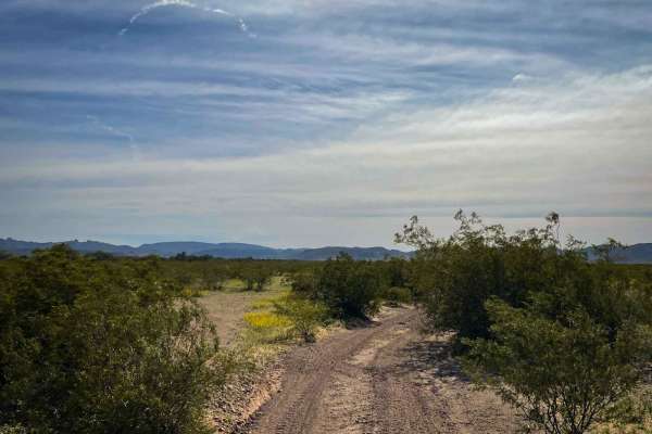
Pipeline Trail
Pipeline Trail starts as a rocky two-track that runs near an open pit Copper mine, and off into the distance to the East. Though this road may seem like your typical easy trail, with some points being two or even three vehicles wide, it quickly deteriorates into a rough trail with long, steep, loose...
Learn more about Pipeline Trail
Pipeline Camp Spur
This out-and-back spur trail features exciting steep, long hill climbs with loose rocks: a few taller shelves, and deep rocky wash crossings. There are plenty of narrow bush sections to clear your vehicle of that pesky clear coat all over your paint. There are magnificent vistas along the trail with...
Learn more about Pipeline Camp Spur
West Silverbell Mountain Loop
Explore a relatively easy trail meandering through quintessential Sonoran Desert landscapes. The trail is mostly smooth and has a good flow to it, with a handful of rockier sections. There are great views of the local mountains and unique rock outcrops. The southern end of West Silverbell Mountain f...
Learn more about West Silverbell Mountain Loop
Stop Playing in the Sand
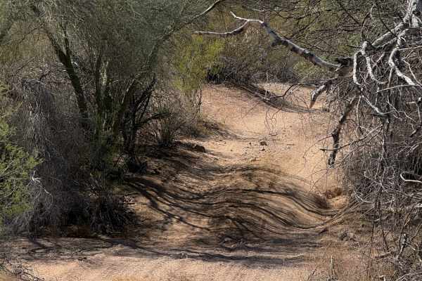
This trail leads out of the sandy wash section of lower Sikort Chapo and off into the desert. The route begins in dense trees with sharp branches sure to cause paint damage. Plenty of wildlife to see, such as jackrabbits and coyotes, quail, and even a long-horned owl, flushed from the trees. Once pa...
Learn more about Stop Playing in the Sand
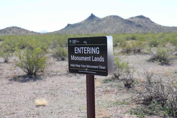
Widow Maker Pass
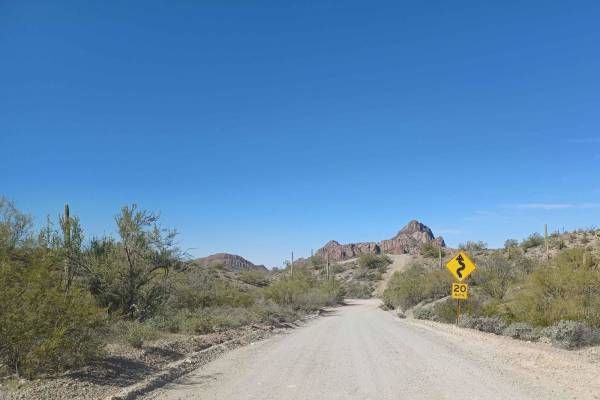
After you enter the gate, you go through a little sand, take a left, and head to the Sawtooth Mountains. Continue on the trail past the Ironwood Forest National Monument. There's wonderful scenery as you travel an easy trail. After you seem to be clearing the mountains, you will go right and up a st...
Learn more about Widow Maker Pass
8106 Trail
The 8106 Trail is filled with a rocky two-track that features washes filled with loose gravel, sand, and rock gardens. These washes have narrow, steep entrances and exits and overgrowth that will guarantee paint damage to your vehicle. Out of the washes, you'll enjoy beautiful scenic vistas of sagua...
Learn more about 8106 Trail
81 OH Tres
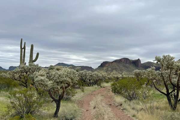
This BLM out-and-back route starts in a dense forest of Saguaro Cacti that almost seamlessly becomes a dense forest of Cholla( the dreaded jumping cacti). It features tall rock faces and formations. A keen eye will notice arches here and there and many caves along the way. Some even appear to be anc...
Learn more about 81 OH Tres
Jackrabbit Trail
Jackrabbit Trail is a rough, long out-and-back from the Pipeline Trail to the Barry Goldwater Test Range to the North. This rocky two-track has plenty to offer in terms of solitude, stunning scenery, and challenging driving. Steep, off-camber entrances and exits to narrow rocky washes pepper this t...
Learn more about Jackrabbit Trail
8107 Trail
BLM Trail 8107 is a narrow two-track that heads south into the majestic Arizona Desert just Southeast of Ajo, AZ. If you can get over the guaranteed paint damage from the sometimes-overgrown trail and the off-camber washes with steep entrances and exits, you'll be treated to extensive views of the m...
Learn more about 8107 Trail
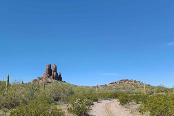
Locomotive Rock
Locomotive Rock Road is easy at the beginning, any 2-wheel drive vehicle can access the area. You can park and hike to Locomotive Rock. There are camping spots on either side of the road big enough for large rigs or a couple of vehicles. Once you pass Locomotive Rock the trail becomes tight, rocky, ...
Learn more about Locomotive Rock
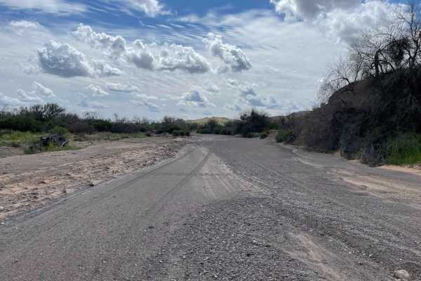
Lower Sikort Chapo Wash
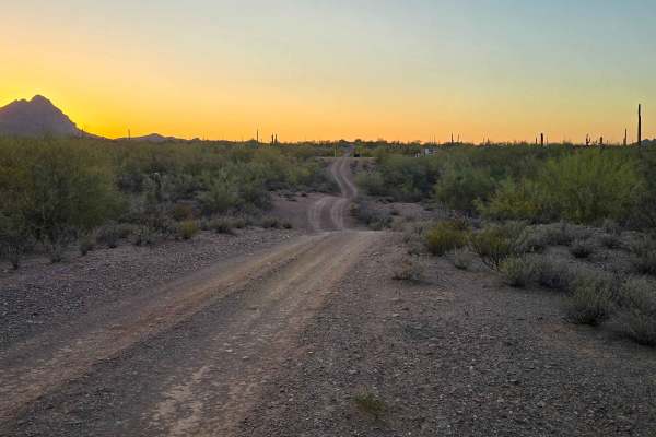
This primarily wide and smooth wash runs from the main route of the gas pipeline road all the way down to the reservation boundary. Just before the border is a small pullout with an excellent camping area next to an old corral and ranching location. The wash is full of life, with many red-tailed haw...
Learn more about Lower Sikort Chapo Wash
Javelina Mountain Trail
This trail is found in the Barry Goldwater Bombing Range, Sand Tank Mountain Area A. A permit is required and easily obtained for free at Luke.isportman.net. Check-in and check-out can easily be done on the same website. This trail takes off from Vekol Road and winds behind Maricopa Peak, Javelina M...
Learn more about Javelina Mountain Trail
Side Route - BLM 8008
Easy off-road wash trail follows a flat sandy bottom, suitable for ATVs and 4x4s. Optional side routes present six to seven obstacles—boulder fields, narrow ledges, soft ruts, and washouts- for experienced drivers. A signed shortcut climbs steeply to an abandoned copper mine. Obstacles are bypassabl...
Learn more about Side Route - BLM 8008
8113B Cemetery Road
8113B road is an easy gravel road, there are sections that can be rutted, and sandy and some spots drive through a wash for a few seconds. There are a couple of camp spots with amazing views. The road ends at a wilderness area Cabeza Prieta National Wildlife Refuge with a gate, it is closed to vehic...
Learn more about 8113B Cemetery Road
8042B
This is a short trail, 0.8 miles long, on the edge of the Table Top Wilderness and BLM land, easily accessible from the Sonoran Desert National Monument Staging Area. It’s mostly an easy desert trail on a mix of hard-packed dirt and sand, meandering through the creosote bushes with minimal elevation...
Learn more about 8042B
8042
BLM route 8042 starts on the north end as a narrower trail between a couple of paloverde trees, with branches sticking out into the trail. After the initial entrance, it opens up as it goes south, wider like a road. The route is a mix of sand washes and hard-packed dirt trails over the low rolling h...
Learn more about 8042
Scenic Loop
The Scenic Loop road is an easy road, it drives through both Private property and the Bureau of Land Management. It is mostly gravel with some sandy areas that drive across a wash, do not attempt when flooded, other than that any 2WD vehicle can access this area. Camping is abundant on this route in...
Learn more about Scenic Loop
Gas Line Road
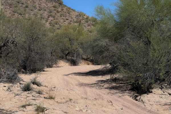
Gas Line Road offers a classic desert wheeling experience, winding through a stunning tapestry of protected landscapes, including the Ironwood Forest National Monument, BLM sections, and Arizona State Trust Land. This single-lane trek provides an intimate look at the rugged backcountry of the Southw...
Learn more about Gas Line Road
Bh1270
This is a 2.2-mile-long desert trail through the BLM land north of the Table Top Wilderness and Interstate 8. The east end of the trail departs from a more major desert road (Bh1271), and it meanders west through a flat desert terrain on a mix of hard-packed dirt and sand. The trail enters a wide sa...
Learn more about Bh1270
ATV trails near Maish Vaya, Arizona
Explore ATV-friendly trails near you. These trails are accessible for vehicles up to 50 inches wide, perfect for ATVs and smaller off-road machines.
Sawtooth Powerline Trail
This powerline trail provides access to the West Silverbell Mountain Loop from the Sawtooth Mountain Loop. Other side trails give access to the Silverbell Sasco loop as well. This is a massive backcountry area with many unmapped trails, very few crowds, and an abundance of Sonoran desert flora and f...
Learn more about Sawtooth Powerline Trail
Pipeline Trail
Pipeline Trail starts as a rocky two-track that runs near an open pit Copper mine, and off into the distance to the East. Though this road may seem like your typical easy trail, with some points being two or even three vehicles wide, it quickly deteriorates into a rough trail with long, steep, loose...
Learn more about Pipeline Trail
Pipeline Camp Spur
This out-and-back spur trail features exciting steep, long hill climbs with loose rocks: a few taller shelves, and deep rocky wash crossings. There are plenty of narrow bush sections to clear your vehicle of that pesky clear coat all over your paint. There are magnificent vistas along the trail with...
Learn more about Pipeline Camp Spur
West Silverbell Mountain Loop
Explore a relatively easy trail meandering through quintessential Sonoran Desert landscapes. The trail is mostly smooth and has a good flow to it, with a handful of rockier sections. There are great views of the local mountains and unique rock outcrops. The southern end of West Silverbell Mountain f...
Learn more about West Silverbell Mountain Loop
UTV/side-by-side trails near Maish Vaya, Arizona
Find UTV and side-by-side trails near you. These trails accommodate vehicles up to 60 inches wide, ideal for UTVs, side-by-sides, and wider off-road rigs.
Sawtooth Powerline Trail
This powerline trail provides access to the West Silverbell Mountain Loop from the Sawtooth Mountain Loop. Other side trails give access to the Silverbell Sasco loop as well. This is a massive backcountry area with many unmapped trails, very few crowds, and an abundance of Sonoran desert flora and f...
Learn more about Sawtooth Powerline Trail
Pipeline Trail
Pipeline Trail starts as a rocky two-track that runs near an open pit Copper mine, and off into the distance to the East. Though this road may seem like your typical easy trail, with some points being two or even three vehicles wide, it quickly deteriorates into a rough trail with long, steep, loose...
Learn more about Pipeline Trail
Pipeline Camp Spur
This out-and-back spur trail features exciting steep, long hill climbs with loose rocks: a few taller shelves, and deep rocky wash crossings. There are plenty of narrow bush sections to clear your vehicle of that pesky clear coat all over your paint. There are magnificent vistas along the trail with...
Learn more about Pipeline Camp Spur
West Silverbell Mountain Loop
Explore a relatively easy trail meandering through quintessential Sonoran Desert landscapes. The trail is mostly smooth and has a good flow to it, with a handful of rockier sections. There are great views of the local mountains and unique rock outcrops. The southern end of West Silverbell Mountain f...
Learn more about West Silverbell Mountain Loop
The onX Offroad Difference
onX Offroad combines trail photos, descriptions, difficulty ratings, width restrictions, seasonality, and more in a user-friendly interface. Available on all devices, with offline access and full compatibility with CarPlay and Android Auto. Discover what you're missing today!
Open Trail Map