
Dirt Bike Trails
Near Le Grand, California
Explore All Dirt Bike Trails Near Le Grand, California
Dirt Bike Trails Near Le Grand, California
Discover the best dirt bike trails near you. Browse trail maps, check difficulty ratings, and find your next adventure — whether you're looking for a quick ride or an all-day expedition.
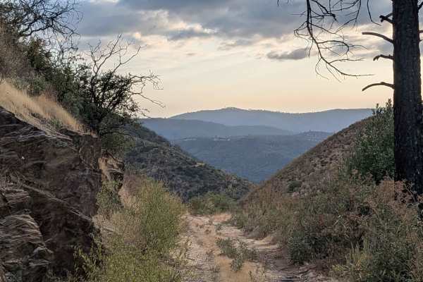
Buffalo Gulch Road
Starting from Highway 140, this rugged track drops nearly 1,500 feet and climbs less than 300 feet in under 4 miles before connecting with Ponderosa Way at the top. The trail averages 1 to 1.5 vehicles wide and is made up of uneven gravel and sand, giving it a rough, bumpy feel throughout. At about ...
Learn more about Buffalo Gulch Road
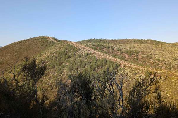
Burma Grade Road
Burma Grade climbs almost 1,400 feet in 3 miles. The trail starts at Bull Creek Road and ends at Bull Creek Road South. To access it, take Briceburg Road behind the Briceburg Visitor Center and cross the bridge. The trail is managed by the BLM. The road is hard-packed dirt, about 1.5 vehicles wide, ...
Learn more about Burma Grade Road
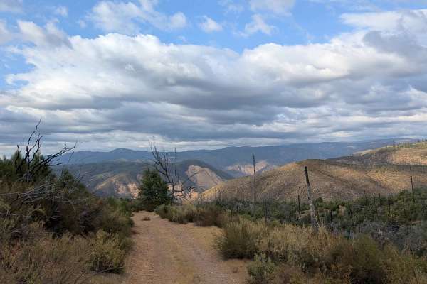
Ponderosa Way
Branching off from Buffalo Gulch Trail, this 3-mile out-and-back route offers big views and a fun ridge-line drive. The sandy track drops more than 700 feet and gains just 90 feet over 2 miles, making it a steady descent out and climb back. The trail averages about 1.5 vehicles wide as it runs along...
Learn more about Ponderosa Way
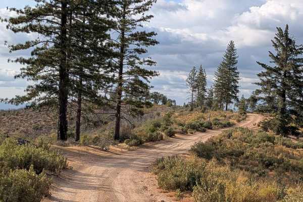
Buffalo Gulch - FS 4S11
Buffalo Gulch begins from Feliciana Mountain Road and winds for nearly 2 miles along a narrow shelf road. The track is one vehicle wide, composed of hard-packed sand, and sees a gentle gain of 120 feet before dropping more than 250 feet toward the end. The route provides excellent views of the surro...
Learn more about Buffalo Gulch - FS 4S11
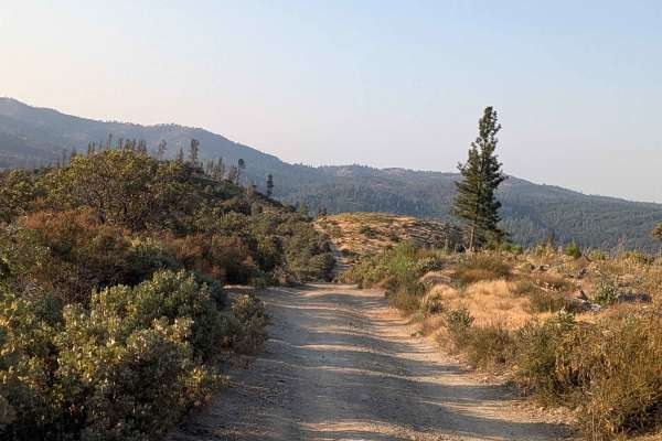
Feliciana Mountain Road - FS 4S012
This sandy and dusty trail winds through canyon terrain, dropping 1,600 feet and climbing just over 400 feet across just over 5 miles of diverse landscape. Starting at the Stairway Trail and Sweetwater Trail junction and ending at Highway 140, the route traverses through the Sierra National Forest, ...
Learn more about Feliciana Mountain Road - FS 4S012
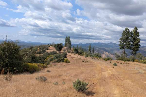
Sweetwater Ridge - FS 3S012
Sweetwater Ridge climbs almost 500 feet and drops almost 800 feet over just 3.6 miles, though this 7-mile out-and-back trail starts at Feliciana Mountain Road. The trail begins as a gravel surface and transitions to sand as it progresses, maintaining a single vehicle width throughout while providing...
Learn more about Sweetwater Ridge - FS 3S012
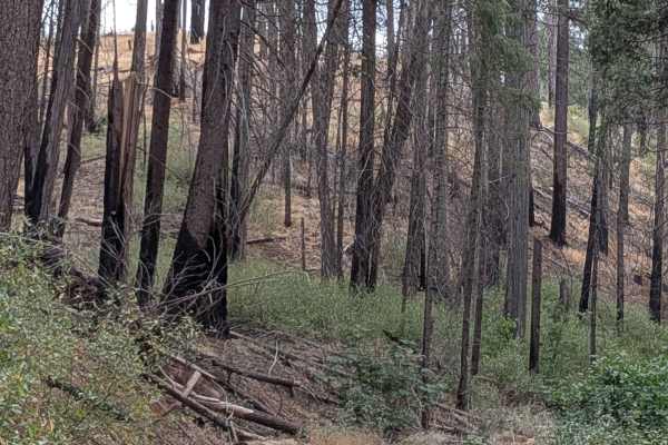
Ferguson Ridge - FS 3S004
This trail climbs over 900 feet and drops almost 800 feet across just under 6 miles, creating a challenging route with significant elevation changes throughout the journey. The track winds up and down hills along ridgelines and shelf roads, providing spectacular 360-degree views of the surrounding m...
Learn more about Ferguson Ridge - FS 3S004
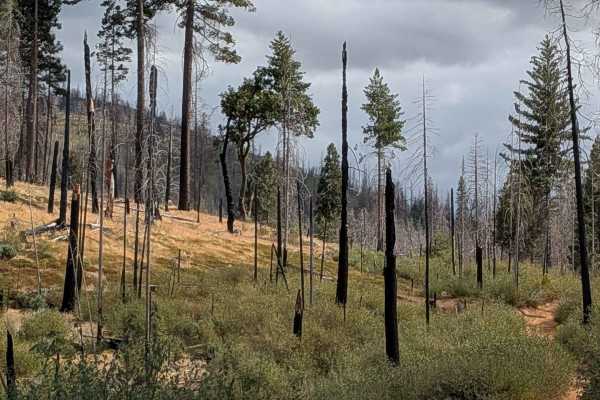
Bronson - FS 3S15
This trail connects Ferguson Ridge to the Sweetwater Ridge and Sweetwater Creek junction, climbing 220 feet and dropping just over 500 feet in less than a mile and a half. The very sandy trail cuts through hills affected by recent forest fire, creating a landscape of burned terrain and recovery vege...
Learn more about Bronson - FS 3S15
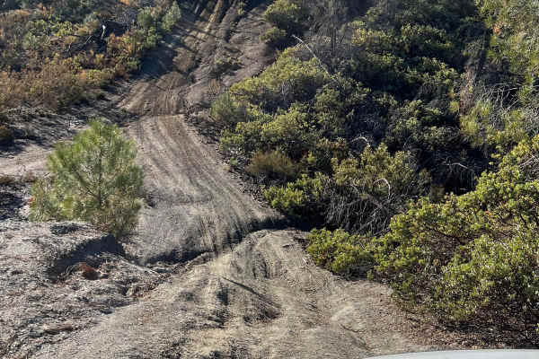
High Times
Discover an exciting off-road trail tailored to 4x4 vehicles, combining moderate terrain with thrilling elements. While mostly easy to navigate, you'll encounter occasional gentle inclines and 12-inch deep ruts, adding a dash of excitement without overwhelming the adventure. Perfect for those seekin...
Learn more about High Times
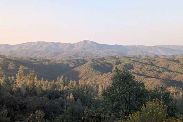
Ponderosa Way Cutoff
Ponderosa Way Cutoff serves as a convenient shortcut connecting Ponderosa Way and Bull Creek Road, following a relatively flat route that still incorporates ups and downs over various hills throughout its length. The trail offers excellent views of the surrounding forest and valleys, providing sceni...
Learn more about Ponderosa Way Cutoff
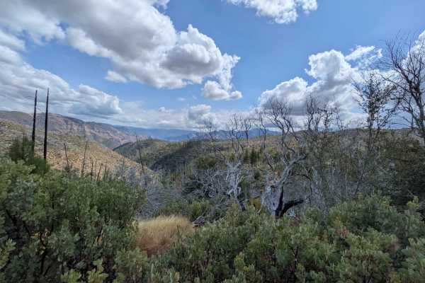
Ferguson Gulch - FS 3S023
This sandy trail climbs almost 400 feet and drops over 400 feet in just under 2 miles, offering stunning views of the valleys below and mountains across the landscape within the Stanislaus National Forest. The single vehicle-wide trail presents significant challenges with overgrown bushes encroachin...
Learn more about Ferguson Gulch - FS 3S023
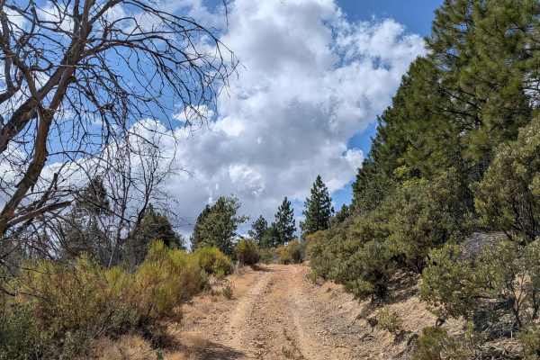
Nutmeg - FS 3S06
Nutmeg is a challenging 3.7-mile trail that features significant elevation changes, climbing over 700 feet and dropping over 700 feet throughout its length. This single-track trail winds through diverse terrain, offering spectacular views of surrounding hillsides, valleys, and distant mountains. The...
Learn more about Nutmeg - FS 3S06
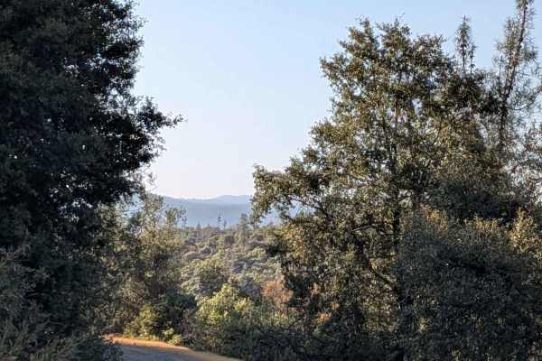
FS 3S15
This 5-mile out-and-back trail starts at Forest Service Road 3S02 and drops over 600 feet while gaining over 300 feet in less than 3 miles, creating varied elevation changes throughout the journey. The route follows a shelf road configuration for its entire length, providing elevated perspectives o...
Learn more about FS 3S15
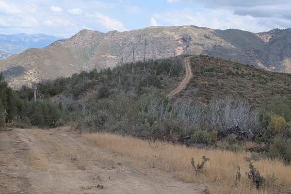
Gimasol Ridge - FS 3S007
This 4-mile out-and-back trail starts at Ferguson Ridge and features dramatic elevation changes, dropping almost 2,000 feet and climbing over 350 feet across 2.5 miles of challenging terrain. The single vehicle-wide trail skirts along the ridge, providing beautiful views of the surrounding mountains...
Learn more about Gimasol Ridge - FS 3S007
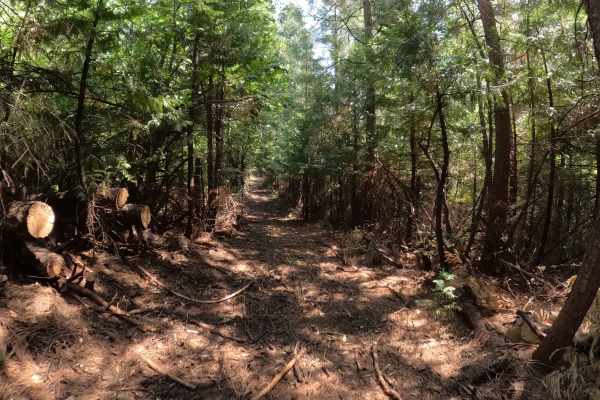
Pilot Cutoff - FS 6S063A
Pilot Cutoff (FS 6S063A) is a trail that comes with a serious warning label: "Horribly Tight." While it appears on the map as a useful connector within the Silver Knob/Miami network, in reality, it is a claustrophobic tunnel of vegetation that feels less like a road and more like a hiking path. The ...
Learn more about Pilot Cutoff - FS 6S063A
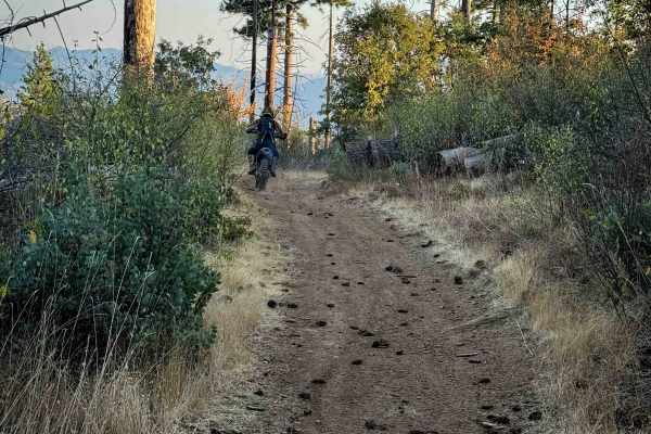
21E238
This is a 0.6-mile-long ATV trail that is very mild and easy, ideal for all skill levels. It starts and ends off of Silver Knob Road (FS 6S063), winding along a hillside on a wide and smooth two-track. The trail has just a little bit of loose rock at times, but remains mostly flat or gradual, with o...
Learn more about 21E238
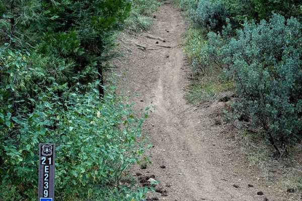
21E239
This is a short and easy ATV trail through the northwest corner of the Miami OHV trail system. Although it is a steep grade for almost the entire 0.7 miles, it remains quite easy because this trail hasn’t been rutted out like many of the other ATV trails in the system, maybe because it is a bit fart...
Learn more about 21E239
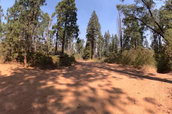
Silver Knob - FS 6S063
Silver Knob (FS 6S063) is the unruly cousin to the well-behaved gravel roads of the Miami Mountain system. While trails like Kamook offer a relaxing Sunday drive, Silver Knob demands you put your coffee down and grab the wheel with both hands. This tight, twisty two-track dives into the forest, imme...
Learn more about Silver Knob - FS 6S063
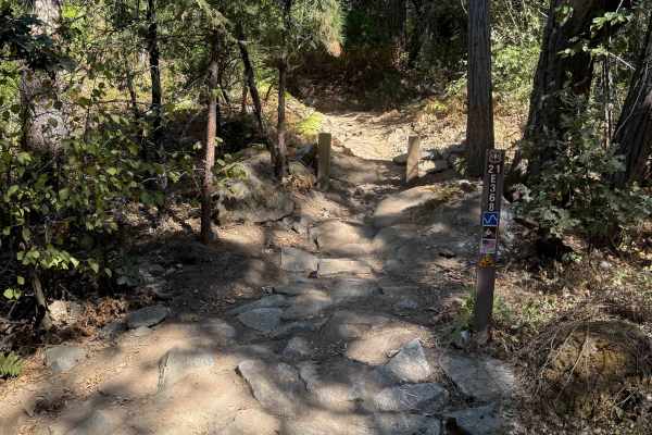
21E368
This is one of the longer and more difficult single tracks in the Miami OHV area. It starts with a small rock feature on the south end, where you have to go up a small ramped rock ledge in order to enter the trail. It continues on a shelfy hillside, weaving around the hill, over a couple of bridges,...
Learn more about 21E368
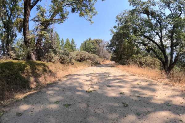
China Wells - FS 6S015
China Wells (FS 6S015) serves as the primary "spinal cord" of the Miami Mountain OHV system. This wide, well-graded forest service road runs north-south through the network, connecting the popular Kamook Staging Area to the southern reaches of the trail system. Unlike the tight, twisty spurs that br...
Learn more about China Wells - FS 6S015
ATV trails near Le Grand, California
Explore ATV-friendly trails near you. These trails are accessible for vehicles up to 50 inches wide, perfect for ATVs and smaller off-road machines.
Buffalo Gulch Road
Starting from Highway 140, this rugged track drops nearly 1,500 feet and climbs less than 300 feet in under 4 miles before connecting with Ponderosa Way at the top. The trail averages 1 to 1.5 vehicles wide and is made up of uneven gravel and sand, giving it a rough, bumpy feel throughout. At about ...
Learn more about Buffalo Gulch Road
Burma Grade Road
Burma Grade climbs almost 1,400 feet in 3 miles. The trail starts at Bull Creek Road and ends at Bull Creek Road South. To access it, take Briceburg Road behind the Briceburg Visitor Center and cross the bridge. The trail is managed by the BLM. The road is hard-packed dirt, about 1.5 vehicles wide, ...
Learn more about Burma Grade Road
Ponderosa Way
Branching off from Buffalo Gulch Trail, this 3-mile out-and-back route offers big views and a fun ridge-line drive. The sandy track drops more than 700 feet and gains just 90 feet over 2 miles, making it a steady descent out and climb back. The trail averages about 1.5 vehicles wide as it runs along...
Learn more about Ponderosa Way
Buffalo Gulch - FS 4S11
Buffalo Gulch begins from Feliciana Mountain Road and winds for nearly 2 miles along a narrow shelf road. The track is one vehicle wide, composed of hard-packed sand, and sees a gentle gain of 120 feet before dropping more than 250 feet toward the end. The route provides excellent views of the surro...
Learn more about Buffalo Gulch - FS 4S11
UTV/side-by-side trails near Le Grand, California
Find UTV and side-by-side trails near you. These trails accommodate vehicles up to 60 inches wide, ideal for UTVs, side-by-sides, and wider off-road rigs.
Buffalo Gulch Road
Starting from Highway 140, this rugged track drops nearly 1,500 feet and climbs less than 300 feet in under 4 miles before connecting with Ponderosa Way at the top. The trail averages 1 to 1.5 vehicles wide and is made up of uneven gravel and sand, giving it a rough, bumpy feel throughout. At about ...
Learn more about Buffalo Gulch Road
Burma Grade Road
Burma Grade climbs almost 1,400 feet in 3 miles. The trail starts at Bull Creek Road and ends at Bull Creek Road South. To access it, take Briceburg Road behind the Briceburg Visitor Center and cross the bridge. The trail is managed by the BLM. The road is hard-packed dirt, about 1.5 vehicles wide, ...
Learn more about Burma Grade Road
Ponderosa Way
Branching off from Buffalo Gulch Trail, this 3-mile out-and-back route offers big views and a fun ridge-line drive. The sandy track drops more than 700 feet and gains just 90 feet over 2 miles, making it a steady descent out and climb back. The trail averages about 1.5 vehicles wide as it runs along...
Learn more about Ponderosa Way
Buffalo Gulch - FS 4S11
Buffalo Gulch begins from Feliciana Mountain Road and winds for nearly 2 miles along a narrow shelf road. The track is one vehicle wide, composed of hard-packed sand, and sees a gentle gain of 120 feet before dropping more than 250 feet toward the end. The route provides excellent views of the surro...
Learn more about Buffalo Gulch - FS 4S11
The onX Offroad Difference
onX Offroad combines trail photos, descriptions, difficulty ratings, width restrictions, seasonality, and more in a user-friendly interface. Available on all devices, with offline access and full compatibility with CarPlay and Android Auto. Discover what you're missing today!
Open Trail Map