
Dirt Bike Trails
Near Lashmeet, West Virginia
Explore All Dirt Bike Trails Near Lashmeet, West Virginia
Dirt Bike Trails Near Lashmeet, West Virginia
Discover the best dirt bike trails near you. Browse trail maps, check difficulty ratings, and find your next adventure — whether you're looking for a quick ride or an all-day expedition.
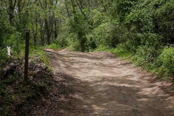
P64
Trail P64 is a 2.2-mile route with a gradual, narrower path that winds through a scenic, lush forest on dark, coal-like dirt. Lined with tall eastern white pines, the trail features minor ruts, small mud puddles, and no significant obstacles, making it a smooth, enjoyable ride. It also intersects wi...
Learn more about P64
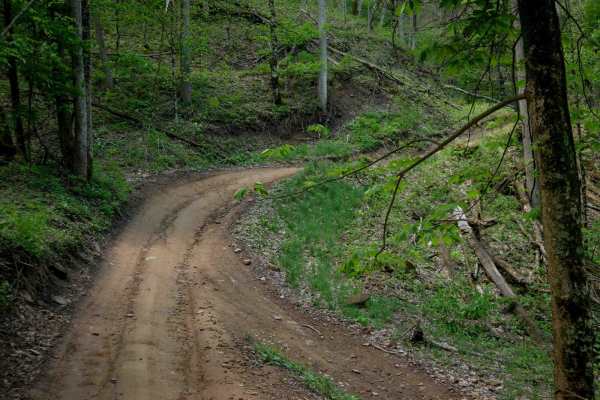
IR 28
Trail 28 is a 5.5-mile easy route that serves as a major connector between the Indian Ridge and Pinnacle Creek trail systems. While generally gradual in grade, the trail has sections that are more rugged, with pronounced ruts, loose rock, and occasional embedded slickrock surfaces. Some areas featur...
Learn more about IR 28
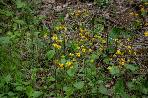
P62
Trail P62 is a short connector, less than a quarter mile in length, linking trails P64 and P16. It features a steeper slope with minor ruts and loose rock but no large obstacles, making it manageable for most riders despite the steep grade. The route passes through a scenic forest with moss-covered ...
Learn more about P62
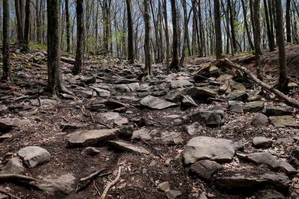
IR 99
From the west entrance, Trail 99 has a short technical climb up a rocky hillside, completely covered in boulders of varying sizes, forming loose shelves up to a couple of feet tall. Riders have to pick a good line and maintain momentum. It mellows out at the top of the hill until it comes to the int...
Learn more about IR 99
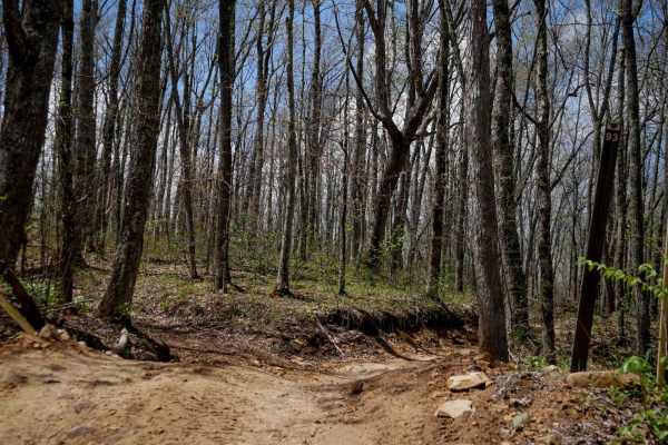
IR 93
Trail 93 is a 1.3-mile easy route that winds through a scenic forest composed of hophornbeam and yellow buckeye trees. The trail features minor ruts and loose rock, with narrower sections containing slightly more loose material. Gradual, sweeping corners and shelfy segments offer a smooth and enjoya...
Learn more about IR 93
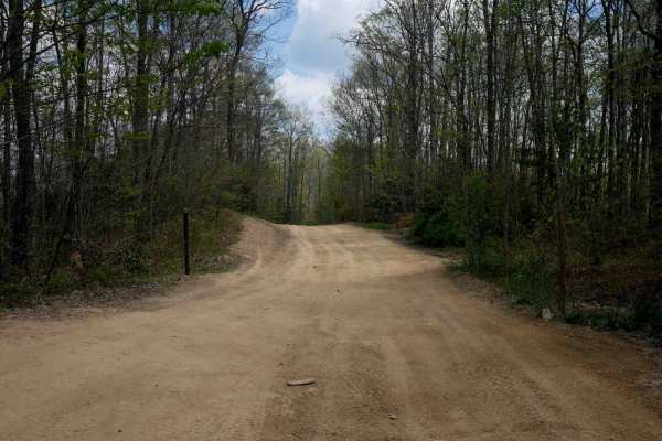
P16
Pocahontas 16 is an easy, 1.7-mile route with gradual grades, shallow ruts, and a wide path that allows for two-way travel, though riders should remain alert for oncoming traffic. The north end passes a small hot dog stand with picnic tables, offering a casual rest stop, likely only open during peak...
Learn more about P16
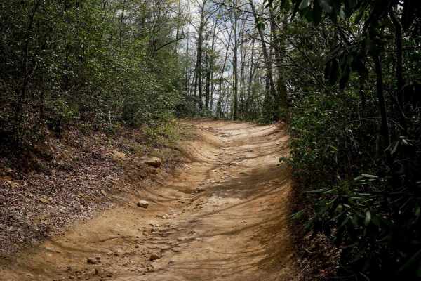
P61
Trail P61 is a short connector between trails P64 and P16, offering a similar level of difficulty to the parallel connector P62. It features shallow ruts, loose rock, and embedded rock in the trail surface that is easily passable. The route climbs a steeper slope with sharper, hairpin-style corners ...
Learn more about P61
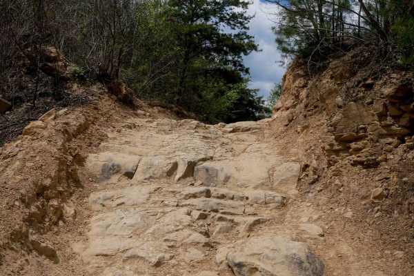
P83
Trail P83 starts at its south entrance with deeper ruts as it climbs beneath powerlines, including a couple of sharp switchbacks. It leads into an embedded rock shelf less than a foot tall that can be approached straight on and driven right up. The trail includes some deep, sloppy, muddy ruts that d...
Learn more about P83
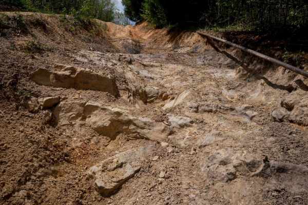
P84
From its southern entrance, Pocahontas 84 branches off from P83 on a narrower path between pine trees, with a warning sign indicating this trail is for highly experienced riders only, and may require winch and 4WD. The trail begins with a steep descent with deeper ruts, loose rock, and some embedded...
Learn more about P84
IR 98
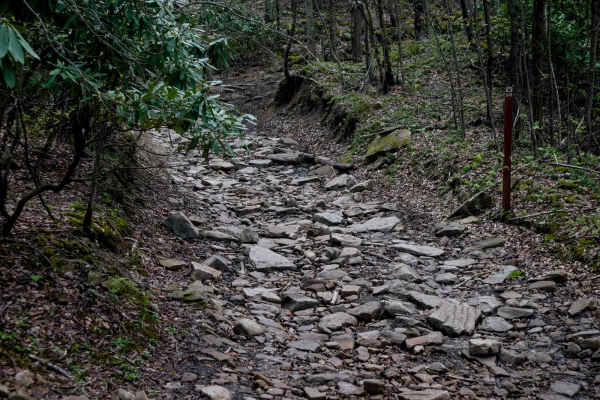
Trail 98 is a half-mile route that gradually ascends from west to east, featuring consistently rocky terrain throughout. The initial section is filled with large flat rock slabs, small shelves, and bedrock outcroppings. While the shelves aren't especially tall, careful line selection is necessary as...
Learn more about IR 98
IR 91
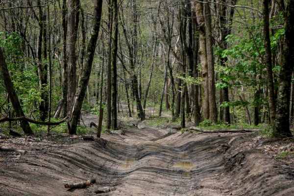
Trail 91 is a one-mile route that descends gradually from north to south. It is a wide, easy connector trail within the system, featuring shallow ruts and gentle corners. The trail passes alongside a small pond, where riders will encounter slightly looser rock. It also includes shelfy, narrower sect...
Learn more about IR 91
IR 180
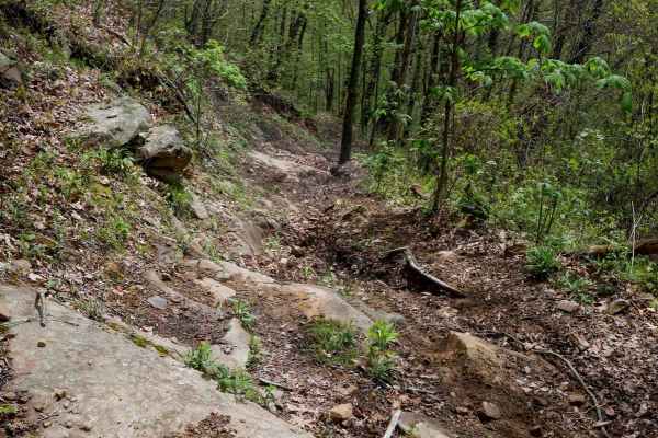
Trail 180 is a 0.6-mile primitive singletrack designed for dirt bikes, beginning along a shelfy hillside with a steep slope to one side. The trail surface includes roots, loose rocks, and embedded rock slabs, with several blunt shelves about a foot tall. Conditions can be slick due to decomposing lo...
Learn more about IR 180
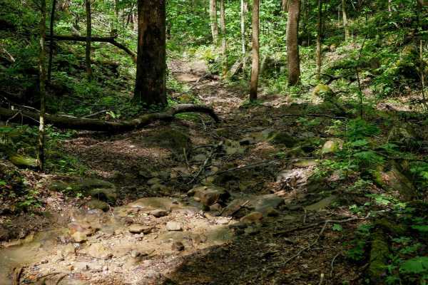
IR 190
Trail 190 is a short singletrack loop rated "Most Difficult," offering a more primitive riding experience through dense forest. The trail features technical sections with rocks and roots, and the terrain remains slick in both wet and dry conditions due to mossy surfaces, decaying leaves, and decompo...
Learn more about IR 190
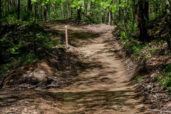
IR 64
Trail 64 is a one-mile-long route that runs flat and wide through the forest, serving as a smooth, easy, and scenic connector. The surface is composed of clean dirt with hardly any rock, making it ideal for beginners. With no noticeable elevation change, it provides a gentle ride from Trail 52 to th...
Learn more about IR 64
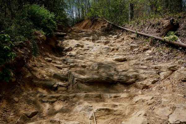
P70
Trail P70 is a short but technical climb, recommended for more experienced drivers. From the southern entrance, it begins with a steep, rocky ascent featuring large loose boulders and a narrow path. Embedded rock shelves--some up to two feet tall--create stair-step obstacles that capable UTVs can ta...
Learn more about P70
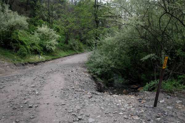
P17
Pocahontas 17 is a wide, generally smooth route, with minor ruts and scattered loose rocks, and a small stream running through sections--creating frequent puddles. The darker soil, typical of the region's coal mining past, adds to the trail's character. It winds through a scenic valley between two m...
Learn more about P17
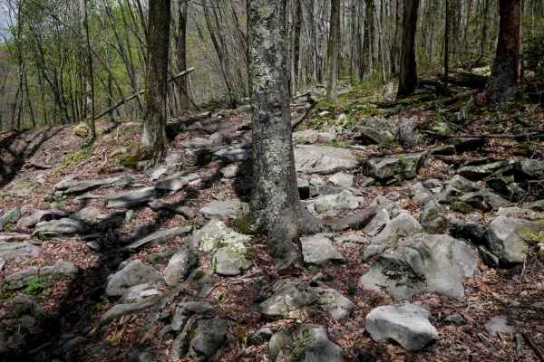
IR 165
While designated as dirt bike-only, both entrances to Trail 165 are lacking the trail designation signs, making the start appear accessible to larger vehicles, and thus widening the route to look more like a two-track. When making a counter-clockwise loop, the trail begins as an easy, wide path wind...
Learn more about IR 165
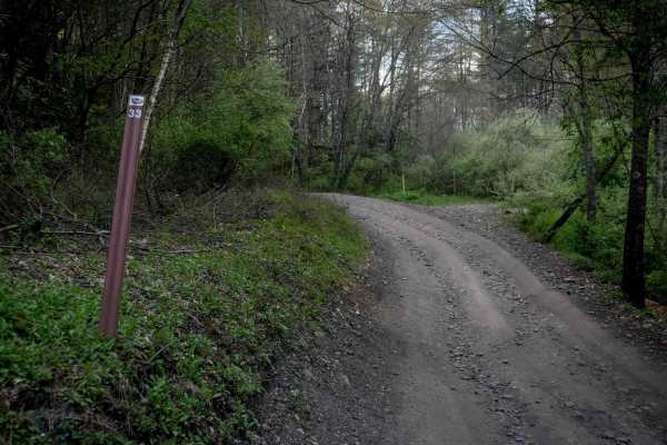
P33
Trail P33 is a short, quarter-mile connector between P13 and P31, with black, coal-like dirt and a deeply eroded, troughed path that sits several feet below the forest floor, creating a tunnel-like feel. It winds through a lush forest of rhododendron with one-lane width but features wide, flowing co...
Learn more about P33
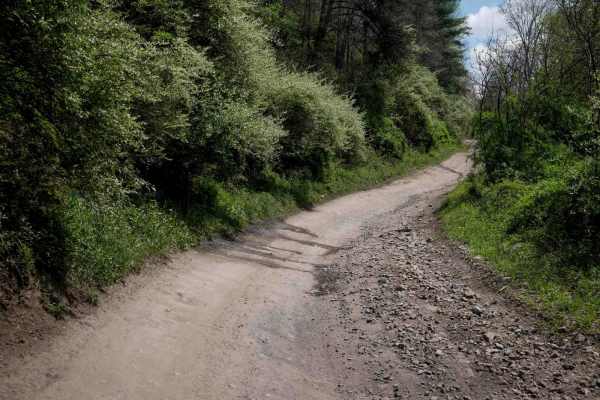
P18
This trail offers a wide, smooth ride with gradual inclines, minor ruts, and water bars, making it accessible for a range of skill levels. Throughout the longer route of 5.7 miles, it features large, sweeping corners and several well-marked intersections, with occasional steeper sections. Visibility...
Learn more about P18
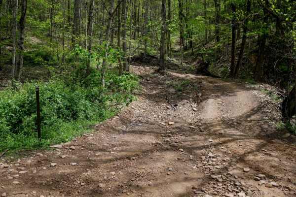
IR 67
Trail 67 is an easy 0.8-mile route that begins at its southern end with a moderate climb up the hillside, featuring some embedded rock and shallow ruts. The trail ascends into a shelfy section with a couple of large hairpin corners, gradually switchbacking uphill. The turns are not overly sharp or s...
Learn more about IR 67
ATV trails near Lashmeet, West Virginia
Explore ATV-friendly trails near you. These trails are accessible for vehicles up to 50 inches wide, perfect for ATVs and smaller off-road machines.
P64
Trail P64 is a 2.2-mile route with a gradual, narrower path that winds through a scenic, lush forest on dark, coal-like dirt. Lined with tall eastern white pines, the trail features minor ruts, small mud puddles, and no significant obstacles, making it a smooth, enjoyable ride. It also intersects wi...
Learn more about P64
IR 28
Trail 28 is a 5.5-mile easy route that serves as a major connector between the Indian Ridge and Pinnacle Creek trail systems. While generally gradual in grade, the trail has sections that are more rugged, with pronounced ruts, loose rock, and occasional embedded slickrock surfaces. Some areas featur...
Learn more about IR 28
P62
Trail P62 is a short connector, less than a quarter mile in length, linking trails P64 and P16. It features a steeper slope with minor ruts and loose rock but no large obstacles, making it manageable for most riders despite the steep grade. The route passes through a scenic forest with moss-covered ...
Learn more about P62
IR 99
From the west entrance, Trail 99 has a short technical climb up a rocky hillside, completely covered in boulders of varying sizes, forming loose shelves up to a couple of feet tall. Riders have to pick a good line and maintain momentum. It mellows out at the top of the hill until it comes to the int...
Learn more about IR 99
UTV/side-by-side trails near Lashmeet, West Virginia
Find UTV and side-by-side trails near you. These trails accommodate vehicles up to 60 inches wide, ideal for UTVs, side-by-sides, and wider off-road rigs.
P64
Trail P64 is a 2.2-mile route with a gradual, narrower path that winds through a scenic, lush forest on dark, coal-like dirt. Lined with tall eastern white pines, the trail features minor ruts, small mud puddles, and no significant obstacles, making it a smooth, enjoyable ride. It also intersects wi...
Learn more about P64
IR 28
Trail 28 is a 5.5-mile easy route that serves as a major connector between the Indian Ridge and Pinnacle Creek trail systems. While generally gradual in grade, the trail has sections that are more rugged, with pronounced ruts, loose rock, and occasional embedded slickrock surfaces. Some areas featur...
Learn more about IR 28
P62
Trail P62 is a short connector, less than a quarter mile in length, linking trails P64 and P16. It features a steeper slope with minor ruts and loose rock but no large obstacles, making it manageable for most riders despite the steep grade. The route passes through a scenic forest with moss-covered ...
Learn more about P62
IR 99
From the west entrance, Trail 99 has a short technical climb up a rocky hillside, completely covered in boulders of varying sizes, forming loose shelves up to a couple of feet tall. Riders have to pick a good line and maintain momentum. It mellows out at the top of the hill until it comes to the int...
Learn more about IR 99
The onX Offroad Difference
onX Offroad combines trail photos, descriptions, difficulty ratings, width restrictions, seasonality, and more in a user-friendly interface. Available on all devices, with offline access and full compatibility with CarPlay and Android Auto. Discover what you're missing today!
Open Trail Map