
Dirt Bike Trails
Near Holland Patent, New York
Explore All Dirt Bike Trails Near Holland Patent, New York
Dirt Bike Trails Near Holland Patent, New York
Discover the best dirt bike trails near you. Browse trail maps, check difficulty ratings, and find your next adventure — whether you're looking for a quick ride or an all-day expedition.
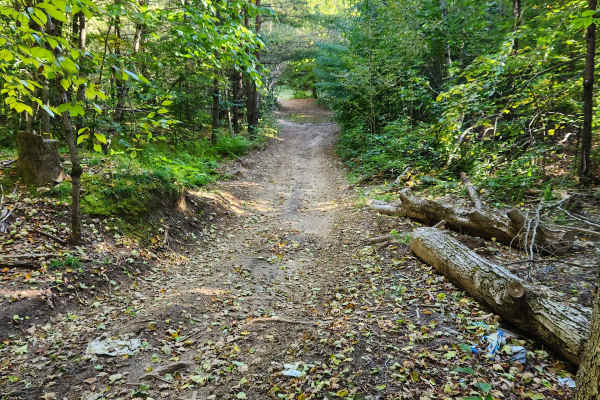
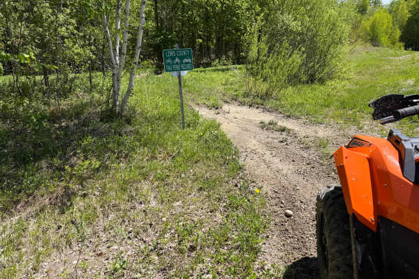
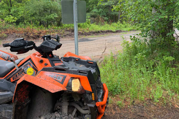
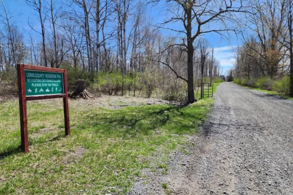
Military Road
Sandy dirt road connecting from Cold Brook to Norway. It is a seasonal road only open during the summer months. They have recently resurfaced part of the road, making it easier for non-lifted vehicles. The sand can make it slow going epically for motorcycles. There are a few side trails with sand pi...
Learn more about Military Road
Grower Green Trail East - 3
While traversing through this route, riders will encounter a moderate wooded trail through rolling terrain featuring a mix of hard-packed dirt, loose rock, shallow ruts, and scattered root sections. Several narrow trail corridors wind through the forest with tight turns, small hill climbs and descen...
Learn more about Grower Green Trail East - 3
Grower Green Trail East - 2
As you traverse this trail, expect a moderately easy route winding through a mix of wooded terrain and open meadow sections. Riders can expect primarily hard-packed dirt with occasional shallow ruts, loose rock, exposed roots, soft grassy sections, slight off-camber descents, and scattered mud holes...
Learn more about Grower Green Trail East - 2
Grower Green Trail East - 1
A moderately easy wooded trail route traveling through classic Lewis County terrain featuring hard-packed dirt, shallow ruts, loose rock, exposed roots, and gradual elevation changes throughout. Riders will travel through dense hardwood forest sections with narrow trail corridors, rolling hills, and...
Learn more about Grower Green Trail East - 1
Bauer Wooded Spur Trail
When traveling along this marked connector trail, riders will pass through a mix of wooded terrain and open grass corridor sections featuring a primarily narrow two-track trail surface. Riders can expect mostly hard-packed dirt with shallow ruts, loose soil, scattered roots, and occasional muddy are...
Learn more about Bauer Wooded Spur Trail
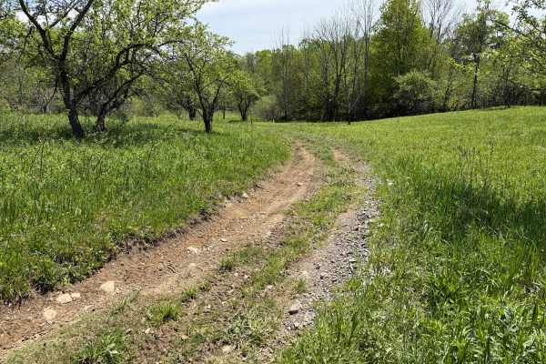
Grower Green Trail West
A scenic and moderately challenging Lewis County ATV trail route traveling through open farm fields, wooded corridors, and remote backcountry terrain. Riders will encounter a mix of hard-packed dirt, loose rock, shallow mud holes, rutted sections, and soft, low-lying areas depending on recent weathe...
Learn more about Grower Green Trail West
Pollock Run Trail
When traversing along this marked connector trail, riders will travel through a mix of open field edges and wooded terrain featuring a narrow two-track trail surface. The route primarily consists of hard-packed dirt and natural soil with light rutting, uneven sections, scattered loose stone, and occ...
Learn more about Pollock Run Trail
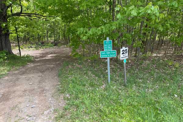
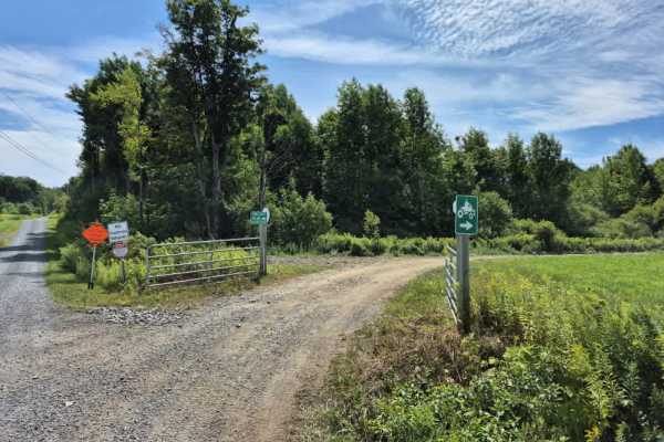
Zimmer Road Spur
This short connector trail provides access to cross New York State Route 26, where riders can use the designated on-road ATV route to connect with other sections of the Lewis County Trail System. The trail primarily serves as a link between riding areas and offers an easy transition to the county’s ...
Learn more about Zimmer Road Spur
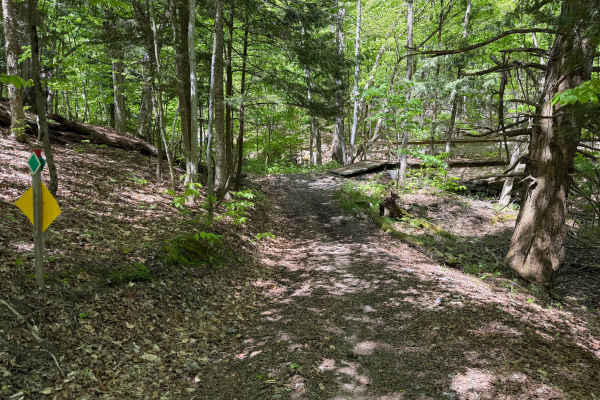
Wildcat Road Green Trail Loop
When traveling along this marked Lewis County ATV trail, riders will pass through a mix of pine and hardwood forest featuring a maintained two-track trail surface. The route primarily consists of hard-packed dirt, natural soil, pine needles, and occasional loose stone with light rutting throughout. ...
Learn more about Wildcat Road Green Trail Loop

The Commons 4
This is a nice wooded trail--hard-packed with no ruts or challenging sections. This is tighter, so 64-inch-wide vehicles or less is best. It's ATV and UTV-accessible with a Lewis County trail permit. It's open seasonally and there are updates regularly on their Facebook page. Expect two-way traffic ...
Learn more about The Commons 4
The Commons 1
This is a nice wooded trail--hard-packed with no ruts or challenging sections. This is tighter, so 64-inch-wide vehicles or less is best. It's ATV and UTV-accessible with a Lewis County trail permit. It's open seasonally and there are updates regularly on their Facebook page. Expect two-way traffic ...
Learn more about The Commons 1
The Commons 3
This is a nice wooded trail--hard-packed with no ruts or challenging sections. This is tighter, so 64-inch-wide vehicles or less is best. It's ATV and UTV-accessible with a Lewis County trail permit. It's open seasonally and there are updates regularly on their Facebook page. Expect two-way traffic ...
Learn more about The Commons 3
The Commons 2
This is a nice wooded trail--hard-packed with no ruts or challenging sections. This is tighter, so 64-inch-wide vehicles or less is best. It's ATV and UTV-accessible with a Lewis County trail permit. It's open seasonally and there are updates regularly on their Facebook page. Expect two-way traffic ...
Learn more about The Commons 2
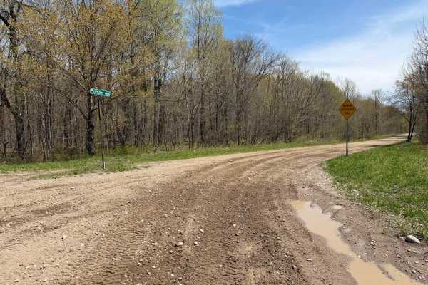
Plumber Road
This route travels through the Lesser Wilderness State Forest, featuring long straightaways, rolling hills, and light curves. The trail primarily consists of maintained gravel and dirt roads with sections of loose rock, shallow mud, and soft shoulders depending on recent weather conditions. Several ...
Learn more about Plumber Road
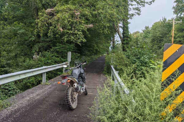
Lee Gulf Extension
Expect a narrow, county-maintained trail best suited for ATVs and small side-by-sides. It features the largest elevation change in the area, requiring four-wheel drive for a safe and responsible climb. Several bridges cross cascading creeks, highlighting local geology and offering spectacular views ...
Learn more about Lee Gulf Extension
Middle Road
Throughout this trail, you will encounter a mix of sand, gravel, roots, and water holes as you take the outer loop trail around the county forest property. Other side trails exist that cut through the center of this loop. These trails are very well marked. Watch for traffic merging in and out of the...
Learn more about Middle Road

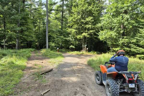
Carpenter Road Play Area
This Lewis County ATV Trail System play area features a maintained main trail with multiple side spur mud and play sections for riders looking for additional challenges. The route travels through a mix of wooded terrain and open hilltop meadows, providing a variety of landscapes and scenic views. Ri...
Learn more about Carpenter Road Play Area
Oswego Recreational Trail
The Oswego Recreational Trail is an old railroad bed with various surface types and old road millings. Very flat with some whoops and potholes in places. It's a nice easy ride through wooded, shaded areas and runs through the three-mile bay wildlife area. There are a couple of restaurants, bars, and...
Learn more about Oswego Recreational Trail
The Old Railbed
This stretch of the old Ogdensburg Railroad line has been converted by Lewis County into one of the main arteries of the Tughill region's snowmobile and ATV traffic. Follow this trail from the Burdick's Crossing Road intersection south to one of the area's premier eateries, Boondocks Restaurant & Ba...
Learn more about The Old Railbed
Tughill Region Connector
This varied, multi-surface route connects the Tug Hill region to the southern Adirondacks. The trail features a mix of pavement, gravel, and occasional Lewis County-permitted side trails, offering diverse terrain and a chance to manage tire heat. Please note that this route experiences high traffic ...
Learn more about Tughill Region Connector
ATV trails near Holland Patent, New York
Explore ATV-friendly trails near you. These trails are accessible for vehicles up to 50 inches wide, perfect for ATVs and smaller off-road machines.
Military Road
Sandy dirt road connecting from Cold Brook to Norway. It is a seasonal road only open during the summer months. They have recently resurfaced part of the road, making it easier for non-lifted vehicles. The sand can make it slow going epically for motorcycles. There are a few side trails with sand pi...
Learn more about Military Road
Grower Green Trail East - 3
While traversing through this route, riders will encounter a moderate wooded trail through rolling terrain featuring a mix of hard-packed dirt, loose rock, shallow ruts, and scattered root sections. Several narrow trail corridors wind through the forest with tight turns, small hill climbs and descen...
Learn more about Grower Green Trail East - 3
Grower Green Trail East - 2
As you traverse this trail, expect a moderately easy route winding through a mix of wooded terrain and open meadow sections. Riders can expect primarily hard-packed dirt with occasional shallow ruts, loose rock, exposed roots, soft grassy sections, slight off-camber descents, and scattered mud holes...
Learn more about Grower Green Trail East - 2
Grower Green Trail East - 1
A moderately easy wooded trail route traveling through classic Lewis County terrain featuring hard-packed dirt, shallow ruts, loose rock, exposed roots, and gradual elevation changes throughout. Riders will travel through dense hardwood forest sections with narrow trail corridors, rolling hills, and...
Learn more about Grower Green Trail East - 1
UTV/side-by-side trails near Holland Patent, New York
Find UTV and side-by-side trails near you. These trails accommodate vehicles up to 60 inches wide, ideal for UTVs, side-by-sides, and wider off-road rigs.
Military Road
Sandy dirt road connecting from Cold Brook to Norway. It is a seasonal road only open during the summer months. They have recently resurfaced part of the road, making it easier for non-lifted vehicles. The sand can make it slow going epically for motorcycles. There are a few side trails with sand pi...
Learn more about Military Road
Grower Green Trail East - 3
While traversing through this route, riders will encounter a moderate wooded trail through rolling terrain featuring a mix of hard-packed dirt, loose rock, shallow ruts, and scattered root sections. Several narrow trail corridors wind through the forest with tight turns, small hill climbs and descen...
Learn more about Grower Green Trail East - 3
Grower Green Trail East - 2
As you traverse this trail, expect a moderately easy route winding through a mix of wooded terrain and open meadow sections. Riders can expect primarily hard-packed dirt with occasional shallow ruts, loose rock, exposed roots, soft grassy sections, slight off-camber descents, and scattered mud holes...
Learn more about Grower Green Trail East - 2
Grower Green Trail East - 1
A moderately easy wooded trail route traveling through classic Lewis County terrain featuring hard-packed dirt, shallow ruts, loose rock, exposed roots, and gradual elevation changes throughout. Riders will travel through dense hardwood forest sections with narrow trail corridors, rolling hills, and...
Learn more about Grower Green Trail East - 1
The onX Offroad Difference
onX Offroad combines trail photos, descriptions, difficulty ratings, width restrictions, seasonality, and more in a user-friendly interface. Available on all devices, with offline access and full compatibility with CarPlay and Android Auto. Discover what you're missing today!
Open Trail Map