
Dirt Bike Trails
Near Hazel, Kentucky
Explore All Dirt Bike Trails Near Hazel, Kentucky
Dirt Bike Trails Near Hazel, Kentucky
Discover the best dirt bike trails near you. Browse trail maps, check difficulty ratings, and find your next adventure — whether you're looking for a quick ride or an all-day expedition.
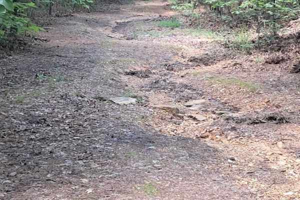
FS 232
Be on the lookout, it sneaks up on your left. It is right before the head of a walking trail. It starts with small washouts and a small off-camber about halfway through. There is a spot where you will want someone to help guide you, one side drops off, and you want to hug the right edge. Once you ma...
Learn more about FS 232
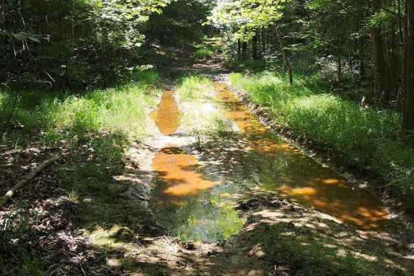
FS 402
Fun trail, lots of puddling, and ways to get your vehicle dirty. Few washouts and slippery areas. There is a tricky spot roughly halfway through where your left side will be much lower than the right side. It does just end at an opening and does not continue past. Good spot to turn around and do it ...
Learn more about FS 402
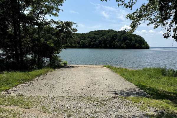
Jones Creek Road
Jones Creek Road takes you to to a primitive campsite and a paved boat ramp on Lake Kentucky. The trail is a gravel forestry road with some soft sand spots that can turn into mud holes after heavy rain. Usually a very easy road. The land between the Lakes is a 170,000-acre inland peninsula. Approxim...
Learn more about Jones Creek Road
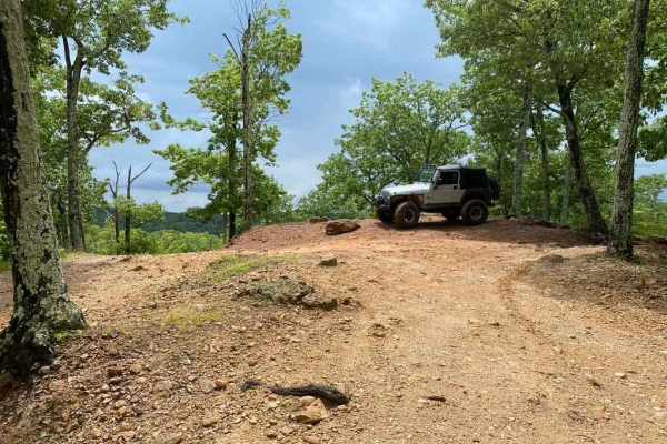
Bay Overlook Trail
The Bay Overlook Trail is a collection of secondary orange and tertiary blue trails put together to form a more challenging and fun route through Turkey Bay OHV, within the Land Between the Lakes National Recreation Area. The official forestry route IDs within this trail, going south to north (B for...
Learn more about Bay Overlook Trail
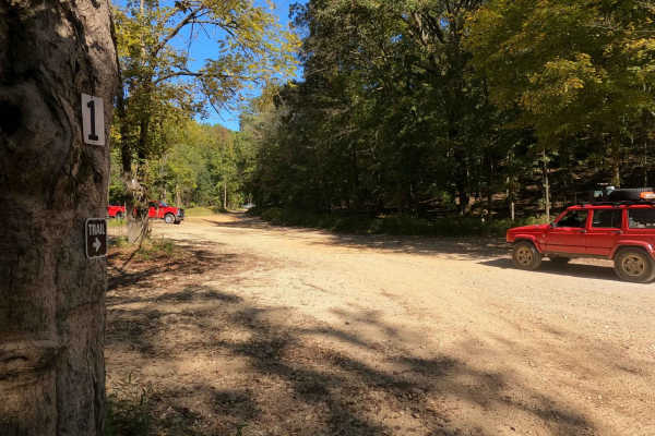
1 to 2 Road
The 1 to 2 Road, is a semi-maintained creek gravel and dirt primary road, with natural tendencies, connecting point to point from the 1 intersection to the 2 intersection in Turkey Bay OHV, within the Land Between the Lakes National Recreation Area. Its official ID is part of Forestry M01. After get...
Learn more about 1 to 2 Road
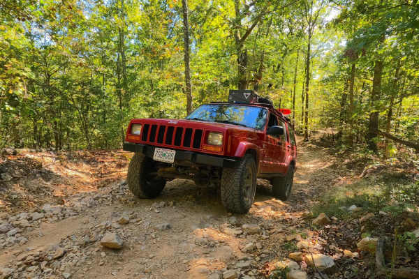
Middle Bays Trail - 4 to A Road
The Middle Bays Trail/4 to A Road, connecting the two middle bays within the OHV park, is a semi-maintained creek gravel and dirt primary road with natural tendencies. It connects point to point from the 4 intersection near Turner Hollow/North Middle Bay to the A intersection near Hendon Cemetery/So...
Learn more about Middle Bays Trail - 4 to A Road
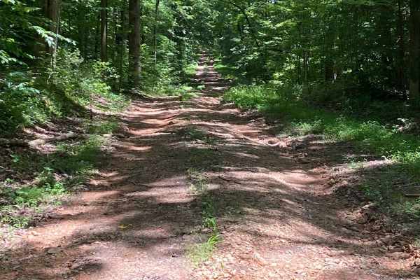
Bear Creek Road
Starts off easy going, small washouts and puddle crossings. The bottoms of the crossings are not muddy and pretty solid. About halfway through, you encounter a 30-degree downward incline. Massive washouts and slippery, loose rock. Spotter advised. Nice little trail through the woods that ends at a p...
Learn more about Bear Creek Road
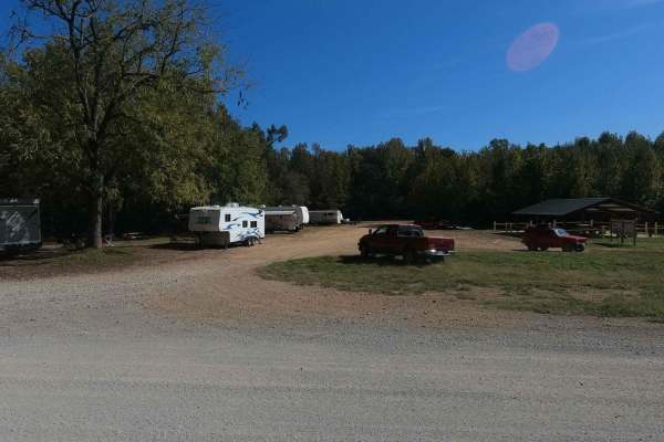
Mays Camp - FS 167 D2
The Mays Camp, also referred to as Turkey Trot Camp, is a popular camp road at Turkey Bay OHV, within the Land Between the Lakes National Recreation Area. Its pet name and official ID is Mays Camping Area FS 167 Spur D2. It features a flat-laying road starting with the small event pavilion and Turke...
Learn more about Mays Camp - FS 167 D2
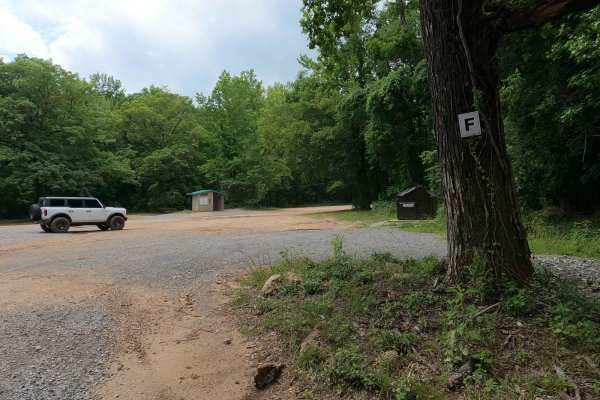
F to E Road
The Turkey Bay F to E Road, is a generally maintained primary gravel/dirt road connecting point to point from the F intersection to E intersection inside the Turkey Bay OHV Area, within the Land Between the Lakes National Recreation Area, it is officially IDs under part of the Forestry M02. The road...
Learn more about F to E Road
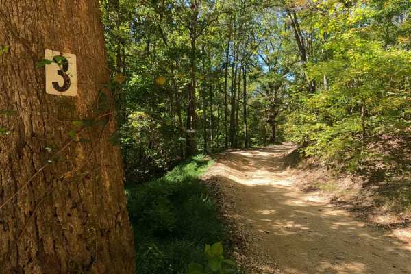
3 to 4 Road
The 3 to 4 Road, is a semi-maintained creek gravel and dirt primary road, connecting point to point from the 3 intersection to the 4 intersection in Turkey Bay OHV, within the Land Between the Lakes National Recreation Area. Its official ID is part of Forestry M01. The Road is a short and simple exa...
Learn more about 3 to 4 Road
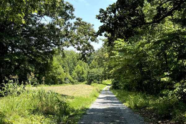
Fords Bay Road
Fords Bay Road connects the main road (Woodlands Trace National Scenic Byway) with CR 165 and CR 347 which takes you to Fords Bay on Lake Barkley. The trail is a gravel forestry road with some soft sand spots that can turn into mud holes after heavy rain. Usually, this is a very easy road. The land ...
Learn more about Fords Bay Road
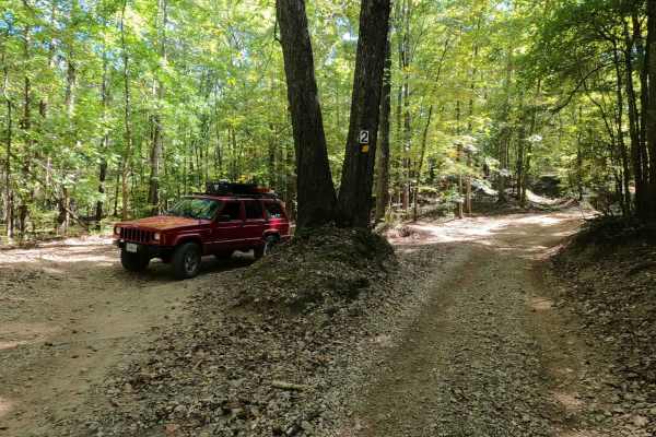
2 to 3 Road
The 2 to 3 Road is a semi-maintained creek gravel and dirt primary road, with natural tendencies, connecting point to point from the 2 intersection at the "V Tree" to the 3 intersection in Turkey Bay OHV, within the Land Between the Lakes National Recreation Area. Its official ID is part of Forestry...
Learn more about 2 to 3 Road
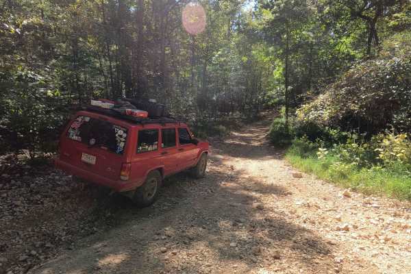
3 to A Road
The 3 to A Road is a semi-maintained primary road with a blend of dirt and natural rock, connecting point to point from the 3 intersection to the A intersection within the Land Between the Lakes National Recreation Area. Its official ID is part of Forestry M04. Going north to south at the 3 intersec...
Learn more about 3 to A Road
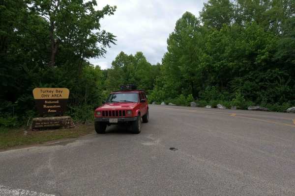
Turkey Bay Gate FSR 167
Turkey Bay Gate FSR 167 is the paved entry to gravel main hub and parking section of the Turkey Bay OHV Area, within the Land Between the Lakes National Recreation Area. At the entry you pass the picture worthy Turkey Bay OHV forestry sign, which shortly leads you to the sign in and fee gate house. ...
Learn more about Turkey Bay Gate FSR 167
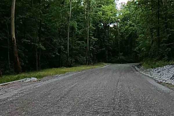
Turkey Creek Road FSR 167
The Turkey Creek Road FSR 167, is the Gravel main hub road and parking section along the southern boundary of the Turkey Bay OHV Area, within the Land Between the Lakes National Recreation Area. The road features generally easy-riding gravel for the first 3/4 of its length, crossing a few mild low w...
Learn more about Turkey Creek Road FSR 167
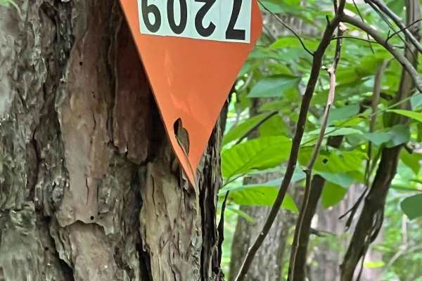
Turkey Bay OHV 7209
This is one of many side trails branching off the 2 to 3 Road. It forms a down-and-back loop with several washout areas--some quite large. While bypasses are usually available, they're not guaranteed. Most of the side trails are extremely narrow, so extra-wide or long vehicles may have difficulty na...
Learn more about Turkey Bay OHV 7209
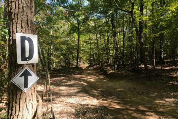
2 to D Road
The 2 to D Road is a semi-maintained creek gravel and dirt primary road, with natural tendencies, connecting point to point from the 2 intersection to the D intersection in Turkey Bay OHV, within the Land Between the Lakes National Recreation Area. Its official ID is the Forestry M05. At the 2 inter...
Learn more about 2 to D Road
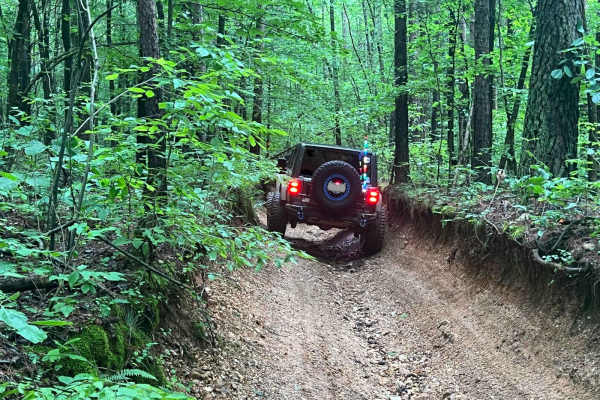
Turkey Bay OVH 5201
This is one of many side trails branching off the 3 to 4 Road and the 5 to 4 Road. It's a two-way trail featuring several washout areas--some of them extremely large. One section includes a "V"-shaped washout roughly 5 feet deep;while passable, it requires extreme caution, and using a spotter is str...
Learn more about Turkey Bay OVH 5201
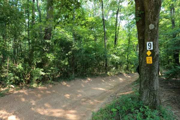
9 to 8 Road
The Turkey Bay 9 to 8 Road is a generally maintained primary gravel/creek bottom road, connecting point to point from the 9 intersection to the 8 intersection inside the Turkey Bay OHV Area, within the Land Between the Lakes National Recreation Area. Its official ID is forestry M01. The road starts ...
Learn more about 9 to 8 Road
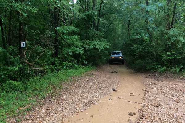
8 to E Road
The Turkey Bay 8 to E Road is a generally maintained primary gravel/dirt road connecting point to point from the 8 intersection to E intersection inside the Turkey Bay OHV area, within the Land Between the Lakes National Recreation Area, this road's official Forest ID is the M06. The road begins on ...
Learn more about 8 to E Road
ATV trails near Hazel, Kentucky
Explore ATV-friendly trails near you. These trails are accessible for vehicles up to 50 inches wide, perfect for ATVs and smaller off-road machines.
FS 232
Be on the lookout, it sneaks up on your left. It is right before the head of a walking trail. It starts with small washouts and a small off-camber about halfway through. There is a spot where you will want someone to help guide you, one side drops off, and you want to hug the right edge. Once you ma...
Learn more about FS 232
FS 402
Fun trail, lots of puddling, and ways to get your vehicle dirty. Few washouts and slippery areas. There is a tricky spot roughly halfway through where your left side will be much lower than the right side. It does just end at an opening and does not continue past. Good spot to turn around and do it ...
Learn more about FS 402
Jones Creek Road
Jones Creek Road takes you to to a primitive campsite and a paved boat ramp on Lake Kentucky. The trail is a gravel forestry road with some soft sand spots that can turn into mud holes after heavy rain. Usually a very easy road. The land between the Lakes is a 170,000-acre inland peninsula. Approxim...
Learn more about Jones Creek Road
Bay Overlook Trail
The Bay Overlook Trail is a collection of secondary orange and tertiary blue trails put together to form a more challenging and fun route through Turkey Bay OHV, within the Land Between the Lakes National Recreation Area. The official forestry route IDs within this trail, going south to north (B for...
Learn more about Bay Overlook Trail
UTV/side-by-side trails near Hazel, Kentucky
Find UTV and side-by-side trails near you. These trails accommodate vehicles up to 60 inches wide, ideal for UTVs, side-by-sides, and wider off-road rigs.
Jones Creek Road
Jones Creek Road takes you to to a primitive campsite and a paved boat ramp on Lake Kentucky. The trail is a gravel forestry road with some soft sand spots that can turn into mud holes after heavy rain. Usually a very easy road. The land between the Lakes is a 170,000-acre inland peninsula. Approxim...
Learn more about Jones Creek Road
Bay Overlook Trail
The Bay Overlook Trail is a collection of secondary orange and tertiary blue trails put together to form a more challenging and fun route through Turkey Bay OHV, within the Land Between the Lakes National Recreation Area. The official forestry route IDs within this trail, going south to north (B for...
Learn more about Bay Overlook Trail
1 to 2 Road
The 1 to 2 Road, is a semi-maintained creek gravel and dirt primary road, with natural tendencies, connecting point to point from the 1 intersection to the 2 intersection in Turkey Bay OHV, within the Land Between the Lakes National Recreation Area. Its official ID is part of Forestry M01. After get...
Learn more about 1 to 2 Road
Middle Bays Trail - 4 to A Road
The Middle Bays Trail/4 to A Road, connecting the two middle bays within the OHV park, is a semi-maintained creek gravel and dirt primary road with natural tendencies. It connects point to point from the 4 intersection near Turner Hollow/North Middle Bay to the A intersection near Hendon Cemetery/So...
Learn more about Middle Bays Trail - 4 to A Road
The onX Offroad Difference
onX Offroad combines trail photos, descriptions, difficulty ratings, width restrictions, seasonality, and more in a user-friendly interface. Available on all devices, with offline access and full compatibility with CarPlay and Android Auto. Discover what you're missing today!
Open Trail Map