
Dirt Bike Trails
Near Haystack, New Mexico
Explore All Dirt Bike Trails Near Haystack, New Mexico
Dirt Bike Trails Near Haystack, New Mexico
Discover the best dirt bike trails near you. Browse trail maps, check difficulty ratings, and find your next adventure — whether you're looking for a quick ride or an all-day expedition.
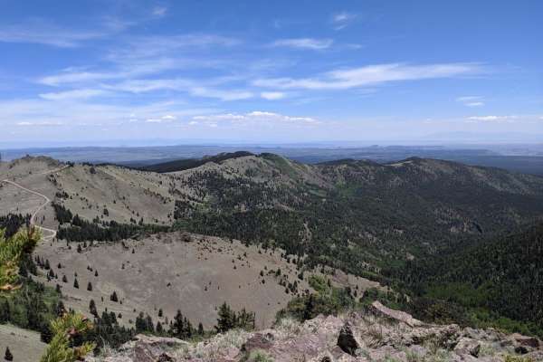
Mt. Taylor Peak 4x4 Road
This 4x4 road is a great intro to overlanding, with stunning views and minimal technical obstacles. Starting from Grants, the road climbs almost 5000 feet to within 1/2 mile of Mt. Taylor peak. The road starts off as graded gravel, giving way to a more primitive dirt road, which is easily passable i...
Learn more about Mt. Taylor Peak 4x4 Road
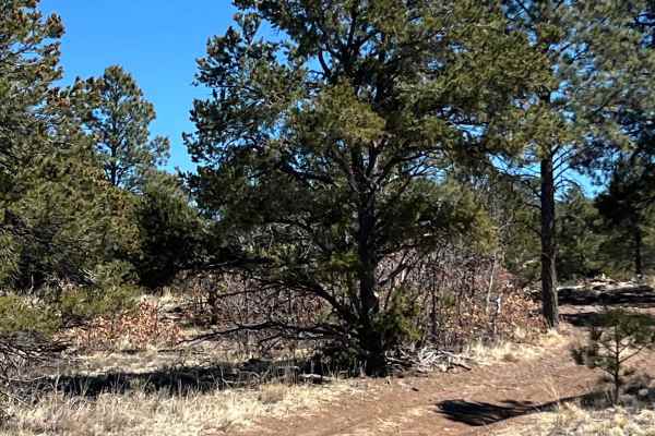
Peaceful Path - FR 194
This minimally traveled route follows FR 194 through the Cibola National Forest and winds along the southern boundaries of the Ignacio Chavez and Chamisa Wilderness Study Areas. It is a level route that has open meadows and gorgeous tree stands. There are many areas for camping, picnics and hiking. ...
Learn more about Peaceful Path - FR 194
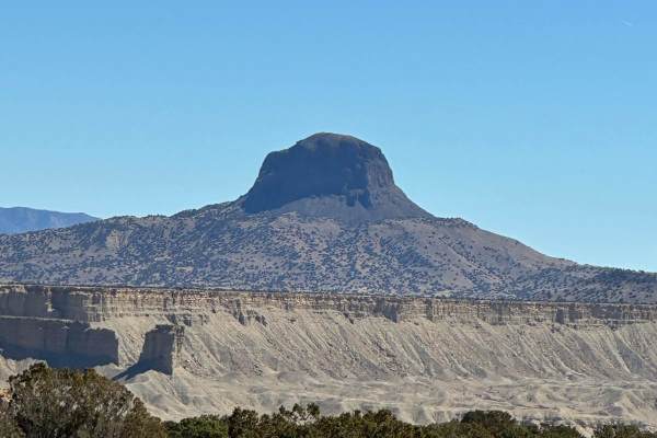
Wilderness Study Areas
This trail follows BLM 1103 from the floor of the Rio Puerco Valley up a steep, rocky section to the top of a mesa. The route travels between the Ignacio Chavez Wilderness Study Area, Chamisa Wilderness Study Area and the Empedrado Wilderness Study Area . There are numerous pull off parking spaces o...
Learn more about Wilderness Study Areas
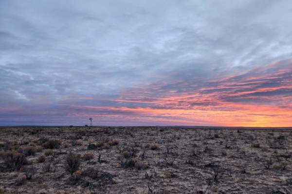
Chaco Overlook
This double-track trail takes you through cattle grazing farmland and ends at an overlook. Cows can be seen near the trail. There is nowhere to camp or turn around until the end of the trail. The trail is smooth and can be done in 2WD under good conditions. The overlook is a great place to camp, rig...
Learn more about Chaco Overlook
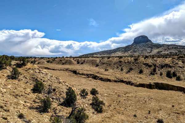
Cabezon Detour
This route might be a good alternative route when certain sections of "Backway to Cabezon" are washed out. The trail coincides with BLM 1113 for some sections but is rerouted for the portion of BLM 1113 that is closed to vehicles. There is a wire gate that one must pass through;please be sure to clo...
Learn more about Cabezon Detour
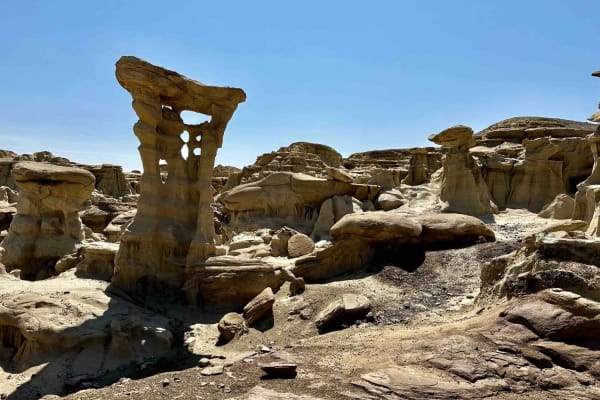
Valley of Dreams East
This is a point-to-point route that takes you from Road 550 in Nageezi to the Valley of Dreams trailhead/parking lot. The first quarter to half mile or so is paved but quickly turns to a graded dirt road which gets increasingly less groomed the closer you get to the trailhead. Rutted and rough in pl...
Learn more about Valley of Dreams East
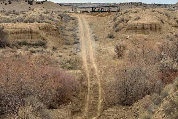
North Pipeline Road
This route connects the Old State Highway 279 off Highway 550 with South Pipeline Road, or Backway to Cabezon Peak. There is one major obstacle through the Rio Puerco Arroyo at the northern end. The water can run deep through the narrow, steep drainage and both sides can be slick.
Learn more about North Pipeline Road
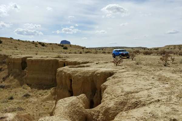
Backway to Cabezon Peak
This set of well maintained, dirt roads provides access to Cabezon Peak from nearby Pipeline Road. It passes through some typical New Mexican high-desert scenery, with shrubs and cacti on either side of a winding dirt road. It takes you up a ridge with excellent views of the surrounding desert and ...
Learn more about Backway to Cabezon Peak
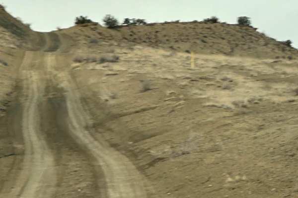
South Pipeline Road
This route follows the pipeline easement along the Ojito Wilderness to the east and through Zia Pueblo land. It connects Cabezon Road with Backway to Cabezon Peak or the North Pipeline Road. The route has some bumps, dips, and ruts and can be slick with the slightest bit of moisture.
Learn more about South Pipeline Road
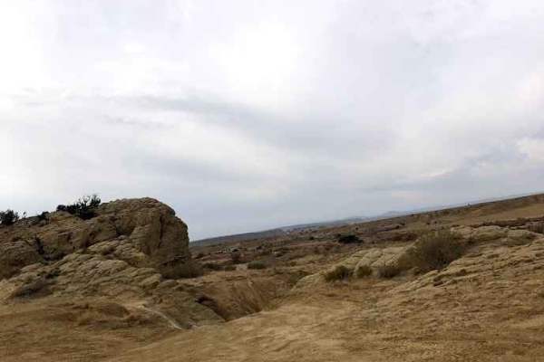
Southern Circle
Southern Circle is located on BLM land in Rio Rancho, New Mexico. This trail can give you access to some tribal land, so be careful not to take other routes. It is an easy off-road drive through the desert. The trail is easy and well-maintained dirt roads, some rocky roadsand loose rocks. You will a...
Learn more about Southern Circle
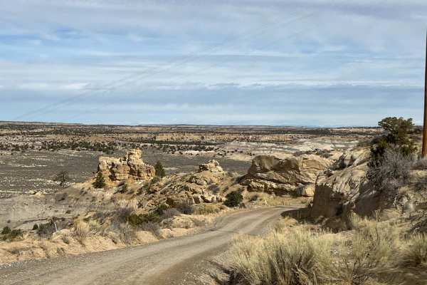
Johnson Canyon
This easy route takes you from Highway 550 on CR 378 through Johnson Canyon to Largo Canyon. The sandy, rutted trail travels around incredible rock formations with black, yellow, and red layers of sedimentary rock. Wind and water erosion has created intriguing shapes with the harder rocks on top of ...
Learn more about Johnson Canyon
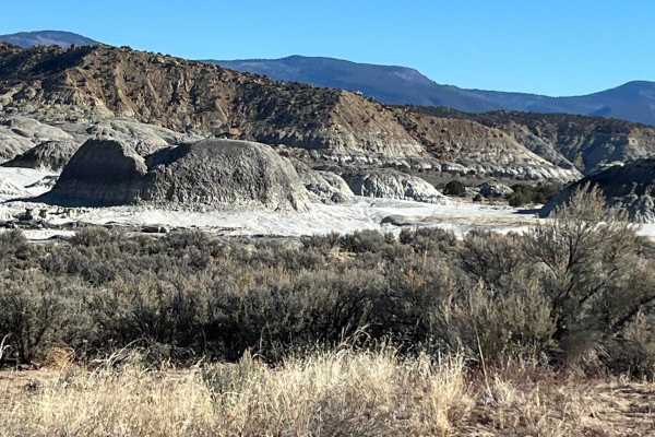
Mesa de Cuba
This sandy, rutted route leads past Mesa de Cuba, the most eastern of the five mesas that comprise the San Juan Basin Badlands. There are a few places to park along the road. A short hike will take you to narrow canyons, hoodoos and beautiful multihued rock sculptures. Views from the road show the r...
Learn more about Mesa de Cuba
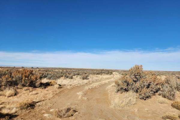
Bisti Badlands Overlook
Off of Da-Na-Zin Road, this short spur trail takes you to an overlook right on the edge of the Bisti badlands. There is a closed gate at the entrance that should be closed behind you. This short two-track trail has a few washouts but can be done in any typical 4WD SUV or truck. The trail is tight, s...
Learn more about Bisti Badlands Overlook
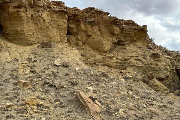
Cabezon Road
This gem of a route has many facets and is close to Albuquerque and Rio Rancho. The facets include geologic formations, bike trails, and hiking trails. The route is easy and there are nice parking areas to access the trails. Most of the route borders the Ojito Wilderness to the north and BLM land to...
Learn more about Cabezon Road
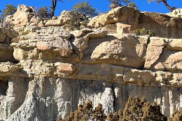
Mesa Chijuilla
This narrow route loops around Mesa Chijuilla the second of five mesas composing the San Juan Basin Badlands. Mesa Chijuilla is about 5 miles long and has brilliantly colored orange and red boulders, hoodoos and white-shale mesa walls capped by thick sandstone. There are a few places to pull off al...
Learn more about Mesa Chijuilla
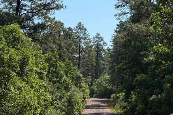
West Trail Creek - FR 20
This route travels through piñon and juniper trees in the lower elevation and ponderosa pine trees and Aspen at the higher elevations. The trail is sandy and rutted in a few spots. There is a nice dispersed camping area with a beautiful overlook on the south side once you climb the ridge. There is r...
Learn more about West Trail Creek - FR 20
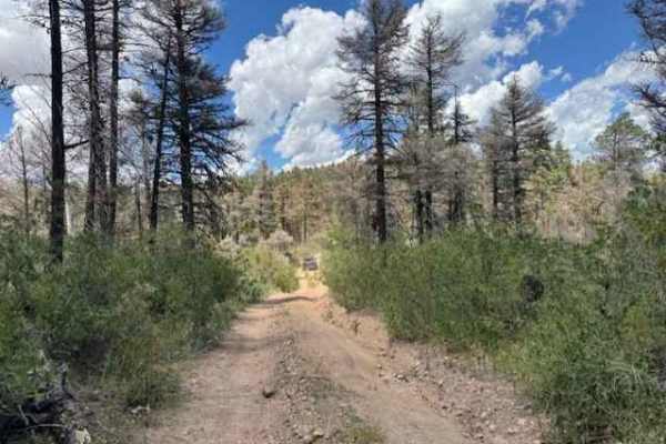
Revengers Ride
This route branches off Forest Service Road 376 past the Gilman Tunnels and follows part of the Old Peggy Mesa Road. The trail is generally easy, with a few moderate rocks near the start and occasional rocky patches further along. When wet, the surface can become slick with muddy ruts. A stock 4x4 w...
Learn more about Revengers Ride
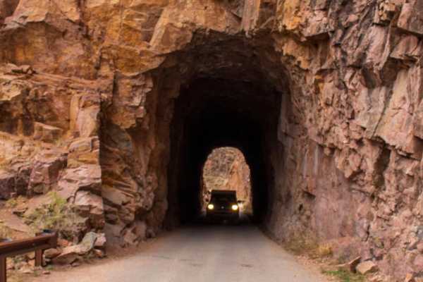
FS376
FS376 is a 23-mile long trail that weaves through the Jemez National Forest, gaining about 3,200 feet in elevation high above the Rio Guadalupe. This route takes you through the historic Gilman Tunnels, which were initially blasted to make way for the Santa Fe Northwestern Railway. Along the rest of...
Learn more about FS376
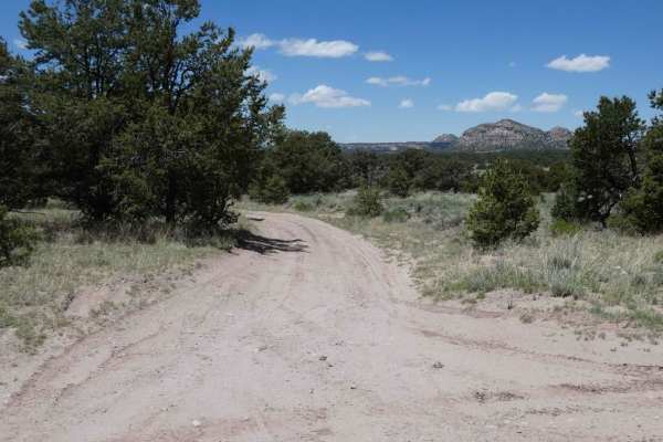
Lone Mountain FS312
Lone Mountain is a spur that leads to the foothills of Lone Mountain and Castle Dome just to the west of the Sawtooth trail. The trail is primarily soft dirt and sand that will be extremely muddy after rain or snow melt. The road is primarily single-vehicle wide with room to pass in areas where open...
Learn more about Lone Mountain FS312
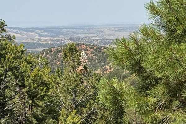
Blue Bird San Diego - FR 533
This is a narrow, rocky route that has some ruts and drop-offs. There are some incredible views of Cuba and the Rio Puerco drainage about halfway through. Scrub oak bushes narrow the trail in spots before opening up into Ponderosa pine trees. There are no easy off-road camping spots along this route...
Learn more about Blue Bird San Diego - FR 533
ATV trails near Haystack, New Mexico
Explore ATV-friendly trails near you. These trails are accessible for vehicles up to 50 inches wide, perfect for ATVs and smaller off-road machines.
Mt. Taylor Peak 4x4 Road
This 4x4 road is a great intro to overlanding, with stunning views and minimal technical obstacles. Starting from Grants, the road climbs almost 5000 feet to within 1/2 mile of Mt. Taylor peak. The road starts off as graded gravel, giving way to a more primitive dirt road, which is easily passable i...
Learn more about Mt. Taylor Peak 4x4 Road
Peaceful Path - FR 194
This minimally traveled route follows FR 194 through the Cibola National Forest and winds along the southern boundaries of the Ignacio Chavez and Chamisa Wilderness Study Areas. It is a level route that has open meadows and gorgeous tree stands. There are many areas for camping, picnics and hiking. ...
Learn more about Peaceful Path - FR 194
Wilderness Study Areas
This trail follows BLM 1103 from the floor of the Rio Puerco Valley up a steep, rocky section to the top of a mesa. The route travels between the Ignacio Chavez Wilderness Study Area, Chamisa Wilderness Study Area and the Empedrado Wilderness Study Area . There are numerous pull off parking spaces o...
Learn more about Wilderness Study Areas
Chaco Overlook
This double-track trail takes you through cattle grazing farmland and ends at an overlook. Cows can be seen near the trail. There is nowhere to camp or turn around until the end of the trail. The trail is smooth and can be done in 2WD under good conditions. The overlook is a great place to camp, rig...
Learn more about Chaco Overlook
UTV/side-by-side trails near Haystack, New Mexico
Find UTV and side-by-side trails near you. These trails accommodate vehicles up to 60 inches wide, ideal for UTVs, side-by-sides, and wider off-road rigs.
Mt. Taylor Peak 4x4 Road
This 4x4 road is a great intro to overlanding, with stunning views and minimal technical obstacles. Starting from Grants, the road climbs almost 5000 feet to within 1/2 mile of Mt. Taylor peak. The road starts off as graded gravel, giving way to a more primitive dirt road, which is easily passable i...
Learn more about Mt. Taylor Peak 4x4 Road
Peaceful Path - FR 194
This minimally traveled route follows FR 194 through the Cibola National Forest and winds along the southern boundaries of the Ignacio Chavez and Chamisa Wilderness Study Areas. It is a level route that has open meadows and gorgeous tree stands. There are many areas for camping, picnics and hiking. ...
Learn more about Peaceful Path - FR 194
Wilderness Study Areas
This trail follows BLM 1103 from the floor of the Rio Puerco Valley up a steep, rocky section to the top of a mesa. The route travels between the Ignacio Chavez Wilderness Study Area, Chamisa Wilderness Study Area and the Empedrado Wilderness Study Area . There are numerous pull off parking spaces o...
Learn more about Wilderness Study Areas
Chaco Overlook
This double-track trail takes you through cattle grazing farmland and ends at an overlook. Cows can be seen near the trail. There is nowhere to camp or turn around until the end of the trail. The trail is smooth and can be done in 2WD under good conditions. The overlook is a great place to camp, rig...
Learn more about Chaco Overlook
The onX Offroad Difference
onX Offroad combines trail photos, descriptions, difficulty ratings, width restrictions, seasonality, and more in a user-friendly interface. Available on all devices, with offline access and full compatibility with CarPlay and Android Auto. Discover what you're missing today!
Open Trail Map