
Dirt Bike Trails
Near Green Valley, South Dakota
Explore All Dirt Bike Trails Near Green Valley, South Dakota
Dirt Bike Trails Near Green Valley, South Dakota
Discover the best dirt bike trails near you. Browse trail maps, check difficulty ratings, and find your next adventure — whether you're looking for a quick ride or an all-day expedition.
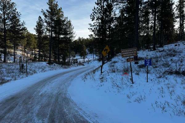
Victoria 159
Victoria 159 is a standard 'off-pavement' route that crosses between Sheridan Lake Rd and Highway 385 just south of Pactola Reservoir. This road is also the main road that offers access to many other full-size, SxS, and single-track trails in this section of the Black Hills. Not only is this an incr...
Learn more about Victoria 159
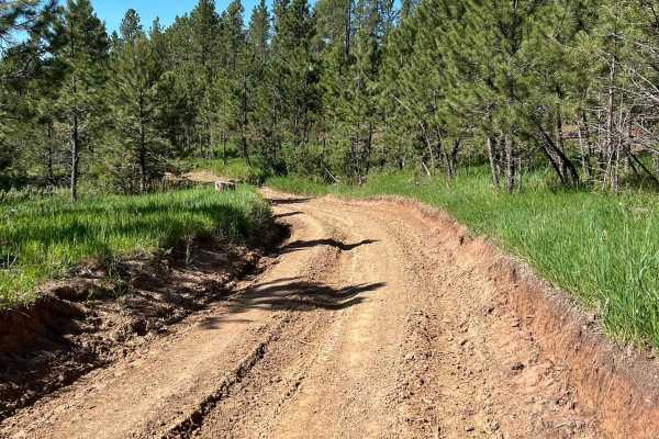
Flat Nastys
This an easier very scenic trail that takes you from Nemo Road over to Highway 44. Some smaller rock-rutted uneven road that can be messy in the rain. One major obstacle that has a steep drop down and a narrow steep grade out. Does get narrow when you are running beside the harder section of Flat Na...
Learn more about Flat Nastys
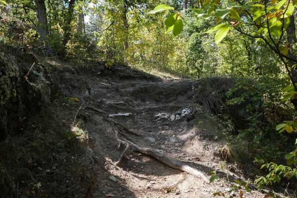
Victoria 11
Victoria 11 is a 1.4-mile-long single track through the Black Hills. The north end starts at the Victoria Trailhead off of Victoria Lake Road along a fence. It goes into a wide open meadow leading into the pine trees on a wide track. It goes under a low canopy of trees, with logs down, and a tricky ...
Learn more about Victoria 11
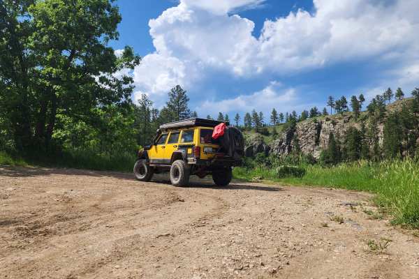
Victoria Lake Dam - FS 6704
This high-clearance trail leads to the historic Victoria Lake Dam recreation area. Although rated a 2/10, clearance is recommended due to embedded rocks along the route. The trail ends at a turnaround with a 62-inch width-restricted UTV trail branching off. The destination highlights the history tha...
Learn more about Victoria Lake Dam - FS 6704
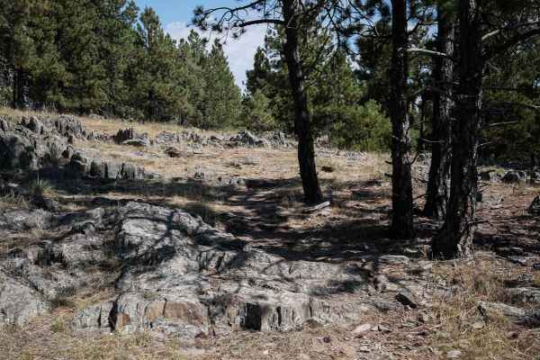
Victoria 06
Victoria 06 meanders through a sparse pine tree forest, through really wide open meadows and dispersed trees, for 1 mile starting and ending on Forest Service road 6715. It crosses some chunky outcroppings of rock in the ground that are across the trail, but they are low and easy to get over, not li...
Learn more about Victoria 06
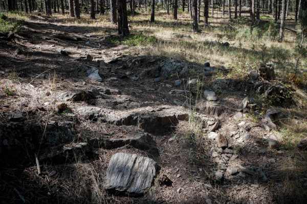
Victoria 09
Victoria 09 is a short and easy single track through the Victoria Trail System. It's mostly a wide path, full of small loose rocks, that goes through grassy meadows under widely separated pine trees in a sparse pine forest. There are bigger chunks of rock in the trail, and you have to ride over embe...
Learn more about Victoria 09
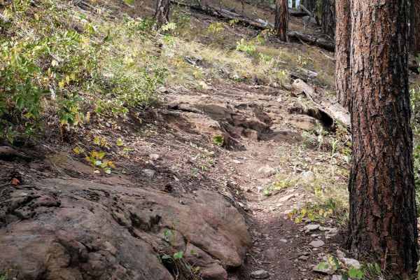
Devils Head 6660
Devil's Head 6660 is a 5-mile-long single track through the Black Hills. The western portion makes a loop off of a Jeep road, and then it continues east to make a semi-circle south to the same dirt road. You'll find a mix of easy and moderately challenging sections throughout the route, with lots of...
Learn more about Devils Head 6660
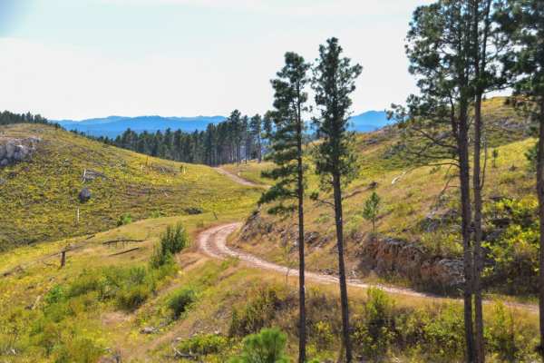
Foster's Gultch
This is a scenic trail meandering through ponderosa pine and quaking aspen trees. From the Rockerville Road entrance of this trail, is it a maintained gravel road that slowly gets narrower, but stays very easy to a staging area for either "Hippie Hollow" hiking trail, or Bikini and T-Back trails, r...
Learn more about Foster's Gultch
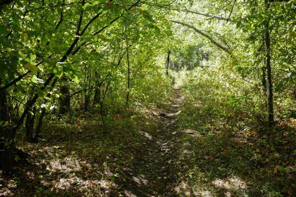
Victoria 10
Victoria 10 is a longer single track, 4.4 miles, through the Black Hills, that is of easy difficulty although it has some easy rock features. It's a long windy trail that would be great for beginners learning to ride rocky single track. This trail is unique compared to some of the surrounding trails...
Learn more about Victoria 10
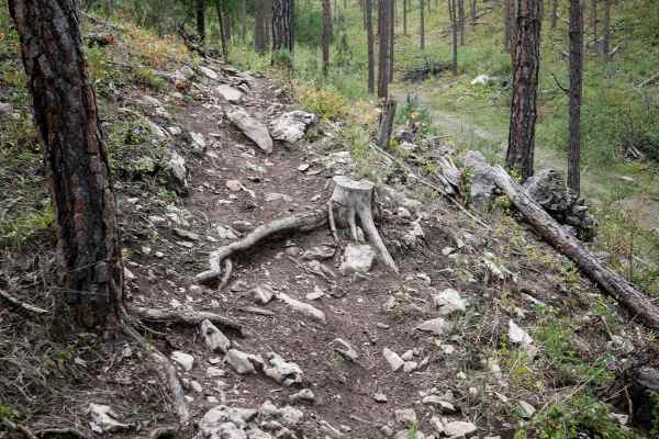
Loamy Loop Lollipop Stem
This is a short segment of 6660 that continues after the Devil's Head segment. It's a mile-long single track with small rocks in the trail, roots across the trail, and bigger loose rocks. There are sections that are smoother and easier as it winds through the rolling Black Hills. The western end end...
Learn more about Loamy Loop Lollipop Stem
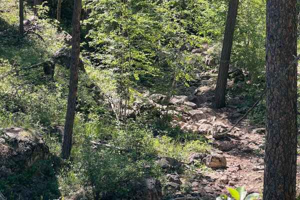
Flat Nastys 6.0
Moderate rock crawling trail for built vehicles. This trail is steep, dangerous and narrow. Vehicle damage is very possible and stock vehicles will not make it on this one. Armor, recovery gear, larger tires, roll cage, spill kit and spare parts are recommended for this trail. Be aware on this one
Learn more about Flat Nastys 6.0
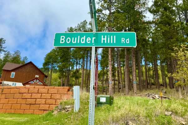
Boulder Hill - FS 358
Boulder Hill Road is a smooth and scenic gravel route winding through pine-covered hills with easy terrain and steady grades. The road offers abundant camping opportunities, including a spacious meadow capable of holding 10+ rigs--ideal for groups or solo rigs seeking room to spread out. Several sid...
Learn more about Boulder Hill - FS 358
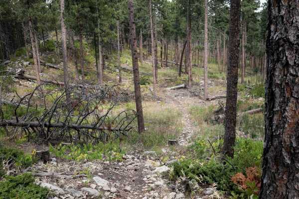
Shanks 6606
This is a short single track through the Black Hills but has technical rocky sections that make it an intermediate trail. There are a few smooth sections through the forest, but the majority of the trail is covered in small loose rocks or small embedded rocks. There are lots of roots and sticks litt...
Learn more about Shanks 6606
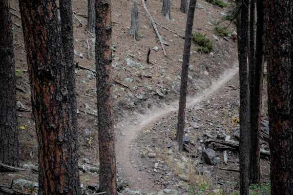
6617
6617 is a mellow and easy single track that meanders through the sparse pine tree forest in the Black Hills. The east side starts at a metal grate pinch point, and then it meanders through the trees and meadows. There are big boulders lining the trail, and small rocks you must ride over, but a lot o...
Learn more about 6617
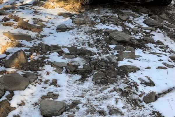
Rocky Gulch
Rocky Gulch is a scenic, 4.7-mile single-track trail in South Dakota's Black Hills National Forest. Geared toward beginner off-roaders and dirt bike riders, the route winds through dense forest with tight corners and narrow passages, spanning elevations between 4,312 and 4,825 feet.
The trail surfa...
Learn more about Rocky Gulch
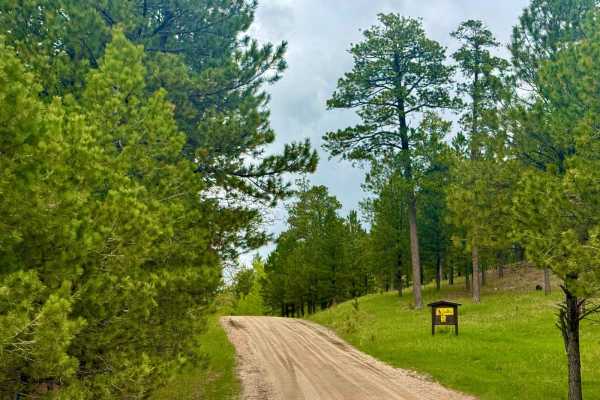
Beretta Road - FS 366.3
FS 366.3 is a main forest road that comes straight off the highway and sees heavy use, especially on weekends and during hunting season. The surface is well-packed dirt and gravel, wide enough for two vehicles to pass comfortably, though expect some washboarding in places. This area is popular with ...
Learn more about Beretta Road - FS 366.3
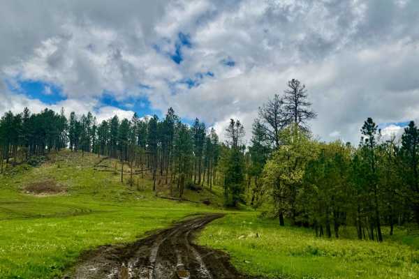
Johnson Gulch - FS 674.1A
Johnson Gulch is a Two track Forest Service road along a popular two track trail outside of Rapid City. This trail is scenic, and a nice jaunt if you'd like to stay close to town. This is an area used actively for target shooting. Be advised, and Stay safe. There are no legal lanes here. Allowing fo...
Learn more about Johnson Gulch - FS 674.1A
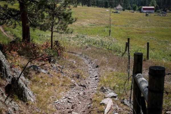
Bogus 6310
6310 is an easy dirt bike trail through the Black Hills. Part of it is a really wide path through the pine forest, but it also narrows up through the grassy meadow. It starts at the staging area on Norris Peak Lane, which is a small dirt parking lot. If staging here, you'll need to take this trail t...
Learn more about Bogus 6310
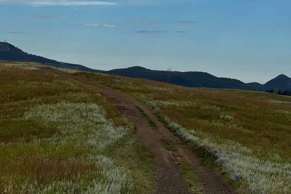
Bald Hills
This is a beautiful trail that is easy and scenic. You can expect to drive on gravel, dirt, and some small rocks. Twin Sisters is located at the top with some cool views. This area in the Black Hills is very open with no trees, hence the name Bald Hills.
Learn more about Bald Hills
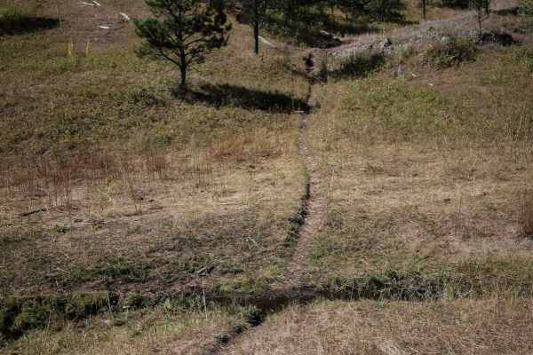
Victoria 12
Victoria 12 is an easy dirt bike trail, but it has become faint in spots and will require some route finding in order to ride the entire trail. The south end starts in a grassy meadow as a skinny trail, crossing some mud puddles, and flowing over rolling grassy hills covered in widely separated pine...
Learn more about Victoria 12
ATV trails near Green Valley, South Dakota
Explore ATV-friendly trails near you. These trails are accessible for vehicles up to 50 inches wide, perfect for ATVs and smaller off-road machines.
Victoria 159
Victoria 159 is a standard 'off-pavement' route that crosses between Sheridan Lake Rd and Highway 385 just south of Pactola Reservoir. This road is also the main road that offers access to many other full-size, SxS, and single-track trails in this section of the Black Hills. Not only is this an incr...
Learn more about Victoria 159
Flat Nastys
This an easier very scenic trail that takes you from Nemo Road over to Highway 44. Some smaller rock-rutted uneven road that can be messy in the rain. One major obstacle that has a steep drop down and a narrow steep grade out. Does get narrow when you are running beside the harder section of Flat Na...
Learn more about Flat Nastys
Victoria Lake Dam - FS 6704
This high-clearance trail leads to the historic Victoria Lake Dam recreation area. Although rated a 2/10, clearance is recommended due to embedded rocks along the route. The trail ends at a turnaround with a 62-inch width-restricted UTV trail branching off. The destination highlights the history tha...
Learn more about Victoria Lake Dam - FS 6704
Foster's Gultch
This is a scenic trail meandering through ponderosa pine and quaking aspen trees. From the Rockerville Road entrance of this trail, is it a maintained gravel road that slowly gets narrower, but stays very easy to a staging area for either "Hippie Hollow" hiking trail, or Bikini and T-Back trails, r...
Learn more about Foster's Gultch
UTV/side-by-side trails near Green Valley, South Dakota
Find UTV and side-by-side trails near you. These trails accommodate vehicles up to 60 inches wide, ideal for UTVs, side-by-sides, and wider off-road rigs.
Victoria 159
Victoria 159 is a standard 'off-pavement' route that crosses between Sheridan Lake Rd and Highway 385 just south of Pactola Reservoir. This road is also the main road that offers access to many other full-size, SxS, and single-track trails in this section of the Black Hills. Not only is this an incr...
Learn more about Victoria 159
Flat Nastys
This an easier very scenic trail that takes you from Nemo Road over to Highway 44. Some smaller rock-rutted uneven road that can be messy in the rain. One major obstacle that has a steep drop down and a narrow steep grade out. Does get narrow when you are running beside the harder section of Flat Na...
Learn more about Flat Nastys
Victoria Lake Dam - FS 6704
This high-clearance trail leads to the historic Victoria Lake Dam recreation area. Although rated a 2/10, clearance is recommended due to embedded rocks along the route. The trail ends at a turnaround with a 62-inch width-restricted UTV trail branching off. The destination highlights the history tha...
Learn more about Victoria Lake Dam - FS 6704
Foster's Gultch
This is a scenic trail meandering through ponderosa pine and quaking aspen trees. From the Rockerville Road entrance of this trail, is it a maintained gravel road that slowly gets narrower, but stays very easy to a staging area for either "Hippie Hollow" hiking trail, or Bikini and T-Back trails, r...
Learn more about Foster's Gultch
The onX Offroad Difference
onX Offroad combines trail photos, descriptions, difficulty ratings, width restrictions, seasonality, and more in a user-friendly interface. Available on all devices, with offline access and full compatibility with CarPlay and Android Auto. Discover what you're missing today!
Open Trail Map