
Dirt Bike Trails
Near Grand Junction, Colorado
Explore All Dirt Bike Trails Near Grand Junction, Colorado
Dirt Bike Trails Near Grand Junction, Colorado
Discover the best dirt bike trails near you. Browse trail maps, check difficulty ratings, and find your next adventure — whether you're looking for a quick ride or an all-day expedition.
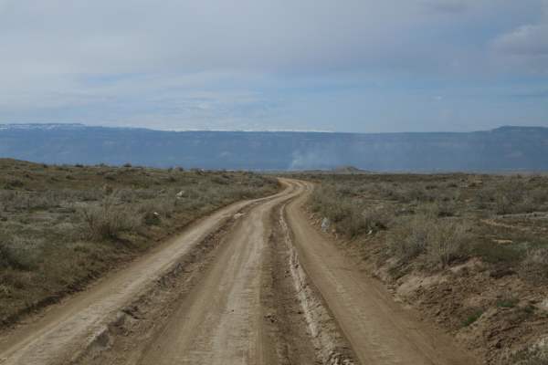
Mesa County Road 25
A good resource for dispersed camping in the Grand Junction Area. There is a vast network of offshoots and alternate routes in this BLM area. Monitoring weather conditions prior to arrival is recommended. Use previously disturbed areas only. Pack out what you pack in. High clearance is recommended t...
Learn more about Mesa County Road 25
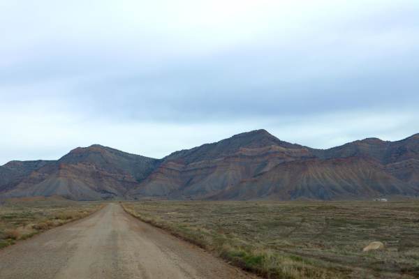
Mesa County Road 27 1/4
A great route for OHV and dispersed camping access in the Grand Junction area. Mostly loose gravel, though the later portion of the trail gets slightly more demanding with larger rocks, ruts, and washes. The road Y's approximately 3.7 miles in, stay left to continue this route;the Right will lead yo...
Learn more about Mesa County Road 27 1/4
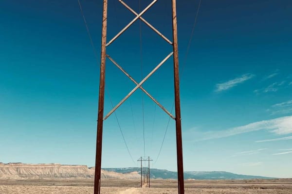
Powerline Wash Loop
Powerline Wash Loop is an ideal option for offroaders of all skill levels seeking a fast, sandy ride with fun banked turns in Colorado's North Desert. This 9.75-mile loop begins with a sandy wash segment that makes up the first quarter of the route, transitioning into a twisting double-track trail f...
Learn more about Powerline Wash Loop
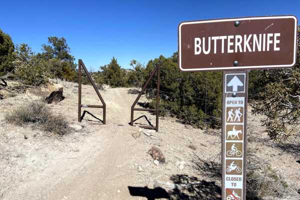
Butterknife
Butterknife is a highly technical, physically demanding singletrack trail designed for experienced dirt bike riders seeking the ultimate challenge within the Bangs Canyon and Third Flats trail networks. Spanning approximately 6.1 miles with a net elevation loss of about 577 feet when traveled from w...
Learn more about Butterknife
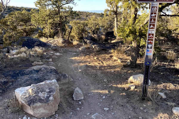
Second Thoughts
Second Thoughts is an awesome intermediate single track trail accessible at the Third Flats Trail head. Most people ride the trail downhill, west to east, which is generally easier, but it is great both ways. The trail has a bit of everything. The west end is the most technical, with some chunky roc...
Learn more about Second Thoughts
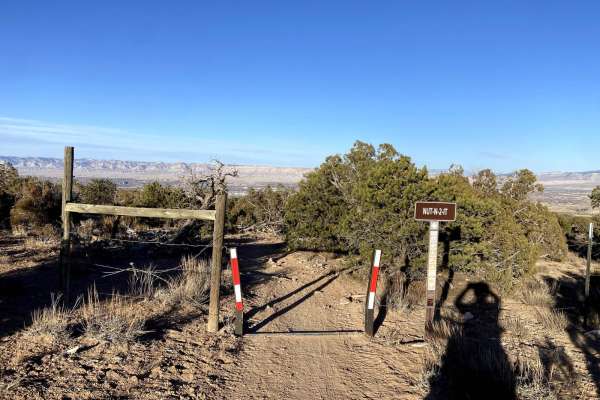
Nut-N-2-It
This is a fun 50-inch trail that is a key connector to other trails in the area. The trail lacks any notable technical features but does have some loose rock and some sand in spots, especially when you drop into a wash on the north side. The trail also features some cool sections of red sand and roc...
Learn more about Nut-N-2-It
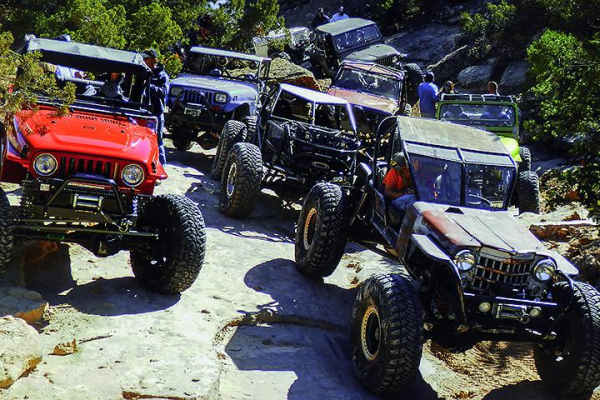
Billings Canyon
A world-class trail that tests the most experienced drivers. It is maintained by Grand Junction Four Wheelers and gives bragging rights to those who can drive it.
Learn more about Billings Canyon
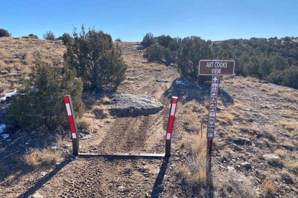
Art Cooks View
This is a 50-inch trail that runs parallel to Third Flats Road. It is a moderate trail as it is consistently technical but lacks any really challenging features. All but maybe one obstacle are under 18 inches. The trail features some good views and has a couple of cool rock features. The trail desce...
Learn more about Art Cooks View
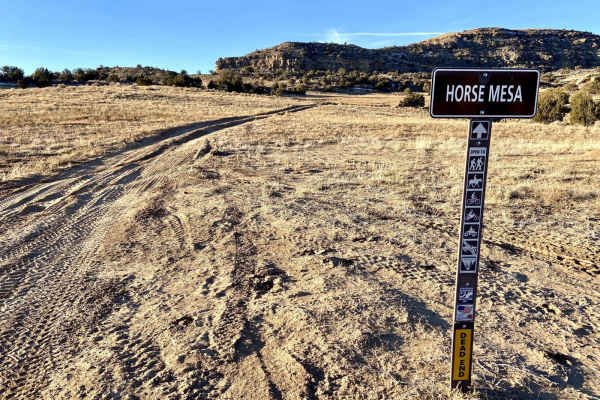
Horse Mesa
Horse Mesa is a lollipop loop starting down by the Gunnison River off of BLM Rte 629. It starts flat and sandy prior to a pretty long, steep, and straight climb onto the mesa. The climb is only mildly technical but is notably steep with some exposure. Once on the mesa, the next section is pretty roc...
Learn more about Horse Mesa
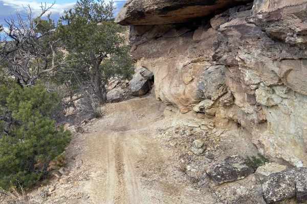
Saddle Up
Saddle Up is a 50-inch trail most accessible from the Bangs Canyon Trailhead. This trail seems to see less usage than others in the area. If you're out in the offseason or on a weekday, you likely will have it to yourself. To access from Bangs Canyon, briefly take the Tabeguache Trail about 500 feet...
Learn more about Saddle Up
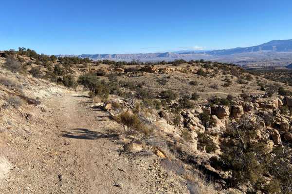
Quad Rocker
Quad Rocker is a 50-inch trail near the trailhead on Third Flats Road. It is a short loop but offers access to a variety of other trails. This a generally rocky trail hence the name. The south side of the loop is rockier while the north side has some of the harder features and steeper grades. The tr...
Learn more about Quad Rocker
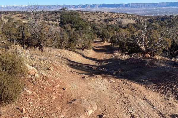
Billings Canyon Road
Billings Canyon Road serves as an excellent, scenic connector for four-wheel-drive vehicles, SxSs, and dirt bikes looking to link up the expansive Third Flats and Bangs Canyon trail systems. Spanning approximately 2.6 miles, this trail offers moderate elevation changes ranging from 5,618 feet to 6,1...
Learn more about Billings Canyon Road
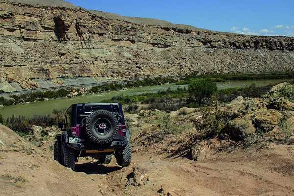
Windmill Loop
The beginning of this trail is much like Moab with a fun open ATV area. You'll get a nice stop at the shoreline of the Gunnison River and of course the windmill. You'll pass Billings Canyon on your way out.
Learn more about Windmill Loop
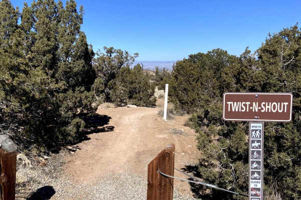
Twist-N-Shout
Flowy 50-inch trail that provides access to a lot of the areas single track. Trail is fast and a lot of fun with only minor technical features and no particularly steep grades. Has some nice turns and a lot of sand, when ridden West to East it would be downhill but it's fun to ride fast in either di...
Learn more about Twist-N-Shout
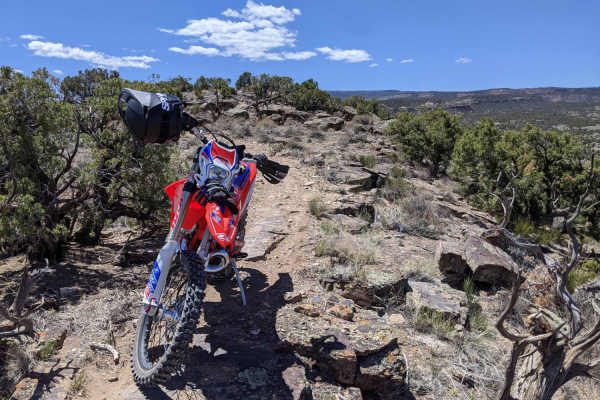
Windmill Loop Single Track
Windmill Loop Single Track is a challenging high-desert ride designed specifically for experienced dirt bikers and mountain bikers seeking a rugged, remote adventure with technical obstacles. Spanning approximately 7.9 miles through the scenic Bangs Canyon area near Grand Junction, Colorado, this de...
Learn more about Windmill Loop Single Track
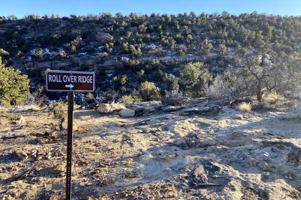
Roll Over Ridge
Roll Over Ridge is a fun, rocky 50-inch trail connecting with the Quad Rocker Loop and Cedar Pt Road. If you are on a dirt bike, it is also the only way to access the more challenging Rampage single track. Going East to West, most of the trail is a combination of loose rock, slick rock, and sand. Th...
Learn more about Roll Over Ridge
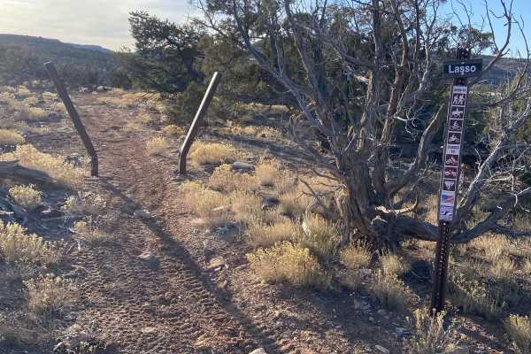
Lasso
Lasso is a fun and scenic single-track trail located in the Bangs Canyon area that is mostly rocky (but not loose rock) and hard-pack dirt. It is accessed via the Saddle Up trail. It strings together very nicely with the more challenging Pony Tail trail to the west. Much of the trail has moderate ex...
Learn more about Lasso
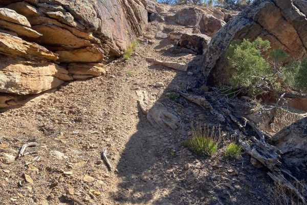
Rampage
This new single-track trail can be accessed from Third Flats Trailhead via Rollover Ridge or Bangs Canyon Trailhead via Billings Canyon Road. This trail is as technical and challenging as any of the other trails in the area. The trail has moderate exposure, tight switchbacks, large rocks, and some t...
Learn more about Rampage
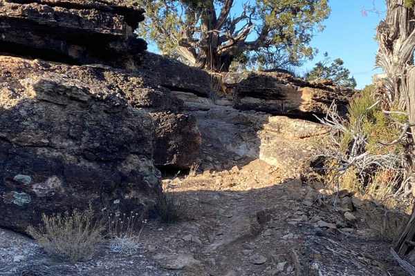
Pony Tail
Pony Tail is a short but fun technical trail in the Bangs Canyon system that is mostly rocky (but not loose rock) and hard-pack dirt. The trail starts and ends on the Saddle Up 50-inch trail. Climb to an awesome 360-degree view before a descent with mild exposure back to the ATV trail. The trail see...
Learn more about Pony Tail
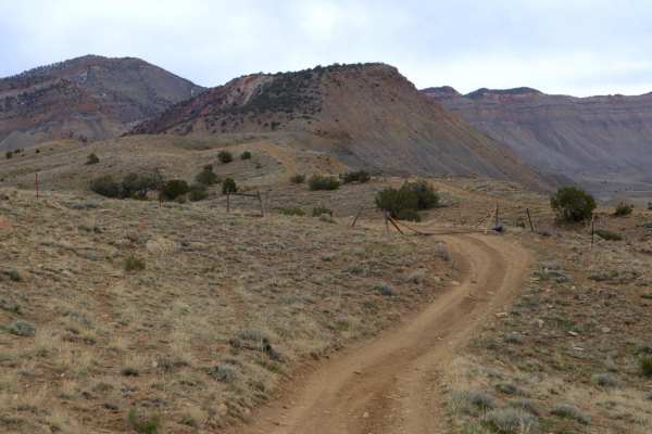
25 and 27 1/4 Connector
This is a good option for connecting Mesa County Roads 25 and 27 1/4 as opposed to backtracking entirely to town. There are other routes in the vicinity to explore, though most either dead end or simply disappear in the cliffs. This is route is mostly easy, flat dirt road, with only a few instances ...
Learn more about 25 and 27 1/4 Connector
ATV trails near Grand Junction, Colorado
Explore ATV-friendly trails near you. These trails are accessible for vehicles up to 50 inches wide, perfect for ATVs and smaller off-road machines.
Mesa County Road 25
A good resource for dispersed camping in the Grand Junction Area. There is a vast network of offshoots and alternate routes in this BLM area. Monitoring weather conditions prior to arrival is recommended. Use previously disturbed areas only. Pack out what you pack in. High clearance is recommended t...
Learn more about Mesa County Road 25
Mesa County Road 27 1/4
A great route for OHV and dispersed camping access in the Grand Junction area. Mostly loose gravel, though the later portion of the trail gets slightly more demanding with larger rocks, ruts, and washes. The road Y's approximately 3.7 miles in, stay left to continue this route;the Right will lead yo...
Learn more about Mesa County Road 27 1/4
Nut-N-2-It
This is a fun 50-inch trail that is a key connector to other trails in the area. The trail lacks any notable technical features but does have some loose rock and some sand in spots, especially when you drop into a wash on the north side. The trail also features some cool sections of red sand and roc...
Learn more about Nut-N-2-It
Billings Canyon
A world-class trail that tests the most experienced drivers. It is maintained by Grand Junction Four Wheelers and gives bragging rights to those who can drive it.
Learn more about Billings Canyon
UTV/side-by-side trails near Grand Junction, Colorado
Find UTV and side-by-side trails near you. These trails accommodate vehicles up to 60 inches wide, ideal for UTVs, side-by-sides, and wider off-road rigs.
Mesa County Road 25
A good resource for dispersed camping in the Grand Junction Area. There is a vast network of offshoots and alternate routes in this BLM area. Monitoring weather conditions prior to arrival is recommended. Use previously disturbed areas only. Pack out what you pack in. High clearance is recommended t...
Learn more about Mesa County Road 25
Mesa County Road 27 1/4
A great route for OHV and dispersed camping access in the Grand Junction area. Mostly loose gravel, though the later portion of the trail gets slightly more demanding with larger rocks, ruts, and washes. The road Y's approximately 3.7 miles in, stay left to continue this route;the Right will lead yo...
Learn more about Mesa County Road 27 1/4
Billings Canyon
A world-class trail that tests the most experienced drivers. It is maintained by Grand Junction Four Wheelers and gives bragging rights to those who can drive it.
Learn more about Billings Canyon
Horse Mesa
Horse Mesa is a lollipop loop starting down by the Gunnison River off of BLM Rte 629. It starts flat and sandy prior to a pretty long, steep, and straight climb onto the mesa. The climb is only mildly technical but is notably steep with some exposure. Once on the mesa, the next section is pretty roc...
Learn more about Horse Mesa
The onX Offroad Difference
onX Offroad combines trail photos, descriptions, difficulty ratings, width restrictions, seasonality, and more in a user-friendly interface. Available on all devices, with offline access and full compatibility with CarPlay and Android Auto. Discover what you're missing today!
Open Trail Map