
Dirt Bike Trails
Near Glade Spring, Virginia
Explore All Dirt Bike Trails Near Glade Spring, Virginia
Dirt Bike Trails Near Glade Spring, Virginia
Discover the best dirt bike trails near you. Browse trail maps, check difficulty ratings, and find your next adventure — whether you're looking for a quick ride or an all-day expedition.
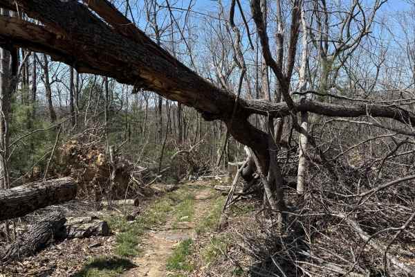
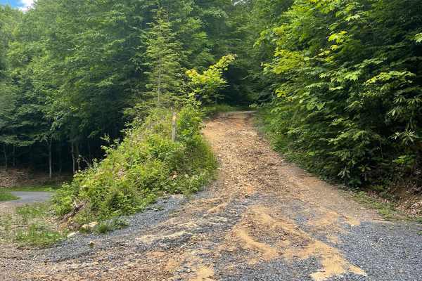
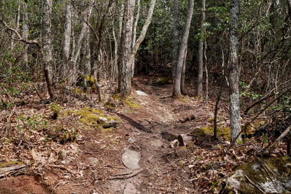
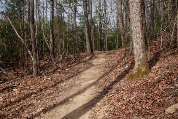
Iron Mountain Spur B
0Iron Mountain Spur B is a 6-mile single-track trail running northeast of Spur A through Jefferson National Forest, connecting Feathercamp Road to the west and Whitetop Road to the east. The trail is open to motorcycles, mountain bikes, hikers, and horseback riders — expect to encounter all of them....
Learn more about Iron Mountain Spur B
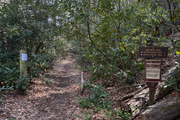
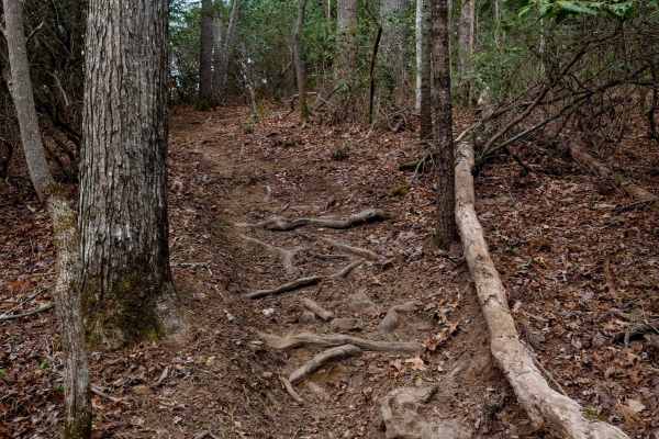
Beech Grove
Beech Grove Trail is a short but very technical 1-mile single-track climb in Jefferson National Forest, starting at the Virginia Creeper Trailhead and crossing over the Appalachian Trail on its way up. Do not let the mileage fool you, this trail packs more challenge per foot than most trails twice i...
Learn more about Beech Grove
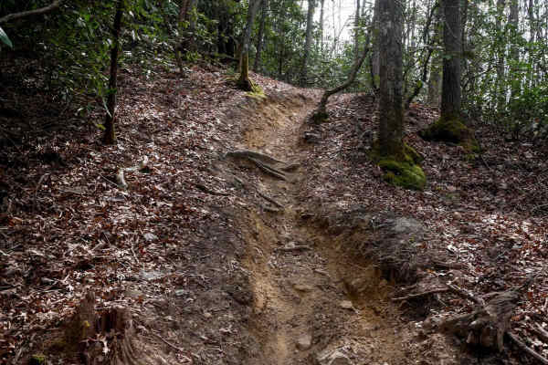
Iron Mountain Spur A
Iron Mountain Spur A is a 6-mile single-track trail starting at the edge of Damascus, Virginia, and running through Jefferson National Forest. The trail is open to motorcycles, mountain bikes, hikers, and horseback riders — expect to encounter all of them. Damascus is a well-known stop on the Appal...
Learn more about Iron Mountain Spur A
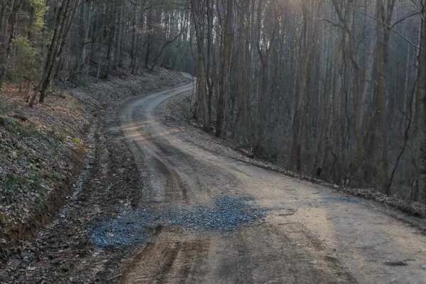
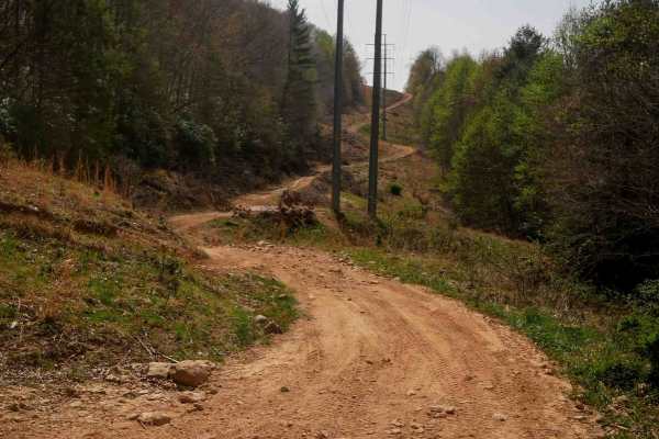
Government Road - FS 43
Forest Service Road 43, commonly known as Government Road, begins outside the town of Damascus, Virginia, and travels generally south toward the Virginia–Tennessee state line through rugged forested terrain. The road provides access to public lands, remote recreation areas, and surrounding mountain ...
Learn more about Government Road - FS 43
Flat Top
Flat Top Trail can be accessed from Forest Service Road 84 (Hurricane), which is part of both the Mid-Atlantic Backcountry Discovery Route (MABDR) and the Virginia TransAmerica Trail (TAT), or via Laurel Valley Road (State Route 603) across from Grindstone National Forest Campground, which is curren...
Learn more about Flat Top
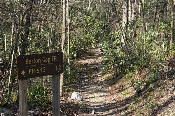
Barton Gap
Barton Gap Trail connects Forest Road 643 (Bartons Gap) to the north and Forest Road 84 (Hurricane) to the south, running through Jefferson National Forest in southwest Virginia. The trail is best suited for dirt bikes due to its tight width and technical terrain, but expect to share the trail with ...
Learn more about Barton Gap
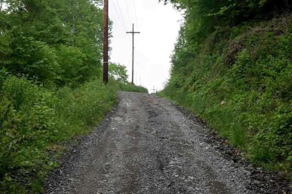
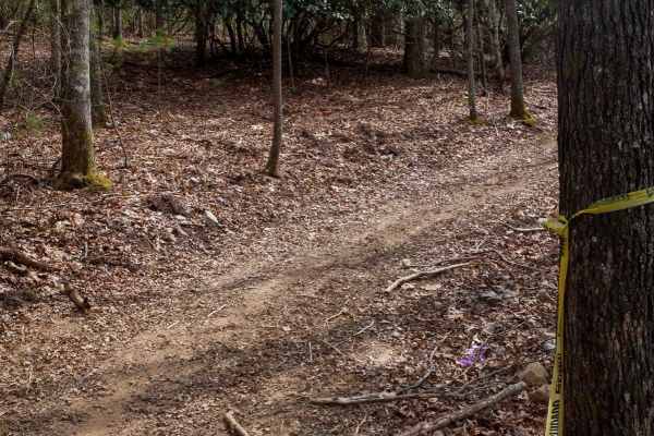
Star Gap
Star Gap Road is an easy gravel route that offers a simple and relaxed drive through a rural setting. The road surface is generally well-maintained with gentle grades, making it accessible for most vehicles under normal conditions. The route is straightforward and does not introduce technical terrai...
Learn more about Star Gap
Gentry Creek
Gentry Creek is a short, easy gravel trail that offers a simple and low-effort drive through a quiet setting. The route begins in close proximity to private property, so drivers should maintain low speeds, stay on the designated path, and be respectful of surrounding landowners. The trail surface is...
Learn more about Gentry Creek
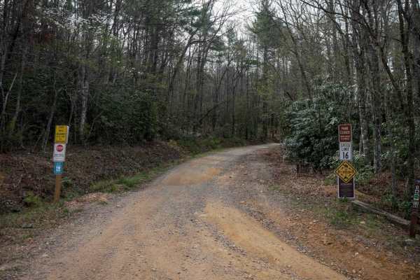
J1
J1 serves as the main access route into the Jawbone trail system, beginning at the ATV trailhead and running over 16 miles to State Route 635. The trail starts as a wide, gravel two-lane road through town, with a quick climb under the powerlines near the J1 trail sign. The first 6 miles are a gradua...
Learn more about J1
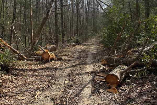
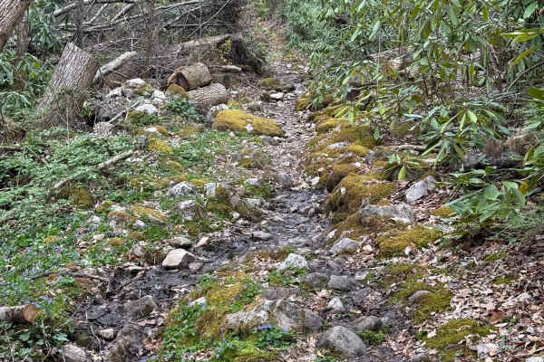
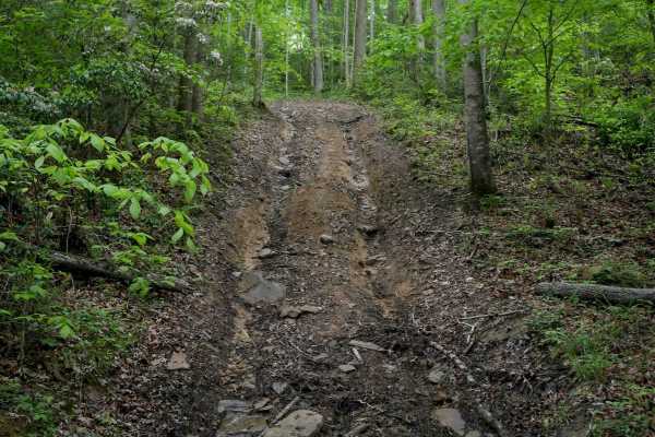
Quarter Branch Road
Quarter Branch Road (FS 49352) is a mixed-use dirt and gravel trail in Jefferson National Forest, accessed from Forest Road 601 to the east. The trail is open to motorcycles from October 1 through April 1, so plan accordingly, as the trail transitions to horseback only beyond the motorized boundary....
Learn more about Quarter Branch Road
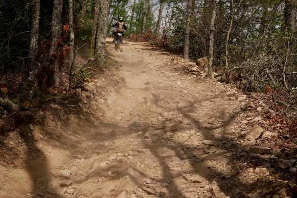
411
Trail 411 is one of the more technically demanding routes at Doe Mountain, known for its rugged, rocky terrain. From its junction with Trail 15, it climbs steeply on a loose, rock-strewn hill up to the Satellite Dish Overlook, then descends sharply to meet Trail 11. The descent is more challenging, ...
Learn more about 411
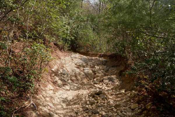
115
Trail 115 is one of the most difficult routes in the Doe Mountain trail system, despite being only about a quarter mile long. Note that it is locally recognized as a "most difficult" black trail and is a restricted trail for the DMRA SxS rentals. It gains roughly 350 feet of elevation from north to ...
Learn more about 115
A6
Trail A6 is a short but demanding connector at Doe Mountain, linking Trails A2 and A5 with a steep climb over less than half a mile from north to south. The narrow singletrack winds through dense bushes and trees, featuring tight, steep switchbacks that would be a challenge for newer riders. Riders ...
Learn more about A6
Y2
Trail Y2 at Doe Mountain is a beginner-friendly, wider single-track that rides more like a two-track along the edge of a hillside. It features gradual curves and a smooth surface with only minimal loose rock, making it ideal for newer riders looking to build confidence or a short training route for ...
Learn more about Y2
A1
Trail A1 is a narrow single-track that begins near the staging area off Trail 11, running beneath the power lines and through open grassy hills next to the tree line--unique compared to most of the dirt bike trails that are densely wooded. The initial stretch features shallow ruts, loose and embedde...
Learn more about A1
A2
Trail A2 at Doe Mountain offers a well-defined singletrack route through a mix of open and dense forest terrain. The trail climbs steadily up the mountainside, weaving through cut logs and occasionally rutted sections with small roots and rocks. Riders will pass through wide open forests of oak and ...
Learn more about A2
Y1
Trail Y1 at Doe Mountain is a beginner-focused training trail designed to give new riders a solid introduction to single track riding. Marked with tape in spots for easy navigation, it follows a wide corridor through the trees with smooth terrain, minimal obstacles, and great visibility. The trail f...
Learn more about Y1
11
From the east end, Trail 11 follows a powerline corridor and features a series of steep hill climbs, often presenting split lines where one side offers a more gradual ascent. The surface includes shallow ruts and loose rocks, but nothing overly technical. Riders are exposed to full sun in the open p...
Learn more about 11
1
Trail 1 serves as the main 8-mile east-to-west access corridor at Doe Mountain Recreation Area, connecting the main parking area to the Morfield Branch Trailhead. Although considered easy the entire route, the eastern section starts off the smoothest, and gradually becomes rockier heading west, with...
Learn more about 1
J100
J100, not open to Jeeps, begins with a more primitive, narrow route descending from north to south through dense woods. The majority of the route is moderate-easy, with gradual switchbacks, embedded rock layers, loose dirt, and overgrown grass in the middle of the trail. It passes oil and gas infras...
Learn more about J100
ATV trails near Glade Spring, Virginia
Explore ATV-friendly trails near you. These trails are accessible for vehicles up to 50 inches wide, perfect for ATVs and smaller off-road machines.
Star Gap
Star Gap Road is an easy gravel route that offers a simple and relaxed drive through a rural setting. The road surface is generally well-maintained with gentle grades, making it accessible for most vehicles under normal conditions. The route is straightforward and does not introduce technical terrai...
Learn more about Star Gap
Gentry Creek
Gentry Creek is a short, easy gravel trail that offers a simple and low-effort drive through a quiet setting. The route begins in close proximity to private property, so drivers should maintain low speeds, stay on the designated path, and be respectful of surrounding landowners. The trail surface is...
Learn more about Gentry Creek
J1
J1 serves as the main access route into the Jawbone trail system, beginning at the ATV trailhead and running over 16 miles to State Route 635. The trail starts as a wide, gravel two-lane road through town, with a quick climb under the powerlines near the J1 trail sign. The first 6 miles are a gradua...
Learn more about J1
Quarter Branch Road
Quarter Branch Road (FS 49352) is a mixed-use dirt and gravel trail in Jefferson National Forest, accessed from Forest Road 601 to the east. The trail is open to motorcycles from October 1 through April 1, so plan accordingly, as the trail transitions to horseback only beyond the motorized boundary....
Learn more about Quarter Branch Road
UTV/side-by-side trails near Glade Spring, Virginia
Find UTV and side-by-side trails near you. These trails accommodate vehicles up to 60 inches wide, ideal for UTVs, side-by-sides, and wider off-road rigs.
Government Road - FS 43
Forest Service Road 43, commonly known as Government Road, begins outside the town of Damascus, Virginia, and travels generally south toward the Virginia–Tennessee state line through rugged forested terrain. The road provides access to public lands, remote recreation areas, and surrounding mountain ...
Learn more about Government Road - FS 43
Star Gap
Star Gap Road is an easy gravel route that offers a simple and relaxed drive through a rural setting. The road surface is generally well-maintained with gentle grades, making it accessible for most vehicles under normal conditions. The route is straightforward and does not introduce technical terrai...
Learn more about Star Gap
Gentry Creek
Gentry Creek is a short, easy gravel trail that offers a simple and low-effort drive through a quiet setting. The route begins in close proximity to private property, so drivers should maintain low speeds, stay on the designated path, and be respectful of surrounding landowners. The trail surface is...
Learn more about Gentry Creek
J1
J1 serves as the main access route into the Jawbone trail system, beginning at the ATV trailhead and running over 16 miles to State Route 635. The trail starts as a wide, gravel two-lane road through town, with a quick climb under the powerlines near the J1 trail sign. The first 6 miles are a gradua...
Learn more about J1
The onX Offroad Difference
onX Offroad combines trail photos, descriptions, difficulty ratings, width restrictions, seasonality, and more in a user-friendly interface. Available on all devices, with offline access and full compatibility with CarPlay and Android Auto. Discover what you're missing today!
Open Trail Map