
Dirt Bike Trails
Near Florence, Arizona
Explore All Dirt Bike Trails Near Florence, Arizona
Dirt Bike Trails Near Florence, Arizona
Discover the best dirt bike trails near you. Browse trail maps, check difficulty ratings, and find your next adventure — whether you're looking for a quick ride or an all-day expedition.

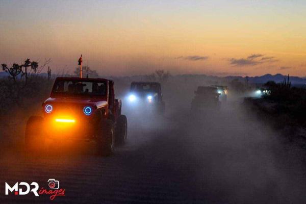
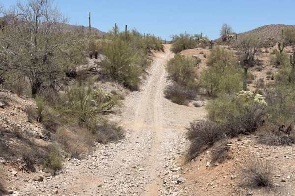
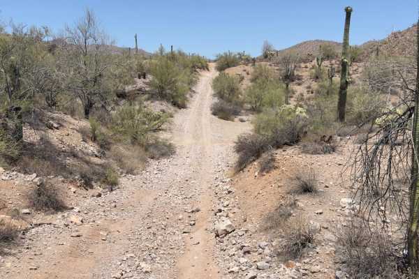
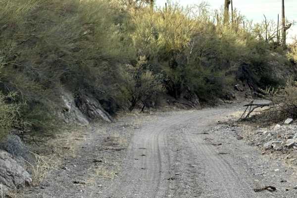
WhoopDeDo Roller Coaster
This Jeep trail will take you a different way into the area north of Box Canyon. The route in from SR 79 is easy, and the eastern end of this entry is very scenic with mountain views and nice stands of saguaro. Once you get into the concentration of trails north of Box Canyon, this track will take y...
Learn more about WhoopDeDo Roller Coaster
Nw2006
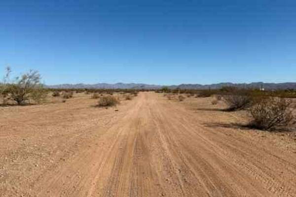
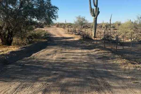
Nw2006 is located to the East of Arizona State Route 79. This is the main North/South connection between WhoopDeDo Roller Coaster and Box Canyon trails. This dirt trail is wide and suitable for full-size vehicles. There are plenty of large campsites suitable for large trailers and RVs on the sides. ...
Learn more about Nw2006
Upper Woodpecker to Ajax Mine
This trail follows the difficult wash known as Upper Woodpecker. At the eastern end of the wash, the trail climbs up a narrow winding trail to join Ajax Mine Road. The wash is very difficult. Lockers and 33 inch or larger tires are recommended. The trail following the wash is intermediate and does n...
Learn more about Upper Woodpecker to Ajax Mine
Nw2010
This is a main North/South trail through Arizona State Trust Land connecting Upper Woodpecker to WhoopDeDo Roller Coaster. This is a wide dirt road suitable for 2WD vehicles with plenty of room to pass. Large campsites are present off this road. Arizona State Trust Land requires a permit. An individ...
Learn more about Nw2010
Nw2014
Nw2014 is located to the East of Arizona State Route 79 and South of the Box Canyon trail. It connects Box Canyon to the main North/South Nw2006 trail. The trail consists of dirt, small loose rocks, and minor ruts. Full-size vehicles are susceptible to pinstriping. One bar of Verizon LTE service was...
Learn more about Nw2014
Sandman
Sandman trail snakes through sandy washes that cut between steep rock walls, making the route feel both intimate and wild. These dry creek beds are the natural arteries of the desert, often marked with fresh animal tracks and seasonal wildflowers. The route connects with other popular trails, rangin...
Learn more about Sandman
Nw2006a
Nw2006a is located to the East of Arizona State Route 79 and South of the Box Canyon trail. This is a side trail to the main North/South Nw2006 trail. The trail consists of dirt and small rocks. It is wide and suitable for full-size vehicles. One bar of Verizon LTE service was available.
Learn more about Nw2006a
Nw2230
Nw2230 is located to the East of AZ State Route 79 and North of the Box Canyon trail. Coming from Box Canyon, it is a little difficult to find at first because of the dirt bike play area. The trail is a mix of single track and wash. Not suitable for full-size vehicles. Pinstriping is imminent and lo...
Learn more about Nw2230
Nw2233
Nw2233 is located to the East of Arizona State Route 79 and South of the Box Canyon trail. This side trail connects Nw2006 to Nw2014 and consists of dirt and small rocks. It is a single track with places to pass. Pinstriping is possible for full-size vehicles. One bar of Verizon LTE service was avai...
Learn more about Nw2233

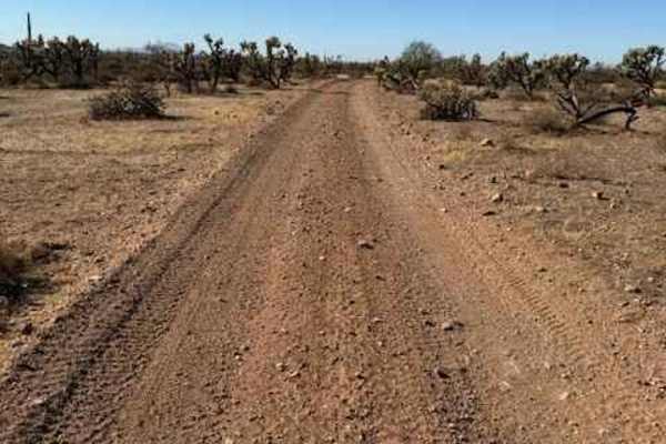
Sw3202
The trail is narrow with few areas to pass. There is a lot of cholla, saguaro, and ocotillo in this area. Spring and fall are great times to do this trail as the desert is blooming and the temperatures are a lot cooler. There are a lot of views in this area of the surrounding buttes. You will get so...
Learn more about Sw3202
Side Quest
Side Quest offers one of the most scenic and geologically striking off-road experiences in the Sonoran Desert. This iconic route winds through narrow, rock-walled canyons and broad desert washes, framed by rugged mountains, towering cliffs, and an abundance of desert flora and fauna. It's a favorite...
Learn more about Side Quest
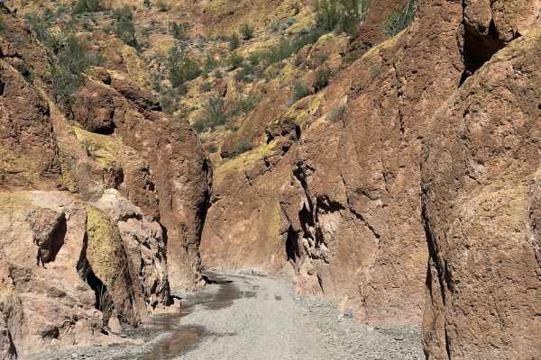
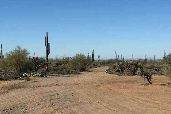
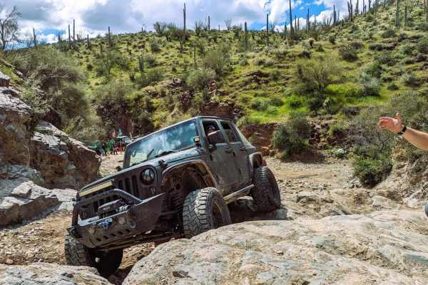
Box Canyon
Box Canyon, located just southeast of Florence, Arizona, is a scenic and moderately challenging trail that winds through a dramatic, high-walled desert canyon. A longtime favorite among 4x4 and off-road enthusiasts, this route highlights the rugged beauty of Arizona’s Sonoran landscape. Recent flash...
Learn more about Box Canyon
Whitlow Ranch Road
Whitlow Ranch is an easy trail with great views of the mountains and the surrounding desert. There are a lot of wild animals in this area, giving you the chance to see deer, coyotes, javelina, tarantulas, and Gila monsters. Some of the trail is only wide enough for one vehicle, but there are areas t...
Learn more about Whitlow Ranch Road
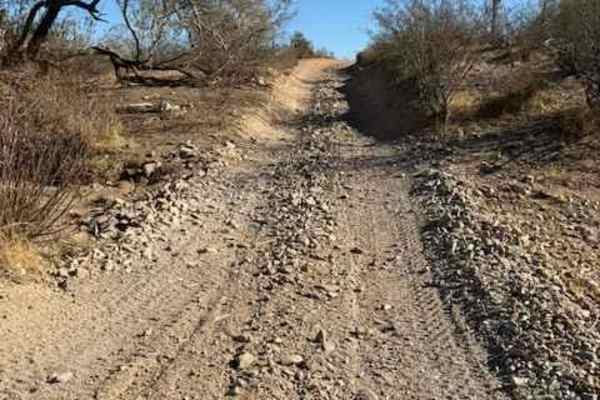
Nw2077a
This is a small wash consisting of dirt and rock. There are a few low-hanging trees and a landslide from the adjacent cliff partially blocking the wash. Mid-size and full-size vehicles can still pass, with pinstriping being inevitable. Traveling East will keep you on BLM and bring you to a well-grad...
Learn more about Nw2077a
Out of the Box
This trail is not for anyone who is concerned about Pin Stripping. There are low-clearance trees that will scratch your rig. However, you can see some pretty amazing sunset views from the peak of the trail. This is a rutted trail with low-clearance trees and some sandy washes.
Learn more about Out of the Box
Nw2030
This trail consists of dirt and rock. It is on the BLM side and borders Arizona State Trust Land. It connects the main East and West arteries to a small wash. When guided, travelling West in the wash will bring you to an open gate to Arizoa State Trust Land. Note: Arizona State Trust Land requires a...
Learn more about Nw2030
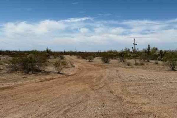
South of Gila River
This is an easy, relaxed Jeep trail through lush Sonoran Desert vegetation while enjoying great scenery. There is even a chance to play in the Gila River, depending on the water flow. Access to this area is the Florence-Kelvin Highway, but the Gila River can sometimes be forded to access this area f...
Learn more about South of Gila River
Jack Handle
This short trail is adventurous! It is an out-and-back, but the main portion of the trail is a loop that brings you back to the fork from the main trail. "Jack's Crack" is a somewhat narrow climb through a boulder that you will certainly want rock sliders for, and some with wider axles may have a ha...
Learn more about Jack Handle
Mineral Mountain
This trail runs between Arizona Highway 60 to the north and Box Canyon to the south. There is a parking area at the north end of the trail with room for several tow vehicles and trailers. The trail is full of ups and downs with wandering desert scenery. When doing this trail from the south, the Box ...
Learn more about Mineral Mountain
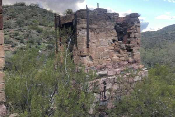
Reymert Mine Trail
The western end is an easy trail through the desert but the trail gets rocky and more difficult as you get closer to the mine. You will have to cross the creek and drive up it for a short distance. This section can vary in difficulty depending on erosion from recent water flows.
Learn more about Reymert Mine Trail
ATV trails near Florence, Arizona
Explore ATV-friendly trails near you. These trails are accessible for vehicles up to 50 inches wide, perfect for ATVs and smaller off-road machines.
WhoopDeDo Roller Coaster
This Jeep trail will take you a different way into the area north of Box Canyon. The route in from SR 79 is easy, and the eastern end of this entry is very scenic with mountain views and nice stands of saguaro. Once you get into the concentration of trails north of Box Canyon, this track will take y...
Learn more about WhoopDeDo Roller Coaster
Nw2006
Nw2006 is located to the East of Arizona State Route 79. This is the main North/South connection between WhoopDeDo Roller Coaster and Box Canyon trails. This dirt trail is wide and suitable for full-size vehicles. There are plenty of large campsites suitable for large trailers and RVs on the sides. ...
Learn more about Nw2006
Upper Woodpecker to Ajax Mine
This trail follows the difficult wash known as Upper Woodpecker. At the eastern end of the wash, the trail climbs up a narrow winding trail to join Ajax Mine Road. The wash is very difficult. Lockers and 33 inch or larger tires are recommended. The trail following the wash is intermediate and does n...
Learn more about Upper Woodpecker to Ajax Mine
Nw2010
This is a main North/South trail through Arizona State Trust Land connecting Upper Woodpecker to WhoopDeDo Roller Coaster. This is a wide dirt road suitable for 2WD vehicles with plenty of room to pass. Large campsites are present off this road. Arizona State Trust Land requires a permit. An individ...
Learn more about Nw2010
UTV/side-by-side trails near Florence, Arizona
Find UTV and side-by-side trails near you. These trails accommodate vehicles up to 60 inches wide, ideal for UTVs, side-by-sides, and wider off-road rigs.
WhoopDeDo Roller Coaster
This Jeep trail will take you a different way into the area north of Box Canyon. The route in from SR 79 is easy, and the eastern end of this entry is very scenic with mountain views and nice stands of saguaro. Once you get into the concentration of trails north of Box Canyon, this track will take y...
Learn more about WhoopDeDo Roller Coaster
Nw2006
Nw2006 is located to the East of Arizona State Route 79. This is the main North/South connection between WhoopDeDo Roller Coaster and Box Canyon trails. This dirt trail is wide and suitable for full-size vehicles. There are plenty of large campsites suitable for large trailers and RVs on the sides. ...
Learn more about Nw2006
Upper Woodpecker to Ajax Mine
This trail follows the difficult wash known as Upper Woodpecker. At the eastern end of the wash, the trail climbs up a narrow winding trail to join Ajax Mine Road. The wash is very difficult. Lockers and 33 inch or larger tires are recommended. The trail following the wash is intermediate and does n...
Learn more about Upper Woodpecker to Ajax Mine
Nw2010
This is a main North/South trail through Arizona State Trust Land connecting Upper Woodpecker to WhoopDeDo Roller Coaster. This is a wide dirt road suitable for 2WD vehicles with plenty of room to pass. Large campsites are present off this road. Arizona State Trust Land requires a permit. An individ...
Learn more about Nw2010
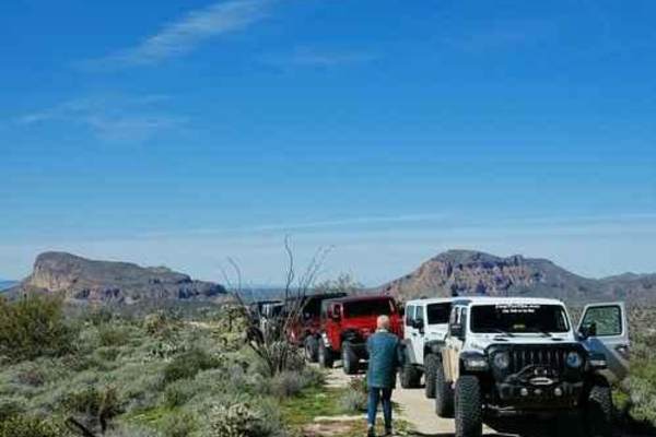
The onX Offroad Difference
onX Offroad combines trail photos, descriptions, difficulty ratings, width restrictions, seasonality, and more in a user-friendly interface. Available on all devices, with offline access and full compatibility with CarPlay and Android Auto. Discover what you're missing today!
Open Trail Map