
Dirt Bike Trails
Near Dewey, Montana
Explore All Dirt Bike Trails Near Dewey, Montana
Dirt Bike Trails Near Dewey, Montana
Discover the best dirt bike trails near you. Browse trail maps, check difficulty ratings, and find your next adventure — whether you're looking for a quick ride or an all-day expedition.
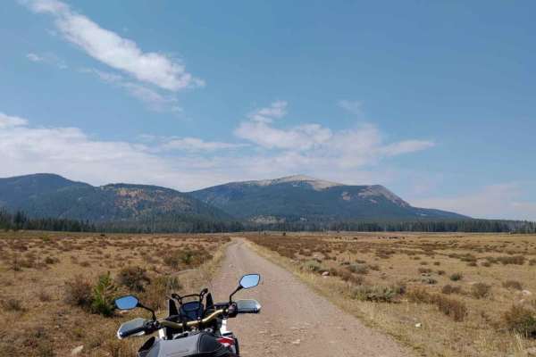
Canyon Creek - Quartz Hill
Canyon Creek - Quartz Hill is an incredibly scenic twenty-three-mile point-to-point offroad trail through the Pioneer Mountains, perfect for beginners and intermediate drivers seeking historic ruins and vast subalpine meadows. Starting near Highway 43 in the north or Interstate 15 to the southeast, ...
Learn more about Canyon Creek - Quartz Hill
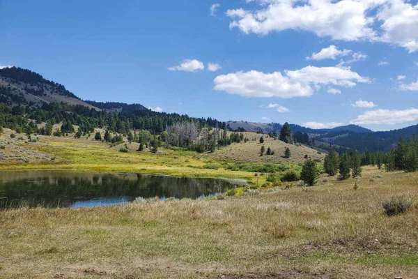
German Gulch
German Gulch is a moderately challenging 14-mile double-track trail designed specifically for 50-inch ATVs and motorcycles, offering riders an exciting mix of rocky climbs and fast, flowing sections near the Continental Divide. Starting at an elevation of approximately 5,500 feet, the route winds it...
Learn more about German Gulch
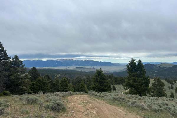
Brazil Ridge
This is a very steep climb through the trees that's very cramped in some areas. It has great views at the top, and when the cattle have been moved into that lot, there will be quite a few roaming. Cow patties are everywhere and the views are gorgeous at the top. The entire valley is in sight when at...
Learn more about Brazil Ridge
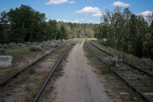
Homestake
The Homestake ATV trail goes west to east for 1.3 miles between 2 sections of Delmoe Lake Road. You can stage at the Homestake trailhead off of Delmoe Lake Road. The entrance to the trail is unmarked, but it starts at the old railroad tracks to the right of the road. It follows the old train tracks ...
Learn more about Homestake
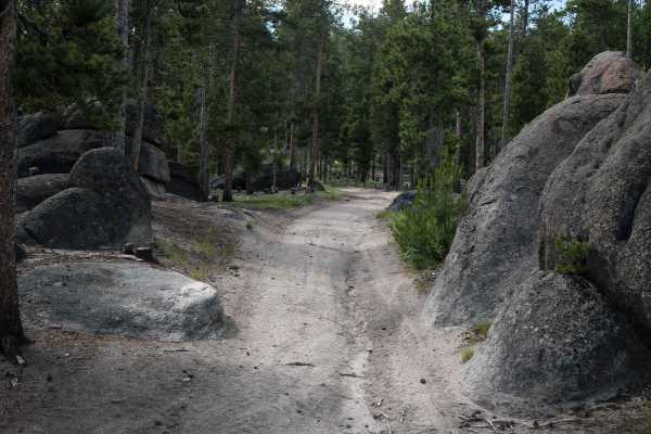
WP862
WP862 is a 1.6-mile long loop off of Delmoe Lake Road. This is a popular ATV riding area, and many dispersed campsites can be found on Delmoe Lake Road near this trail. The trail is made of dirt and decomposed granite with embedded flat surfaces of granite rock but is overall pretty smooth. It goes ...
Learn more about WP862
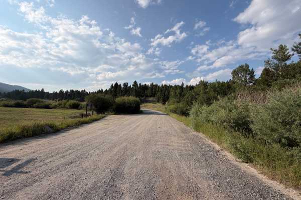
Toll Mountain Road
Toll Mountain Road leads North from Montana Highway 2, which runs east to west between the towns of Butte and Whitehall, to the Toll Mountain Campground. This gravel road gives access to a quiet campground with two vault toilets, picnic tables, five designated camping spaces that can accommodate tra...
Learn more about Toll Mountain Road
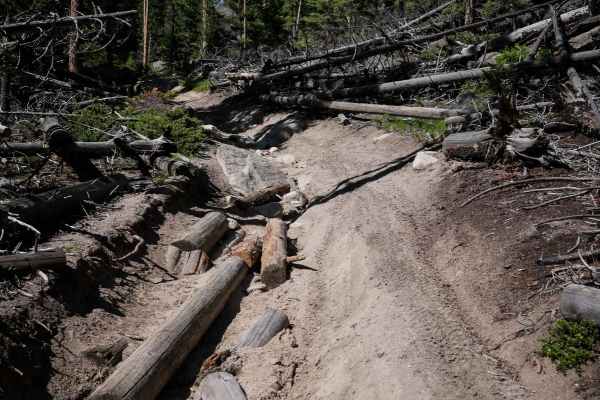
WP231
WP231 starts from the south end as an easy ATV trail, winding through a pine tree forest on a grassy overgrown two-track. The beginning has some ruts, but it starts to get rockier as it goes north. There are some embedded bumpy rocks on the surface of the trail. Then the embedded rock turns into bou...
Learn more about WP231
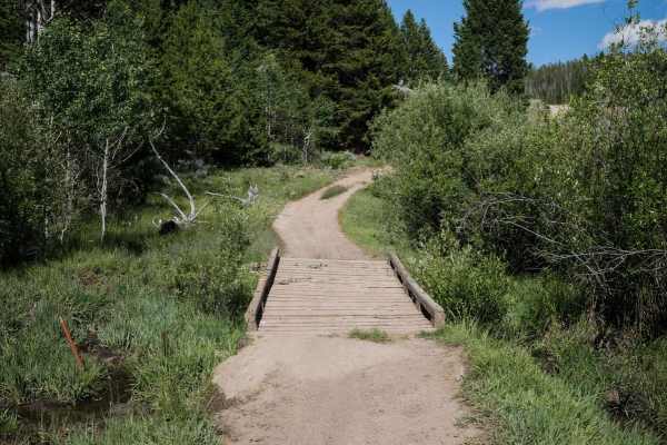
7268
This is a 1 mile ATV trail through the Deerlodge National Forest in the Pipestone OHV area. Two boulders lining the trail at the west entrance prevent full-width vehicles from entering, but it continues as a road-width dirt trail through the forest and connects to another road. It goes over a wooden...
Learn more about 7268
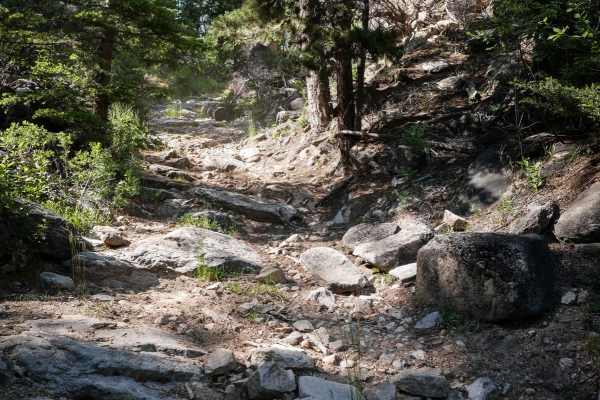
Lion Gulch
Lion Gulch is a harder ATV trail in the Pipestone OHV system that connects with WP231 and is accessed off of Delmoe Lake Road from the Homestake Trailhead. It's unmarked at the entrances but does have a wooden bridge over a stream that is only wide enough for ATVs and dirt bikes. The trail is primit...
Learn more about Lion Gulch
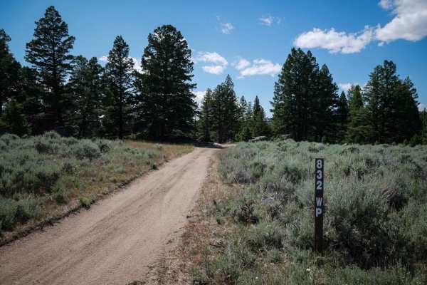
832 WP
This is a 1.4-mile long 50" trail that follows some powerlines through the Pipestone OHV area in the Deerlodge National Forest. The west end is accessed off of Delmoe Lake Road at a rock pinch point, and there is dispersed camping nearby all along Delmoe Lake Road. The trail has moderate obstacles, ...
Learn more about 832 WP
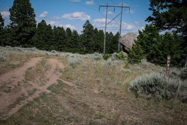
WP832
This is a 1.4-mile-long ATV trail that goes west to east underneath a power. It goes through a gate for an active grazing area, and you must close the gates behind you. The trail is straightforward, with many gradual curves and a gradual downhill descent from west to east. It's a dirt surface covere...
Learn more about WP832
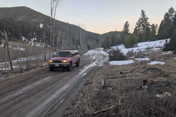
Flume Gultch
FS 85, beginning north of Rocker at just over 5,500 feet, is a single-lane trail that goes through several private land parcels before ascending to 6,900 feet. There are very minimal opportunities for camping south of the intersection with FS 608. Going west, staying on FS 85, opens up with a two-la...
Learn more about Flume Gultch
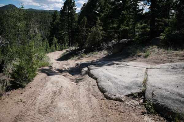
Canyon ATV Trail
This is an unmarked trail for vehicles 50" or less. The east end starts off of WP832, another 50" trail. It's an easy two track in a low alpine terrain, below pine trees. The trail is dirt, covered in pea gravel, with some embedded granite rock surfaces, uneven and curvy. It traverses a hillside thr...
Learn more about Canyon ATV Trail
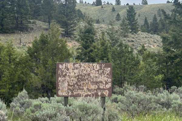
Devil's Canyon
A popular fishing spot at the beginning of the road, it passes through many private plots of land and leads into National Forest and BLM land. There are a couple of camping spots along the trail and it's popular among locals. The road starts and ends along Devils Canyon Creek. The end of the road be...
Learn more about Devil's Canyon
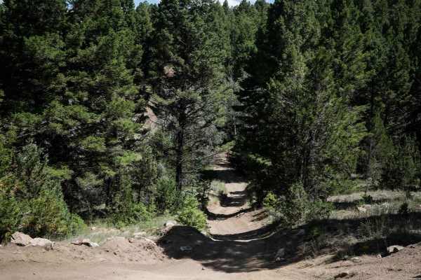
Trail 21
Trail 21 is a 3-mile long trail designated for vehicles 50" or less. It's unmarked at the north end, but has several trail signs and 50" pinch points later throughout the 3 miles. From the north end, in the beginning, there is a harder hill climb with embedded rock and ruts, but there is an easier w...
Learn more about Trail 21
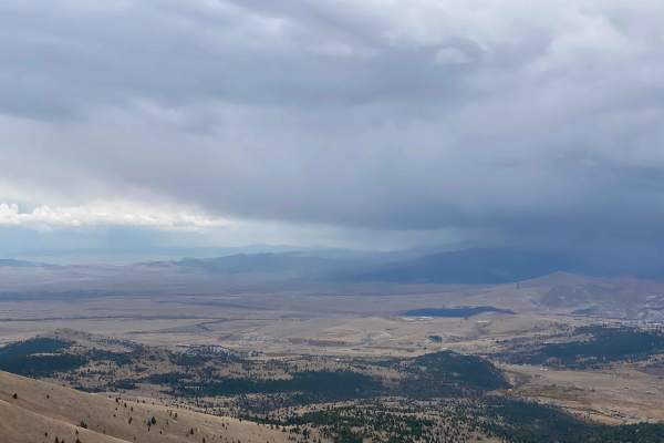
Anaconda Microwave Overlook
On the trail, you will go past a few residential homes and generally stay left to avoid their driveways and stay on the route. After passing through an H1 wide wallow, you will go through a brief narrower canyon that opens up into a wide park. There are two trails exiting the park to the north. Take...
Learn more about Anaconda Microwave Overlook
BLM 20
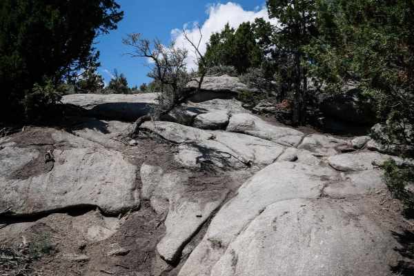
Trail 20 is a technical dirt bike trail in the Pipestone Trail System near Butte Montana. It is the hardest single track in the area. It starts from the south end as super wide and whooped like a Jeep trail. It drops down a steep hill right away on pea gravel with embedded rocks, loose boulders, and...
Learn more about BLM 20

WP185
WP185 is a short unmarked ATV trail in the Pipestone OHV area. It's a dirt two-track covered in gravel, with lots of embedded rock slabs within the dirt. The embedded rock is mostly flat surfaces and a few small boulders, but not ledges. It's tight and windy through the pine trees and between giant ...
Learn more about WP185
Spire Flat Track 8635
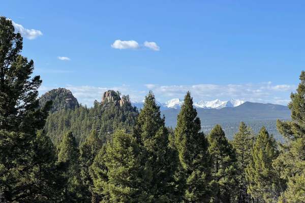
On this trail, you can expect small rocks, nice straightaways, some corners, and small inclines/declines. Overall the trail is fairly smooth and excellent for all riders alike. The trail runs North to South and meets up with several other trails. Don't forget to stop and take a look at some of the b...
Learn more about Spire Flat Track 8635

GSVA Route
Pipestone has about 75 miles of developed ORV riding trails and is open year around. There are 5 major parking areas Pipestone Trailhead, Four Corners Staging Area, Ringing Rocks Staging Area, Whiskey Gulch Trailhead and Delmoe Lake Campground. There is plenty of room for large trailers to turn ar...
Learn more about GSVA Route
ATV trails near Dewey, Montana
Explore ATV-friendly trails near you. These trails are accessible for vehicles up to 50 inches wide, perfect for ATVs and smaller off-road machines.
Canyon Creek - Quartz Hill
Canyon Creek - Quartz Hill is an incredibly scenic twenty-three-mile point-to-point offroad trail through the Pioneer Mountains, perfect for beginners and intermediate drivers seeking historic ruins and vast subalpine meadows. Starting near Highway 43 in the north or Interstate 15 to the southeast, ...
Learn more about Canyon Creek - Quartz Hill
German Gulch
German Gulch is a moderately challenging 14-mile double-track trail designed specifically for 50-inch ATVs and motorcycles, offering riders an exciting mix of rocky climbs and fast, flowing sections near the Continental Divide. Starting at an elevation of approximately 5,500 feet, the route winds it...
Learn more about German Gulch
Brazil Ridge
This is a very steep climb through the trees that's very cramped in some areas. It has great views at the top, and when the cattle have been moved into that lot, there will be quite a few roaming. Cow patties are everywhere and the views are gorgeous at the top. The entire valley is in sight when at...
Learn more about Brazil Ridge
Homestake
The Homestake ATV trail goes west to east for 1.3 miles between 2 sections of Delmoe Lake Road. You can stage at the Homestake trailhead off of Delmoe Lake Road. The entrance to the trail is unmarked, but it starts at the old railroad tracks to the right of the road. It follows the old train tracks ...
Learn more about Homestake
UTV/side-by-side trails near Dewey, Montana
Find UTV and side-by-side trails near you. These trails accommodate vehicles up to 60 inches wide, ideal for UTVs, side-by-sides, and wider off-road rigs.
Canyon Creek - Quartz Hill
Canyon Creek - Quartz Hill is an incredibly scenic twenty-three-mile point-to-point offroad trail through the Pioneer Mountains, perfect for beginners and intermediate drivers seeking historic ruins and vast subalpine meadows. Starting near Highway 43 in the north or Interstate 15 to the southeast, ...
Learn more about Canyon Creek - Quartz Hill
Brazil Ridge
This is a very steep climb through the trees that's very cramped in some areas. It has great views at the top, and when the cattle have been moved into that lot, there will be quite a few roaming. Cow patties are everywhere and the views are gorgeous at the top. The entire valley is in sight when at...
Learn more about Brazil Ridge
Toll Mountain Road
Toll Mountain Road leads North from Montana Highway 2, which runs east to west between the towns of Butte and Whitehall, to the Toll Mountain Campground. This gravel road gives access to a quiet campground with two vault toilets, picnic tables, five designated camping spaces that can accommodate tra...
Learn more about Toll Mountain Road
Flume Gultch
FS 85, beginning north of Rocker at just over 5,500 feet, is a single-lane trail that goes through several private land parcels before ascending to 6,900 feet. There are very minimal opportunities for camping south of the intersection with FS 608. Going west, staying on FS 85, opens up with a two-la...
Learn more about Flume Gultch
The onX Offroad Difference
onX Offroad combines trail photos, descriptions, difficulty ratings, width restrictions, seasonality, and more in a user-friendly interface. Available on all devices, with offline access and full compatibility with CarPlay and Android Auto. Discover what you're missing today!
Open Trail Map