
Dirt Bike Trails
Near Desert Center, California
Explore All Dirt Bike Trails Near Desert Center, California
Dirt Bike Trails Near Desert Center, California
Discover the best dirt bike trails near you. Browse trail maps, check difficulty ratings, and find your next adventure — whether you're looking for a quick ride or an all-day expedition.
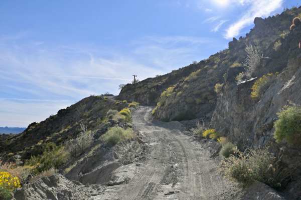
Chuckwalla Peak Road
This is a 3.8 miles each way out and back trail rated 4 in the Chuckwalla Mountains Wilderness. Crazy elevation gain? Check. Shelf Road? Check. Pucker factor? Indeed. You know those towers on top of that big peak that you've been seeing for miles? That's where you're going if you traverse this trail...
Learn more about Chuckwalla Peak Road
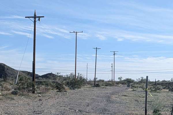
Gas Line Road North 281
This 11-plus-mile north-to-south trail starts off Highway 10, just past an open gate. Use caution at the start, as there is no off-ramp to access this trail from the highway. The surface is sandy with some small rocks and is just over one vehicle wide. The trail is lined with desert ironwood and occ...
Learn more about Gas Line Road North 281
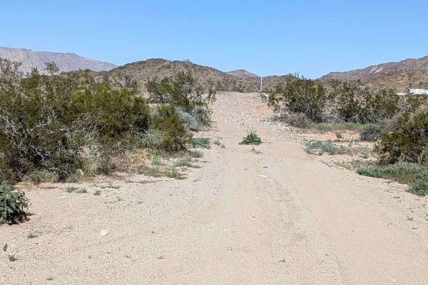
BLM 311
This 1.4-mile, relatively flat trail runs from Gas Line 281 to Red Cloud Mine Road. The surface is hard-packed sand with some rocks. The trail goes in and out of some washes with off-camber sections throughout. You'll enjoy nice views of the surrounding Orocopia Mountains as well as the Joshua Tree ...
Learn more about BLM 311
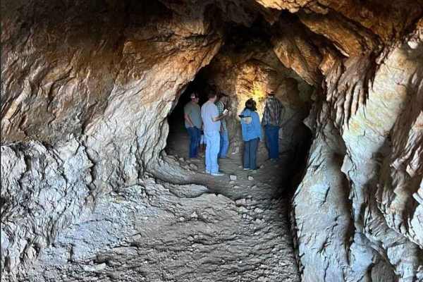
Red Cloud Mine
Red Cloud Mine trail is a 12.6-mile (25.2-mile) out-and-back rated 3 of 10 located near Desert Center. This generally level dirt trail has multiple sand washes that must be crossed to get to the trail end. This is a destination trail that offers several stops within the historic Chuckwalla Mining Di...
Learn more about Red Cloud Mine
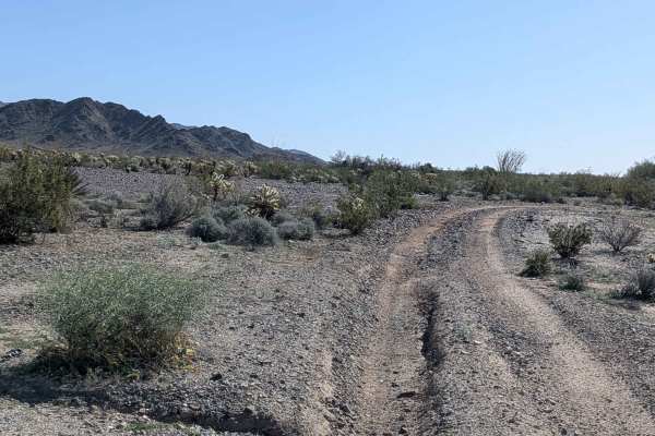
Queen Ester Road
This out-and-back trail climbs almost 800 feet in just under 8 miles, running east to west from Gas Line Road 281. The trail is one vehicle wide with a hard-pack sand surface and small rocks. This is one of the most scenic trails in the area, lined with lots of vegetation, including desert ironwood,...
Learn more about Queen Ester Road
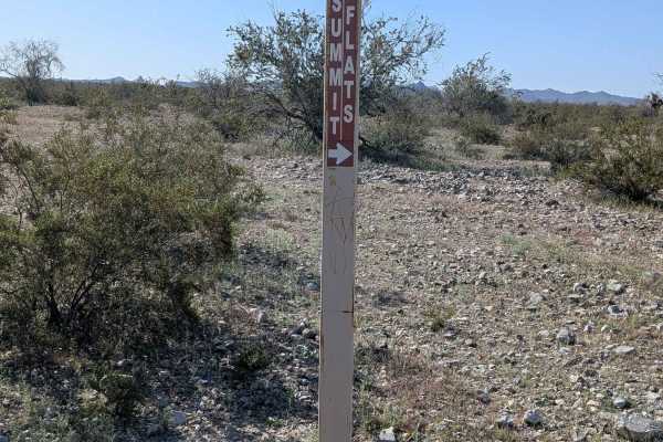
Summit Flats 280
This relatively flat trail connects Summit Road with Gas Line Road 281, running from west to east. The trail is one vehicle wide and mostly sandy. You'll encounter some washboards and whoops along the way. The route offers nice views of the surrounding Orocopia Mountains as well as the Joshua Tree N...
Learn more about Summit Flats 280
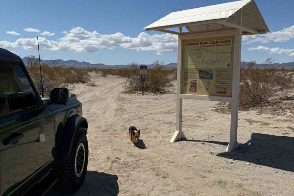
Dupont Road
Dupont Rd is a 17.7-mile trail rated 3 out of 10. Depending on the direction run, two thousand one hundred seventy-seven feet of elevation are gained or lost on this trail. The majority of the trail is packed with dirt and sandy washes. The trail's south end is roughly 3-4 miles of washes with small...
Learn more about Dupont Road
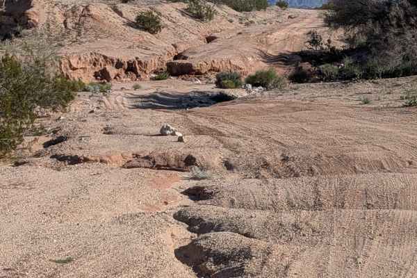
Summit Road
This 4.5-mile trail connects Bradshaw Trail with Summit Flats Road. The surface is sandy and hard-packed with some ruts less than 12 inches deep. Coming from the Bradshaw Trail, the trail opens up into a big wash after half a mile, which is lined with mud walls on one side. The wash is filled with l...
Learn more about Summit Road

Amy's Wash
This 9 mile out and back trail starts off the Bradshaw Trail and runs north to south. The trail was originally a loop but half the trail, which is outside the wash is now private and marked no trespassing with owner controlled access. Amy's Wash is surrounded by 20 foot red mud walls and is lined wi...
Learn more about Amy's Wash

SR2013 Red Canyon Jeep Trail
The SR2013 Red Canyon Jeep Trail is an ideal route for novice offroaders and scenic explorers looking to experience rugged Southern California desert landscapes with minimal technical difficulty. Running approximately 13.1 miles, this scenic point-to-point trail winds south from Interstate 10, navig...
Learn more about SR2013 Red Canyon Jeep Trail
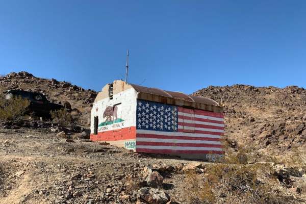
Old Dale Road
Old Dale Road is an iconic trail in the mountains of Joshua Tree National Park. Start from either the north or the south trailhead and enjoy a trek through the history and beauty of the desert. Visit abandoned mines throughout the trail or set up camp away from the crowds. This trail is appropriate ...
Learn more about Old Dale Road
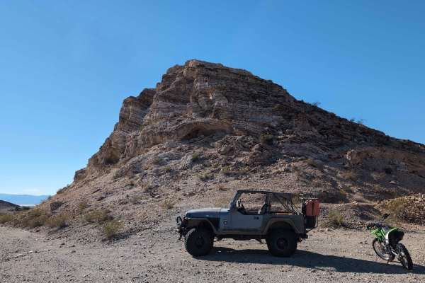
Palen Pass
Palen Pass is an old WWII Army training ground used by General Patton. The trail is hardpack dirt with some soft sand in washes. The trail is easy enough that large fuel trucks can get to some of the off-grid radio towers along the trail. The trail starts off Arlington Mine Road and goes all the way...
Learn more about Palen Pass
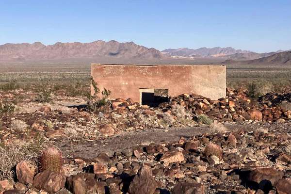
Patton's Cabin Road
This is an out-and-back trail to the ruins of General Patton's cabin near the foothills of the Palen/McCoy Wilderness area. The trail begins as a two-track path primarily consisting of sand that winds in and out of shallow washes. There are also frequent whoops up to a foot high in this section. The...
Learn more about Patton's Cabin Road
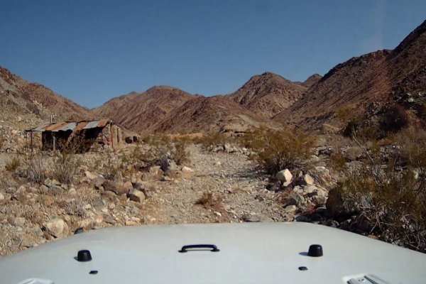
Brooklyn Mine Trail
Brooklyn Mine Trail offers four-wheel-drive enthusiasts and SxS drivers a rugged, scenic journey into the historic Dale Mining District near Joshua Tree. Spanning approximately 1.9 miles, this route climbs through a sandy and rocky wash from an elevation of 1,860 feet to nearly 2,280 feet, gaining a...
Learn more about Brooklyn Mine Trail
Ok Mine Road Route 1937
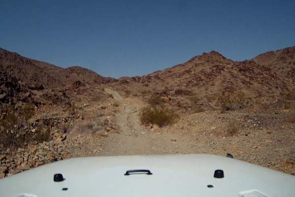
This is a trail hidden within the mountains of Joshua Tree that detours from Old Dale Road and Brooklyn Mine. It cuts through the mountains on rocky shelf roads that descend and ascend on loose rocky hills and traverses through a sandy desert wash. The trail has amazing history with its abandoned mi...
Learn more about Ok Mine Road Route 1937
Arlington and Blackjack Mine
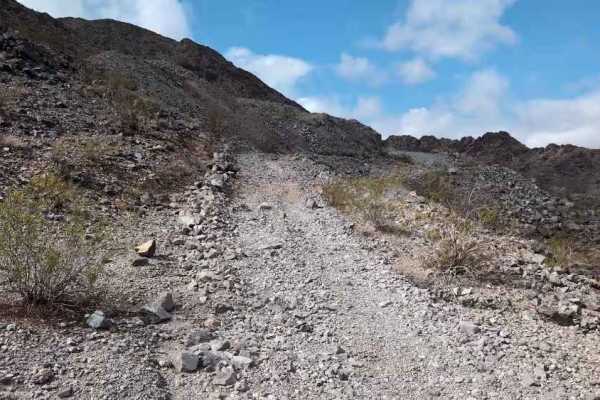
This is a short spur trail, but there are many old mineshafts. The trail is mostly rock, with some small boulders. It has old mining canyons that you can drive in, and lots of large open mineshafts. The top of the trail can be a bit challenging, but most 4x4 vehicles with a low range should fare fin...
Learn more about Arlington and Blackjack Mine
Little Box Canyon Meccacopia Loop
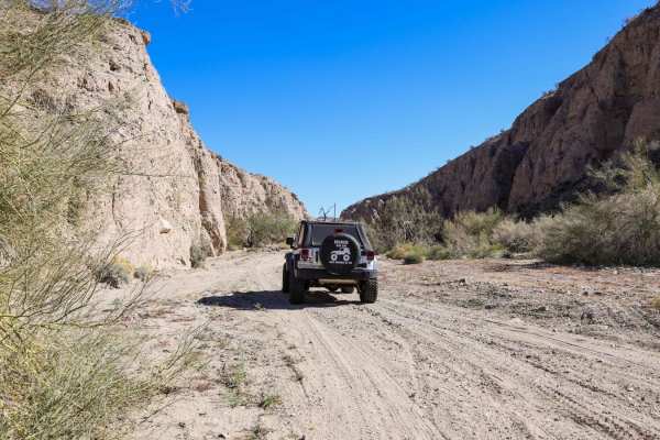
Hidden in the Mecca Hills just South of Joshua Tree National Park is a fun little trail that winds you through tight canyon washes surrounded by high vertical cliffs of up to 40 feet. The Little Box Canyon Trail is like a baby version of the famous Sandstone Canyon Trail in Anza Borrego. There is on...
Learn more about Little Box Canyon Meccacopia Loop
Wiley Well District Geode Beds
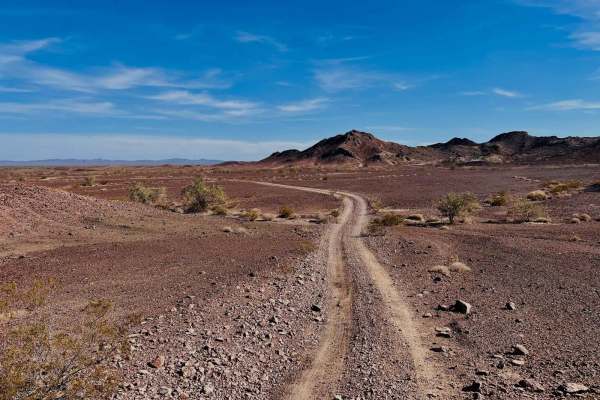
This short, sweet cutover is much easier and less technical than the Western Hauser Geode beds route. The hill transitions are less severe and steep. The northern half is private property and signage states that it needs to be left alone for collecting, while the southern 2/3 of the trail is open BL...
Learn more about Wiley Well District Geode Beds
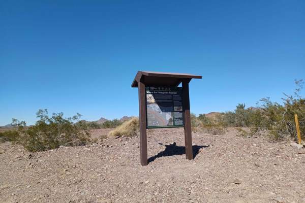
Milpitas Wash
Milpitas Wash is a mix surface of gravel, road and sand, with some sections more rutted, rocky and washed out. This road runs through Bureau Land Management, with plently of spots to pull over and camp. Be aware this area is prone to flooding, some sections of this road either drive in a wash or thr...
Learn more about Milpitas Wash
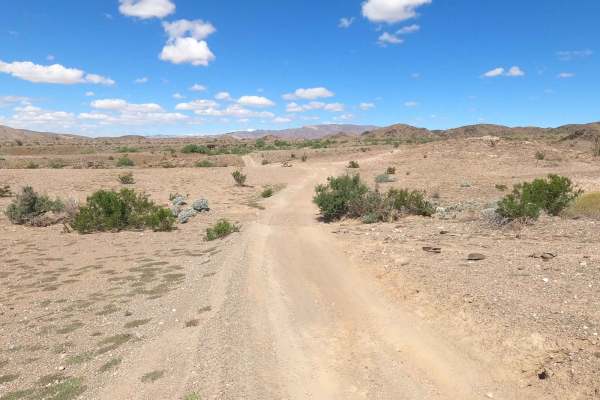
Mecca Orocopia Jeep Trail
This is the Mecca Orocopia Trail, a connection to the Little Box Canyon Meccacopia Loop. This is an easy dirt road trail where you can admire the beautiful views of the Orocopia mountains. There is nothing challenging about this route;it's perfect for dirt bikes, UTVs, and 2WD rides. It's great for ...
Learn more about Mecca Orocopia Jeep Trail
ATV trails near Desert Center, California
Explore ATV-friendly trails near you. These trails are accessible for vehicles up to 50 inches wide, perfect for ATVs and smaller off-road machines.
Chuckwalla Peak Road
This is a 3.8 miles each way out and back trail rated 4 in the Chuckwalla Mountains Wilderness. Crazy elevation gain? Check. Shelf Road? Check. Pucker factor? Indeed. You know those towers on top of that big peak that you've been seeing for miles? That's where you're going if you traverse this trail...
Learn more about Chuckwalla Peak Road
Gas Line Road North 281
This 11-plus-mile north-to-south trail starts off Highway 10, just past an open gate. Use caution at the start, as there is no off-ramp to access this trail from the highway. The surface is sandy with some small rocks and is just over one vehicle wide. The trail is lined with desert ironwood and occ...
Learn more about Gas Line Road North 281
BLM 311
This 1.4-mile, relatively flat trail runs from Gas Line 281 to Red Cloud Mine Road. The surface is hard-packed sand with some rocks. The trail goes in and out of some washes with off-camber sections throughout. You'll enjoy nice views of the surrounding Orocopia Mountains as well as the Joshua Tree ...
Learn more about BLM 311
Red Cloud Mine
Red Cloud Mine trail is a 12.6-mile (25.2-mile) out-and-back rated 3 of 10 located near Desert Center. This generally level dirt trail has multiple sand washes that must be crossed to get to the trail end. This is a destination trail that offers several stops within the historic Chuckwalla Mining Di...
Learn more about Red Cloud Mine
UTV/side-by-side trails near Desert Center, California
Find UTV and side-by-side trails near you. These trails accommodate vehicles up to 60 inches wide, ideal for UTVs, side-by-sides, and wider off-road rigs.
Chuckwalla Peak Road
This is a 3.8 miles each way out and back trail rated 4 in the Chuckwalla Mountains Wilderness. Crazy elevation gain? Check. Shelf Road? Check. Pucker factor? Indeed. You know those towers on top of that big peak that you've been seeing for miles? That's where you're going if you traverse this trail...
Learn more about Chuckwalla Peak Road
Gas Line Road North 281
This 11-plus-mile north-to-south trail starts off Highway 10, just past an open gate. Use caution at the start, as there is no off-ramp to access this trail from the highway. The surface is sandy with some small rocks and is just over one vehicle wide. The trail is lined with desert ironwood and occ...
Learn more about Gas Line Road North 281
BLM 311
This 1.4-mile, relatively flat trail runs from Gas Line 281 to Red Cloud Mine Road. The surface is hard-packed sand with some rocks. The trail goes in and out of some washes with off-camber sections throughout. You'll enjoy nice views of the surrounding Orocopia Mountains as well as the Joshua Tree ...
Learn more about BLM 311
Red Cloud Mine
Red Cloud Mine trail is a 12.6-mile (25.2-mile) out-and-back rated 3 of 10 located near Desert Center. This generally level dirt trail has multiple sand washes that must be crossed to get to the trail end. This is a destination trail that offers several stops within the historic Chuckwalla Mining Di...
Learn more about Red Cloud Mine
The onX Offroad Difference
onX Offroad combines trail photos, descriptions, difficulty ratings, width restrictions, seasonality, and more in a user-friendly interface. Available on all devices, with offline access and full compatibility with CarPlay and Android Auto. Discover what you're missing today!
Open Trail Map