
Dirt Bike Trails
Near Crest View Heights, New York
Explore All Dirt Bike Trails Near Crest View Heights, New York
Dirt Bike Trails Near Crest View Heights, New York
Discover the best dirt bike trails near you. Browse trail maps, check difficulty ratings, and find your next adventure — whether you're looking for a quick ride or an all-day expedition.
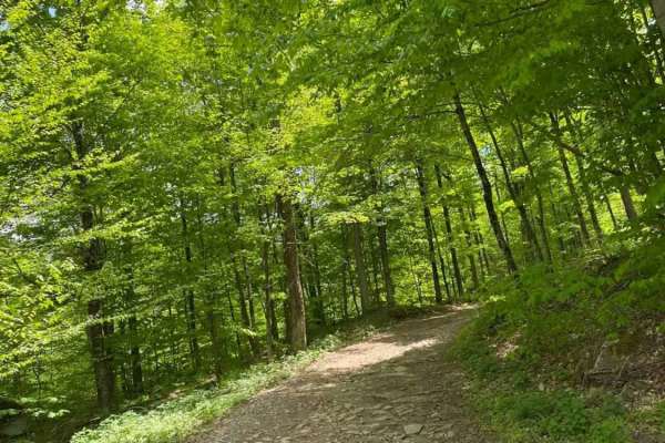
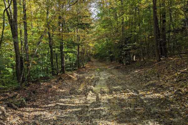
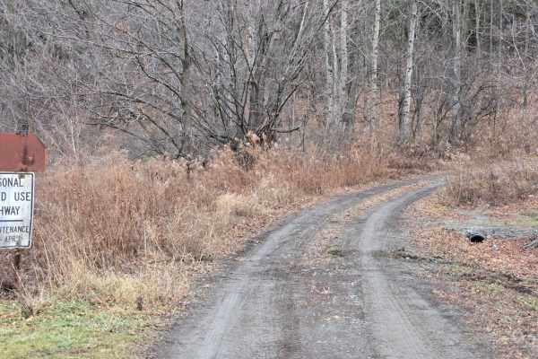
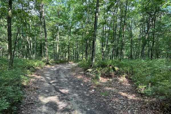
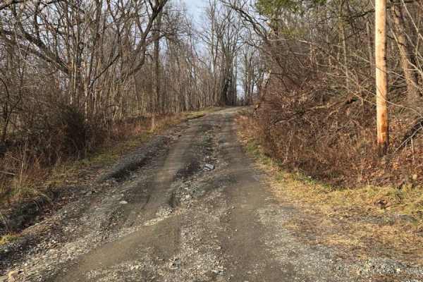
Big Valley Road
Big Valley Road offers a scenic and highly accessible offroad driving experience for novice drivers and seasoned explorers alike, serving as a tranquil passage through Pennsylvania's dense State Game Lands. Stretching approximately 2.2 miles, this winding forest road climbs from an elevation of 1,29...
Learn more about Big Valley Road
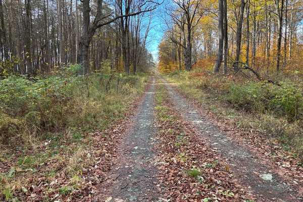
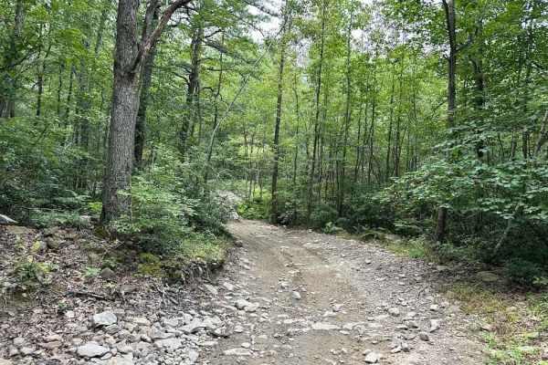
Cross Island Road
This is a seasonal gravel road that winds through the eastern section of Taylor Valley State Forest. The road starts with well-maintained gravel and transitions into a narrower two-track as it pushes deeper into the forest. Cross Island Road provides a scenic drive through mixed hardwoods and conife...
Learn more about Cross Island Road
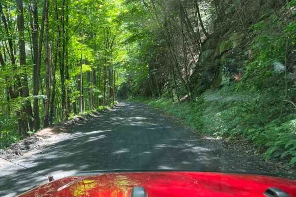
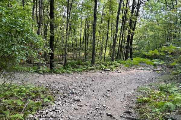
T-743/T-727
The trail starts off in Poyntelle as Township-727 and in Winterdale as T-743. This section of the O and W Trail is a recognized Township route open to street-licensed 4x4s. The trail follows the former route of the Ohio and Western Railroad. Multiple former stations can be observed along the route. ...
Learn more about T-743/T-727
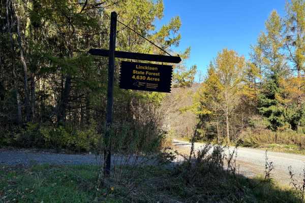
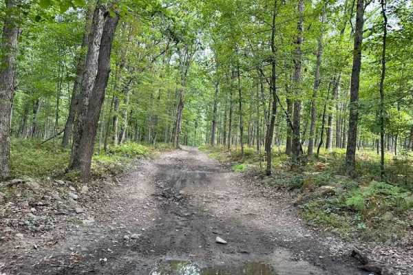
Linklaen State Forest
This route consists of seasonal gravel roads that are generally well-maintained in the summer. During the winter the roads are used for snowmobile trails. The roads lead to several side routes that are two-tracks, most are out-and-back routes and will add adventure to the ride. The main road is easi...
Learn more about Linklaen State Forest
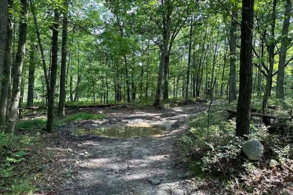
Chambers Road
This is a rough seasonal road frequented by local 4X4 enthusiasts. The trail starts at County Route 16 and continues through to Hornby Road in Beaver Dams. Just down Hornby Road is Beaver Dams Powersports and 5 miles from the trail is a Dandy Mart. This trail features several mud holes on either sid...
Learn more about Chambers Road
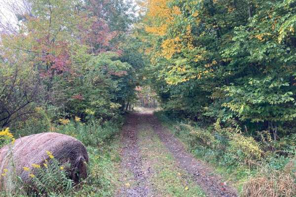
Templar Falls - Sugar Hill Road
This is an easy dirt road that will become rutted and muddy come spring. This section has access to primitive camping and multiple hiking trails including the Finger Lakes Trail, A-Trail, and Mohawk Trail. Mohawk trail activities include hiking, horseback, mountain biking, snowmobiling, and cross-co...
Learn more about Templar Falls - Sugar Hill Road
Bellinger Road
This is a seasonal road connecting Miller Road and County Route 42 in the town of Hornby. The track passes farmland and hardwood forest. Caution should be exercised when driving from west to east, as there is a landowner driveway that can be confused with the main track. Stay to the left. Washouts a...
Learn more about Bellinger Road
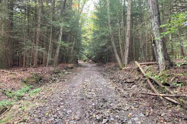
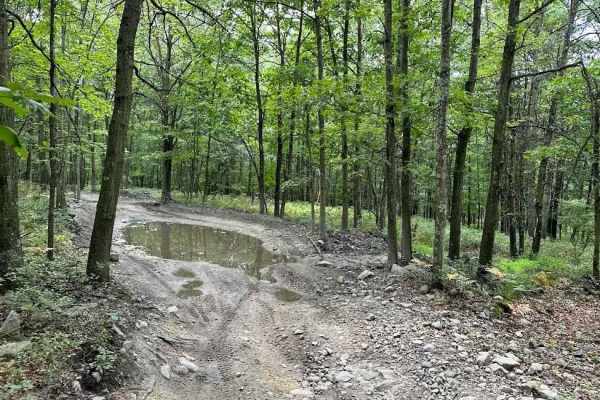
Cook Road
This is a short and rocky seasonal road connecting Borden Hollow Road to West Hill Road in the town of Hornby. Often after heavy rain, washouts, loose rocks, and downed trees can be expected. Minimal maintenance is provided by the local township. There are homes present on the west end of the track,...
Learn more about Cook Road
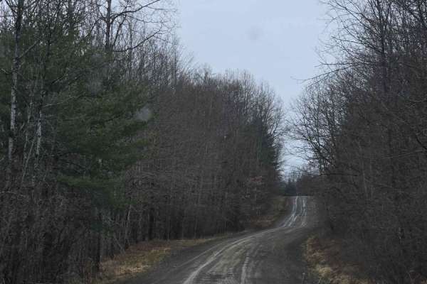
Bigelow Hill Road
This is a seasonal road that becomes soft, slick, and washed out in the later Fall, Winter, and Spring. On the seasonal portion, this road is one vehicle width wide. Bigelow Hill Road can be accessed off NY-226. The surface is a mix of gravel and clay. During winter and the shoulder seasons, the roa...
Learn more about Bigelow Hill Road
20 Green - A
20 Green has a wide variety of terrain including rocky sections, off-camber areas, slight up-and-down slopes, shallow water crossings, and muddy obstacles. Along the way on this uneven, loose gravel trail, you find a wooden bridge that is able to be crossed. Please follow the signs, be safe, and slo...
Learn more about 20 Green - A
12 Red
12 Red takes you through the woods with some tighter areas along the way. Get ready for some water crossings! Depths can vary depending on any recent rainfall. There are some bypasses along the way but the stream isn't bad. Small to medium-sized rocks are scattered throughout the trail along with so...
Learn more about 12 Red
Jason's Journey Green
Jason's Journey Green is a wooded trail that is a relatively dirt trail with various small rocks scattered throughout the trail. There are shallow water and muddy obstacles that you may barely notice however, if rain has been in the forecast the depth might be a bit more exciting.
Learn more about Jason's Journey Green
Wanderer Green
Wanderer is a loop-type trail system off of the main trail as you enter the main trail network. It can be turned onto for a good warm-up section or to lead you to the next trail area. Trails weave through different trees and scrub brush working through the boneyard.
Learn more about Wanderer Green
Quickening Green
Quickening green is an exit trail to leads you back to the main road. It is a trail full of twists and turns with small rocks and a few puddles. This is a great trail for any skill level to take. Use this to add time to your trail route or to wind down your day.
Learn more about Quickening Green
Single Track Blue
This single-track trail can range in severity but are designed to be tight and flow with some slight speed. The obstacles can include hills, rocks, logs, twists, turns and off-camber. There are usually drop-offs nearby and plenty of areas that can catch the novice rider. Be cautious on single-track ...
Learn more about Single Track Blue

20 Green - B
20 Green has a wide variety of terrain including rocky sections, off-camber areas, slight up-and-down slopes, shallow water crossings, and muddy obstacles. Along the way on this uneven, loose gravel trail, you find a wooden bridge that is able to be crossed. Please follow the signs, be safe, and slo...
Learn more about 20 Green - B
XC - One green
If you are looking for just a fun trail, XC- One Green is for you. This uneven, dirt trail takes you through the woods where you will encounter various sizes of small to medium-sized rocks and shallow water crossings. Downed trees and logs can also be found so use caution.
Learn more about XC - One green

Shootout Green
Shootout Green is a return trail that goes along the main road and has a few small challenges. These challenges include small rocks, puddles, mud, and tree roots. It is an easier trail section and all obstacles are avoidable for a novice rider. This can be a good alternative route if there is traffi...
Learn more about Shootout Green

10 Red - B
10 Red will have you rockin! The trail has a mud pit area but also is littered with rocks. Baseball-sized rocks, watermelon-sized rocks, and flat table-sized rocks. In between the rocks, there are some short, gooey muddy obstacles and some shallow water holes. This uneven, rocky trail takes you thro...
Learn more about 10 Red - B
Talbort Hill - Pulver - Losey Hill
This is a steep seasonal road coming out of Tyrone, NY. The road becomes heavily washed out in spring time and between November and May terrain becomes soft. The surface turns to clay at the top of the hill and becomes slick, a moderate challenge for ADV bikes. Within 1-2 miles of Waneta and Lamoka...
Learn more about Talbort Hill - Pulver - Losey Hill
ATV trails near Crest View Heights, New York
Explore ATV-friendly trails near you. These trails are accessible for vehicles up to 50 inches wide, perfect for ATVs and smaller off-road machines.
Big Valley Road
Big Valley Road offers a scenic and highly accessible offroad driving experience for novice drivers and seasoned explorers alike, serving as a tranquil passage through Pennsylvania's dense State Game Lands. Stretching approximately 2.2 miles, this winding forest road climbs from an elevation of 1,29...
Learn more about Big Valley Road
Cross Island Road
This is a seasonal gravel road that winds through the eastern section of Taylor Valley State Forest. The road starts with well-maintained gravel and transitions into a narrower two-track as it pushes deeper into the forest. Cross Island Road provides a scenic drive through mixed hardwoods and conife...
Learn more about Cross Island Road
T-743/T-727
The trail starts off in Poyntelle as Township-727 and in Winterdale as T-743. This section of the O and W Trail is a recognized Township route open to street-licensed 4x4s. The trail follows the former route of the Ohio and Western Railroad. Multiple former stations can be observed along the route. ...
Learn more about T-743/T-727
Linklaen State Forest
This route consists of seasonal gravel roads that are generally well-maintained in the summer. During the winter the roads are used for snowmobile trails. The roads lead to several side routes that are two-tracks, most are out-and-back routes and will add adventure to the ride. The main road is easi...
Learn more about Linklaen State Forest
UTV/side-by-side trails near Crest View Heights, New York
Find UTV and side-by-side trails near you. These trails accommodate vehicles up to 60 inches wide, ideal for UTVs, side-by-sides, and wider off-road rigs.
Big Valley Road
Big Valley Road offers a scenic and highly accessible offroad driving experience for novice drivers and seasoned explorers alike, serving as a tranquil passage through Pennsylvania's dense State Game Lands. Stretching approximately 2.2 miles, this winding forest road climbs from an elevation of 1,29...
Learn more about Big Valley Road
Cross Island Road
This is a seasonal gravel road that winds through the eastern section of Taylor Valley State Forest. The road starts with well-maintained gravel and transitions into a narrower two-track as it pushes deeper into the forest. Cross Island Road provides a scenic drive through mixed hardwoods and conife...
Learn more about Cross Island Road
T-743/T-727
The trail starts off in Poyntelle as Township-727 and in Winterdale as T-743. This section of the O and W Trail is a recognized Township route open to street-licensed 4x4s. The trail follows the former route of the Ohio and Western Railroad. Multiple former stations can be observed along the route. ...
Learn more about T-743/T-727
Linklaen State Forest
This route consists of seasonal gravel roads that are generally well-maintained in the summer. During the winter the roads are used for snowmobile trails. The roads lead to several side routes that are two-tracks, most are out-and-back routes and will add adventure to the ride. The main road is easi...
Learn more about Linklaen State Forest
The onX Offroad Difference
onX Offroad combines trail photos, descriptions, difficulty ratings, width restrictions, seasonality, and more in a user-friendly interface. Available on all devices, with offline access and full compatibility with CarPlay and Android Auto. Discover what you're missing today!
Open Trail Map