
Dirt Bike Trails
Near Crescent Valley, Nevada
Explore All Dirt Bike Trails Near Crescent Valley, Nevada
Dirt Bike Trails Near Crescent Valley, Nevada
Discover the best dirt bike trails near you. Browse trail maps, check difficulty ratings, and find your next adventure — whether you're looking for a quick ride or an all-day expedition.
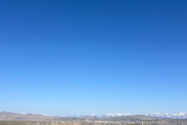
Adobe Heights Bypass
Adobe Heights Bypass is an easy trail that connects Mountain City Highway to North 5th Street in Elko, NV. This trail starts as a maintained gravel road and turns into an unmaintained dirt trail. The unmaintained section has some uneven areas with small ruts, but nothing crazy. You will follow power...
Learn more about Adobe Heights Bypass
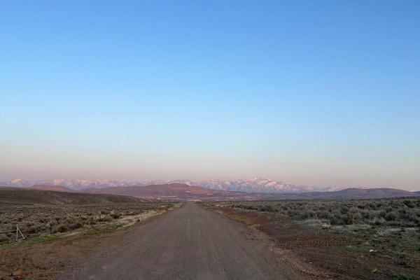
North 5th Street
North 5th Street is a maintained gravel road that is a little bumpy and washboard in areas. This trail travels North from Elko, Nevada, and ends at a small ski area with a small chairlift and rope tow. You will travel through the rolling hills of the high desert, which are covered with sagebrush and...
Learn more about North 5th Street
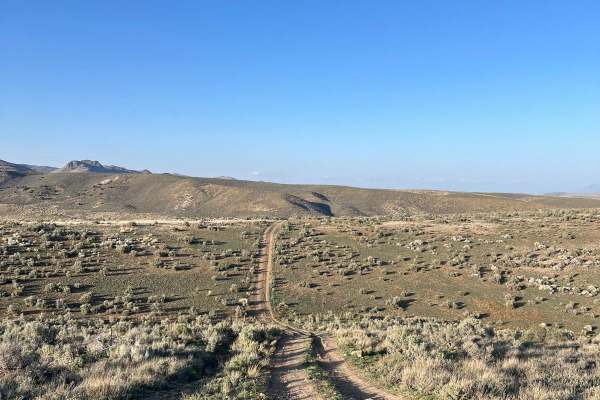
North 5th Street Side Connector
This fun side trail is just over 3 miles long, starting and ending on North 5th Street. The more southern section of this trail is fairly pretty with some small rocky and rutted areas. As you return to North 5th Street, this trail will have fun hill climbs and falls. This area will have a few minor ...
Learn more about North 5th Street Side Connector
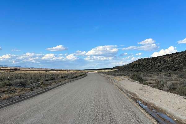
North Last Chance Road
North Last Chance Road is a well-maintained gravel road. You will pass alongside residential areas, accompanied by ranch lands. Some places can be a little washboard and dusty. There is a good possibility you will see other rigs on this trail, so keep your eyes up.
Learn more about North Last Chance Road
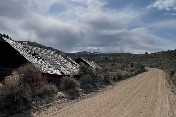
Harrison Pass
Harrison Pass is a maintained gravel road except during the winter months. There are areas on this road that can be extremely washboarded. If you are going too fast, some of these washboards could cause you to lose control of your rig. You will pass an old mining town and a mill foundation as you tr...
Learn more about Harrison Pass
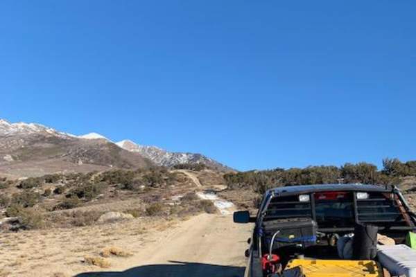
Ruby Crest Trailhead
This road leads from Harrison Pass up to the Ruby Crest Trailhead. It's a relatively easy and short road that can save you some time and distance if you plan to hike the Ruby Crest Trail. This route can be done in 2WD with decent tires and some clearance. Be careful if there is any snow, as there a...
Learn more about Ruby Crest Trailhead
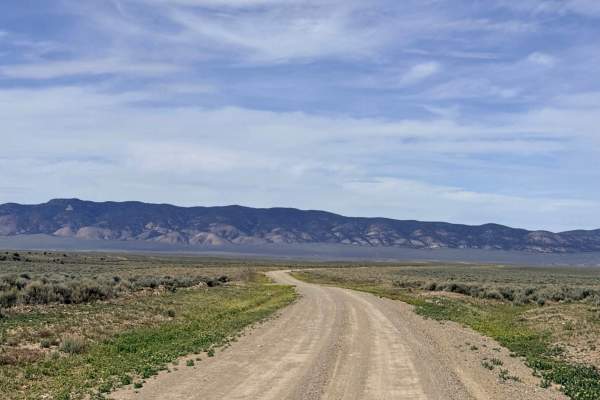
Silver Creek Road
Silver Creek Road serves as a high-desert gateway, offering a well-maintained and relatively flat dirt route that connects Highway 305 to the historic Old Highway Road. This is an excellent entrance or exit point for those looking to transition from the main pavement into the deeper trail networks o...
Learn more about Silver Creek Road
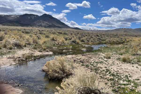
Spaulding Canyon Trail
This is a super easy trail, with tons of offroading to explore. When we did the trail the snow melt was in full swing tons of water flowing in creeks everywhere. There are tons of offroading to explore from this main trail. Lots of camping spots and just places to stop and explore as well.
Learn more about Spaulding Canyon Trail
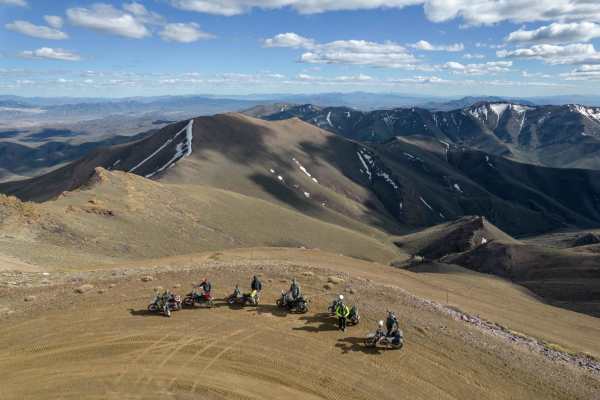
Hot Spring Hill to Mount Lewis
This route takes you from just outside of Eureka Nevada at Hot Spring Hill to Mount Lewis. The route starts out taking you to Bartine Hot Springs, a funny little heart-shaped hot springs that in the summer and fall can be nice to soak in. It then takes you North past abandoned active open-pit gold m...
Learn more about Hot Spring Hill to Mount Lewis

Antelope Valley Road
Antelope Valley Road offers a long, fast, and wide dirt track that serves as the main artery for the western side of the valley. The journey begins right off Highway 50 at a massive, well-leveled staging area, an ideal spot for those hauling trailers to unload side-by-sides or motorcycles before div...
Learn more about Antelope Valley Road
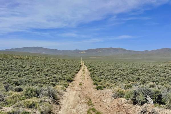
Box Spring FS43227
This trail offers a captivating journey through shifting landscapes, beginning as a straight shot across the desert plains before transitioning into a more intimate driving experience. The route twists and turns through scenic groves of Utah Juniper and Pinyon Pine, providing a shaded canopy that fe...
Learn more about Box Spring FS43227
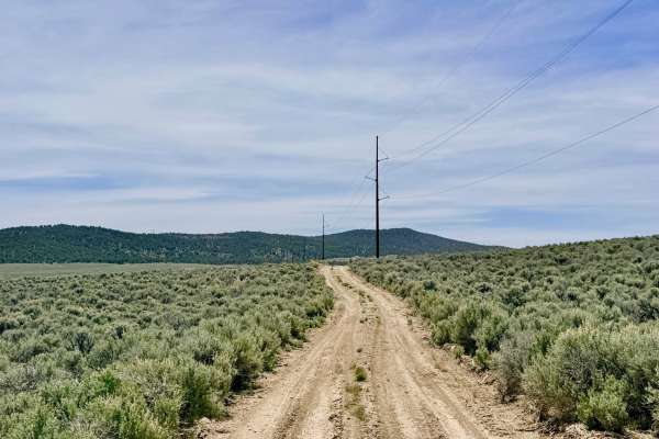
Streshley Springs FS42496
Streshley Springs is a trail of two halves. Starting from the north, the route is a well-graded, easy-to-navigate road that offers several options to branch into the surrounding canyon network. However, as the trail progresses southward, the character of the drive shifts dramatically. The road narro...
Learn more about Streshley Springs FS42496
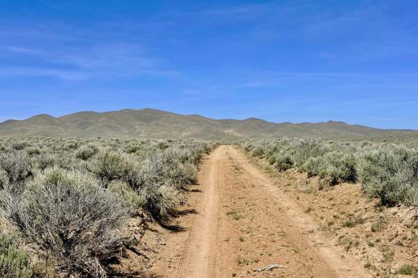
Willow Creek Connector/Bypass - FS 43497+98
This combined route of FS 43497 and FS 43498 serves as the modern, essential connector for explorers heading toward the Barton Creek and Willow Creek loop systems. Navigation in this area has changed significantly over time; the far eastern end of the original bypass route no longer exists and has b...
Learn more about Willow Creek Connector/Bypass - FS 43497+98
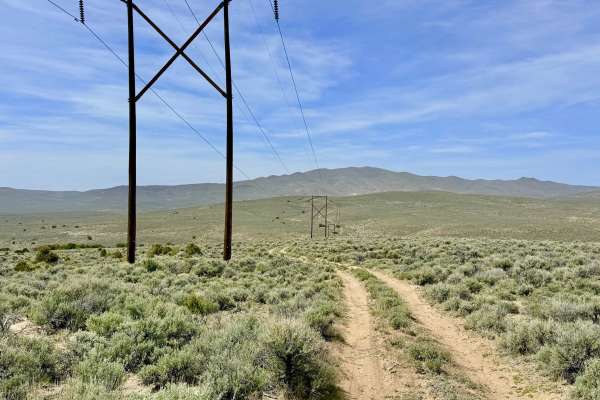
Willow Creek Ranch Cutoff FS43496A
The Willow Creek Ranch Cutoff is a fantastic, highly recommended alternative to the dense "pinstripe" sagebrush found at the southern end of Streshley Springs. This engaging trail serves as a vital link, twisting and turning its way along the regional power line corridor as it transitions between th...
Learn more about Willow Creek Ranch Cutoff FS43496A
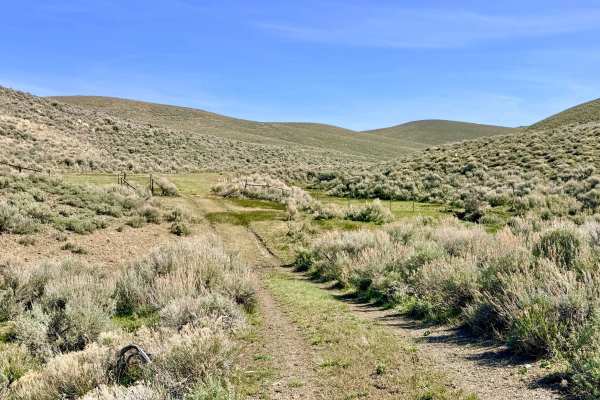
Barton Creek-Willow Creek Loop - FS 43011
The Barton Creek-Willow Creek Loop is a beautiful and immersive journey through the high-desert riparian zones of the Toiyabe Range. This trail offers a refreshing change of pace as it crisscrosses through Willow Creek, where the typical Nevada sagebrush gives way to lush, grassy trails and water-lo...
Learn more about Barton Creek-Willow Creek Loop - FS 43011
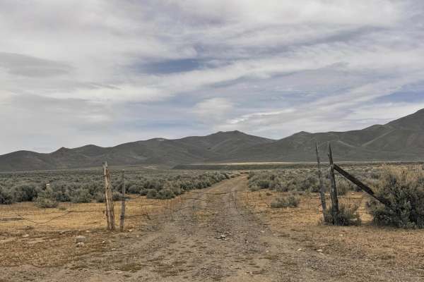
Cottonwood Canyon
Cottonwood Canyon is a rugged out-and-back trail that follows the winding path of Cottonwood Creek, a rare and vital desert waterway fed by natural springs higher up in the range. The journey begins relatively easily, with a few minor washouts that most high-clearance vehicles can handle without iss...
Learn more about Cottonwood Canyon
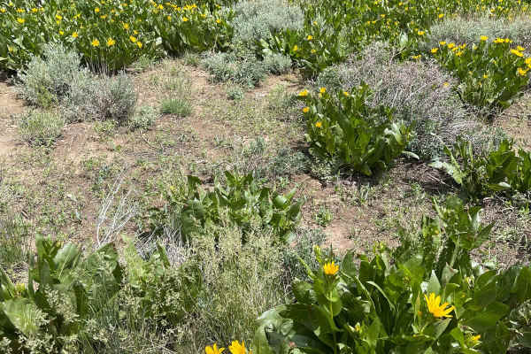
Sonoma Peak Access Trail
This is a dirt road. It is very rutted and uneven in spots. About midway through the trail the rise in elevation starts, and there are no real good places to turn around until you are actually near the top. You should not do this trail in bad weather because rain and thunder storms come out of nowhe...
Learn more about Sonoma Peak Access Trail
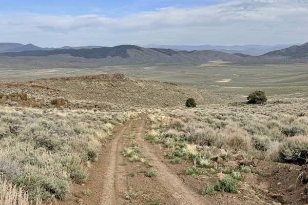
Willow Creek Loop (FS43493)
The Willow Creek Loop is an exceptionally scenic high-altitude route that traverses the crest of the Toiyabe Range, cutting over a dramatic mountain pass. This trail takes you through expansive alpine meadows dominated by mountain scrub and sagebrush, offering a stark, rugged beauty. The primary dra...
Learn more about Willow Creek Loop (FS43493)
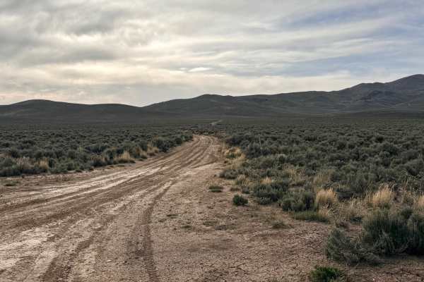
Emigrant Canyon - FS 43222
Emigrant Canyon is a historic and scenic passage that crests at Emigrant Pass (elevation 7,182 feet). This trail is a significant segment of the Emigrant Trails West network, offering modern explorers a chance to trace the exact path taken by pioneers during the 19th century. As you reach the summit...
Learn more about Emigrant Canyon - FS 43222
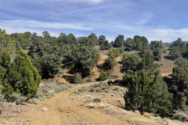
North Silver King Mine - FS 43182
North Silver King Mine - FS 43182 is a secluded out-and-back trail that takes you deep into the heart of the historic mining landscape just north of Austin. While the route initially appears to connect through to the Old Highway trail, it ultimately terminates at a massive, towering tailings pile at...
Learn more about North Silver King Mine - FS 43182
ATV trails near Crescent Valley, Nevada
Explore ATV-friendly trails near you. These trails are accessible for vehicles up to 50 inches wide, perfect for ATVs and smaller off-road machines.
Adobe Heights Bypass
Adobe Heights Bypass is an easy trail that connects Mountain City Highway to North 5th Street in Elko, NV. This trail starts as a maintained gravel road and turns into an unmaintained dirt trail. The unmaintained section has some uneven areas with small ruts, but nothing crazy. You will follow power...
Learn more about Adobe Heights Bypass
North 5th Street
North 5th Street is a maintained gravel road that is a little bumpy and washboard in areas. This trail travels North from Elko, Nevada, and ends at a small ski area with a small chairlift and rope tow. You will travel through the rolling hills of the high desert, which are covered with sagebrush and...
Learn more about North 5th Street
North 5th Street Side Connector
This fun side trail is just over 3 miles long, starting and ending on North 5th Street. The more southern section of this trail is fairly pretty with some small rocky and rutted areas. As you return to North 5th Street, this trail will have fun hill climbs and falls. This area will have a few minor ...
Learn more about North 5th Street Side Connector
North Last Chance Road
North Last Chance Road is a well-maintained gravel road. You will pass alongside residential areas, accompanied by ranch lands. Some places can be a little washboard and dusty. There is a good possibility you will see other rigs on this trail, so keep your eyes up.
Learn more about North Last Chance Road
UTV/side-by-side trails near Crescent Valley, Nevada
Find UTV and side-by-side trails near you. These trails accommodate vehicles up to 60 inches wide, ideal for UTVs, side-by-sides, and wider off-road rigs.
Adobe Heights Bypass
Adobe Heights Bypass is an easy trail that connects Mountain City Highway to North 5th Street in Elko, NV. This trail starts as a maintained gravel road and turns into an unmaintained dirt trail. The unmaintained section has some uneven areas with small ruts, but nothing crazy. You will follow power...
Learn more about Adobe Heights Bypass
North 5th Street
North 5th Street is a maintained gravel road that is a little bumpy and washboard in areas. This trail travels North from Elko, Nevada, and ends at a small ski area with a small chairlift and rope tow. You will travel through the rolling hills of the high desert, which are covered with sagebrush and...
Learn more about North 5th Street
North 5th Street Side Connector
This fun side trail is just over 3 miles long, starting and ending on North 5th Street. The more southern section of this trail is fairly pretty with some small rocky and rutted areas. As you return to North 5th Street, this trail will have fun hill climbs and falls. This area will have a few minor ...
Learn more about North 5th Street Side Connector
North Last Chance Road
North Last Chance Road is a well-maintained gravel road. You will pass alongside residential areas, accompanied by ranch lands. Some places can be a little washboard and dusty. There is a good possibility you will see other rigs on this trail, so keep your eyes up.
Learn more about North Last Chance Road
The onX Offroad Difference
onX Offroad combines trail photos, descriptions, difficulty ratings, width restrictions, seasonality, and more in a user-friendly interface. Available on all devices, with offline access and full compatibility with CarPlay and Android Auto. Discover what you're missing today!
Open Trail Map