
Dirt Bike Trails
Near Crawfordville, Florida
Explore All Dirt Bike Trails Near Crawfordville, Florida
Dirt Bike Trails Near Crawfordville, Florida
Discover the best dirt bike trails near you. Browse trail maps, check difficulty ratings, and find your next adventure — whether you're looking for a quick ride or an all-day expedition.
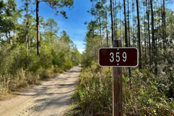
Forest Road 359
Forest Road 359 winds through a tight canopy of trees, offering a shaded and immersive ride deep into the Florida forest. The trail is dotted with large potholes and mud holes that can become especially challenging during the wet season--making for a fun, technical drive with plenty of character. Nu...
Learn more about Forest Road 359
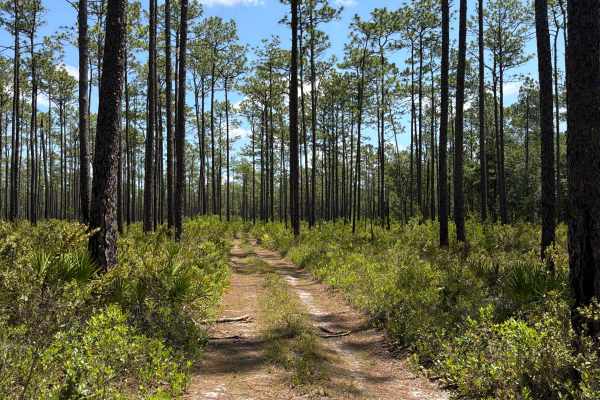
FS 313C
Forest Road 313C connects Powerline - FS 312F at the west end and the Cow House Bay at the east end. It takes you through the northeast part of the Apalachicola National Forest along the Cow Swamp. The road conditions are a mixture of packed sand, loose sand, and some deep holes that can turn into 2...
Learn more about FS 313C
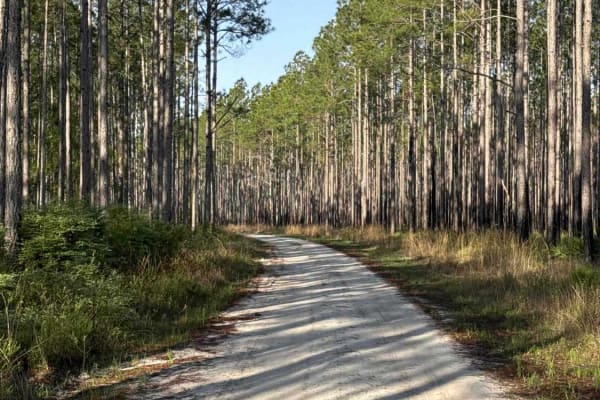
Ashmore - Apalachicola FR 321
The Ashmore Trail, also known as Apalachicola National Forest Road 321, connects US 319 at the south end and US 319 at the north end. It takes you through the eastern part of the Apalachicola National Forest and gives you access to several OHV trails. The road conditions are a mixture of packed sand...
Learn more about Ashmore - Apalachicola FR 321
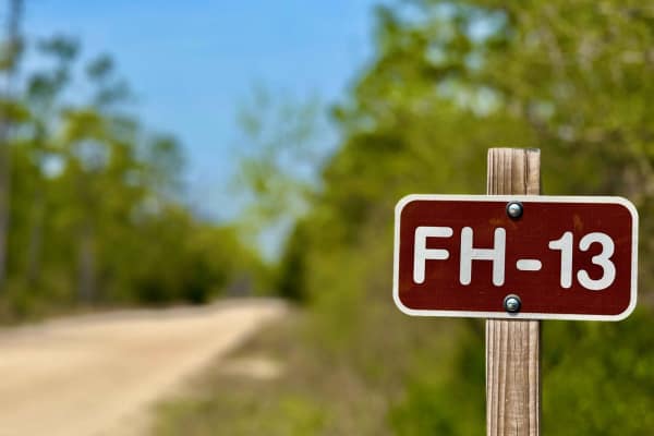
Forest Highway 13
Forest Highway 13 is a well-traveled, wide forest service road that serves as a primary route through the heart of the forest. With a generally smooth and sandy surface, it offers easy access for most vehicles and acts as a backbone connecting numerous side trails, campsites, and deeper off-grid are...
Learn more about Forest Highway 13
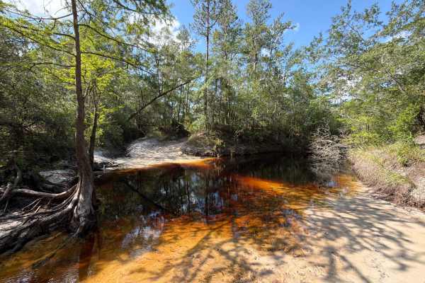
FS 312D
Forest Road 312D connects Powerline (312F) at the south end and the Ranger trail at the north end. It takes you through the northeast part of the Apalachicola National Forest along the Cow Swamp and gives you access to Lost Creek, including a creek crossing. It is definitely one of the more technica...
Learn more about FS 312D
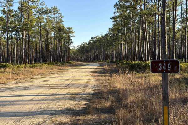
Little Hammock - FS 348
Little Hammock, also known as Apalachicola National Forest Road 348, connects Brown House at the north end and Sopchoppy at the south end. It's a more than 10-mile-long trail that takes you through the north-east part of the Apalachicola National Forest and gives you access to several trails surroun...
Learn more about Little Hammock - FS 348
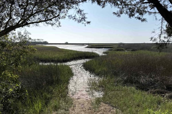
Purify Bay Road
The Purify Bay Road takes you through the western part of the St. Marks National Wildlife Refuge and gives you access to the Purify Creek Park that offers several paddling trails. The road conditions are a mixture of packed sand, loose sand, some deep holes, and ditches that can turn into 2-foot dee...
Learn more about Purify Bay Road
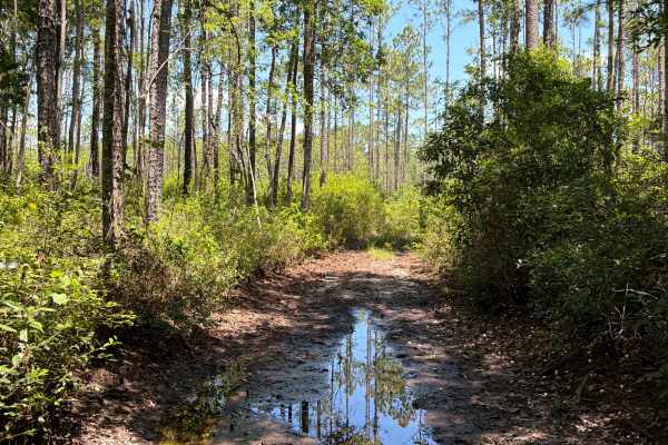
FS 312S
Forest Road 312S connects FS 313C at the south end and the Ranger trail at the north end. It takes you through the northeast part of the Apalachicola National Forest along the Cow Swamp. The road conditions are a mixture of packed sand, loose sand, and some deep holes that can turn into 2-foot-deep ...
Learn more about FS 312S
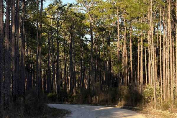
Lawhorn Bay - FS 357
Lawhorn Bay, also known as Apalachicola National Forest Road 357, connects Sopchoppy at the west end and Lawhorn Mill Road at the east end. It takes you through the north-east part of the Apalachicola National Forest and gives you access to several trails in the area. The road conditions are a mixtu...
Learn more about Lawhorn Bay - FS 357
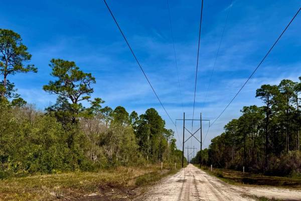
FS 394
Powerline Trail offers a unique route through the forest, following utility corridors with open views and wide sandy stretches. During the time of mapping, there was ongoing construction on the latter half of the trail due to severe weather impacts and a road blowout, which may affect accessibility....
Learn more about FS 394
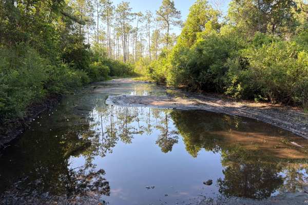
Maige Branch - FS 313B
Maige Branch, also known as Apalachicola National Forest Road 313B, connects Cow House Bay at the north end and the Ranger trail at the south end. It takes you through the northeast part of the Apalachicola National Forest along the Cow Swamp and gives you access to a few OHV and Off-road trails. It...
Learn more about Maige Branch - FS 313B
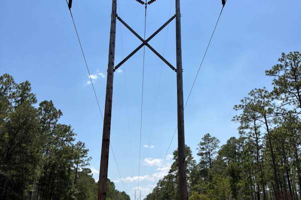
Powerline - FS 365J
Forest Road 365J connects Little Hammock at the north end and Sopchoppy at the south end. It takes you through the northeast part of the Apalachicola National Forest along the Power Lines. The road conditions are a mixture of packed sand, loose sand, and some deep holes that can turn into 2-foot-dee...
Learn more about Powerline - FS 365J
Sopchoppy Branch - FS 349
Sopchoppy Branch, also known as Apalachicola National Forest Road 349, connects Little Hammock at the north end and Sopchoppy at the south end. It takes you through the north-east part of the Apalachicola National Forest and gives you access to several trails in the area. The road conditions are a m...
Learn more about Sopchoppy Branch - FS 349
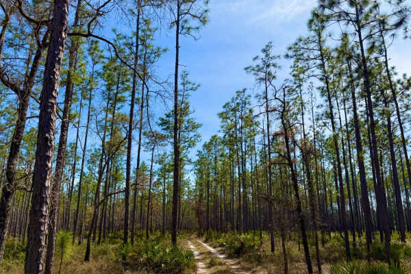
FS-350-B
This trail transforms when dry, feeling like an entirely different experience--almost three times as fast and fun. Winding deep into the heart of the forest, it gives off a unique mix of Baja, California, and Florida vibes, with its wide-open sandy stretches and rugged beauty. Much drier than surrou...
Learn more about FS-350-B
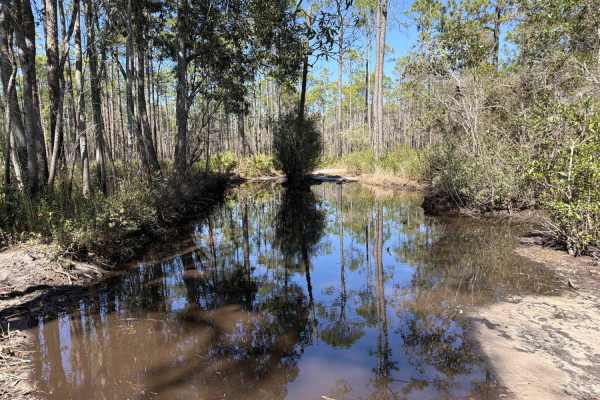
Ditch Bay - FS 351
Ditch Bay, also known as Apalachicola National Forest Road 351, connects Forest Highway 13 at the north end and Little Hammock at the south end. It takes you through the north-east part of the Apalachicola National Forest and gives you access to several OHV trails surrounding the Bradwell Bay Wilder...
Learn more about Ditch Bay - FS 351
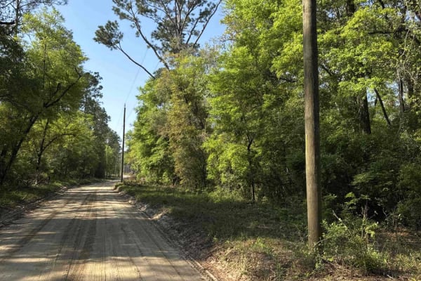
Bostic Pelt-Lawhorn Mill - Apalachicola FR 356
The Bostic Pelt-Lawhorn Mill Trail, also known as Apalachicola National Forest Road 356, connects US 319 at the south end and Lawhorn Mill Road at the north end. It takes you through the eastern part of the Apalachicola National Forest and gives you access to the Wakulla Equestrian Center. The road ...
Learn more about Bostic Pelt-Lawhorn Mill - Apalachicola FR 356
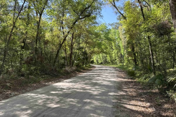
Wakulla Beach
The Wakulla Beach Road takes you through the western part of the St. Marks National Wildlife Refuge and gives you access to the Wakulla Beach, part of the Goose Creek Bay. The road conditions are a mixture of packed sand, loose sand, some deep holes, and ditches that can turn into 2-foot deep mud ho...
Learn more about Wakulla Beach
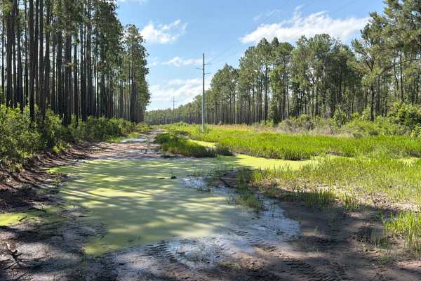
Powerline - FS 312F
The Powerline Forest Road 312F connects Ranger Trail at the north end and Forest Highway 13 at the south end. It takes you through the northeast part of the Apalachicola National Forest along the Power Line and gives you access to several OHV and Off-road trails. It is definitely one of the most tec...
Learn more about Powerline - FS 312F
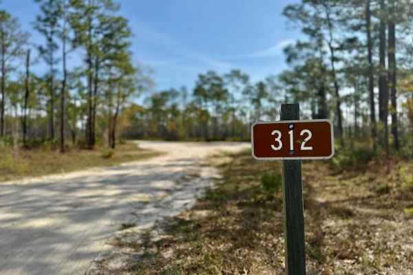
Ranger Trail - FS 312
Ranger Trail is a fairly straightforward and enjoyable forest track, ideal for a casual ride with just enough variety to keep things interesting. The trail features a few small bridges and a mostly sandy base, making for a smooth and manageable route in dry conditions. However, after rain, several d...
Learn more about Ranger Trail - FS 312
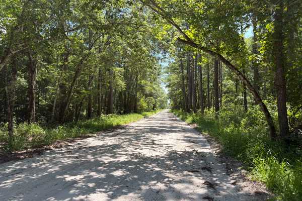
Stephen C Revell Road - FS 343
Stephen C Revell Road, also known as Apalachicola National Forest Road 343, connects Sopchoppy at the north end and Greenough Road at the south end. It takes you through the northeast part of the Apalachicola National Forest and gives you access to the Florida Scenic Trail. The road conditions are a...
Learn more about Stephen C Revell Road - FS 343
ATV trails near Crawfordville, Florida
Explore ATV-friendly trails near you. These trails are accessible for vehicles up to 50 inches wide, perfect for ATVs and smaller off-road machines.
Forest Road 359
Forest Road 359 winds through a tight canopy of trees, offering a shaded and immersive ride deep into the Florida forest. The trail is dotted with large potholes and mud holes that can become especially challenging during the wet season--making for a fun, technical drive with plenty of character. Nu...
Learn more about Forest Road 359
FS 313C
Forest Road 313C connects Powerline - FS 312F at the west end and the Cow House Bay at the east end. It takes you through the northeast part of the Apalachicola National Forest along the Cow Swamp. The road conditions are a mixture of packed sand, loose sand, and some deep holes that can turn into 2...
Learn more about FS 313C
Ashmore - Apalachicola FR 321
The Ashmore Trail, also known as Apalachicola National Forest Road 321, connects US 319 at the south end and US 319 at the north end. It takes you through the eastern part of the Apalachicola National Forest and gives you access to several OHV trails. The road conditions are a mixture of packed sand...
Learn more about Ashmore - Apalachicola FR 321
Forest Highway 13
Forest Highway 13 is a well-traveled, wide forest service road that serves as a primary route through the heart of the forest. With a generally smooth and sandy surface, it offers easy access for most vehicles and acts as a backbone connecting numerous side trails, campsites, and deeper off-grid are...
Learn more about Forest Highway 13
UTV/side-by-side trails near Crawfordville, Florida
Find UTV and side-by-side trails near you. These trails accommodate vehicles up to 60 inches wide, ideal for UTVs, side-by-sides, and wider off-road rigs.
Forest Road 359
Forest Road 359 winds through a tight canopy of trees, offering a shaded and immersive ride deep into the Florida forest. The trail is dotted with large potholes and mud holes that can become especially challenging during the wet season--making for a fun, technical drive with plenty of character. Nu...
Learn more about Forest Road 359
FS 313C
Forest Road 313C connects Powerline - FS 312F at the west end and the Cow House Bay at the east end. It takes you through the northeast part of the Apalachicola National Forest along the Cow Swamp. The road conditions are a mixture of packed sand, loose sand, and some deep holes that can turn into 2...
Learn more about FS 313C
Ashmore - Apalachicola FR 321
The Ashmore Trail, also known as Apalachicola National Forest Road 321, connects US 319 at the south end and US 319 at the north end. It takes you through the eastern part of the Apalachicola National Forest and gives you access to several OHV trails. The road conditions are a mixture of packed sand...
Learn more about Ashmore - Apalachicola FR 321
Forest Highway 13
Forest Highway 13 is a well-traveled, wide forest service road that serves as a primary route through the heart of the forest. With a generally smooth and sandy surface, it offers easy access for most vehicles and acts as a backbone connecting numerous side trails, campsites, and deeper off-grid are...
Learn more about Forest Highway 13
The onX Offroad Difference
onX Offroad combines trail photos, descriptions, difficulty ratings, width restrictions, seasonality, and more in a user-friendly interface. Available on all devices, with offline access and full compatibility with CarPlay and Android Auto. Discover what you're missing today!
Open Trail Map