
Dirt Bike Trails
Near Cornville, Arizona
Explore All Dirt Bike Trails Near Cornville, Arizona
Dirt Bike Trails Near Cornville, Arizona
Discover the best dirt bike trails near you. Browse trail maps, check difficulty ratings, and find your next adventure — whether you're looking for a quick ride or an all-day expedition.
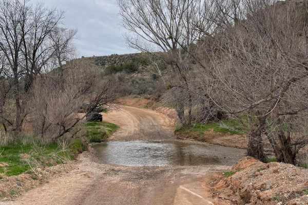
Lower Oak Creek Access #1
This 4-mile-long trail is laid back and a maintained dirt road. There is camping at the beginning of this trail that is on State Land. Be aware that you need a permit to camp on State Land in Arizona. The rest of the trip is on National Forest land with restrictions on camping. There are two water c...
Learn more about Lower Oak Creek Access #1
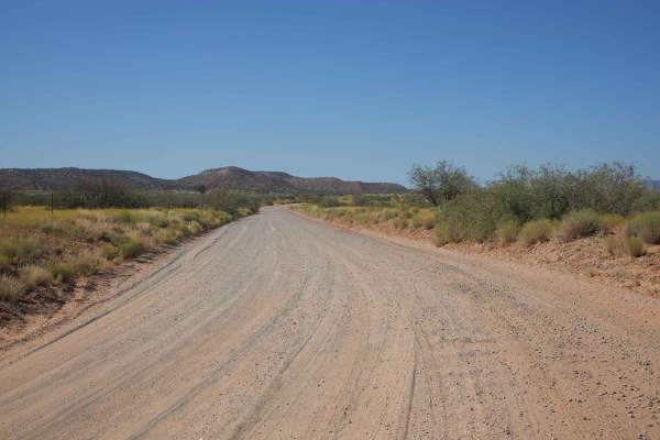
Bill Gray View
The Bill Gray View trail is a wide and graded gravel road that moves through the Coconino National Forest. Popular with campers, this road is well traveled by remote residents as well, so be aware of traffic. The road rolls gently, providing views of the beautiful Arizona Red Rock to the East. The l...
Learn more about Bill Gray View
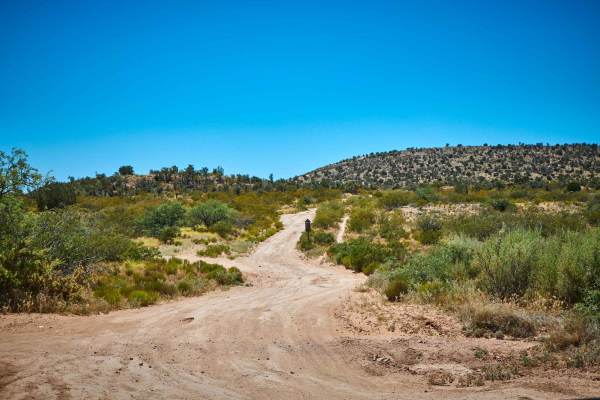
Camber Collusion
Camber Collusion is a track that has a few tricks hidden away. Shaped by water and wind, the trail puts your vehicle into a near constant stretch and flex with its continual runoff crossings and washouts. Further to the south, you'll dip into and out of washes with steep entrances and exits, with nu...
Learn more about Camber Collusion
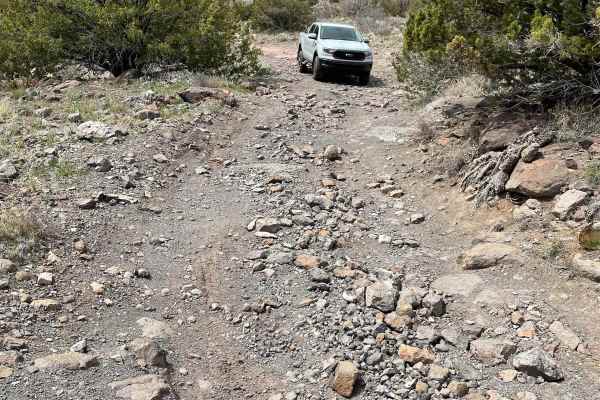
Lower Oak Creek Access #2
This trail will be easy to drive most of the way until you start to fall in elevation toward Oak Creek. The road deteriorates quickly, with several ledges of rock outcroppings right next to switchbacks. High clearance and 4-low with lockers are needed to make it back out of this canyon. Airing tires...
Learn more about Lower Oak Creek Access #2
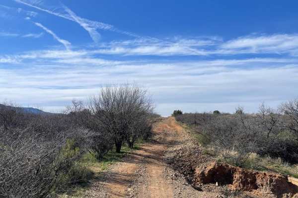
Side by Side Bypass
This trail is a natural gas pipeline road. The first part is an easy section of rolling hills then starts to get rough and eroded when going down into the first wash. The road becomes covered with ruts, loose rock, and uneven dirt. The second wash crossing has a huge washout right next to the trail ...
Learn more about Side by Side Bypass
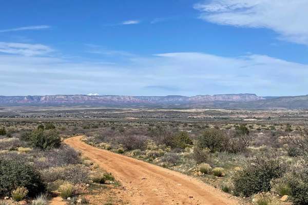
Road to the Mountain's Foot
Measuring just shy of 5 miles, this trail takes you from the lower elevation desert to the base of the Black Hills. The first part of this trail is a dirt road with small rock gardens here and there. After the first section, there is a long straightaway that becomes a mixture of small rock gardens, ...
Learn more about Road to the Mountain's Foot
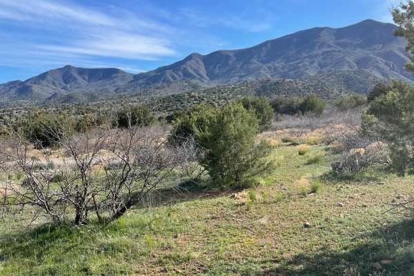
Quail Spring
Quail Spring is a short 2.5-mile road that is occasionally maintained. This road is washboarded in lots of areas and can be dusty at times. The road turns slightly to the right as you get close to the end of the road. The ending point of this trail is a parking area for a hiking trail called Black C...
Learn more about Quail Spring
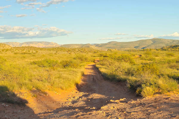
Sheepshead Trail - FS 9541
This almost 3-mile trail navigates through the Coconino National Forest with beautiful views all around, connecting Bill Gray View (FS 761) and FS 9571. This trail is marked as FS 9541 and has a few places that could be difficult to traverse in a 2WD vehicle; 4WD is recommended. This trail could pro...
Learn more about Sheepshead Trail - FS 9541
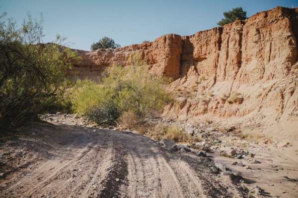
Cottonwood Loop #509
The Cottonwood Loop is a 7-mile ATV trail accessed from Hayfield Draw. From the east end, it starts off of Forest Service Road 9604C at an unmarked right turn that looks like a full-width road. You'll see the first trail sign when the trail crosses a sandy wash for the first time, and then it is mor...
Learn more about Cottonwood Loop #509
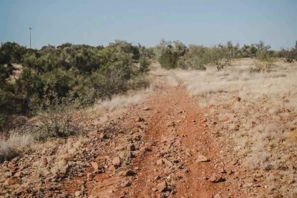
Crucifixion #9703
Crucifixion is a desert two-track for vehicles 50 inches wide or less, accessed directly from the Hayfield Draw OHV staging area. The trail is a decent width for ATVs, even though it looks mostly ridden by dirt bikes. It's full of big loose rocks in the trail at times, but also has many sections tha...
Learn more about Crucifixion #9703
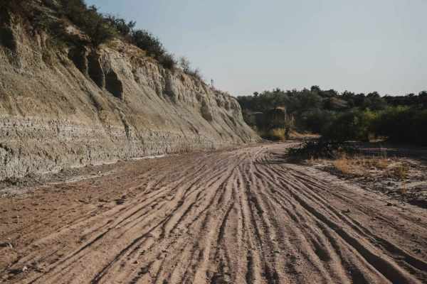
Sand Wash #527
The Sand Wash Trail is an easy sand wash for the entire 4.5 miles. The wash has small loose bits of gravel in the wash but no big rocks. It's easy to ride, with the harder parts being some tighter curves and sections of deeper sand. However, the wash has lots of unmarked splits, so following a GPS t...
Learn more about Sand Wash #527
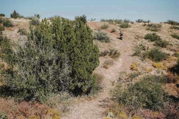
Camp Verde Trail #545 (North)
Camp Verde Trail in total is a long 13-mile 50-inch trail in the Black Hills of Prescott National Forest near Camp Verde, Arizona. The north segment is a 10.7-mile stretch connecting the Copper Canyon and Hayfield Draw trailheads. The entire north segment is easy and rideable by a 50-inch ATV. It's ...
Learn more about Camp Verde Trail #545 (North)
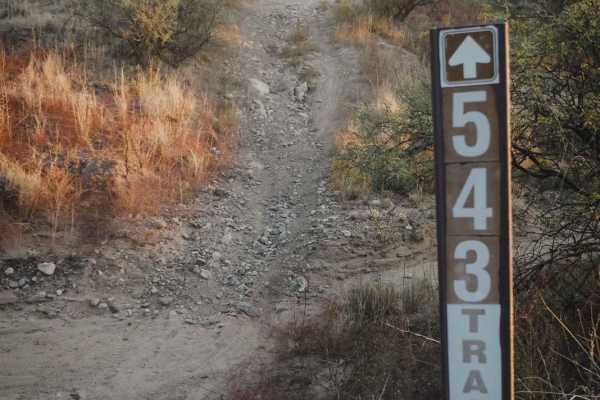
Grapevine #543
Grapevine is a 50-inch trail in the Hayfield Draw OHV area near Camp Verde, Arizona, and is one of the first trails accessed from the staging area. This trail heads south from the parking lot, paralleling the Camp Verde Trail. Although it's a 50-inch trail, it looks mostly used by dirt bikers, since...
Learn more about Grapevine #543
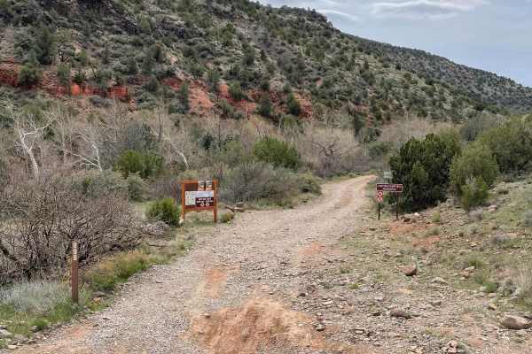
Lower Oak Creek Access #3
This trail is mostly a maintained dirt road except for the last part that hugs Oak Creek. There are several designated camping sites along this trail. The trail becomes covered with river rock once you start traveling next to Oak Creek. There are several places to pull over when you are next to Oak ...
Learn more about Lower Oak Creek Access #3
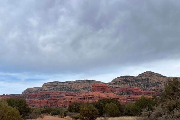
525 to 795 Palatki Heritage Site
This well-maintained road takes you through the Red Rock District of the Coconino National Forest. Starting on FS Road 525, it turns onto FS Road 795 which leads you to the Palatki Heritage Site. This historical site has ancient ruins and well-preserved petroglyphs. Most 2WD vehicles can travel this...
Learn more about 525 to 795 Palatki Heritage Site
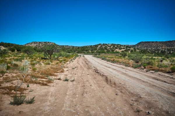
Uphill Slog
The Uphill Slog Trail is a challenging rock track that almost immediately starts into a steep, long, rocky climb. With washouts and erosion, you'll have to take it slow, and choose lines wisely as it's evident that this trail is shaped and reshaped by the running waters of Arizona's monsoons. Sneaky...
Learn more about Uphill Slog
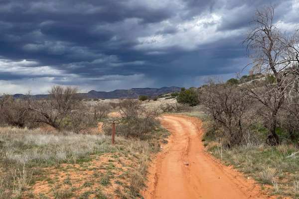
Ranch Loop OHV
This OHV trail clocks in right at 8 miles long and provides beautiful views of Sedona on the north end. This is a very popular trail and you are almost guaranteed to see others driving/riding. The route has many different surfaces, ranging from dirt, sand, rock, and gravel. The sandy areas are not d...
Learn more about Ranch Loop OHV
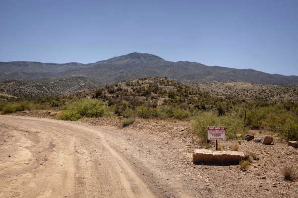
Mingus Mountain
Mingus Mountain is a rugged, unmaintained shelf road climbing 16 miles from Cottonwood to the 7,545-foot summit. Gaining over 4,400 feet with grades up to 24 degrees, this narrow trail features tight switchbacks, exposed cliffs, and no turnout zones. High-clearance, short-wheelbase vehicles are reco...
Learn more about Mingus Mountain
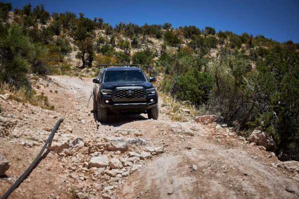
Ledge Pipe Climb
The Ledge Pipe Climb Trail is intense either way you run it. With large campsites at each end, this area is a popular spot for offroad enthusiasts. From the South end, you'll bob and weave through the creosote and underbrush toward the most itimidating obstacles on the trail - a series of uphill cli...
Learn more about Ledge Pipe Climb
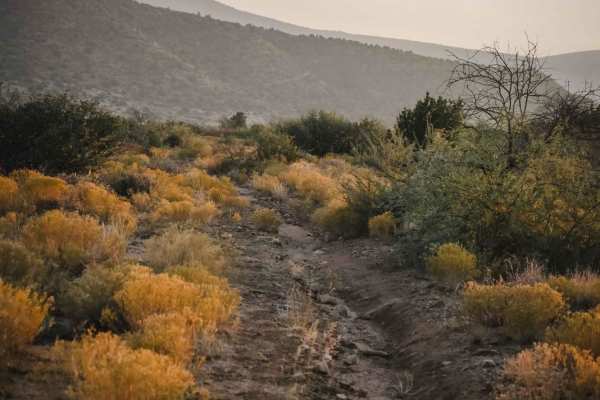
Underhill #528
Underhill is a 50-inch trail in the Hayfield Draw OHV area that goes through a rolling desert terrain in the Sonoran Desert, around 3,600 feet in elevation. This one is fun for dirt bikes because it is narrower in spots, almost like a single track. It goes west from the intersection with Camp Verde ...
Learn more about Underhill #528
ATV trails near Cornville, Arizona
Explore ATV-friendly trails near you. These trails are accessible for vehicles up to 50 inches wide, perfect for ATVs and smaller off-road machines.
Lower Oak Creek Access #1
This 4-mile-long trail is laid back and a maintained dirt road. There is camping at the beginning of this trail that is on State Land. Be aware that you need a permit to camp on State Land in Arizona. The rest of the trip is on National Forest land with restrictions on camping. There are two water c...
Learn more about Lower Oak Creek Access #1
Bill Gray View
The Bill Gray View trail is a wide and graded gravel road that moves through the Coconino National Forest. Popular with campers, this road is well traveled by remote residents as well, so be aware of traffic. The road rolls gently, providing views of the beautiful Arizona Red Rock to the East. The l...
Learn more about Bill Gray View
Camber Collusion
Camber Collusion is a track that has a few tricks hidden away. Shaped by water and wind, the trail puts your vehicle into a near constant stretch and flex with its continual runoff crossings and washouts. Further to the south, you'll dip into and out of washes with steep entrances and exits, with nu...
Learn more about Camber Collusion
Lower Oak Creek Access #2
This trail will be easy to drive most of the way until you start to fall in elevation toward Oak Creek. The road deteriorates quickly, with several ledges of rock outcroppings right next to switchbacks. High clearance and 4-low with lockers are needed to make it back out of this canyon. Airing tires...
Learn more about Lower Oak Creek Access #2
UTV/side-by-side trails near Cornville, Arizona
Find UTV and side-by-side trails near you. These trails accommodate vehicles up to 60 inches wide, ideal for UTVs, side-by-sides, and wider off-road rigs.
Lower Oak Creek Access #1
This 4-mile-long trail is laid back and a maintained dirt road. There is camping at the beginning of this trail that is on State Land. Be aware that you need a permit to camp on State Land in Arizona. The rest of the trip is on National Forest land with restrictions on camping. There are two water c...
Learn more about Lower Oak Creek Access #1
Bill Gray View
The Bill Gray View trail is a wide and graded gravel road that moves through the Coconino National Forest. Popular with campers, this road is well traveled by remote residents as well, so be aware of traffic. The road rolls gently, providing views of the beautiful Arizona Red Rock to the East. The l...
Learn more about Bill Gray View
Camber Collusion
Camber Collusion is a track that has a few tricks hidden away. Shaped by water and wind, the trail puts your vehicle into a near constant stretch and flex with its continual runoff crossings and washouts. Further to the south, you'll dip into and out of washes with steep entrances and exits, with nu...
Learn more about Camber Collusion
Lower Oak Creek Access #2
This trail will be easy to drive most of the way until you start to fall in elevation toward Oak Creek. The road deteriorates quickly, with several ledges of rock outcroppings right next to switchbacks. High clearance and 4-low with lockers are needed to make it back out of this canyon. Airing tires...
Learn more about Lower Oak Creek Access #2
The onX Offroad Difference
onX Offroad combines trail photos, descriptions, difficulty ratings, width restrictions, seasonality, and more in a user-friendly interface. Available on all devices, with offline access and full compatibility with CarPlay and Android Auto. Discover what you're missing today!
Open Trail Map