
Dirt Bike Trails
Near Cedar Slope, California
Explore All Dirt Bike Trails Near Cedar Slope, California
Dirt Bike Trails Near Cedar Slope, California
Discover the best dirt bike trails near you. Browse trail maps, check difficulty ratings, and find your next adventure — whether you're looking for a quick ride or an all-day expedition.
Mule Peak South - FS 22S03
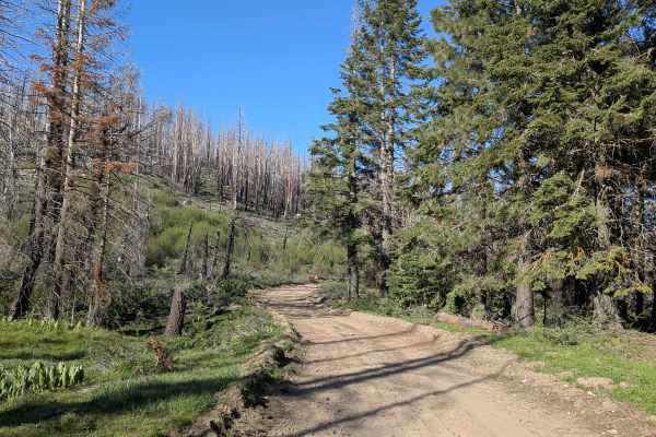
Mule Peak South FS 22S03 begins off Highway M90, where the first 1.25 miles have been graded and covered with gravel by the Forest Service to improve drainage and traction. Beyond that, the surface transitions to hard-packed dirt with muddy spots in sections. The trail winds through tall pine trees ...
Learn more about Mule Peak South - FS 22S03
Redwood Meadow - FS 22S13
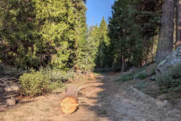
Redwood Meadow FS 22S13 departs from Highway M90 and drops nearly 300 feet over just over a mile, serving as a connector trail to the Long Meadow Campground Loop. The trail cuts through a couple of small creek crossings and passes through an area with active tree cleanup underway following the 2016 ...
Learn more about Redwood Meadow - FS 22S13
Forks - FS 23S62
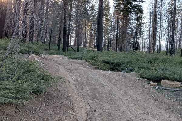
Forks FS 23S62 branches off Parker Forks and climbs aggressively through Sequoia National Forest pine trees before transitioning onto a shelf road with a deep embankment dropping hundreds of feet to the valley floor below. Evidence of the 2021 Windy Fire is visible throughout. Note that the final th...
Learn more about Forks - FS 23S62
Parker Forks - FS 22S18
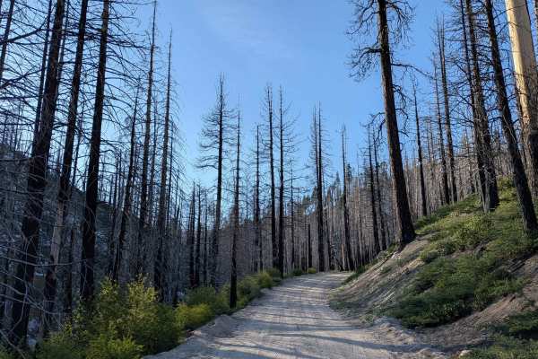
Parker Forks FS 22S18 departs from the Great Western Divide Highway and follows Parker Meadow Creek through Sequoia National Forest to a nice meadow at the trail's end. The mixed surface of sand, dirt, and ash is a direct reflection of the heavy impact of the 2021 Windy Fire, evidence of which is vi...
Learn more about Parker Forks - FS 22S18
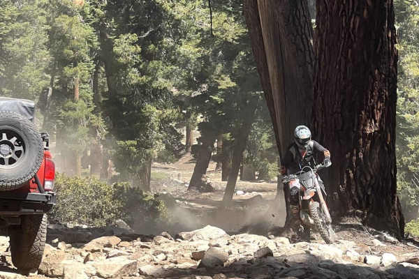
Old Sherman Pass 4x4 Jeep Trail - Continued
Located in the Sequoia National Forest, the trail is a very narrow and rocky trail. The potential for creek crossing and snow patches. However, it has beautiful scenery of forest and mountain views. Please be aware there can be dirt bikers on this trail. If driving a full-size truck there is a risk ...
Learn more about Old Sherman Pass 4x4 Jeep Trail - Continued
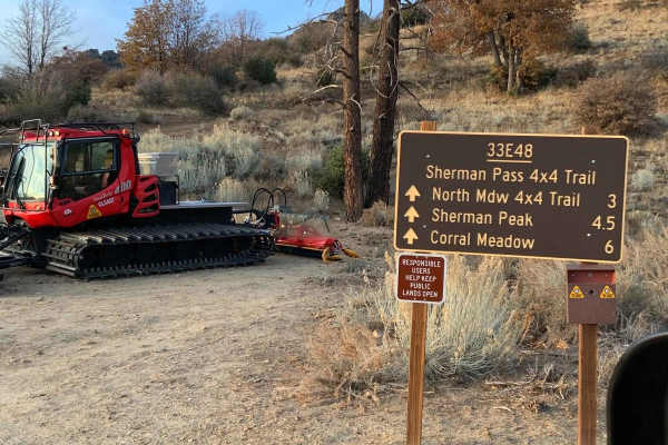
Sherman Pass 4x4 Jeep Trail
This trail is open year-round. It is a typical Sierra dirt-type trail with some rutting and snow left from previous years. The drive to the trailhead is easy, and coming from the west via Kernville and Lake Isabella, allows views of the Kern River and its canyon.
Learn more about Sherman Pass 4x4 Jeep Trail
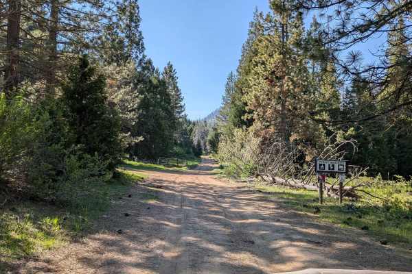
Horse Meadow Creek - FS 22S04
Horse Meadow Creek FS 22S04 departs from Highway M504 and cuts through a large pine forest within Sequoia National Forest, reaching Horse Meadow a couple of miles in. The meadow provides a natural destination and a pleasant open contrast to the dense pine forest along the approach. Dispersed camping...
Learn more about Horse Meadow Creek - FS 22S04
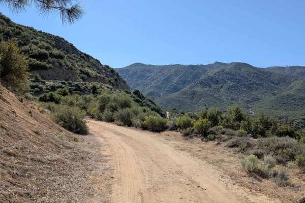
Rincon - FS 22S51
Rincon FS 22S51 runs parallel to Sherman Pass Road, rolling up and down dirt hills with dramatic views of the canyon below and surrounding mountains, including Brush Creek and Brush Creek Falls. The trail eventually drops into the valley, where additional trails branch off for further exploration, a...
Learn more about Rincon - FS 22S51
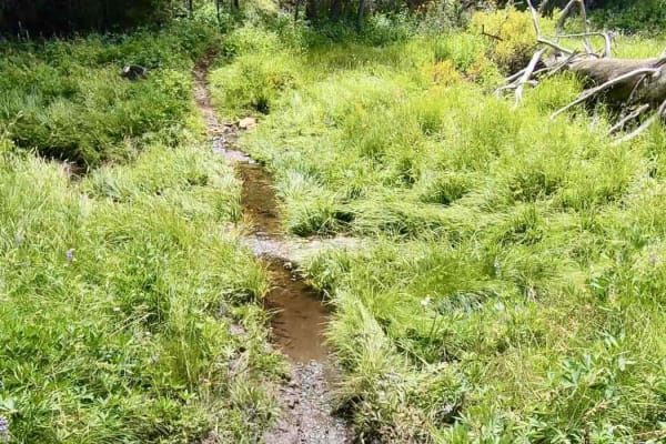
Sherman Pass
There are a couple of water crossings but the rocks aren't bad under them. Trees are down all over the area, so expect to hop some logs. This trail has quite the elevation change with a lot of big rocks to deal with and big roots as well. The view at the top is well worth it.
Learn more about Sherman Pass
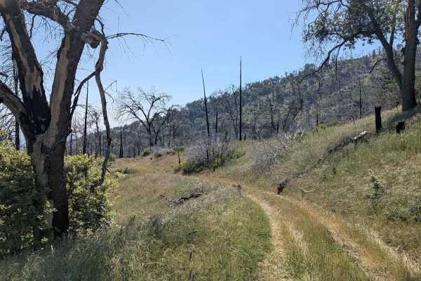
Starvation Creek - FS 23S65
Starvation Creek FS 23S65 winds through rolling hills within Sequoia National Forest through what was once a mature forest, now heavily impacted by the 2021 Windy Fire. Most of the trees along the route are burned, giving the landscape an open and stark character. Overgrown grass has taken over much...
Learn more about Starvation Creek - FS 23S65
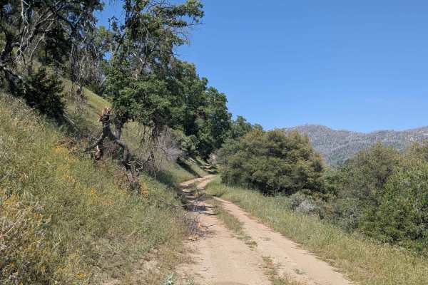
Chute Springs - FS 23S68
Chute Springs FS 23S68 departs from Highway M504 and runs along a shelf road high above the valley and canyon below through Sequoia National Forest. The trail is lined with oak and pine trees, green grass, and other bushes, with overgrown grass encroaching on the trail in sections. Evidence of the 2...
Learn more about Chute Springs - FS 23S68
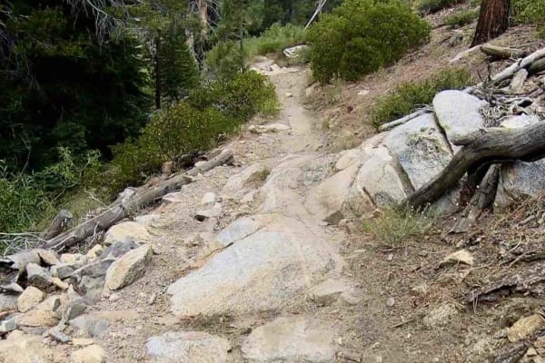
Beach Trail
Beach Meadow pretty much has it all. There are a lot of water crossings through Rattlesnake Creek, some fairly decent elevation changes with some off-camber rocky sections, and a big rock section on the mountainside that is very tricky. Trees are down everywhere and cut through the single-track trai...
Learn more about Beach Trail
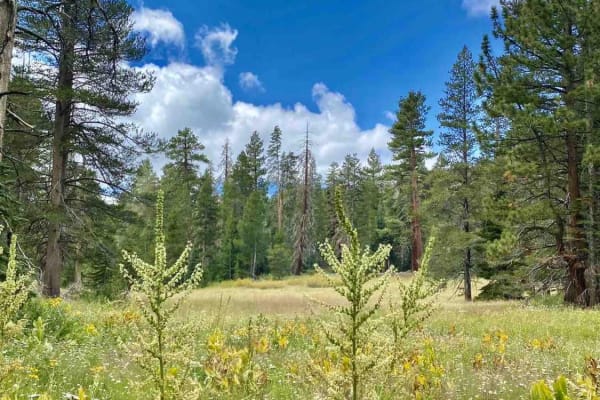
Boone Meadow
This trail has some great meadows and standard rock sections with some sand mixed in for good times. Trees cut around the trail everywhere, as usual. A very fun scenic trail, perfect for a good break, it has your usual off-camber elevation changes to expect with some mud here and there.
Learn more about Boone Meadow
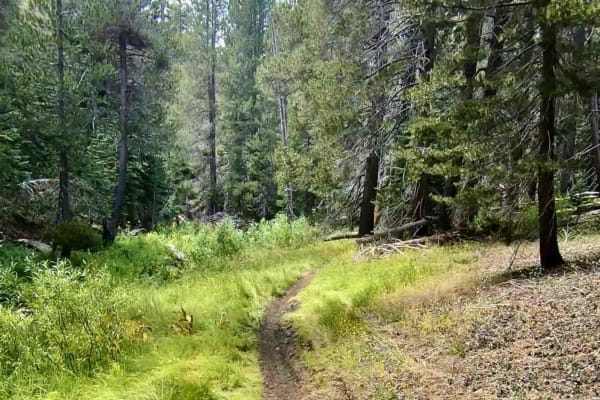
Trout Creek Trail
A nice trail that runs along Trout Creek. You will find a few creek crossings and rocks--it's not bad, but a lot of fun. As usual, there are a lot of trees down in the area, but they do a good job of keeping the trail clear. Stay alert.
Learn more about Trout Creek Trail
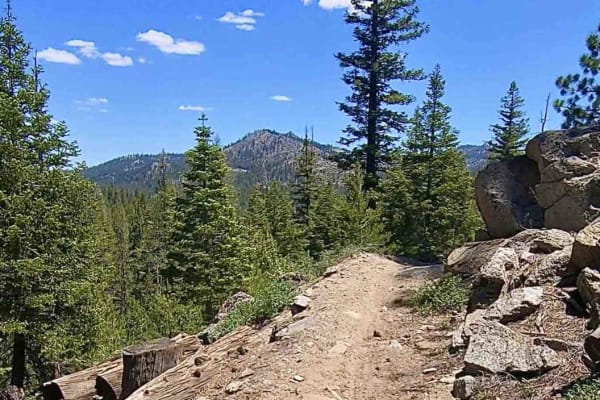
Beach Ridge Trail
This is another fun scenic single track that comes equipped with a couple of rock sections and some sand. There are a couple of creek crossings, one of which could get a little spicy with the runoff from the snowmelt. Overall, it's a great trail to hit from the nearby campground.
Learn more about Beach Ridge Trail
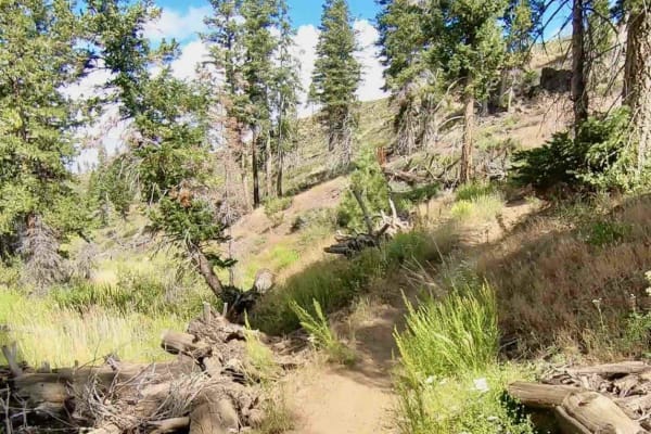
Rattlesnake Creek
This single-track trail winds through the creek, so there will be several water crossings. Like the entire area, there are cut logs, so keep your toes in. There are some off-camber good times to be had, but this trail isn't too difficult. It's very fun.
Learn more about Rattlesnake Creek
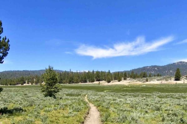
Granit/Broder
This trail crosses through a couple of really nice meadows with water. It has some sand sections and a couple of nice rock sections as well. There are trees down everywhere but they are cut around the trail. The usual forest single-track conditions can be expected. This is a very fun trail.
Learn more about Granit/Broder
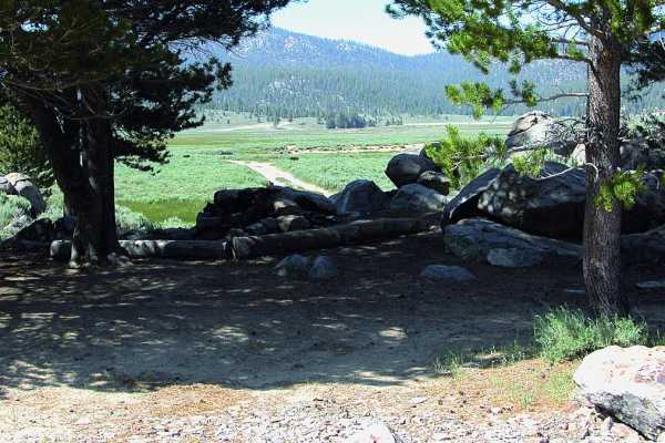
Monache Meadows
Monache Meadows is a scenic, remote off-highway haven perfect for high-clearance four-wheel-drive vehicles, offering access to one of the largest meadows in the Sierra Nevada. This 9-mile route weaves through a high-elevation valley situated between 7,800 and 8,600 feet, surrounded by pristine wilde...
Learn more about Monache Meadows
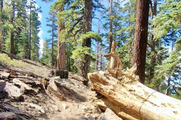
Mahogany
Mahogany has a lot of off-camber sections. Some rock sections aren't too bad, but there's a possible water crossing on the trail to be aware of. It's a fairly moderate single track with some great elevation changes, so there is a nice uphill section. There are great views here.
Learn more about Mahogany
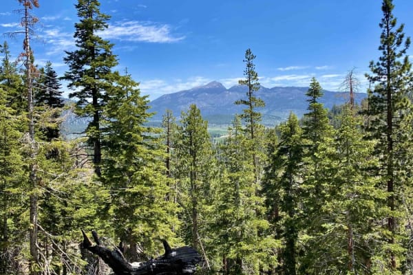
Jackass Peak
This single-track trail has a lot of off-camber sections with mostly embedded rocks. There are plenty of roots and cut logs to squeeze through. It has some awesome elevation changes with some crazy views. There is one very tight switchback to be aware of and a couple of small water crossings.
Learn more about Jackass Peak
ATV trails near Cedar Slope, California
Explore ATV-friendly trails near you. These trails are accessible for vehicles up to 50 inches wide, perfect for ATVs and smaller off-road machines.
Mule Peak South - FS 22S03
Mule Peak South FS 22S03 begins off Highway M90, where the first 1.25 miles have been graded and covered with gravel by the Forest Service to improve drainage and traction. Beyond that, the surface transitions to hard-packed dirt with muddy spots in sections. The trail winds through tall pine trees ...
Learn more about Mule Peak South - FS 22S03
Redwood Meadow - FS 22S13
Redwood Meadow FS 22S13 departs from Highway M90 and drops nearly 300 feet over just over a mile, serving as a connector trail to the Long Meadow Campground Loop. The trail cuts through a couple of small creek crossings and passes through an area with active tree cleanup underway following the 2016 ...
Learn more about Redwood Meadow - FS 22S13
Forks - FS 23S62
Forks FS 23S62 branches off Parker Forks and climbs aggressively through Sequoia National Forest pine trees before transitioning onto a shelf road with a deep embankment dropping hundreds of feet to the valley floor below. Evidence of the 2021 Windy Fire is visible throughout. Note that the final th...
Learn more about Forks - FS 23S62
Parker Forks - FS 22S18
Parker Forks FS 22S18 departs from the Great Western Divide Highway and follows Parker Meadow Creek through Sequoia National Forest to a nice meadow at the trail's end. The mixed surface of sand, dirt, and ash is a direct reflection of the heavy impact of the 2021 Windy Fire, evidence of which is vi...
Learn more about Parker Forks - FS 22S18
UTV/side-by-side trails near Cedar Slope, California
Find UTV and side-by-side trails near you. These trails accommodate vehicles up to 60 inches wide, ideal for UTVs, side-by-sides, and wider off-road rigs.
Mule Peak South - FS 22S03
Mule Peak South FS 22S03 begins off Highway M90, where the first 1.25 miles have been graded and covered with gravel by the Forest Service to improve drainage and traction. Beyond that, the surface transitions to hard-packed dirt with muddy spots in sections. The trail winds through tall pine trees ...
Learn more about Mule Peak South - FS 22S03
Redwood Meadow - FS 22S13
Redwood Meadow FS 22S13 departs from Highway M90 and drops nearly 300 feet over just over a mile, serving as a connector trail to the Long Meadow Campground Loop. The trail cuts through a couple of small creek crossings and passes through an area with active tree cleanup underway following the 2016 ...
Learn more about Redwood Meadow - FS 22S13
Forks - FS 23S62
Forks FS 23S62 branches off Parker Forks and climbs aggressively through Sequoia National Forest pine trees before transitioning onto a shelf road with a deep embankment dropping hundreds of feet to the valley floor below. Evidence of the 2021 Windy Fire is visible throughout. Note that the final th...
Learn more about Forks - FS 23S62
Parker Forks - FS 22S18
Parker Forks FS 22S18 departs from the Great Western Divide Highway and follows Parker Meadow Creek through Sequoia National Forest to a nice meadow at the trail's end. The mixed surface of sand, dirt, and ash is a direct reflection of the heavy impact of the 2021 Windy Fire, evidence of which is vi...
Learn more about Parker Forks - FS 22S18
The onX Offroad Difference
onX Offroad combines trail photos, descriptions, difficulty ratings, width restrictions, seasonality, and more in a user-friendly interface. Available on all devices, with offline access and full compatibility with CarPlay and Android Auto. Discover what you're missing today!
Open Trail Map