
Dirt Bike Trails
Near Cave Creek, Arizona
Explore All Dirt Bike Trails Near Cave Creek, Arizona
Dirt Bike Trails Near Cave Creek, Arizona
Discover the best dirt bike trails near you. Browse trail maps, check difficulty ratings, and find your next adventure — whether you're looking for a quick ride or an all-day expedition.
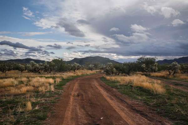
3200
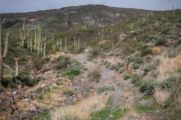
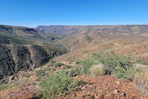
3200 is a shortcut between two halves of the Quail Springs Loop. This trail is more ridden and beat in. It's a hardpack dirt surface with some loose rocks, some steeper grades, and ruts on the sides of the trail, but is much less rocky than Shoemaker, 3197, and 497. It goes through wide-open desert ...
Learn more about 3200
Shoemaker Spring
Shoemaker Spring runs south to north at the edge of the Tonto National Forest near New River, Arizona. It's a primitive route in a lightly used OHV area that is accessed off of North New River Road. This one is intermediate difficulty because it crosses several washes, and it's rocky in spots with l...
Learn more about Shoemaker Spring
Shoemaker Spring Access Trail
This is a short high-clearance primitive road that starts off of North New River Road and connects to Shoemaker Spring. It's uneven and bumpy, with deep ruts that are filled in with round softball-sized rocks. Loose rocks are strewn about the trail for much of it. It's mostly flat in a green desert ...
Learn more about Shoemaker Spring Access Trail
Shoemaker Connector
This 1.7-mile segment of trail runs north-south between 3197 and the Quail Springs Loop in this primitive OHV area near New River, Arizona. This trail is more of a main thoroughfare compared to Shoemaker Springs. It's a wider, well-used road that has some challenges such as deep ruts filled in with ...
Learn more about Shoemaker Connector
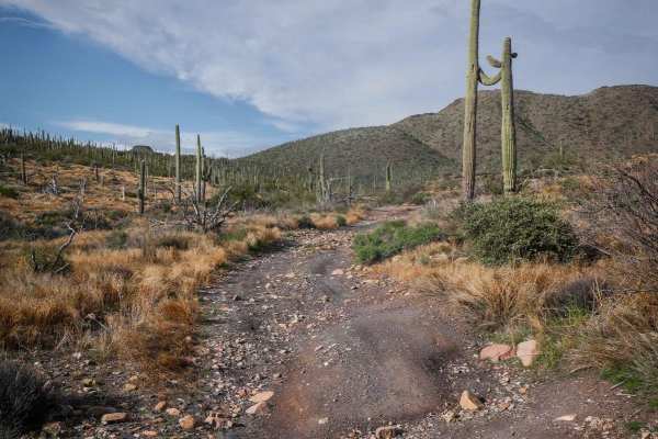
3197
3197 runs west-east in the Tonto National Forest near New River and is an intermediate Jeep trail in a lightly used OHV area. The west end departs from the neighborhood from West Mingus Road and heads east for 1.8 miles. The trail is pretty beat in and used, with frequent signage. The easternmost po...
Learn more about 3197
King Well 497
497 is a wider dirt trail with lots of small and medium-sized loose rocks on the surface for much of the route. It goes through wide open desert terrain, with ruts running down the road, often filled in with loose rocks like a trough. It goes past great big saguaro cacti and a couple of spots to bac...
Learn more about King Well 497
West Rockaway Hills Road
West Rockaway Hills Road serves as a connector trail leading toward the Opportunity Trail. It runs east–west as a point-to-point route and provides a fun drive through the desert. The trail features large ruts formed from past rainfall, so drivers should watch their speed and line choice while trave...
Learn more about West Rockaway Hills Road
West Desert Hills Trail
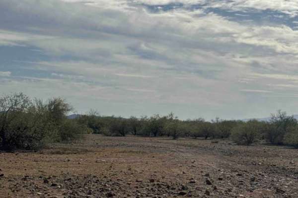
West Desert Hills Trail is a bumpy dirt route with many scattered rocks that eventually leads out to a popular shooting area. While the trail is rough in places, there are no technical sections or major obstacles, making it relatively easy to navigate. The trail is lined with desert creosote and cho...
Learn more about West Desert Hills Trail
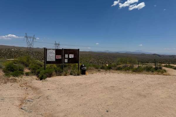
Gateway to Seven Springs
This is a very easy trail that takes you from the Tonto National Forest Border in Cave Creek to the Cave Creek Trailhead in the Seven Springs Recreation Area. This is one of the most overlooked areas in this part of the Tonto National Forest. The first 2.2 miles of the trail are paved, and the remai...
Learn more about Gateway to Seven Springs
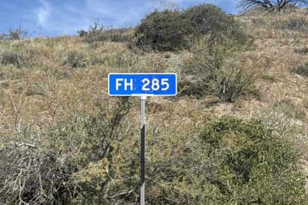
FS 285
FS 285 begins off Gateway to Seven Springs and is an out-and-back gravel shelf road offering beautiful views of the valley to the south. About a quarter mile in, the gravel becomes rougher with larger rocks scattered along the trail, some reaching up to 12 inches. The route is lined with tall natura...
Learn more about FS 285
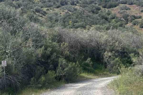
FS 483
FS 483 begins off Gateway to Seven Springs Road (FS 24). A small parking area is located at the start of the trail. This gravel road winds through a wash before transitioning into a popular scenic gravel route. Along the way, you’ll be treated to views of the surrounding hills, tall desert vegetatio...
Learn more about FS 483
Fence Line Connector
Fence Line Connector is a north–south connector trail linking the Trail of Opportunity with the West Desert Hills Trail. The connection point also serves as an entry access into the surrounding trail system. The route travels over a few small hills with occasional ruts and minor washouts, but there ...
Learn more about Fence Line Connector
Cramm Mountain Loop
This very short, easy, loop trail around Cramm Mountain offers sweeping 360 views of the desert landscape. It does seem that this trail is minimally used and therefore has vegetation overgrowth in places - higher clearance vehicles advised. This overgrowth makes the trail less obvious in spots, but ...
Learn more about Cramm Mountain Loop
Trail of Opportunity
Trail of Opportunity is a point-to-point connector trail that runs primarily east–west through the desert before turning as it approaches the wash. The route is a dirt and gravel road that is generally easy to drive but can be bumpy with a few scattered rocks along the way. The trail is easy to navi...
Learn more about Trail of Opportunity
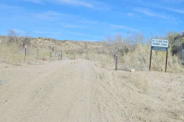
St Clair OHV from Camp Creek to Kentuck Staging
This is a very scenic loop between Bartlett Lake Road and Horseshoe Dam Road. The trail takes you through deep sand washes, rolling dirt trails, and passes a few rock formations. This trail is part of the Tonto National Forest St. Clair OHV Permit Zone trail system opened on 1-1-2025. This area is s...
Learn more about St Clair OHV from Camp Creek to Kentuck Staging
Big Maggie May
This very short section connects to two other trails and contains a couple of interesting sections. At the very beginning, the trail crosses a sandy wash. This could be hazardous or dangerous in wet (rain) or flash flood conditions. Around the following corner is some deep water erosion damage on th...
Learn more about Big Maggie May
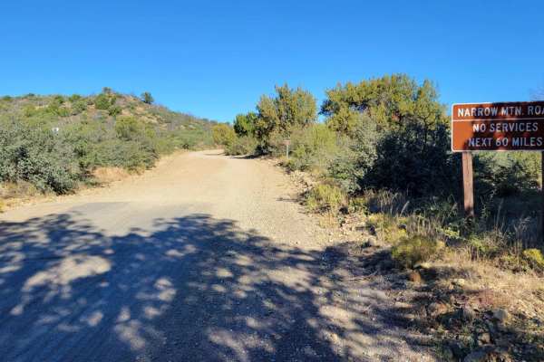
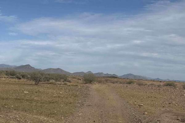
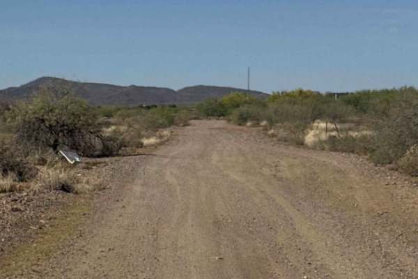
Mesa Connection
This easy dirt road section is the start/end of a 60-mile trail. It leads to the top of the mesa with beautiful desert views and scattered primitive camping. Connects to the (OnX) New River trail. On the south end, there are a couple of established campgrounds, as well as a small staging area. There...
Learn more about Mesa Connection
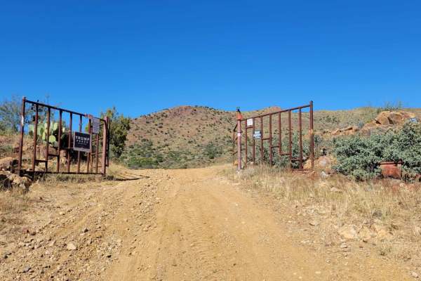
Walnut Spring Trail
This out-and-back trail begins right off Seven Spring Road, and immediately there is a sandy river wash to cross. Be aware that it could be hazardous in flash flooding conditions. Shortly after, there is a gate that could potentially be closed, maybe in the winter months or for land management. The ...
Learn more about Walnut Spring Trail

El Paso Pipeline Road
This is a dirt-covered service road that is regularly maintained. It's a fun, easy route for getting to different areas. There's nothing technical about this trail aside from a couple of sandy washes. Note of caution, people tend to drive really fast out here. Trophy trucks and performance side-by-s...
Learn more about El Paso Pipeline Road
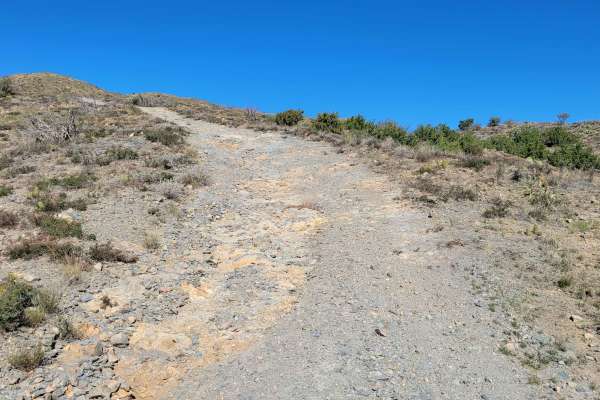
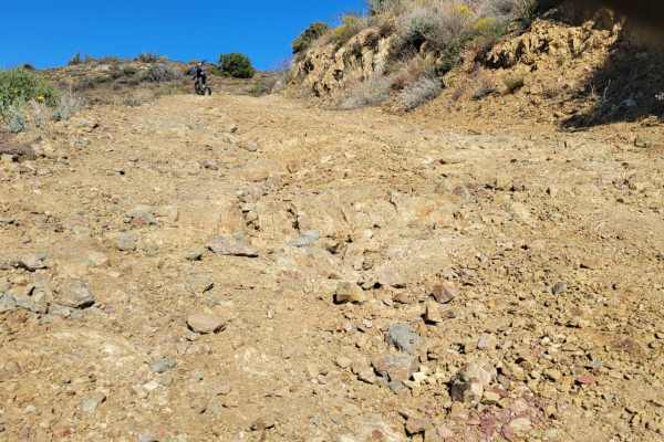
Trail 1940
An out-and-back offshoot trail for those interested in a bit more of a challenge. Right away there are steep, loose, rocky grades to ascend with more to come. There is a hill-top point when the trail splits left or right, but reconvenes at the bottom of the hill. The left trail offers a slightly les...
Learn more about Trail 1940
ATV trails near Cave Creek, Arizona
Explore ATV-friendly trails near you. These trails are accessible for vehicles up to 50 inches wide, perfect for ATVs and smaller off-road machines.
3200
3200 is a shortcut between two halves of the Quail Springs Loop. This trail is more ridden and beat in. It's a hardpack dirt surface with some loose rocks, some steeper grades, and ruts on the sides of the trail, but is much less rocky than Shoemaker, 3197, and 497. It goes through wide-open desert ...
Learn more about 3200
Shoemaker Spring
Shoemaker Spring runs south to north at the edge of the Tonto National Forest near New River, Arizona. It's a primitive route in a lightly used OHV area that is accessed off of North New River Road. This one is intermediate difficulty because it crosses several washes, and it's rocky in spots with l...
Learn more about Shoemaker Spring
Shoemaker Spring Access Trail
This is a short high-clearance primitive road that starts off of North New River Road and connects to Shoemaker Spring. It's uneven and bumpy, with deep ruts that are filled in with round softball-sized rocks. Loose rocks are strewn about the trail for much of it. It's mostly flat in a green desert ...
Learn more about Shoemaker Spring Access Trail
Shoemaker Connector
This 1.7-mile segment of trail runs north-south between 3197 and the Quail Springs Loop in this primitive OHV area near New River, Arizona. This trail is more of a main thoroughfare compared to Shoemaker Springs. It's a wider, well-used road that has some challenges such as deep ruts filled in with ...
Learn more about Shoemaker Connector
UTV/side-by-side trails near Cave Creek, Arizona
Find UTV and side-by-side trails near you. These trails accommodate vehicles up to 60 inches wide, ideal for UTVs, side-by-sides, and wider off-road rigs.
3200
3200 is a shortcut between two halves of the Quail Springs Loop. This trail is more ridden and beat in. It's a hardpack dirt surface with some loose rocks, some steeper grades, and ruts on the sides of the trail, but is much less rocky than Shoemaker, 3197, and 497. It goes through wide-open desert ...
Learn more about 3200
Shoemaker Spring
Shoemaker Spring runs south to north at the edge of the Tonto National Forest near New River, Arizona. It's a primitive route in a lightly used OHV area that is accessed off of North New River Road. This one is intermediate difficulty because it crosses several washes, and it's rocky in spots with l...
Learn more about Shoemaker Spring
Shoemaker Spring Access Trail
This is a short high-clearance primitive road that starts off of North New River Road and connects to Shoemaker Spring. It's uneven and bumpy, with deep ruts that are filled in with round softball-sized rocks. Loose rocks are strewn about the trail for much of it. It's mostly flat in a green desert ...
Learn more about Shoemaker Spring Access Trail
Shoemaker Connector
This 1.7-mile segment of trail runs north-south between 3197 and the Quail Springs Loop in this primitive OHV area near New River, Arizona. This trail is more of a main thoroughfare compared to Shoemaker Springs. It's a wider, well-used road that has some challenges such as deep ruts filled in with ...
Learn more about Shoemaker Connector
The onX Offroad Difference
onX Offroad combines trail photos, descriptions, difficulty ratings, width restrictions, seasonality, and more in a user-friendly interface. Available on all devices, with offline access and full compatibility with CarPlay and Android Auto. Discover what you're missing today!
Open Trail Map