
Dirt Bike Trails
Near Black Mountain, North Carolina
Explore All Dirt Bike Trails Near Black Mountain, North Carolina
Dirt Bike Trails Near Black Mountain, North Carolina
Discover the best dirt bike trails near you. Browse trail maps, check difficulty ratings, and find your next adventure — whether you're looking for a quick ride or an all-day expedition.

South Toe River
South Toe River is a basic, but scenic trail located near Mount Mitchell in North Carolina. The trail begins at the Blue Ridge Parkway on its south end and terminates at the Toe River Trail at its north end. The quaint forest service road meanders along the south toe river and past a handful of smal...
Learn more about South Toe River

Toe River Trail
Toe River Trail is a scenic, beginner-friendly route in the Pisgah National Forest ideal for stock four-wheel-drive vehicles, SxSs, and overland setups looking to escape the pavement and explore North Carolina's rugged wilderness. Starting near Dicks Gap and Highway 80, the trail stretches approxima...
Learn more about Toe River Trail
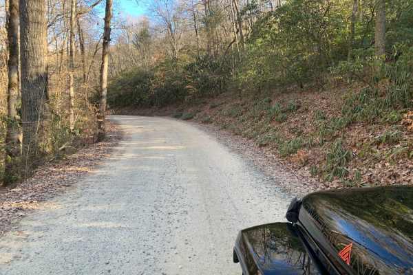
Wash Creek FR 5000
This is an easy road that does not require 4x4. The road is not maintained when it has snowed. You gain 945 feet of elevation, but it is very gradual. There are several places along the road with stunning views, but you would have to go in the winter to get the best views. There are several designat...
Learn more about Wash Creek FR 5000
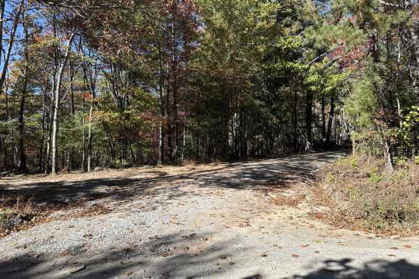
Dobson Knob - FS 106
This out-and-back trail is a gravel-over-packed-dirt route beginning at Old North Carolina 105 and following a ridge with scenic views on both sides. Around 4.4 miles in, it narrows to a six-foot-wide path near a large camping area, then continues another 1.5 miles as the Mountains-to-Sea hiking tra...
Learn more about Dobson Knob - FS 106
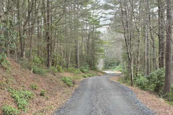
White Oak Flats
White Oak Flats is a mostly easy gravel route with a short but more technical section at the beginning. The first approximately 0.4 miles features a narrower two-track with a rocky descent that requires more attention to line choice and vehicle control. While still manageable, this section introduce...
Learn more about White Oak Flats
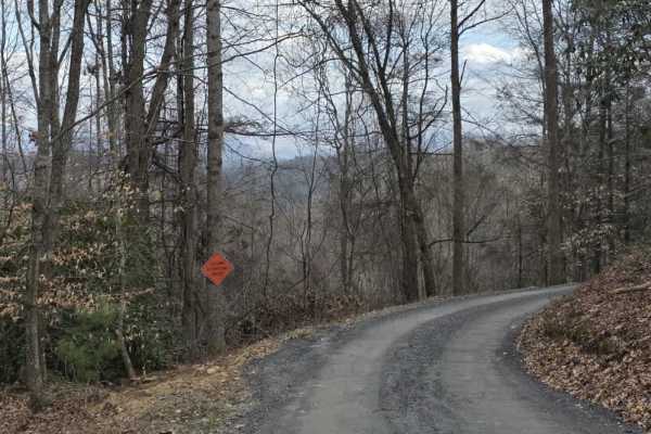
White Oak Flats Spur
White Oak Flats Spur is an easy, graded gravel route that provides a smooth and predictable driving experience. The road is wide and well-maintained, allowing for comfortable travel and easy passing in most areas. The surface is consistent throughout, offering good traction and minimal variation, ma...
Learn more about White Oak Flats Spur
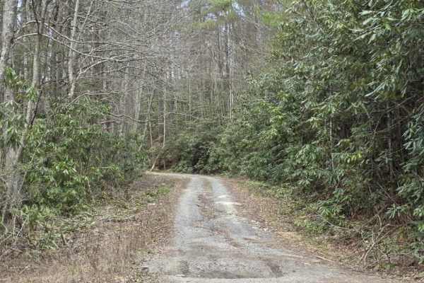
Granny Lewis
Granny Lewis is an easy out-and-back trail that follows closely along Granny Lewis Creek, offering a relaxed drive with frequent water views and a quiet forest setting. The route is primarily smooth and consistent, making it accessible for most drivers under normal conditions. The surface includes o...
Learn more about Granny Lewis
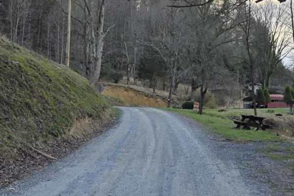
Sams Branch Road
Sams Branch Road is an easy gravel route that offers a quiet drive through a rural setting with minimal technical features. The road surface is primarily gravel and generally well-maintained, making it accessible for most drivers under normal conditions. The route follows gentle grades and remains w...
Learn more about Sams Branch Road
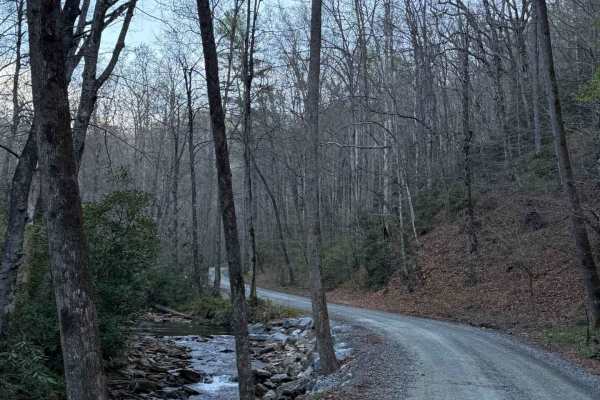
Avery Creek - FS 477
Avery Creek is a well-maintained gravel road that winds through Pisgah National Forest. This is a single-track road with room to pass most of the way through. There are lots of great creekside campsites toward the beginning of the south entrance. Dispersed camping in designated sites only. Once you...
Learn more about Avery Creek - FS 477
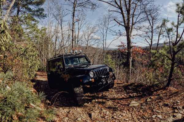
No Business Knob
No Business Knob is a tight but simple trail located in Cherokee National Forest. You will most likely get pinstripes from the branches lining the trail in an SUV or truck. The trail is just under 10 miles round-trip and traverses the side of the mountain range. Expect steep drop-offs on the side of...
Learn more about No Business Knob
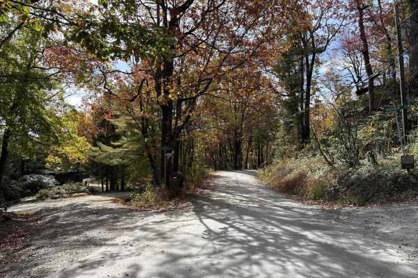
Upper Roses Creek - FS 210
Forest Service Road 210, also known as Roses Creek Road, begins at the south end of Table Rock Road. This route is popular for hiking access to three nearby trails, dispersed camping, and seasonal deer and dog hunting. The road is fairly well maintained with gravel over hard-packed dirt. Some sectio...
Learn more about Upper Roses Creek - FS 210

Ephraim Road - FS 5583
Ephraim Road (FS 5583) is primarily an easy forest road that offers a straightforward drive with a gradual change in terrain as you progress. The route begins as a well-maintained gravel road with gentle grades and a predictable surface, making it accessible for most vehicles under normal conditions...
Learn more about Ephraim Road - FS 5583
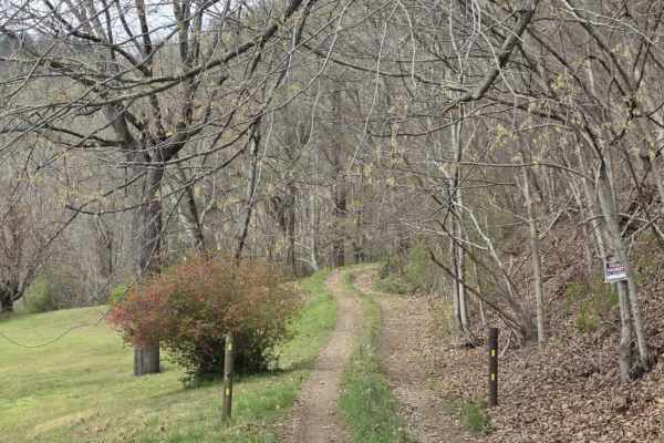
Green Knob
Green Knob is a slow-moving, highly technical trail that demands focus from start to finish. While the primary surface is gravel, the route is extremely rocky with constant obstacles that prevent maintaining any real speed. The trail is very tight, with heavy overgrowth and closely spaced trees that...
Learn more about Green Knob
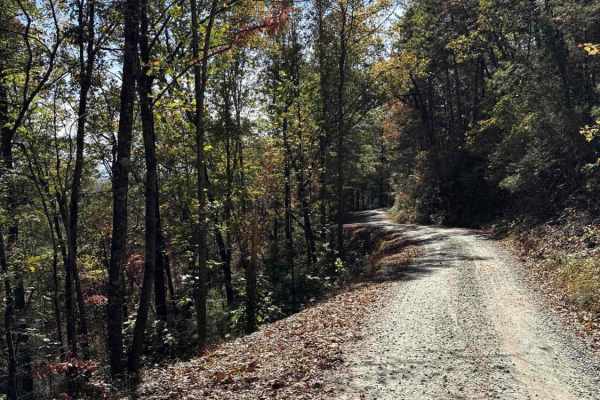
Steeles Creek - FS 228
This trail is fairly well maintained with gravel over hard-packed dirt. Some sections are narrow with pull-off areas, while others are wide enough for two vehicles to pass. A single water crossing has a warning sign advising caution during heavy rain and high water. Drivers should watch for narrow s...
Learn more about Steeles Creek - FS 228
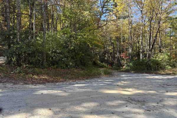
FS 496
This Forest Service road is a well-maintained gravel route over hard-packed dirt with occasional small washes, typically less than a foot deep. It features multiple switchbacks bordered by scenic gorges on both sides and may have light water flow after rainfall. Some areas show signs of past washout...
Learn more about FS 496
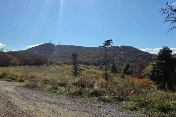
Viking Mountain Road
Turning to gravel 5 miles in, Viking Mountain Road is a 3.5-mile out-and-back single-lane forest service road on the Tennessee side of the Cherokee National Forest, southeast of Greeneville, Tennessee, leading up to the Bald Mountains region. On pavement, it is accessed from Greeneville, Tennessee v...
Learn more about Viking Mountain Road
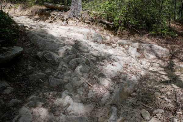
1A
Trail 1A is a difficult and narrow ATV trail open to vehicles 50" or less. The trail winds through a lush forest, crossing small creeks and constantly weaving against the mountainside, often with blind corners. The trail has big embedded rock layers, maintained cinderblock paths, deep ruts, fast and...
Learn more about 1A
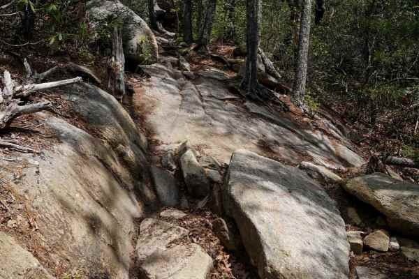
Trail 2 Elliot Deer
Trail 2 is a difficult ATV trail for vehicles 50" or less. It starts as a shelfy and smooth traverse across the mountainside, dug out in spots, with big sweeping corners, and fast between the trees, but has large rock obstacles for the majority of the route. Most of the obstacles are large embedded ...
Learn more about Trail 2 Elliot Deer

Rich Mountain Summit
Rich Mountain Summit is the legal continuation of Rich Mountain Trail which has seasonal closures typically from December 20 through late March and is considered an 'out and back' experience. The Rich Mountain Summit Trail begins by taking a 90-degree right turn and passing through a Forest Service ...
Learn more about Rich Mountain Summit
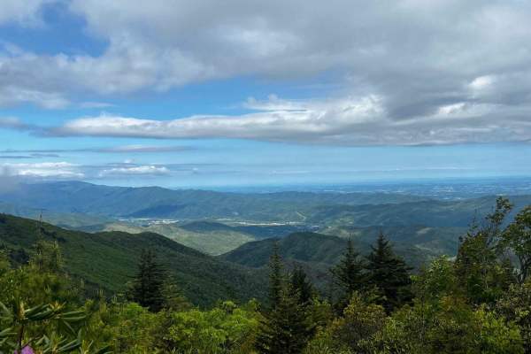
The Beauty Spot
Nestled in the heart of the Unaka mountains, the Beauty Spot trail (FS 230) offers a captivating experience for adventure seekers and nature enthusiasts alike. With its rugged terrain and awe-inspiring views of the majestic Smoky Mountains, this trail is a true gem waiting to be discovered. Get read...
Learn more about The Beauty Spot
ATV trails near Black Mountain, North Carolina
Explore ATV-friendly trails near you. These trails are accessible for vehicles up to 50 inches wide, perfect for ATVs and smaller off-road machines.
South Toe River
South Toe River is a basic, but scenic trail located near Mount Mitchell in North Carolina. The trail begins at the Blue Ridge Parkway on its south end and terminates at the Toe River Trail at its north end. The quaint forest service road meanders along the south toe river and past a handful of smal...
Learn more about South Toe River
Toe River Trail
Toe River Trail is a scenic, beginner-friendly route in the Pisgah National Forest ideal for stock four-wheel-drive vehicles, SxSs, and overland setups looking to escape the pavement and explore North Carolina's rugged wilderness. Starting near Dicks Gap and Highway 80, the trail stretches approxima...
Learn more about Toe River Trail
Wash Creek FR 5000
This is an easy road that does not require 4x4. The road is not maintained when it has snowed. You gain 945 feet of elevation, but it is very gradual. There are several places along the road with stunning views, but you would have to go in the winter to get the best views. There are several designat...
Learn more about Wash Creek FR 5000
Dobson Knob - FS 106
This out-and-back trail is a gravel-over-packed-dirt route beginning at Old North Carolina 105 and following a ridge with scenic views on both sides. Around 4.4 miles in, it narrows to a six-foot-wide path near a large camping area, then continues another 1.5 miles as the Mountains-to-Sea hiking tra...
Learn more about Dobson Knob - FS 106
UTV/side-by-side trails near Black Mountain, North Carolina
Find UTV and side-by-side trails near you. These trails accommodate vehicles up to 60 inches wide, ideal for UTVs, side-by-sides, and wider off-road rigs.
South Toe River
South Toe River is a basic, but scenic trail located near Mount Mitchell in North Carolina. The trail begins at the Blue Ridge Parkway on its south end and terminates at the Toe River Trail at its north end. The quaint forest service road meanders along the south toe river and past a handful of smal...
Learn more about South Toe River
Wash Creek FR 5000
This is an easy road that does not require 4x4. The road is not maintained when it has snowed. You gain 945 feet of elevation, but it is very gradual. There are several places along the road with stunning views, but you would have to go in the winter to get the best views. There are several designat...
Learn more about Wash Creek FR 5000
Dobson Knob - FS 106
This out-and-back trail is a gravel-over-packed-dirt route beginning at Old North Carolina 105 and following a ridge with scenic views on both sides. Around 4.4 miles in, it narrows to a six-foot-wide path near a large camping area, then continues another 1.5 miles as the Mountains-to-Sea hiking tra...
Learn more about Dobson Knob - FS 106
White Oak Flats
White Oak Flats is a mostly easy gravel route with a short but more technical section at the beginning. The first approximately 0.4 miles features a narrower two-track with a rocky descent that requires more attention to line choice and vehicle control. While still manageable, this section introduce...
Learn more about White Oak Flats
The onX Offroad Difference
onX Offroad combines trail photos, descriptions, difficulty ratings, width restrictions, seasonality, and more in a user-friendly interface. Available on all devices, with offline access and full compatibility with CarPlay and Android Auto. Discover what you're missing today!
Open Trail Map