
Dirt Bike Trails
Near American Falls, Idaho
Explore All Dirt Bike Trails Near American Falls, Idaho
Dirt Bike Trails Near American Falls, Idaho
Discover the best dirt bike trails near you. Browse trail maps, check difficulty ratings, and find your next adventure — whether you're looking for a quick ride or an all-day expedition.
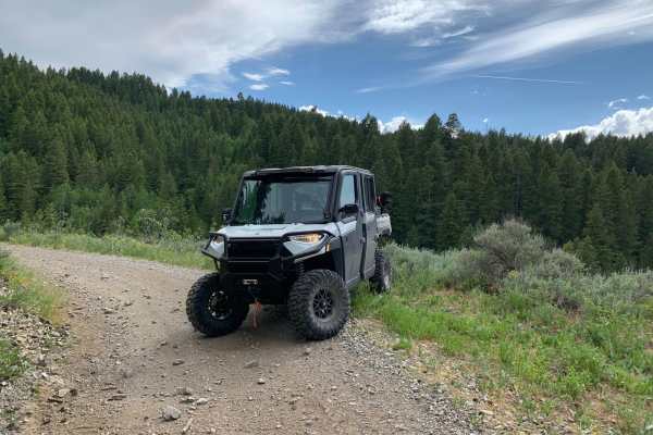
Houtz Canyon
Houtz Canyon from the Rockland side is a great off-road adventure for all vehicles, but it can become narrow due to brush. The BLM provides plenty of parking at the start of the trail. The trail takes you from high desert sagebrush and junipers into the pine forest. The trail is dirt/rock gravel and...
Learn more about Houtz Canyon
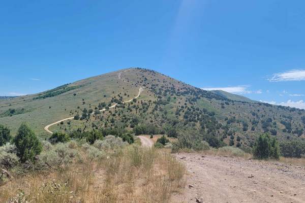
Route 352 to Chinese Peak
Start just off of American Road and West Buckskin Road. The road is marked 352. This short route just outside of Pocatello is thrilling. In about three miles you gain 1700 feet in elevation. In the middle of the trail, there are two smaller mountains that are pretty steep. Both sides of the road hav...
Learn more about Route 352 to Chinese Peak
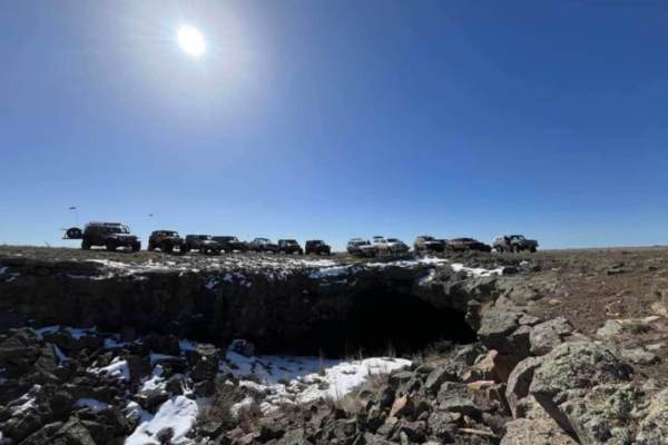
Bear Trap Cave North
Bear Trap Cave is one of many lave caves located in southeast Idaho. This trail begins from Coffee Point and winds southwest across the desert to the Bear Trap cave. It is a relatively easy-going trail, with a mostly dirt road that is only challenging in snow or mud. There are plenty of scenic oppor...
Learn more about Bear Trap Cave North
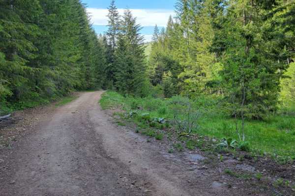
Sheep Canyon 1
This section of trail is one continuous, long hill climb/descent depending which direction you're going. (West to East is uphill). There are some loose rocky patches scattered throughout and a few small mud ruts here and there. The summit of the trail offers amazing views of the surrounding mountain...
Learn more about Sheep Canyon 1
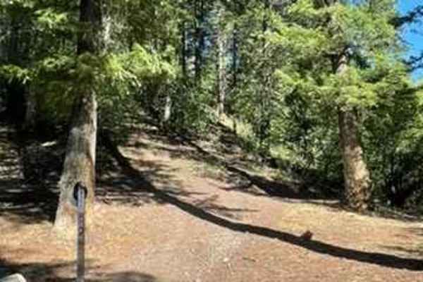
Crestline trail - Bell Marsh Creek
This was an awesome single-track trail filled with all types of terrain. It involves a lot of flow that you can rip through and also has good technical rocky features. Crestline trail is probably meant for beginner/intermediate riders and has only a few spots that are tricky, but nothing too crazy. ...
Learn more about Crestline trail - Bell Marsh Creek
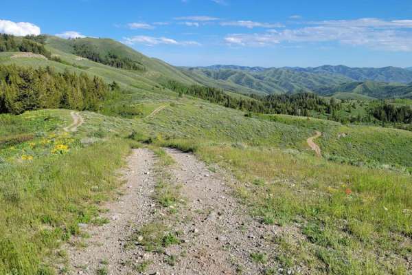
Line Canyon
Open to 50" wide machines or less (also: hiking, horseback, biking), this is an advanced race-track-esque trail as it weaves its way through the forest and atop the mountain summit. The Southern part of the trail is one long hill climb/descent. At the summit, you'll find some of the most beautiful a...
Learn more about Line Canyon
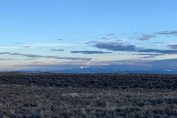
Springfield to Big Southern Butte
The route takes you from Springfield, Idaho to Big Southern Butte via part of Goodale's Cutoff. For a brief history of the cutoff see below. This trail is best ridden in the spring when the snow has melted until it gets hot and then in the late fall. There are awesome picturesque views of the entire...
Learn more about Springfield to Big Southern Butte
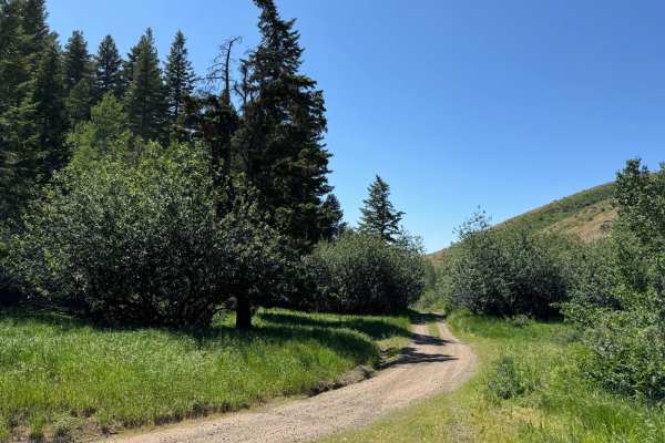
South Heglar Canyon
Starting from the Raft River Side, you will pass by dry farms on a well-maintained gravel road as you make your way up the Sawtooth National Forest. It quickly transitions from sagebrush into Aspens and Pine trees as you leave the high desert. One small creek crossing is effortless to make it throug...
Learn more about South Heglar Canyon
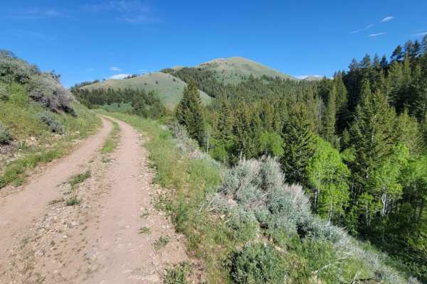
Sheep Canyon 2
This curvy and windy section of Sheep's Canyon hugs alongside the slope of the mountainside, offering beautiful views of the surrounding Sawtooth National Forest. There are loose rocky patches, especially around some of the corners. Mud ruts exist here and there. Caution of standing water/mud holes,...
Learn more about Sheep Canyon 2
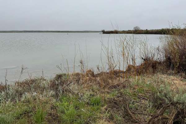
Lake View
A very well-maintained gravel road leads right to the lake through the bird refuge. Although this is a short trip off the main road, it gives you access to the lake, which is very limited due to the wildlife refuge. You would not know this area was here unless you took this trail to a shallow reserv...
Learn more about Lake View
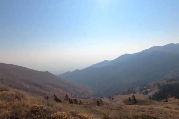
Scout Mountain
This trail is just outside of Pocatello. It goes into the National Forest, so there is some free camping in this area. On this trail, you will gain 3,000 feet in elevation. You start down in the forest trees, working your way up an easy dirt road. You will get epic views as you climb the mountain. I...
Learn more about Scout Mountain
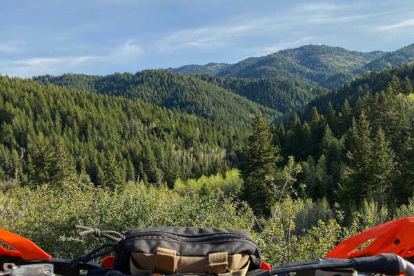
North Heglar
Starting From the Raft River Side, you will pass by dry farms on a well-maintained gravel road as you make your way up the Sawtooth National Forest. As you make your way from the high desert and into more forest, full of aspens and pine trees, the elevation of the limestone mountains around you dras...
Learn more about North Heglar
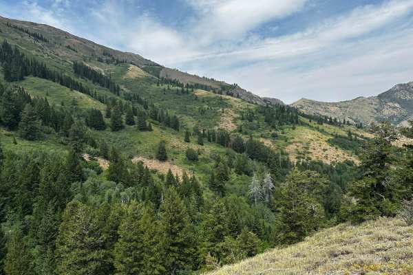
Goodenough - Bell Marsh Creek
From the Goodenough parking lot, leave to the north and follow the 2 track to where it turns single track (Bells Marsh) up to the top and then back to the parking lot. The 2 track is typical, but the single to the top has several creek crossings (none deep), roots and rocks and ledges for challenges...
Learn more about Goodenough - Bell Marsh Creek
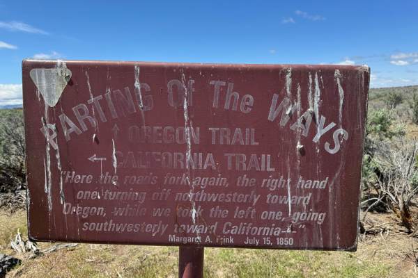
Oregon/California Parting of the Ways
Travel along the California Historical Trail and pass by the Parting of the Ways. Turning off Yale Road and onto the two-track dirt road with some basalt outcrops, you can't help but imagine a wagon making its way across this landscape. Although it may look desolate from the interstate, there is qui...
Learn more about Oregon/California Parting of the Ways
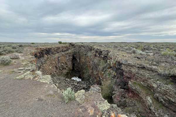
Bear Trap/Crystal Ice Cave Trail
This dirt road follows the route from Bear Trap Cave to Crystal Ice Caves and King's Bowl. The route can be traveled in either direction, as it is accessed by various BLM roads and trails. Watch for the deep chasm of King's Bowl Rift as you near the Wapi Lava Flow. In the 1970s, people often crowded...
Learn more about Bear Trap/Crystal Ice Cave Trail
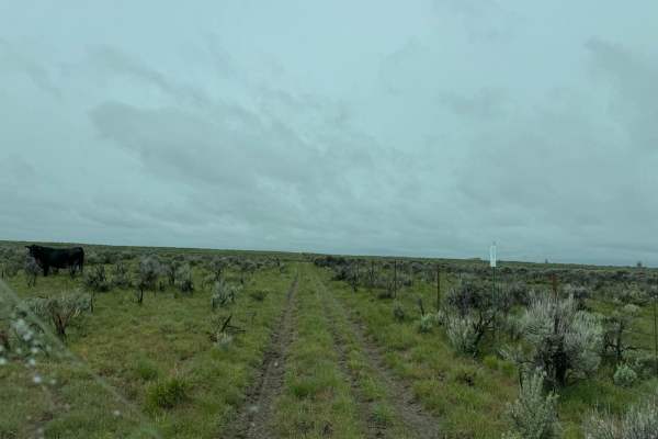
Ride to the Dam
From the old highway, you will start on an excellent gravel road lined with sagebrush and basalt rock, which will turn into a dirt two-track with some basalt rock. As you make your way along the fence line, you will get great views of the reservoir and the high desert. This trail runs right beside a...
Learn more about Ride to the Dam
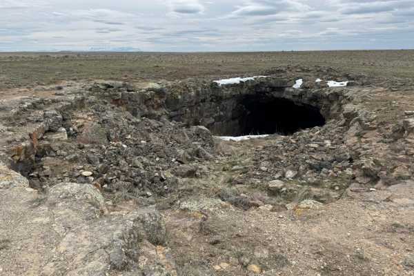
Bear Trap Cave
The road to Bear Trap Cave follows the Minidoka-Arco Road. The road changes conditions frequently depending on weather and the amount of traffic. It is an easy road but can be muddy and washboarded at times. The trail begins where farmland ends and leads you through a southern Idaho desert landscape...
Learn more about Bear Trap Cave
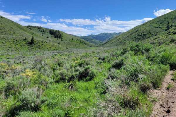
Heglar Canyon
This section of trail connects to a handful of other trails in the area. The northern half is more mountainous terrain as it winds its way up/down. There are mud ruts, erosion spots, and rocky patches here and there. Caution in the early seasons. The southern half is a wide-open, easy dirt road that...
Learn more about Heglar Canyon
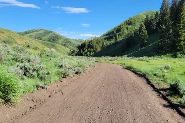
Lake Fork
If you're looking for an easy, scenic drive through the Sawtooth National Forest, then this trail is for you. As you drive through the little valley, beautiful views of the hills and ridges surround you. Time to complete depends if you take any of the connecting trails from off this one or simply go...
Learn more about Lake Fork

Sublett
This easy dirt road starts at Sublett Reservoir, taking you around the Northern section of the lake, and leads to Sublett Campground. Other trails continue past that point. Beautiful views overlooking the reservoir. There are primitive camp spots along the shore of the reservoir, as well as towards ...
Learn more about Sublett
ATV trails near American Falls, Idaho
Explore ATV-friendly trails near you. These trails are accessible for vehicles up to 50 inches wide, perfect for ATVs and smaller off-road machines.
Houtz Canyon
Houtz Canyon from the Rockland side is a great off-road adventure for all vehicles, but it can become narrow due to brush. The BLM provides plenty of parking at the start of the trail. The trail takes you from high desert sagebrush and junipers into the pine forest. The trail is dirt/rock gravel and...
Learn more about Houtz Canyon
Route 352 to Chinese Peak
Start just off of American Road and West Buckskin Road. The road is marked 352. This short route just outside of Pocatello is thrilling. In about three miles you gain 1700 feet in elevation. In the middle of the trail, there are two smaller mountains that are pretty steep. Both sides of the road hav...
Learn more about Route 352 to Chinese Peak
Bear Trap Cave North
Bear Trap Cave is one of many lave caves located in southeast Idaho. This trail begins from Coffee Point and winds southwest across the desert to the Bear Trap cave. It is a relatively easy-going trail, with a mostly dirt road that is only challenging in snow or mud. There are plenty of scenic oppor...
Learn more about Bear Trap Cave North
Sheep Canyon 1
This section of trail is one continuous, long hill climb/descent depending which direction you're going. (West to East is uphill). There are some loose rocky patches scattered throughout and a few small mud ruts here and there. The summit of the trail offers amazing views of the surrounding mountain...
Learn more about Sheep Canyon 1
UTV/side-by-side trails near American Falls, Idaho
Find UTV and side-by-side trails near you. These trails accommodate vehicles up to 60 inches wide, ideal for UTVs, side-by-sides, and wider off-road rigs.
Houtz Canyon
Houtz Canyon from the Rockland side is a great off-road adventure for all vehicles, but it can become narrow due to brush. The BLM provides plenty of parking at the start of the trail. The trail takes you from high desert sagebrush and junipers into the pine forest. The trail is dirt/rock gravel and...
Learn more about Houtz Canyon
Route 352 to Chinese Peak
Start just off of American Road and West Buckskin Road. The road is marked 352. This short route just outside of Pocatello is thrilling. In about three miles you gain 1700 feet in elevation. In the middle of the trail, there are two smaller mountains that are pretty steep. Both sides of the road hav...
Learn more about Route 352 to Chinese Peak
Bear Trap Cave North
Bear Trap Cave is one of many lave caves located in southeast Idaho. This trail begins from Coffee Point and winds southwest across the desert to the Bear Trap cave. It is a relatively easy-going trail, with a mostly dirt road that is only challenging in snow or mud. There are plenty of scenic oppor...
Learn more about Bear Trap Cave North
Sheep Canyon 1
This section of trail is one continuous, long hill climb/descent depending which direction you're going. (West to East is uphill). There are some loose rocky patches scattered throughout and a few small mud ruts here and there. The summit of the trail offers amazing views of the surrounding mountain...
Learn more about Sheep Canyon 1
The onX Offroad Difference
onX Offroad combines trail photos, descriptions, difficulty ratings, width restrictions, seasonality, and more in a user-friendly interface. Available on all devices, with offline access and full compatibility with CarPlay and Android Auto. Discover what you're missing today!
Open Trail Map