
Beginner Off-Road Trails
Near Weston, New Jersey
Explore All Beginner Trails Near Weston, New Jersey
Beginner Off-Road Trails Near Weston, New Jersey
Discover the best beginner-friendly off-road trails near you. These easier, lower-rated trails are a great place to start — browse trail maps, check difficulty ratings, and find your next adventure.
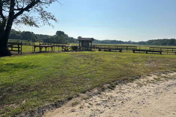
UTT Connector Trail
The route starts off on Eldridge Road, runs the side of Assunpink Lake, and the trail is mostly dirt and gravel with some sand, mostly flat, with nothing challenging. There are plenty of access areas to the lake, end of the trail, it loops back on itself, and exits on Hightstown road.
Learn more about UTT Connector Trail
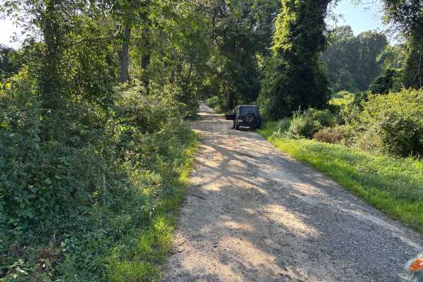
Mitchell - Roosevelt Road
Gravel road, nothing to changeling, there are some slight elevation changes. There are some spots that are washed out with erosion off the sides of the trails, which may cause issues with heavy rain (potentially). Very scenic access road that would be great for a fall drive, this is also an access...
Learn more about Mitchell - Roosevelt Road
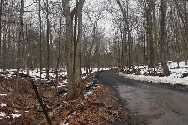
Mount Airy Road
This is a mostly easy hardpack dirt road located in the woods of Upper Bucks County. The Northeastern end of the trail is a steep climb out of the creek valley, which in any snow can be difficult, sometimes impassible. It is a municipal road, which means all vehicles must obey posted speed limits an...
Learn more about Mount Airy Road
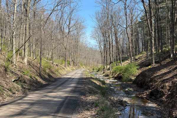
Permanent School Road
This is a generally easy hard-pack dirt road located in the woods of Upper Bucks County. This route begins off of the paved Geigel Hill road on either end, being named Permanent School Road on the eastern end and turning into Tettemer Road on the western end. If driven east to west, it climbs in ele...
Learn more about Permanent School Road
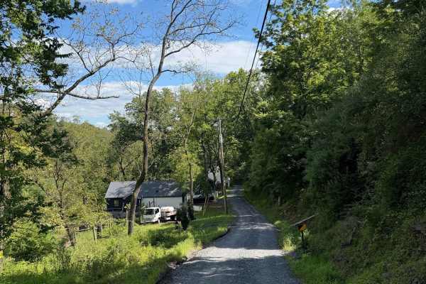
Twin Lear Road
This is a narrow but generally easy hard-pack dirt road that drops abruptly into the Delaware River Valley, meeting the Smithtown Creek right off of River Road. It is a municipal road, which means all vehicles must obey posted speed limits and be registered/insured. Open year-round, it does receive ...
Learn more about Twin Lear Road
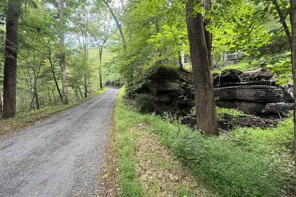
Smithtown Road
This is a scenic, easy hard-pack dirt road that follows the Smithtown Creek as it descends into the Delaware River. It is a municipal road, which means all vehicles must obey posted speed limits and be registered/insured. Open year-round, it does receive winter maintenance, but is usually plowed lat...
Learn more about Smithtown Road
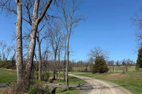
Tettemer Road
This is a mostly easy hard-pack dirt road located in the woods of Upper Bucks County. It is a municipal road, which means all vehicles must obey posted speed limits and be registered/insured. Open year-round, it does receive winter maintenance, but is usually plowed later than the surrounding paved ...
Learn more about Tettemer Road
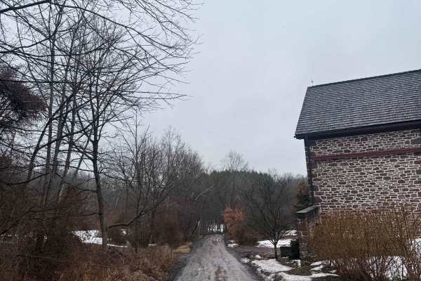
Ridge Valley Road
This is an easy hardpack dirt road located in the woods of Upper Bucks County. It is a municipal road, which means all vehicles must obey posted speed limits and be registered/insured. Open year-round, it does receive winter maintenance, but is usually plowed later than the surrounding paved roads. ...
Learn more about Ridge Valley Road
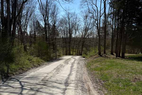
Tankhannen Road
This is an easy hardpack dirt road located in the woods of Upper Bucks County. It connects the paved Geigel Hill road to the Ridge Valley dirt road. It is a municipal road, which means all vehicles must obey posted speed limits and be registered/insured. Open year-round, it does receive winter maint...
Learn more about Tankhannen Road
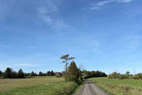
Randts Mill Road
This is an easy hard-pack dirt road located in Upper Bucks County. While not difficult, this trail and its scenery are incredibly aesthetic - go slow and enjoy the view. It is a municipal road, which means all vehicles must obey posted speed limits and be registered/insured. Open year-round, it does...
Learn more about Randts Mill Road
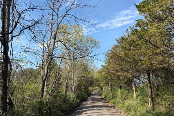
Oak Grove Road
While this is a mostly easy hardpack dirt road, it does feature a handful of very tight loose turns, steep inclines/declines, and is more narrow then most nearby dirt roads. This route is located in the woods of Upper Bucks County, close to 611, and is a public municipal road. At its northern end, ...
Learn more about Oak Grove Road
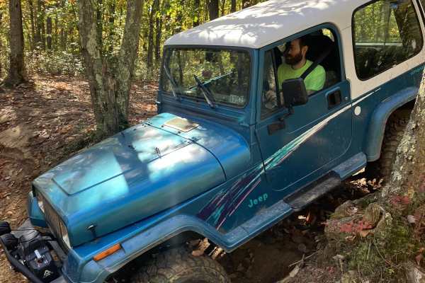
Two Towers Loop
The trailhead for the Two Towers Loop is accessed from Reed Rd. You will see wild animals from the adjacent Six Flags safari park. Once you turn onto the trails you will be on soft Pine Barren sand and dirt. This terrain varies with the seasons-deep in the summer, loose in the fall and firm in sprin...
Learn more about Two Towers Loop
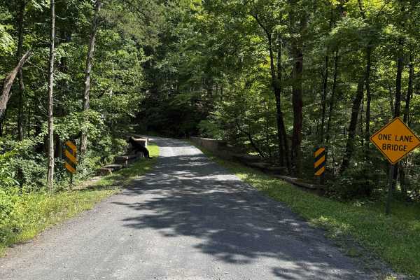
Quarry Road
This is a generally easy hard-pack dirt road that drops in and back out of the Rapp Creek valley. It is a municipal road, which means all vehicles must obey posted speed limits and be registered/insured. Open year-round, it does receive winter maintenance, but is usually plowed later than the surrou...
Learn more about Quarry Road
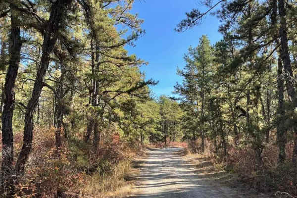
Success Road
Success Road winds through the Collier Mills Wildlife Management Area. It's a dirt road, about two vehicles wide, that receives occasional maintenance before hunting seasons. The road transitions to sand with some deep patches and potential for water pooling, offering the first view of Success Lake....
Learn more about Success Road
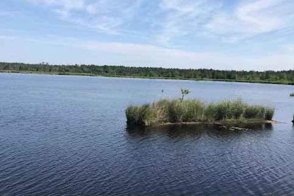
Whitesbog Village Trail
This is an open easy trail through Whites Bog Village and the Bogs in the area. These are maintained bog roads that require no special skill or vehicle to navigate. Along this loop, you will encounter many other drivers, fishing, wildlife, and other colorful scenery. This trail is open only during d...
Learn more about Whitesbog Village Trail
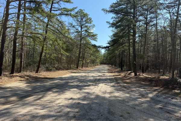
Mount Misery and Pasadena Road
This is an easy, flat dirt and sand road that takes you under the branches of the Barrens Pines. After a good rain, expect many water and mudholes ranging from small to covering the road. There are many foot trails in the area, so if you like hiking, you can stop and stretch your legs. A great run f...
Learn more about Mount Misery and Pasadena Road
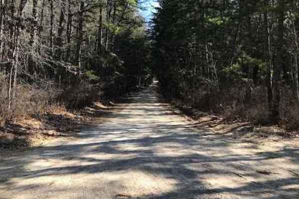
Muddy Road Trail
Muddy Road Trail is a trail within the Brendan T. Byrne State Forest. This trail routes you around the back side of Pakim Pond and a picnic area. This short trail is 2.1 miles long and contains multiple deep water/mud holes and a tight winding trail. You can access this trail from either Coppers Roa...
Learn more about Muddy Road Trail
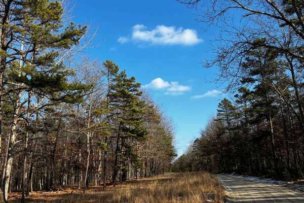
Webb Mill Road to 539
This is a nice short route that begins a little bit off of Pasadena Woodmanse Road and spurs off of the Brendan T. Bryne to Bear Swamp Hill route. This will take you through some nice hilly areas in the Pine Barrens with some slight sandy patches. After crossing over Route 539, there are some large ...
Learn more about Webb Mill Road to 539
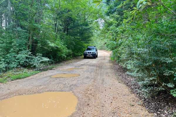
Butler Place Road
This approximately 7-mile trail runs through Brendon T. Byrne State Forrest in Brown Mills, NJ. Accessible from RT. 72. It's an easy trial and makes for a relaxing ride through the Pine Barrens. Towards the end, by Lebanon State Forrest Rd, there is an interesting collection of animal statues with a...
Learn more about Butler Place Road
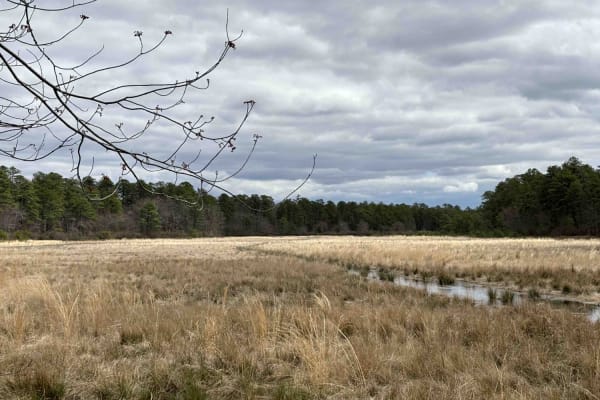
Bryant to Hays Road
Enter off 539. The trail is mostly sand and gravel and is somewhat flat. About a quarter mile in, there is a depressed campsite. After it rains, you can expect pools of water large and small. Some have go-around areas; the best practice is to stay on the outside of them. There can be ruts in the mid...
Learn more about Bryant to Hays Road
Beginner ATV trails near Weston, New Jersey
Explore ATV-friendly trails near you. These trails are accessible for vehicles up to 50 inches wide, perfect for ATVs and smaller off-road machines.
Two Towers Loop
The trailhead for the Two Towers Loop is accessed from Reed Rd. You will see wild animals from the adjacent Six Flags safari park. Once you turn onto the trails you will be on soft Pine Barren sand and dirt. This terrain varies with the seasons-deep in the summer, loose in the fall and firm in sprin...
Learn more about Two Towers Loop
Whitesbog Village Trail
This is an open easy trail through Whites Bog Village and the Bogs in the area. These are maintained bog roads that require no special skill or vehicle to navigate. Along this loop, you will encounter many other drivers, fishing, wildlife, and other colorful scenery. This trail is open only during d...
Learn more about Whitesbog Village Trail
Mount Misery and Pasadena Road
This is an easy, flat dirt and sand road that takes you under the branches of the Barrens Pines. After a good rain, expect many water and mudholes ranging from small to covering the road. There are many foot trails in the area, so if you like hiking, you can stop and stretch your legs. A great run f...
Learn more about Mount Misery and Pasadena Road
Muddy Road Trail
Muddy Road Trail is a trail within the Brendan T. Byrne State Forest. This trail routes you around the back side of Pakim Pond and a picnic area. This short trail is 2.1 miles long and contains multiple deep water/mud holes and a tight winding trail. You can access this trail from either Coppers Roa...
Learn more about Muddy Road Trail
Beginner UTV/side-by-side trails near Weston, New Jersey
Find UTV and side-by-side trails near you. These trails accommodate vehicles up to 60 inches wide, ideal for UTVs, side-by-sides, and wider off-road rigs.
Two Towers Loop
The trailhead for the Two Towers Loop is accessed from Reed Rd. You will see wild animals from the adjacent Six Flags safari park. Once you turn onto the trails you will be on soft Pine Barren sand and dirt. This terrain varies with the seasons-deep in the summer, loose in the fall and firm in sprin...
Learn more about Two Towers Loop
Whitesbog Village Trail
This is an open easy trail through Whites Bog Village and the Bogs in the area. These are maintained bog roads that require no special skill or vehicle to navigate. Along this loop, you will encounter many other drivers, fishing, wildlife, and other colorful scenery. This trail is open only during d...
Learn more about Whitesbog Village Trail
Mount Misery and Pasadena Road
This is an easy, flat dirt and sand road that takes you under the branches of the Barrens Pines. After a good rain, expect many water and mudholes ranging from small to covering the road. There are many foot trails in the area, so if you like hiking, you can stop and stretch your legs. A great run f...
Learn more about Mount Misery and Pasadena Road
Muddy Road Trail
Muddy Road Trail is a trail within the Brendan T. Byrne State Forest. This trail routes you around the back side of Pakim Pond and a picnic area. This short trail is 2.1 miles long and contains multiple deep water/mud holes and a tight winding trail. You can access this trail from either Coppers Roa...
Learn more about Muddy Road Trail
The onX Offroad Difference
onX Offroad combines trail photos, descriptions, difficulty ratings, width restrictions, seasonality, and more in a user-friendly interface. Available on all devices, with offline access and full compatibility with CarPlay and Android Auto. Discover what you're missing today!
Open Trail Map