
Beginner Off-Road Trails
Near Victor, Montana
Explore All Beginner Trails Near Victor, Montana
Beginner Off-Road Trails Near Victor, Montana
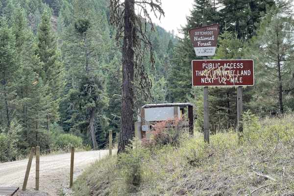
Discover the best beginner-friendly off-road trails near you. These easier, lower-rated trails are a great place to start — browse trail maps, check difficulty ratings, and find your next adventure.
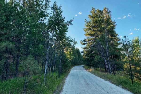
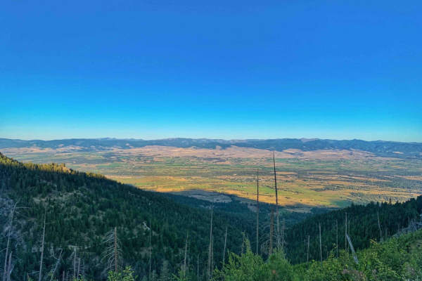
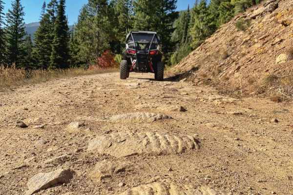
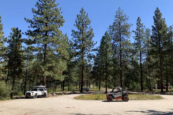
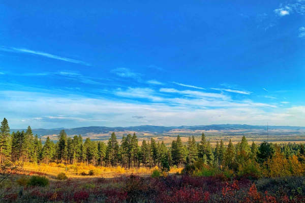
Big Creek Trailhead
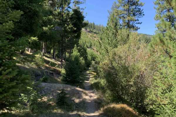
This is a short and beautiful drive. It's a windy and easy graded road that almost any car can make. Once you pass the residential area, the trail twists back and forth through a beautiful canyon and ends at a hiking trailhead with several parking spots, a pit toilet, and one official campsite with ...
Learn more about Big Creek Trailhead
Smith Ridge Dead End
Small offshoot trail on the Smith trail. Some dispersed camping right at the beginning. The trail cuts hard left into the woods. From here, it is super narrow and really difficult to find a turnaround spot. The trail dead-ends at a really narrow spot; a large rig would have to back out. Seasonally c...
Learn more about Smith Ridge Dead End
Lower Smith Ridge
This is an offshoot from the main trail. Seasonally closed Oct 14th through June 16th. It features forest views and chances to spot deer and elk. There is a small dispersed campsite at the end of the trail and a larger-style campsite on the way. The larger site has evidence of large bonfires and man...
Learn more about Lower Smith Ridge
Smiths Grassy Offshoot
A grassy offshoot from Smiths Trail. Seasonally closed from Oct 14th through June 16th. This trail features a beautiful ride through the woods on a lesser traveled trail. Please use caution when stopping in the taller grasses in the summer months as hot exhaust could spark a fire, based on the heig...
Learn more about Smiths Grassy Offshoot
Smith Ridge Glen Lake
This is a stunning drive into the Bitterroots from the Bell Crossing area. You start in a residential area and ascend to the trailhead for the Glen Lake hike. Along the way are a few hidden waterfalls, some dispersed camping spots, and a few breathtaking corners as you climb above the Bitterroot Val...
Learn more about Smith Ridge Glen Lake
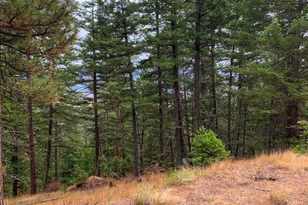
Smith Ridge
This is a twisty dirt out-and-back trail gaining elevation up to a nice campsite or turn around. It's a mostly treed trail with some beautiful views out to the Bitterroot Valley where the trees open up. Some of the trees are pines and others are aspens; it's a beautiful area to see in the fall when...
Learn more about Smith Ridge
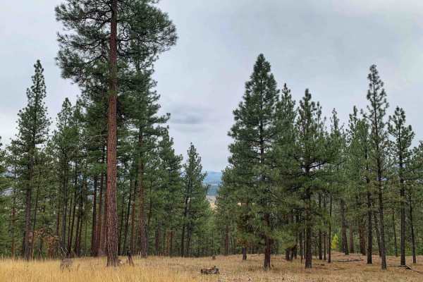
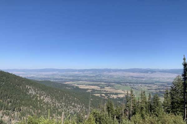
Bear Creek Overlook Trail
A well-maintained dirt road that is easily driven or accessible by all types of vehicles including 2WD passenger cars. The first half of the trail is a nice winding drive through tall pine trees the second half of the trail opens up to mountain views over the Bitterroot Valley and a few spots look o...
Learn more about Bear Creek Overlook Trail
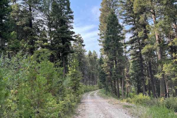
McCalla Switchbacks
Dirt and rocky switchback trail running up to McCalla peak. This trail is overgrown and very narrow in a lot of places. Would recommend this trail be traveled in smaller offroad vehicles such as SxS, ATV, or Dirtbike. There is a campsite or area to park a truck and trailer at the beginning of th...
Learn more about McCalla Switchbacks
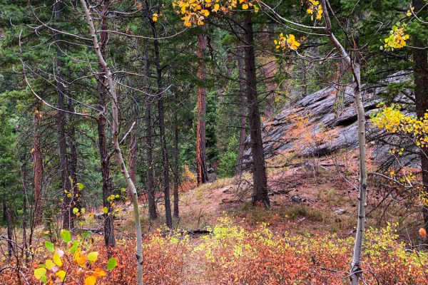
St. Mary's Peak Trail
This trail is mostly a 1 but earns the 2 rating in the last mile due to two switchbacks getting to the top of the trail. This trail is used primarily to access the very popular St.Mary's hiking trailhead. There is a small parking area at the top that tightly accommodates about 10 vehicles. From the ...
Learn more about St. Mary's Peak Trail
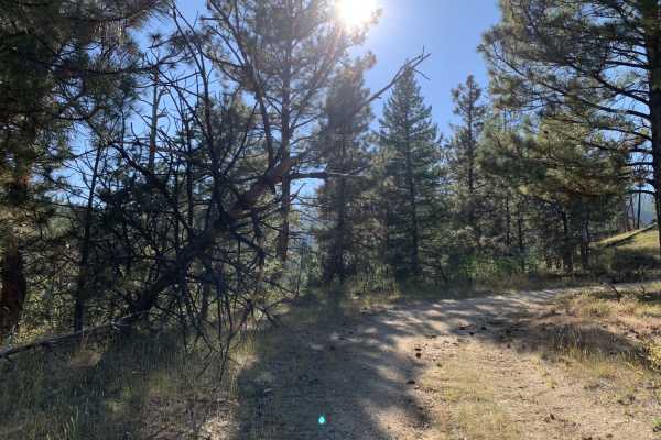
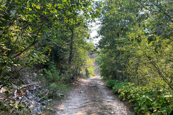
Gash Sweathouse Face Trail
Easy dirt forest road, less traveled and pretty overgrown. No problem for SxS and smaller vehicles. Small trucks and small 4x4 SUVs would make it but might incur scratches. Larger vehicles would need to do some trail maintenance to proceed. Low hanging tree across the trail in one spot. The trail is...
Learn more about Gash Sweathouse Face Trail
Gash Creek
Most of the trail up is a smooth easy graded road and would be no issue for any vehicle but it has been trimmed on either side of the road so it would be fine for larger vehicles as well. Beautiful scenic drive along the edge of the mountain in and out of the trees tons of stunning views. In some ar...
Learn more about Gash Creek
McCalla to St.Mary's Connection
This is a pretty wooded dirt trail that runs along the hillsides between McCalla Ridge and St.Mary's. It can be used to connect all three trails up to make a loop. This trail is less traveled than the others and is narrow in places running one car width along some of the ridge sections. with few g...
Learn more about McCalla to St.Mary's Connection
Cow Creek Road and Shiefman Hiking Trail
Generally, this is an easy dirt road that consists of multiple switchbacks and some decent elevation climbs. It begins in a neighborhood where it is asked to please drive slowly, and after, it turns into a dirt forest road. It should be pretty easy for an adventurous city car to make it, at least al...
Learn more about Cow Creek Road and Shiefman Hiking Trail
Mill Creek Trailhead
A very short out and back it's less than a mile Easily .8, most of it is through a neighborhood with private homes. The signage does ask that you stay on the main road. At the end is in the national forest and the trail ends at a large parking lot with toilets and at least one picnic table and an of...
Learn more about Mill Creek Trailhead
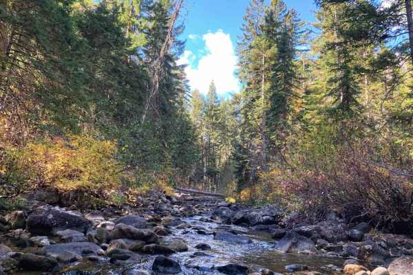
Sawmill Saddle
Easy graded forest road with plenty of switchbacks and a few loose gravel sections. It's a nice trail with some views of the valley as you head into the mountains. The lower part of the trail takes you through town and along a nice creek briefly. As you climb, there are a few spots to pull off and c...
Learn more about Sawmill Saddle
Lower Willow St Clair
Easy little forest road that begins in a housing area and winds through private property until you reach the forest. There's a small creek alongside the road and a few pullouts. Saw one dispersed camping site along the way. The intersection at the end of the lower section splits to upper Willow St C...
Learn more about Lower Willow St Clair
Bass Overlook Trail
Fun switchback dirt trail that ends at a small parking area with a nice overlook. This is where the Bass Overlook Hiking trail #392 starts and is part of the Selway-Bitterroot Wilderness. Bass Overlook Trailhead has adequate parking for both cars and trailers. The overlook is a short walk from the p...
Learn more about Bass Overlook Trail
Blodgett Hiking Trail and Campground
This is a short out and back trail with stunning views of the rock formations up the canyon. The middle portion of the trail is through private land. At the end of the trail is a larger dirt parking area that can accommodate horse trailers as well as passenger cars. There is access to the Blodgett...
Learn more about Blodgett Hiking Trail and Campground
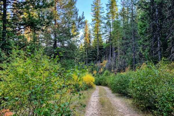
Gold Creek Trail
Easy dirt trail safe for most 4WD and 2WD vehicles all the way to the Gold Creek Campground. The trail continues past the Gold Creek campground but turns into 4WD high clearance only. The trail begins through a neighborhood and is well-maintained gravel, watch for pedestrians walking their dogs. Th...
Learn more about Gold Creek Trail
Gold Creek
Gold Creek Trail is a good trail to check out when in the Willow Creek area. The trail is an eleven mile out and back that has a maximum difficulty of a 3/10. For full width vehicles, this trail is only open from June 16 - October 14. To find this trail you will need to take the "Lower Willow St Cla...
Learn more about Gold Creek
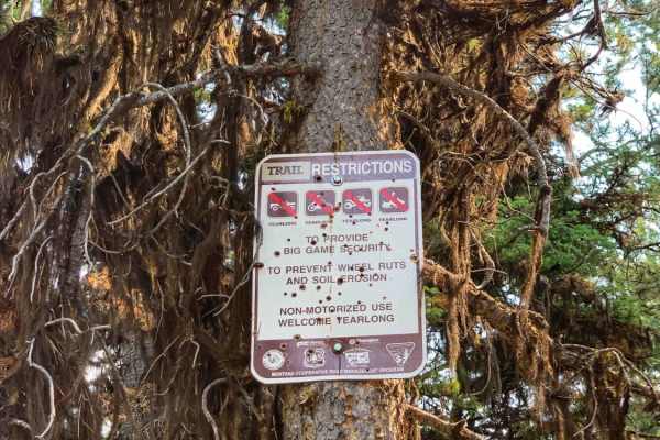
Beginner ATV trails near Victor, Montana
Explore ATV-friendly trails near you. These trails are accessible for vehicles up to 50 inches wide, perfect for ATVs and smaller off-road machines.
Smith Ridge Dead End
Small offshoot trail on the Smith trail. Some dispersed camping right at the beginning. The trail cuts hard left into the woods. From here, it is super narrow and really difficult to find a turnaround spot. The trail dead-ends at a really narrow spot; a large rig would have to back out. Seasonally c...
Learn more about Smith Ridge Dead End
Lower Smith Ridge
This is an offshoot from the main trail. Seasonally closed Oct 14th through June 16th. It features forest views and chances to spot deer and elk. There is a small dispersed campsite at the end of the trail and a larger-style campsite on the way. The larger site has evidence of large bonfires and man...
Learn more about Lower Smith Ridge
Smiths Grassy Offshoot
A grassy offshoot from Smiths Trail. Seasonally closed from Oct 14th through June 16th. This trail features a beautiful ride through the woods on a lesser traveled trail. Please use caution when stopping in the taller grasses in the summer months as hot exhaust could spark a fire, based on the heig...
Learn more about Smiths Grassy Offshoot
Smith Ridge Glen Lake
This is a stunning drive into the Bitterroots from the Bell Crossing area. You start in a residential area and ascend to the trailhead for the Glen Lake hike. Along the way are a few hidden waterfalls, some dispersed camping spots, and a few breathtaking corners as you climb above the Bitterroot Val...
Learn more about Smith Ridge Glen Lake
Beginner UTV/side-by-side trails near Victor, Montana
Find UTV and side-by-side trails near you. These trails accommodate vehicles up to 60 inches wide, ideal for UTVs, side-by-sides, and wider off-road rigs.
Big Creek Trailhead
This is a short and beautiful drive. It's a windy and easy graded road that almost any car can make. Once you pass the residential area, the trail twists back and forth through a beautiful canyon and ends at a hiking trailhead with several parking spots, a pit toilet, and one official campsite with ...
Learn more about Big Creek Trailhead
Smith Ridge Dead End
Small offshoot trail on the Smith trail. Some dispersed camping right at the beginning. The trail cuts hard left into the woods. From here, it is super narrow and really difficult to find a turnaround spot. The trail dead-ends at a really narrow spot; a large rig would have to back out. Seasonally c...
Learn more about Smith Ridge Dead End
Lower Smith Ridge
This is an offshoot from the main trail. Seasonally closed Oct 14th through June 16th. It features forest views and chances to spot deer and elk. There is a small dispersed campsite at the end of the trail and a larger-style campsite on the way. The larger site has evidence of large bonfires and man...
Learn more about Lower Smith Ridge
Smiths Grassy Offshoot
A grassy offshoot from Smiths Trail. Seasonally closed from Oct 14th through June 16th. This trail features a beautiful ride through the woods on a lesser traveled trail. Please use caution when stopping in the taller grasses in the summer months as hot exhaust could spark a fire, based on the heig...
Learn more about Smiths Grassy Offshoot
The onX Offroad Difference
onX Offroad combines trail photos, descriptions, difficulty ratings, width restrictions, seasonality, and more in a user-friendly interface. Available on all devices, with offline access and full compatibility with CarPlay and Android Auto. Discover what you're missing today!
Open Trail Map