
Beginner Off-Road Trails
Near Vergennes, Illinois
Explore All Beginner Trails Near Vergennes, Illinois
Beginner Off-Road Trails Near Vergennes, Illinois
Discover the best beginner-friendly off-road trails near you. These easier, lower-rated trails are a great place to start — browse trail maps, check difficulty ratings, and find your next adventure.

Big Muddy Levee Road
The Big Muddy River Levee Road is the southern publicly accessible 10-mile-long gravel road following the ridge top of the Levee, along the lower southern section of the Big Muddy River in Jackson County Illinois. Note that the Northern 3.4 mile section of this road has transferred from the public-o...
Learn more about Big Muddy Levee Road
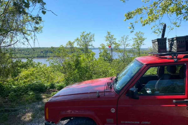
Happy Hollow FSR 787
The Happy Hollow FSR 787 is a gravel forestry route in the northwest Mississippi Bluffs sector of Shawnee National Forest. The trail specifically goes up into the hills along the Mississippi River north of Grand Tower, IL. It climbs just shy of 300 feet over the first .7 mile of the gravel, which is...
Learn more about Happy Hollow FSR 787
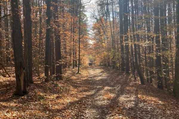
SFR 743/743A
SFR 743/743A offers a scenic and moderately challenging descent through the dense canopy of the Shawnee National Forest, making it an excellent short adventure for offroaders looking to test their traction. Branching off Natural Bridge Road (SFR 750) near the Pomona Natural Bridge, this 1.4-mile tra...
Learn more about SFR 743/743A
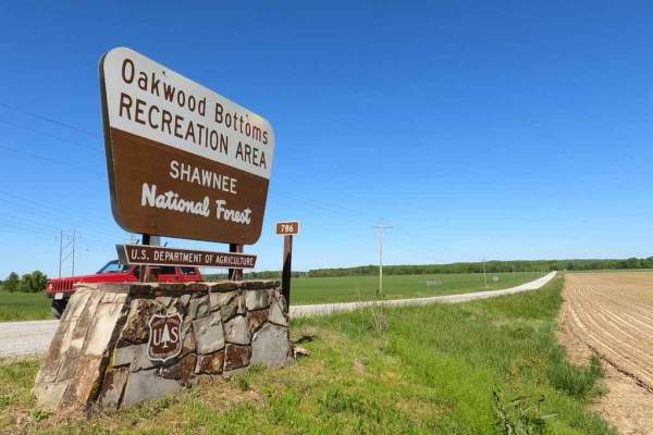
Oakwood Bottoms/Turkey Bayou FSR 786/786R
The Oakwood Bottoms FSR 786, and Turkey Bayou FSR 786R, also know in the forestry maps as Johns Spur Road, is a gravel forestry road through the wetland bottoms in the northwest Mississippi Bluffs sector of Shawnee National Forest. Through there is two separate road names and IDs the road seamlessly...
Learn more about Oakwood Bottoms/Turkey Bayou FSR 786/786R
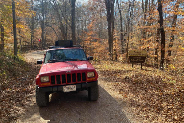
Natural Bridge Road
This is a maintained gravel road with an occasional flat natural rock sticking up in the middle of the road. This trail features beautiful tall pines and areas you can see for miles. The road leads up a steep grade that may include washboards and mild washes when the season is wet and conditions are...
Learn more about Natural Bridge Road
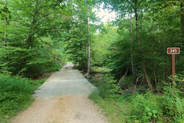
Rattlesnake Ferry - FS 345
Rattlesnake Ferry - FS 345 is maintained gravel transforming to a natural forest service road in Shawnee National Forest, north of the LaRue-Pine Hills/Otter Pond Research Natural Area, a part of the greater Mississippi Bluffs unit. The Rattlesnake Ferry features smoother gravel from the higher elev...
Learn more about Rattlesnake Ferry - FS 345
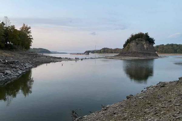
Tower Rock Road PCR 460
Tower Rock Road or Perry County Road 460 is a gravel road that parallels the Mississippi River, leading you to the historic Tower Rock Natural Area. The road has a few steep grades and is amongst the forest. Expect some serious washboarding and gravel mounding due to heavy use. Near the end you cros...
Learn more about Tower Rock Road PCR 460
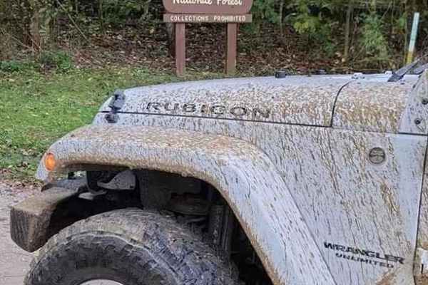
Pine Hills Road SFR 236
Pine Hills Road SFR 236 within Shawnee National Forest is a very lovely gravel Shawnee National Forest Road with access to hiking trails, scenic overlooks, and a campground all in one. Its biggest obstacles are a few steep grades with lite water washes, mounding loose gravel, and mild washboarding. ...
Learn more about Pine Hills Road SFR 236
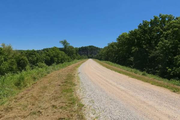
Muddy Levee Road
Muddy Levee Road, not to be confused with Big Muddy Levee Road, is the gravel levee road along the southeast side of Big Muddy River, crossing over Levee District land, and Shawnee National Forest, to enter the LaRue-Pine Hills Natural Research Area. The road is commonly used as the gateway access t...
Learn more about Muddy Levee Road

LaRue Road - FS 345
LaRue Road FS 345, Scatters Road, or North LaRue Road to differentiate it from the Snake Road, is a maintained gravel road with easement over privately owned Jackson County land and Shawnee National Forest, within the LaRue-Pine Hills/Otter Pond Research Natural Area, a part of the greater Mississip...
Learn more about LaRue Road - FS 345
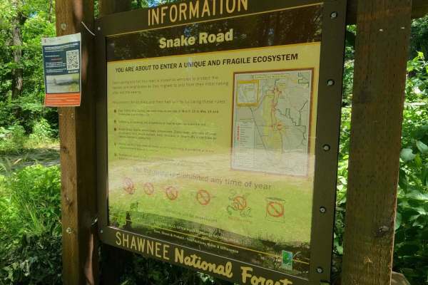
Snake Road - FS 345
Snake Road FS 345 or South LaRue Road, is a maintained gravel road in Shawnee National Forest, within the LaRue-Pine Hills/Otter Pond Research Natural Area, a part of the greater Mississippi Bluffs unit. Snake Road gets its name from the local snakes that migrate over the road between the limestone ...
Learn more about Snake Road - FS 345

North Forest Road
North Forest Road is the gravel-based southern forest loop within the Illinois Trail of Tears State Forest. It features a one-way track from the eastern entry to the west exit on the paved State Forest Road. The area features a yearly closure from December 24th to the end of the wild Turkey Season (...
Learn more about North Forest Road
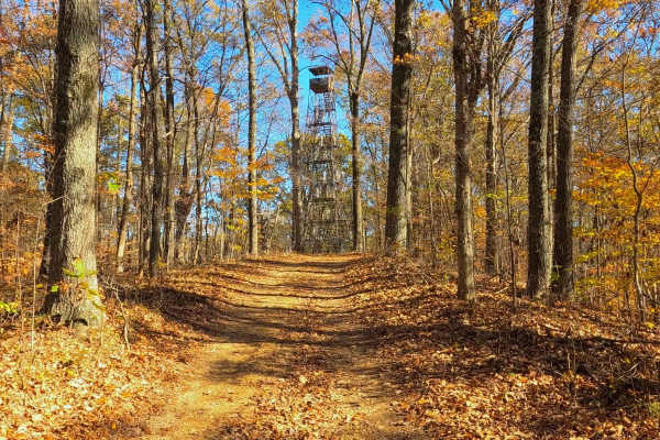
South Forest Road
South Forest Road is the gravel-based southern forest loop within the Illinois Trail of Tears State Forest. It features a one-way track from the western entry to the east exit on the paved State Forest Road. The area features a yearly closure from December 24th to the end of the wild Turkey Season (...
Learn more about South Forest Road
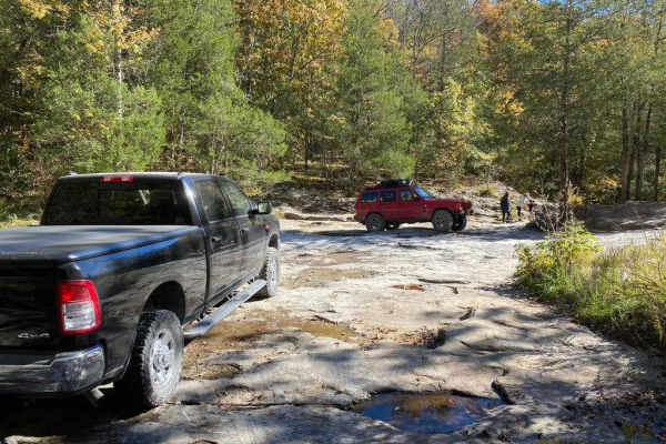
Bork Falls Road
Bork Falls Road, also known partly as Regent Lane and Cedar Grove Road and featuring the Goreville Waterfall, is a gravel road through Johnson County, Illinois. It provides access to the western section of Ferne Clyffe State Park and Bork Falls. The road is generally well-maintained, featuring only ...
Learn more about Bork Falls Road

Lovejoy Creek Road
The Lovejoy Creek Road, also known as the Cape Girardeau County Road 532, is one of the last true creek bottom roads in Cape Girardeau County. The road on both ends is maintained with gravel by the County Highway Department, but the center section still travels over the natural creek bed of Lovejoy ...
Learn more about Lovejoy Creek Road
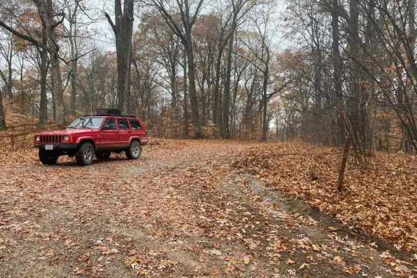
Hamburg SFR 266A
As a branch of Atwood Road 266, the Hamburg 266A is a bit more of an offroading road and less of a scenic road within Shawnee National Forest. It has an off-camber hill within .2 of the entrance followed by many water collection areas that get muddy, the gravel fades in on the hilltops and out in th...
Learn more about Hamburg SFR 266A
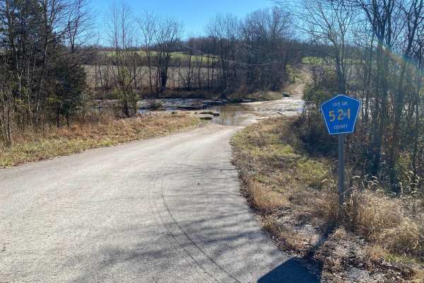
Cape Gir. Co 521 / 520
The Cape Girardeau County Roads 521 and 520 form a great scenic gravel road and loop with the main road of the area (US-61, with help from Cape Co 510). The roads were constructed around two creeks in the area, Hughes Creek and Buckeye Creek. It features a natural low-water bridge traversing over be...
Learn more about Cape Gir. Co 521 / 520
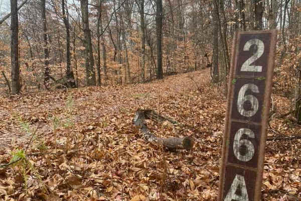
N Hamburg Hill Spur
The N Hamburg Hill Spur 266AA, within Shawnee National Forest, is a trail that once was traversable by full-width vehicles, but in its current state should only be trekked by dirt bikes and 4-wheelers, within the first .1 mile there is a turnaround/parking area to unload, but from there on, the trai...
Learn more about N Hamburg Hill Spur
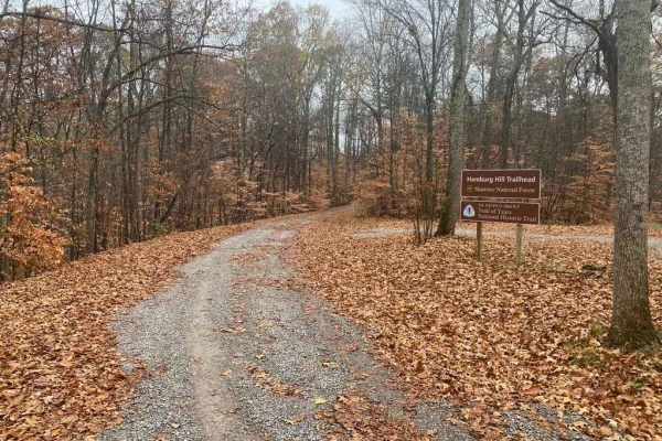
Atwood Road SFR 266
Atwood Road SFR 266 is a Shawnee National Forest state forest road that travels to the old Atwood lookout tower site. The hill's grade is one of the steepest and tallest in the area right at a 500-foot elevation climb within 1.5 miles. The road features sections of well-maintained gravel along with ...
Learn more about Atwood Road SFR 266
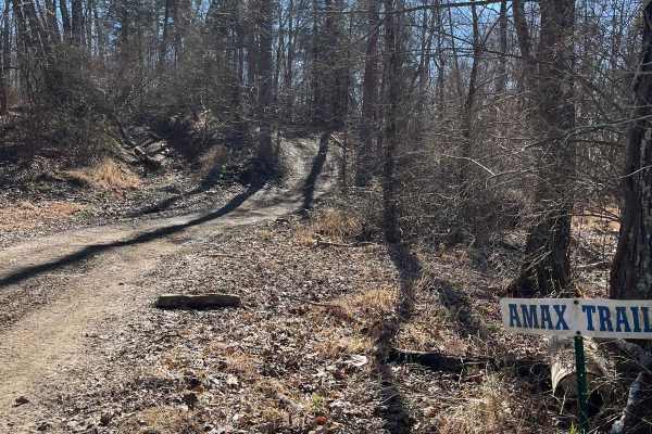
Amax Trail
The Amax Trail can be seen from the main gate to Little Egypt Off Road and is the westernmost main trail on the property. It traverses from alongside Old Route 13 to the Boundary Trail on the south end. The Amax Trail overlooks the creek bottoms that make up the southwest corner of the property, a g...
Learn more about Amax Trail
Beginner ATV trails near Vergennes, Illinois
Explore ATV-friendly trails near you. These trails are accessible for vehicles up to 50 inches wide, perfect for ATVs and smaller off-road machines.
Natural Bridge Road
This is a maintained gravel road with an occasional flat natural rock sticking up in the middle of the road. This trail features beautiful tall pines and areas you can see for miles. The road leads up a steep grade that may include washboards and mild washes when the season is wet and conditions are...
Learn more about Natural Bridge Road
N Hamburg Hill Spur
The N Hamburg Hill Spur 266AA, within Shawnee National Forest, is a trail that once was traversable by full-width vehicles, but in its current state should only be trekked by dirt bikes and 4-wheelers, within the first .1 mile there is a turnaround/parking area to unload, but from there on, the trai...
Learn more about N Hamburg Hill Spur
Amax Trail
The Amax Trail can be seen from the main gate to Little Egypt Off Road and is the westernmost main trail on the property. It traverses from alongside Old Route 13 to the Boundary Trail on the south end. The Amax Trail overlooks the creek bottoms that make up the southwest corner of the property, a g...
Learn more about Amax Trail
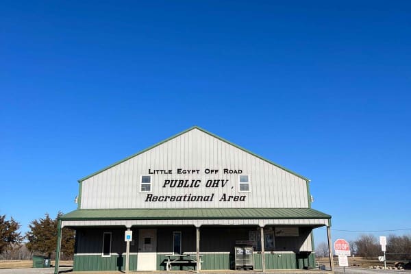
Little Egypt Off-Road OHV Park Entrance
Welcome to Little Egypt Off-Road OHV Park! Our hours of operation are 8 AM to 5 PM on Saturdays and Sundays, including most holidays. We offer over 50 miles of trails, from beginner access roads to challenging single-track, extending throughout our roughly 1000-acre park. Side-by-sides, ATVs, and d...
Learn more about Little Egypt Off-Road OHV Park Entrance
Beginner UTV/side-by-side trails near Vergennes, Illinois
Find UTV and side-by-side trails near you. These trails accommodate vehicles up to 60 inches wide, ideal for UTVs, side-by-sides, and wider off-road rigs.
Natural Bridge Road
This is a maintained gravel road with an occasional flat natural rock sticking up in the middle of the road. This trail features beautiful tall pines and areas you can see for miles. The road leads up a steep grade that may include washboards and mild washes when the season is wet and conditions are...
Learn more about Natural Bridge Road
Hamburg SFR 266A
As a branch of Atwood Road 266, the Hamburg 266A is a bit more of an offroading road and less of a scenic road within Shawnee National Forest. It has an off-camber hill within .2 of the entrance followed by many water collection areas that get muddy, the gravel fades in on the hilltops and out in th...
Learn more about Hamburg SFR 266A
Atwood Road SFR 266
Atwood Road SFR 266 is a Shawnee National Forest state forest road that travels to the old Atwood lookout tower site. The hill's grade is one of the steepest and tallest in the area right at a 500-foot elevation climb within 1.5 miles. The road features sections of well-maintained gravel along with ...
Learn more about Atwood Road SFR 266
Amax Trail
The Amax Trail can be seen from the main gate to Little Egypt Off Road and is the westernmost main trail on the property. It traverses from alongside Old Route 13 to the Boundary Trail on the south end. The Amax Trail overlooks the creek bottoms that make up the southwest corner of the property, a g...
Learn more about Amax Trail
The onX Offroad Difference
onX Offroad combines trail photos, descriptions, difficulty ratings, width restrictions, seasonality, and more in a user-friendly interface. Available on all devices, with offline access and full compatibility with CarPlay and Android Auto. Discover what you're missing today!
Open Trail Map