
Beginner Off-Road Trails
Near Turkey Creek, Arizona
Explore All Beginner Trails Near Turkey Creek, Arizona
Beginner Off-Road Trails Near Turkey Creek, Arizona
Discover the best beginner-friendly off-road trails near you. These easier, lower-rated trails are a great place to start — browse trail maps, check difficulty ratings, and find your next adventure.
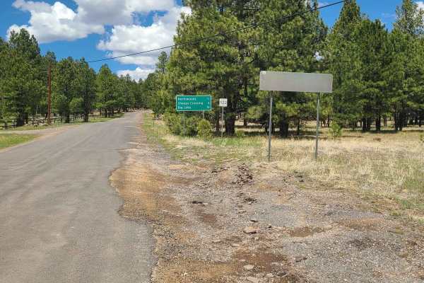
Springer Mountain
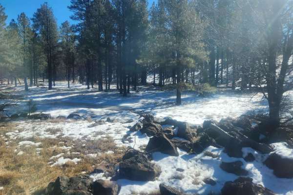
Springer Mountain is an easy and scenic point-to-point trail through the Apache-Sitgreaves National Forest near Lakeside, AZ. The route is graded and covered with gravel and easily passable by most vehicles. Rain may increase the trail difficulty, and winter travel may not be possible. This is a gre...
Learn more about Springer Mountain
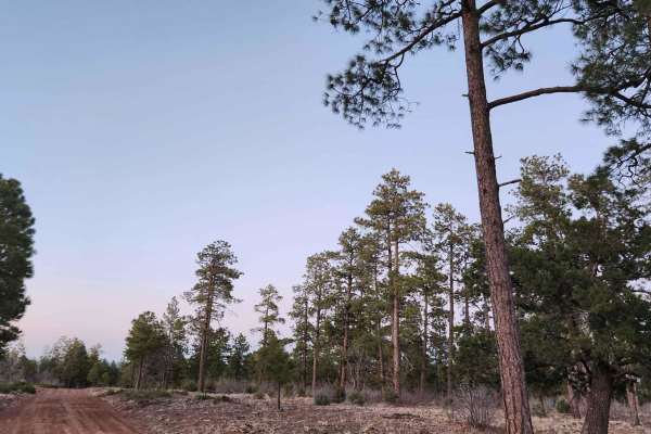
Ski Hi to Turkey Mountain
This is a nice little drive in the forest--nothing technical. Ski Hi is accessible by high-clearance cars. There are beautiful pines and awesome starry night skies in the late spring/summer! The roads are usually passable in the snow but not always. A few tanks along the way may bring some wildlife ...
Learn more about Ski Hi to Turkey Mountain

FR283 - Marshall Mountain
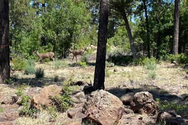
You'll find lots of Ponderosa Pine, Some Oak, and Juniper. You'll also see changes to see wildlife such as Elk, Deer, Turkey, Rabbits & Squirrels. This is a nice easy drive through the forest. This trail will take you from Porter Mountain Road to FR271 if you stay through and don't wander on the man...
Learn more about FR283 - Marshall Mountain
Turkey Mountain
This is a little jumper road between FR182 and FR283 with lots of side trails to explore. It is a really easy grade. It may become impassible in winter. Less than 1/2 hour - more like a 15-minute ride from one road to the next on a nice day. Winter may take a little longer depending on the snow.
Learn more about Turkey Mountain
Forest Service Road 112
This is an easy, well-graded two-lane road that connects the 260 Highway to the 273 Highway. This road has beautiful views of Sunrise Ski Resort, Mount Baldy, and a few reservoirs and crosses over Hall Creek. There are many fun side trails, including the Pole Knoll trail system which often has an ab...
Learn more about Forest Service Road 112
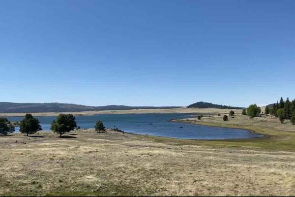
Log Landing
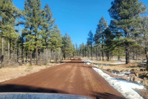
Log Landing is an easy, two-lane gravel road leading to Big Lake in the Apache-Sitgreaves National Forest in the beautiful Arizona White Mountains. Besides snow during the winter, there are no obstacles associated with this trail. The trail leads to Big Lake and offers camping and other recreation a...
Learn more about Log Landing
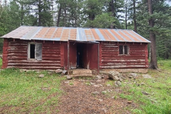
Porter Mountain Loop
Spring, Summer, Fall - mostly easy trail with some great side spurs with awesome views. Along this route, you will also see an old run-down cabin near the Sawmill tank and an old homestead North of the Timber Mesa Trailhead, which we call Twin Chimneys. Parts of this trail are shared with maintained...
Learn more about Porter Mountain Loop
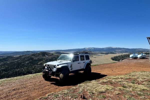
Greens Peak
Take a beautiful drive from Highway 260 to FR 118 up north. You'll pass through wide-open meadows and dense forests of pine and aspen on a moderately bumpy dirt road with some small washouts. Along the way, you'll find cool spots to camp and fun side roads, including a stop at Greens Peak lookout to...
Learn more about Greens Peak
Pole Knoll Summit
This trail can be accessed off Highway 260 or FSR 112. This short trail will take you through some beautiful aspen trees that canopy over the trail near the summit. The forest is pretty dense throughout most of the trail and often you will see wildlife, with elk, deer, and turkeys being the most com...
Learn more about Pole Knoll Summit
Forest Service Road 61/64F
This is a very scenic drive that will take you by the Thode Cabin and the old Whiting Saw Mill that both date back to the early 1900's as well as a small side trail that will take the Greens Peak lookout tower. About half of the trail is a well-maintained Forest Service Road, while the other half is...
Learn more about Forest Service Road 61/64F
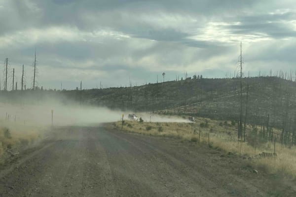
Conklin Spring Road - Forest Road 68
Conklin Spring Road (Forest Road 68) is a scenic forest drive cutting across the Apache-Sitgreaves National Forest north of Big Lake. This well-maintained dirt road runs through diverse high-country landscapes, from open grasslands with burned stands of old timber to lush green pine and aspen groves...
Learn more about Conklin Spring Road - Forest Road 68
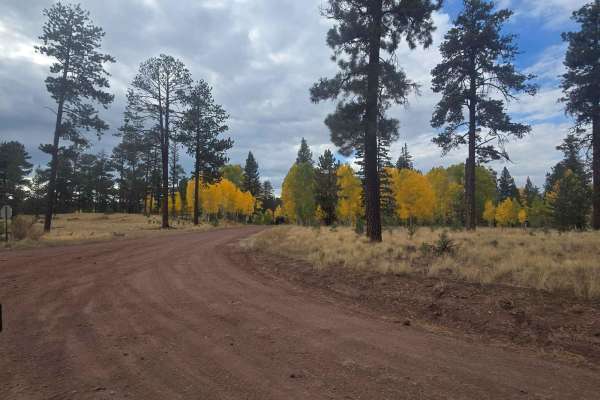
Hall Creek Road
Hall Creek Road connects Fire Service Road 87 to Forest Service Road 112, providing entry to several shorter trails with desirable camping sites and fun trails. Those visiting in autumn will witness the picturesque transformation of roadside trees. It's also common to encounter deer and elk populati...
Learn more about Hall Creek Road
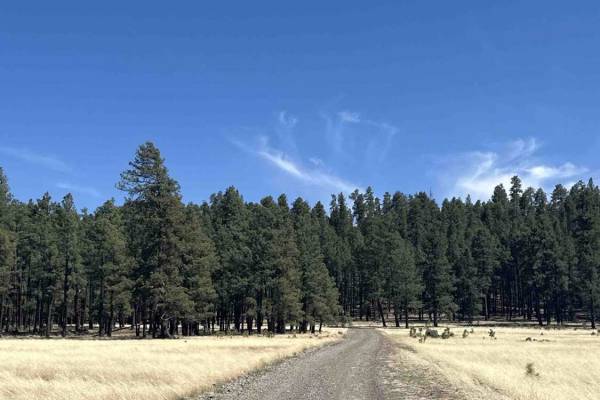
FS 25H
Forest Service Road 25 is an easy trail through a large open area, giving you plenty of opportunities to see wildlife like elk, deer, big horn sheep, and pronghorns. FS 25H is slightly more difficult with a narrower road and a couple of areas that were washed out by rain. There are amazing views on ...
Learn more about FS 25H
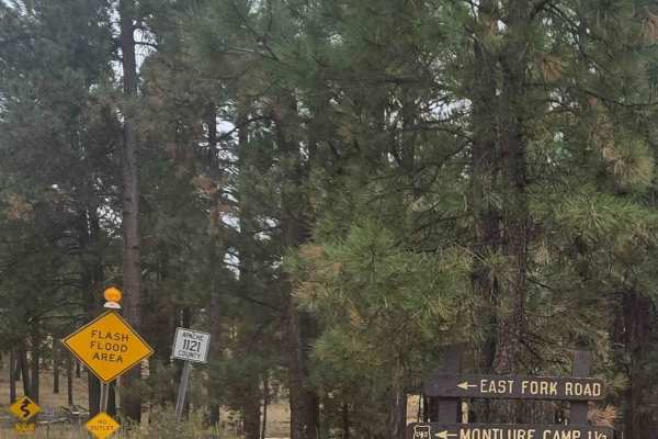
East Fork
This trail starts right before you enter the town of Greer. Close to the beginning of the road is the Butler Canyon Nature Trail (a short hiking trail) and the road ends at the Montlure Presbyterian Church Camp. This is a well-maintained gravel road that takes you along the side of the Little Colora...
Learn more about East Fork
FR140
Use FR140 to cross between Joe Tank Road (FR136) and Rim Road (FR300)--it is a good access road to some great side trips for a day of exploring. Wild horses and bald eagles are present in the area. Bringing a motorhome or car back here for camping is not recommended, but it is a good area for overla...
Learn more about FR140
Decon1
This trail seems like it will lead to a dead end;there's a lot of overgrowth and many downed trees on and near the road. Surprisingly, it continues through. There's nothing hard about this trek and it has a great view of a prairie-type land at the north end.
Learn more about Decon1
Wonderland
This trail is accessed off Highway 373 just out of Greer. It will take to the East side of the Greer "lake" called River Reservoir. The road is just over 2 miles and can easily be traveled by car. The road ends where it meets private property and a road-closed sign. There is a nice parking lot with ...
Learn more about Wonderland
Forest Service Road 87
Apache County Road 1122 is an easy two-lane gravel road from Greer to Highway 273. There are several nice camping spots along the road and access to a non-motorized hiking/biking trail by the scenic bridge. Along this route, you will have views of Sunrise Ski Mountain and Mount Baldy, one of the tal...
Learn more about Forest Service Road 87
FR135
FR135 is another great connection between Rim Road (FR300) and Joe Tank Road (FR136). This has a greater change in elevation than FR140 and in the winter can become impassable due to snow and the grade combined. This trail has several really cool side trails and some spurs as well. It's great to exp...
Learn more about FR135
Carnero Creek Trail
This is a very scenic drive through the heart of the White Mountains in Arizona. The trail is a well-maintained Forest Service road, suited for a vehicle with average ground clearance. Licensed and registered vehicles are required to travel this trail. There are spots of washboard, but driving slowl...
Learn more about Carnero Creek Trail
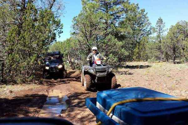
Beginner ATV trails near Turkey Creek, Arizona
Explore ATV-friendly trails near you. These trails are accessible for vehicles up to 50 inches wide, perfect for ATVs and smaller off-road machines.
Springer Mountain
Springer Mountain is an easy and scenic point-to-point trail through the Apache-Sitgreaves National Forest near Lakeside, AZ. The route is graded and covered with gravel and easily passable by most vehicles. Rain may increase the trail difficulty, and winter travel may not be possible. This is a gre...
Learn more about Springer Mountain
Ski Hi to Turkey Mountain
This is a nice little drive in the forest--nothing technical. Ski Hi is accessible by high-clearance cars. There are beautiful pines and awesome starry night skies in the late spring/summer! The roads are usually passable in the snow but not always. A few tanks along the way may bring some wildlife ...
Learn more about Ski Hi to Turkey Mountain
FR283 - Marshall Mountain
You'll find lots of Ponderosa Pine, Some Oak, and Juniper. You'll also see changes to see wildlife such as Elk, Deer, Turkey, Rabbits & Squirrels. This is a nice easy drive through the forest. This trail will take you from Porter Mountain Road to FR271 if you stay through and don't wander on the man...
Learn more about FR283 - Marshall Mountain
Turkey Mountain
This is a little jumper road between FR182 and FR283 with lots of side trails to explore. It is a really easy grade. It may become impassible in winter. Less than 1/2 hour - more like a 15-minute ride from one road to the next on a nice day. Winter may take a little longer depending on the snow.
Learn more about Turkey Mountain
Beginner UTV/side-by-side trails near Turkey Creek, Arizona
Find UTV and side-by-side trails near you. These trails accommodate vehicles up to 60 inches wide, ideal for UTVs, side-by-sides, and wider off-road rigs.
Springer Mountain
Springer Mountain is an easy and scenic point-to-point trail through the Apache-Sitgreaves National Forest near Lakeside, AZ. The route is graded and covered with gravel and easily passable by most vehicles. Rain may increase the trail difficulty, and winter travel may not be possible. This is a gre...
Learn more about Springer Mountain
Ski Hi to Turkey Mountain
This is a nice little drive in the forest--nothing technical. Ski Hi is accessible by high-clearance cars. There are beautiful pines and awesome starry night skies in the late spring/summer! The roads are usually passable in the snow but not always. A few tanks along the way may bring some wildlife ...
Learn more about Ski Hi to Turkey Mountain
FR283 - Marshall Mountain
You'll find lots of Ponderosa Pine, Some Oak, and Juniper. You'll also see changes to see wildlife such as Elk, Deer, Turkey, Rabbits & Squirrels. This is a nice easy drive through the forest. This trail will take you from Porter Mountain Road to FR271 if you stay through and don't wander on the man...
Learn more about FR283 - Marshall Mountain
Turkey Mountain
This is a little jumper road between FR182 and FR283 with lots of side trails to explore. It is a really easy grade. It may become impassible in winter. Less than 1/2 hour - more like a 15-minute ride from one road to the next on a nice day. Winter may take a little longer depending on the snow.
Learn more about Turkey Mountain
The onX Offroad Difference
onX Offroad combines trail photos, descriptions, difficulty ratings, width restrictions, seasonality, and more in a user-friendly interface. Available on all devices, with offline access and full compatibility with CarPlay and Android Auto. Discover what you're missing today!
Open Trail Map