
Beginner Off-Road Trails
Near Scipio, Utah
Explore All Beginner Trails Near Scipio, Utah
Beginner Off-Road Trails Near Scipio, Utah
Discover the best beginner-friendly off-road trails near you. These easier, lower-rated trails are a great place to start — browse trail maps, check difficulty ratings, and find your next adventure.
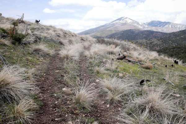
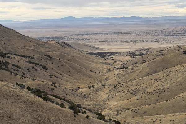
Richfield Pioneer Road North
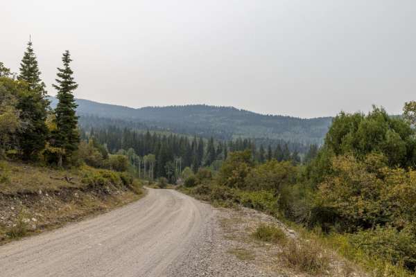
Richfield Pioneer Road North is an 11.9-mile (23.8-mile round trip) out-and-back trail rated 3 of 10 located in Millard County. The trail is located within the Fishlake National Forest, Fillmore Ranger District. This trail is also marked as Paiute Side Trail #96 and is popular with the ATV/UTV crowd...
Learn more about Richfield Pioneer Road North
Sheep Trail Road
The Sheep Trail Road is a well-maintained road that gives access to Pahvant Butte. The east end is at the junction of Highway 50 and Highway 100. The south end is off the Clear Lake Road. There are some dunes on BLM land on the east end of the road. In that area, the sand does get blown across the r...
Learn more about Sheep Trail Road
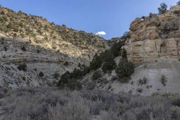
Willow Creek Canyon Road
Willow Creek Canyon Road traverses nearly 4,000 feet of elevation from the Sevier Valley floor to the junction with Richfield-Pioneer Road. The northern end of the road meanders through sagebrush flats dotted with cedar trees. As you start the rise up, the mountain cedar trees give way to large pine...
Learn more about Willow Creek Canyon Road
Richfield-Pioneer Road
The north end is accessed via Willow Creek Canyon Road and follows along the top of the Tushar Mountain Range. The area has several meadows, large Pine Trees, red rock outcroppings, and views of the Sevier, Sanpete, and Millard County Valleys. Many different species of wildlife can be viewed along t...
Learn more about Richfield-Pioneer Road
Willow Creek Road
Willow Creek Road provides access to Fishlake and Manti-La Sal national forests from the north end of Sevier County and the south end of Sanpete County. Over its nearly 17-mile stretch, it gains nearly 4,000 feet of elevation. The vegetation is diverse, from cedar trees and scrub oak on the low end ...
Learn more about Willow Creek Road
431
431 is a short ATV route that starts at the Chalk Creek Trailhead and goes into the Fishlake National Forest for a mile until it connects with 327. The trail is decently wide and easy for vehicles 50" or less for the whole route. It meanders into the mountains, through grassy rolling hills, mostly o...
Learn more about 431
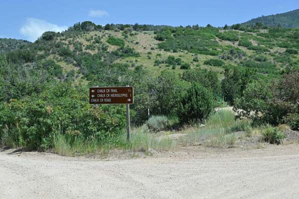
Chalk Creek Road/PST 03A
It is a stunning canyon trail that runs between Fillmore, UT, to the west and connects with Paiute01 near Indian Springs USFS Guard Station to the east. This trail initially starts as a well-improved dirt road from west to east due to access to several USFS picnic areas interspersed along the creek ...
Learn more about Chalk Creek Road/PST 03A
Mellor Canyon Road
Private land holdings and BLM trail closures make the connector from Fayetteville to Manti partially inaccessible. This connector is important for the Arapeen Trail system because it allows access to Manti trails from the Fayette/Yuba Lake area. There is a nice mix of canyons and ridges that make th...
Learn more about Mellor Canyon Road
327
327 is a short and scenic ATV trail in the Paiute ATV Trail Area in the Fishlake National Forest near Fillmore, Utah. It's a continuation of Trail 431, starting at a short and steep hill climb up a small hill. It continues on the ridge line of the rolling hills and meanders around the meadows and fo...
Learn more about 327

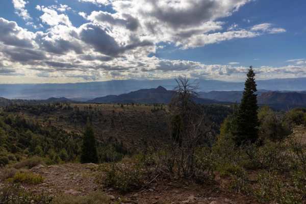
Strawberry Canyon
Strawberry Canyon is a stunning out-and-back trail that offers a perfect mix of technical driving and high-alpine scenery. The trail winds alongside the vibrant red rock walls of the canyon, opening up into expansive, lush meadows. Width Restriction: This is a 60-inch trail. It is strictly for narro...
Learn more about Strawberry Canyon

Mayfield-Gunnison Road
This is the main access road to Mayfield Canyon. The well maintained wide gravel road allows two way traffic and plenty of primitive camping spots along the way. There are multiple bathrooms at many of the camping locations which are maintained by the forest service.Pine, Aspen, and Cedar trees, alo...
Learn more about Mayfield-Gunnison Road
Chicken Creek
This trail starts out in a little town called Levan. The trail follows a gravel road along Chicken Creek. Along the trail, there are great views with cool mountain ledges, and big Aspen and Pine trees. This trail will end in a dead end with some private property signs and gates.
Learn more about Chicken Creek
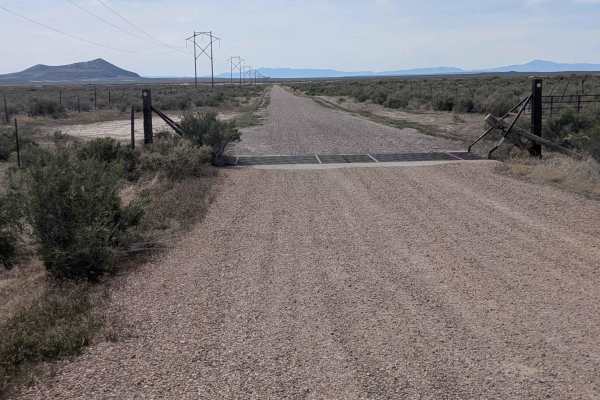
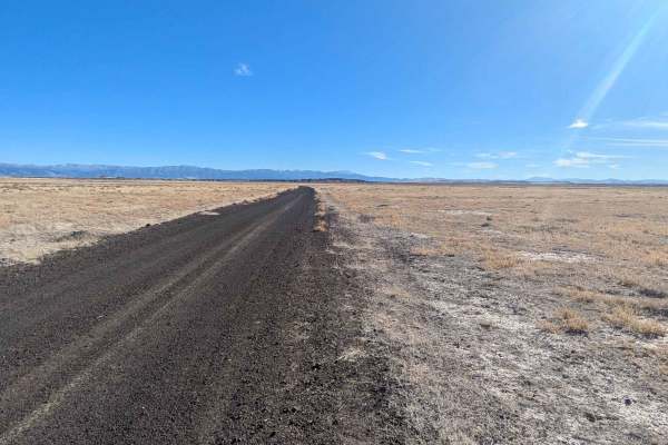
Clear Lake Road
The Clear Lake Road is a well-maintained, graded gravel road accessible by all vehicles. The east end of the road is located in the town of Flowell, Utah, which is west of Fillmore, Utah. There are no services in Flowell. Fillmore will be the best option for fuel or other amenities. The west end of ...
Learn more about Clear Lake Road
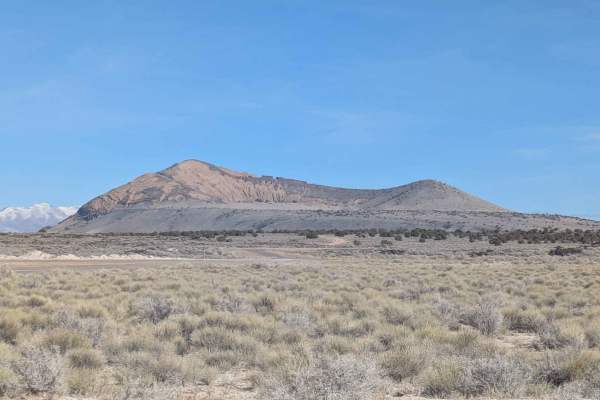
Pahvant Butte Bowl
This trail is short but worth your time to travel down. While not as difficult as the trail leading up to the turn, it is still a little sandy with a couple of small, rockier sections as you travel across the bowl. As you travel across the bowl, you start climbing until you reach the end of the trai...
Learn more about Pahvant Butte Bowl
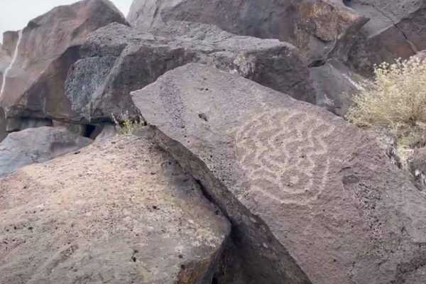
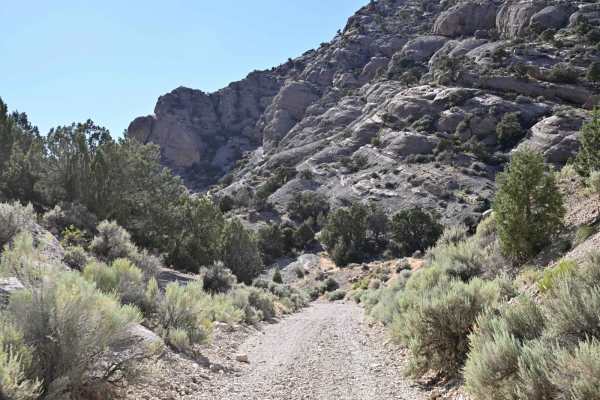
Devil's Kitchen - CR 3551
Devils Kitchen is a 2.1-mile (4.2-mile round trip) out-and-back destination trail rated 2 of 10 located in Millard County. The trail is an intermittently maintained road that leads to the Devil's Kitchen Petroglyph site. The road is packed gravel and dirt, and is suitable for any 4WD and most 2WD ve...
Learn more about Devil's Kitchen - CR 3551
Soldier Canyon Road
Soldier Canyon trail can be accessed on the north end from the Old Canyon Road in Salina, UT, The I-70 frontage road or Gooseberry Road on the south end. The road stretches for 7.2 miles and ascends about 1000 feet if traveling from north to south.The area has sparse vegetation including cedar, sage...
Learn more about Soldier Canyon Road
Squidike Road
The Squidike Road is a graded gravel road with patches of washboard. It goes around the west side of the Flowell Lava Flow. On the south end, there is a restroom and parking area at the Lava Tubes trailhead. The north end drops out on the Clear Lake Road. From this road, there are many roads where y...
Learn more about Squidike Road
Death Hollow - 50148
The trail is double track. Is very narrow with a mixture of open spaces and tight tree/scrub oak cover. Minimal obstacles, although there can be 12-18 inch ruts that can get muddy if wet weather has been recent. Higher clearance, four-wheelers, and motorcycles would be most ideal. This trail is an o...
Learn more about Death Hollow - 50148
Long Juab Canyon
This trail runs from Old Highway 50 up Long Canyon (Juab County). The trail starts out as a graded, maintained road, but once it starts gaining elevation, it becomes a rocky two-track trail. High clearance is recommended for a few bigger rocks sticking out of the ground, but it may be manageable in ...
Learn more about Long Juab Canyon
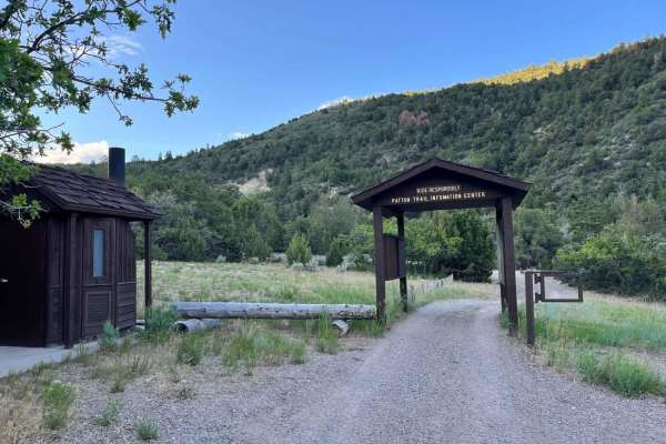
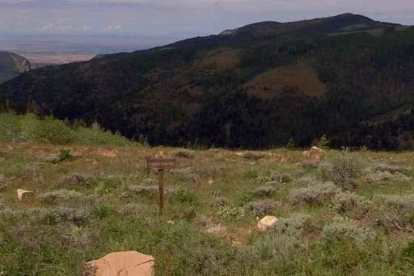
Heaven and Earth
In the beginning, God created Heaven and Earth. As this is the first starting point into the Arapeen trail system that you'll encounter in Manti Canyon, and because you'll soon be scanning heavenly vistas, I thought this would be an appropriate name. This trail will be your portal into hundreds of m...
Learn more about Heaven and Earth
Beginner ATV trails near Scipio, Utah
Explore ATV-friendly trails near you. These trails are accessible for vehicles up to 50 inches wide, perfect for ATVs and smaller off-road machines.
Richfield Pioneer Road North
Richfield Pioneer Road North is an 11.9-mile (23.8-mile round trip) out-and-back trail rated 3 of 10 located in Millard County. The trail is located within the Fishlake National Forest, Fillmore Ranger District. This trail is also marked as Paiute Side Trail #96 and is popular with the ATV/UTV crowd...
Learn more about Richfield Pioneer Road North
Sheep Trail Road
The Sheep Trail Road is a well-maintained road that gives access to Pahvant Butte. The east end is at the junction of Highway 50 and Highway 100. The south end is off the Clear Lake Road. There are some dunes on BLM land on the east end of the road. In that area, the sand does get blown across the r...
Learn more about Sheep Trail Road
Willow Creek Canyon Road
Willow Creek Canyon Road traverses nearly 4,000 feet of elevation from the Sevier Valley floor to the junction with Richfield-Pioneer Road. The northern end of the road meanders through sagebrush flats dotted with cedar trees. As you start the rise up, the mountain cedar trees give way to large pine...
Learn more about Willow Creek Canyon Road
Richfield-Pioneer Road
The north end is accessed via Willow Creek Canyon Road and follows along the top of the Tushar Mountain Range. The area has several meadows, large Pine Trees, red rock outcroppings, and views of the Sevier, Sanpete, and Millard County Valleys. Many different species of wildlife can be viewed along t...
Learn more about Richfield-Pioneer Road
Beginner UTV/side-by-side trails near Scipio, Utah
Find UTV and side-by-side trails near you. These trails accommodate vehicles up to 60 inches wide, ideal for UTVs, side-by-sides, and wider off-road rigs.
Richfield Pioneer Road North
Richfield Pioneer Road North is an 11.9-mile (23.8-mile round trip) out-and-back trail rated 3 of 10 located in Millard County. The trail is located within the Fishlake National Forest, Fillmore Ranger District. This trail is also marked as Paiute Side Trail #96 and is popular with the ATV/UTV crowd...
Learn more about Richfield Pioneer Road North
Sheep Trail Road
The Sheep Trail Road is a well-maintained road that gives access to Pahvant Butte. The east end is at the junction of Highway 50 and Highway 100. The south end is off the Clear Lake Road. There are some dunes on BLM land on the east end of the road. In that area, the sand does get blown across the r...
Learn more about Sheep Trail Road
Willow Creek Canyon Road
Willow Creek Canyon Road traverses nearly 4,000 feet of elevation from the Sevier Valley floor to the junction with Richfield-Pioneer Road. The northern end of the road meanders through sagebrush flats dotted with cedar trees. As you start the rise up, the mountain cedar trees give way to large pine...
Learn more about Willow Creek Canyon Road
Richfield-Pioneer Road
The north end is accessed via Willow Creek Canyon Road and follows along the top of the Tushar Mountain Range. The area has several meadows, large Pine Trees, red rock outcroppings, and views of the Sevier, Sanpete, and Millard County Valleys. Many different species of wildlife can be viewed along t...
Learn more about Richfield-Pioneer Road
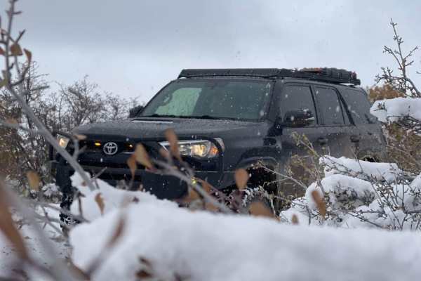
The onX Offroad Difference
onX Offroad combines trail photos, descriptions, difficulty ratings, width restrictions, seasonality, and more in a user-friendly interface. Available on all devices, with offline access and full compatibility with CarPlay and Android Auto. Discover what you're missing today!
Open Trail Map