
Beginner Off-Road Trails
Near Fayette, Utah
Explore All Beginner Trails Near Fayette, Utah
Beginner Off-Road Trails Near Fayette, Utah
Discover the best beginner-friendly off-road trails near you. These easier, lower-rated trails are a great place to start — browse trail maps, check difficulty ratings, and find your next adventure.
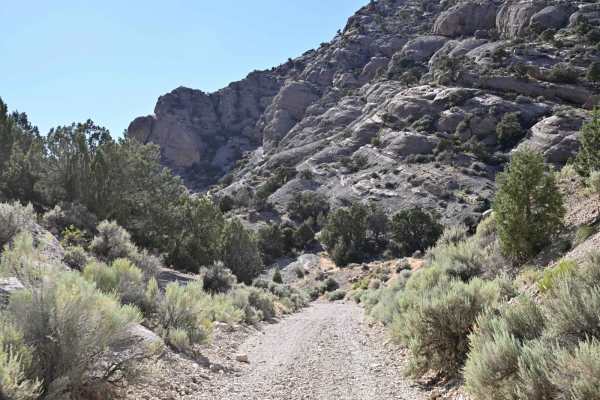
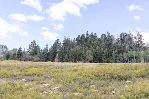
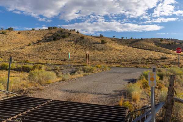
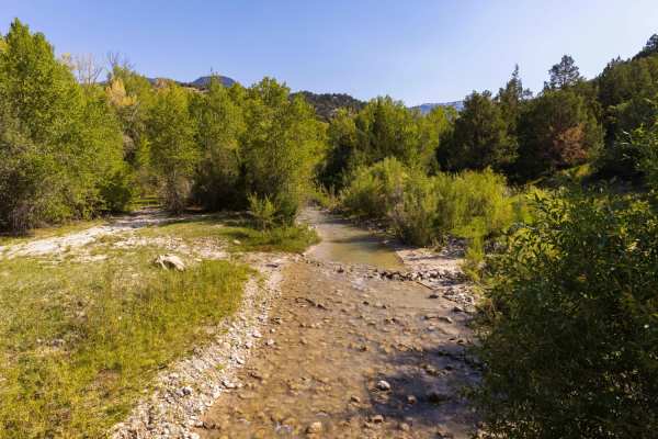
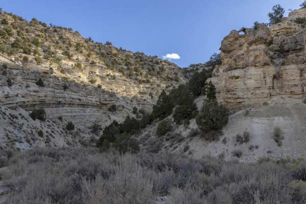
Mellor Canyon Road
Private land holdings and BLM trail closures make the connector from Fayetteville to Manti partially inaccessible. This connector is important for the Arapeen Trail system because it allows access to Manti trails from the Fayette/Yuba Lake area. There is a nice mix of canyons and ridges that make th...
Learn more about Mellor Canyon Road

Mayfield-Gunnison Road
This is the main access road to Mayfield Canyon. The well maintained wide gravel road allows two way traffic and plenty of primitive camping spots along the way. There are multiple bathrooms at many of the camping locations which are maintained by the forest service.Pine, Aspen, and Cedar trees, alo...
Learn more about Mayfield-Gunnison Road
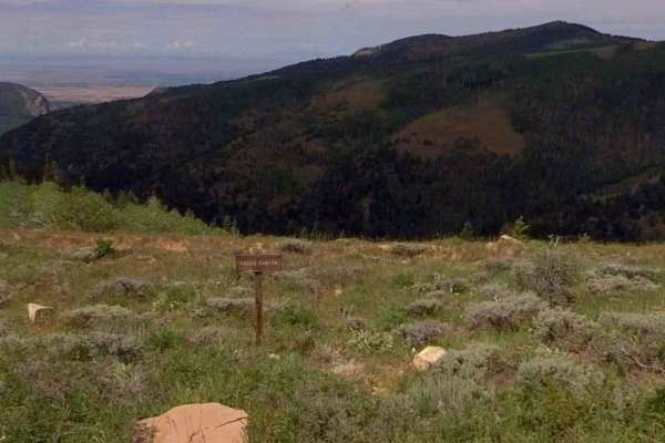
Heaven and Earth
In the beginning, God created Heaven and Earth. As this is the first starting point into the Arapeen trail system that you'll encounter in Manti Canyon, and because you'll soon be scanning heavenly vistas, I thought this would be an appropriate name. This trail will be your portal into hundreds of m...
Learn more about Heaven and Earth
Willow Creek Road
Willow Creek Road provides access to Fishlake and Manti-La Sal national forests from the north end of Sevier County and the south end of Sanpete County. Over its nearly 17-mile stretch, it gains nearly 4,000 feet of elevation. The vegetation is diverse, from cedar trees and scrub oak on the low end ...
Learn more about Willow Creek Road
Burnt Hill
From the bottom, this trail begins in dense pine and quaking groves but quickly bursts out into open, green pastoral fields that present majestic white cliffs to the south, sweeping vistas to the valley below on the west, and inspiring views of the mountains to the east that are beckoning to you to ...
Learn more about Burnt Hill
Dandelion Flat
What started out as an attempt to access the Olsen Canyon trail turned into a dead-end trail. The trail is unmaintained and can be difficult to traverse in inclement weather. Pine, aspen, and cedar trees, along with many different types of grass, can make for some incredible views. Keep your eye out...
Learn more about Dandelion Flat
Pinchot to Cowboy Camp Trail
The area is made up of several smaller trails which traverse the Manti-La Sal National Forest. Pinchot to Cowboy Camp trail offers a short ride through the Aspen's and Pines flush with wild flowers, brush and grasses.Wildlife can be viewed anywhere along this trail, especially during early mornings ...
Learn more about Pinchot to Cowboy Camp Trail
Olsen - Clear Creek Trail
Connector trail between Olsen Canyon trail and Clear Creek-Woods Lake. The trail is unmaintained and can be difficult to traverse in inclement weather. There are some incredible views from the different species of trees and grasses. Keep your eye out for the many species of wildlife that inhabit the...
Learn more about Olsen - Clear Creek Trail
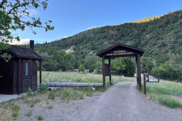
Patton's Boot
This is a short, mostly flat route. It is 2 miles and has an elevation change of 700 feet. It skirts the east side of Burnt Hill and flirts with views of Milk Creek. At the midpoint of the route, you can choose to journey on to a variety of other trails that snake around other sides of Burnt Hill.
Learn more about Patton's Boot
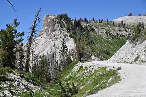
Willow Creek Canyon Road
Willow Creek Canyon Road traverses nearly 4,000 feet of elevation from the Sevier Valley floor to the junction with Richfield-Pioneer Road. The northern end of the road meanders through sagebrush flats dotted with cedar trees. As you start the rise up, the mountain cedar trees give way to large pine...
Learn more about Willow Creek Canyon Road
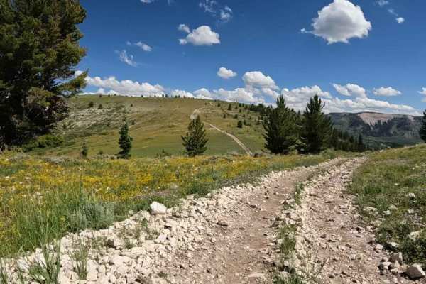
Richfield Pioneer Road North
Richfield Pioneer Road North is an 11.9-mile (23.8-mile round trip) out-and-back trail rated 3 of 10 located in Millard County. The trail is located within the Fishlake National Forest, Fillmore Ranger District. This trail is also marked as Paiute Side Trail #96 and is popular with the ATV/UTV crowd...
Learn more about Richfield Pioneer Road North
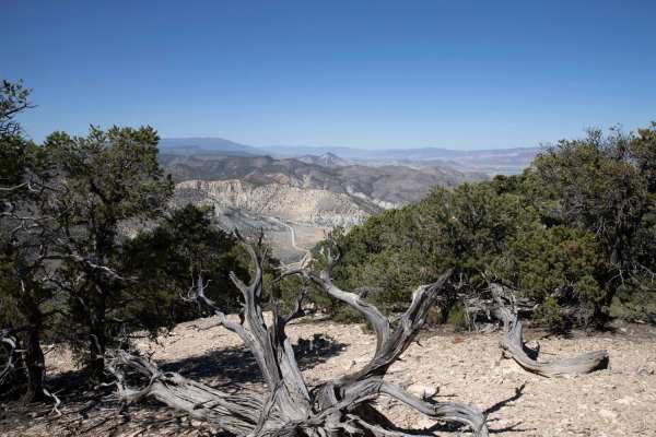
Cedar Mountain East Ridge
The area is covered in cedar trees, sage brush and grasses. Late Fall and early Winter are the perfect time to make this ride if you're looking for wildlife. The open flats are favored by elk and deer alike. Remember animals like to eat when we do. You may have to skip a meal to make this ride. View...
Learn more about Cedar Mountain East Ridge
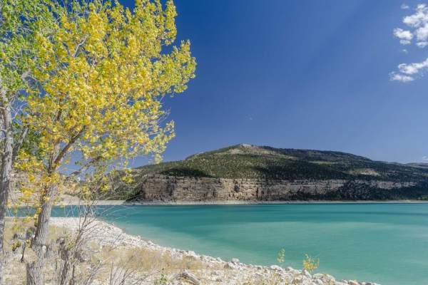
Arapeen Ephraim Canyon to Joes Valley
This trail climbs Ephraim Canyon to Skyline Drive before a few miles on Skyline. There is then a 50" trail that descends the back of the mountain to Joes Valley Reservoir before another trail climbs back to Skyline and back down Ephraim Canyon. There are amazing views the entire way.
Learn more about Arapeen Ephraim Canyon to Joes Valley
Beaver Creek Road
The area is made up of several smaller trails and roads which traverse the scenic beauty of the Manti-LaSal National Forest. Beaver Creek road intertwines with several trails as it traverses East-West between the Mayfield-Gunnison road and Skyline Drive. Pine, Aspen, and Cedar trees cover the area a...
Learn more about Beaver Creek Road
Stock Driveway
With a variety of terrain, this is a fun start to the Arapeen system from Manti Canyon. Rocky hill climbs in the west lead to fast straights in the east with more than a few mudholes in between during wetter weather. It connects to Patton Trail in the west and Skyline Drive at just shy of 10,000 fee...
Learn more about Stock Driveway
Skyline Drive/FR50150
Skyline Drive is the central attraction of the Arapeen Trail System and as such runs from US-6 in the north to its termination at the Fishlake National Forest where it continues but becomes the Great Western Trail. This is the central section between Manti and Ephraim access points. While generally ...
Learn more about Skyline Drive/FR50150
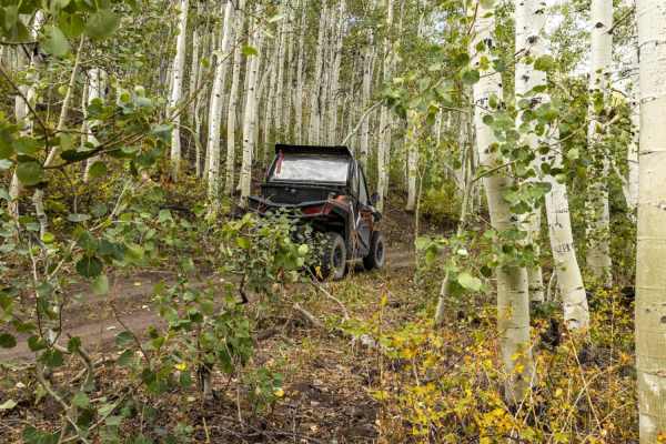
Water Hollow Trail
The trail traverses through dense pine and aspen trees. It starts on the west end at the junction of Water Hollow and Willow Creek Roads. The east end of the trail can be accessed via the Bull Valley trail. This area is known for the abundance of mule deer and rocky mountain elk. You may also encoun...
Learn more about Water Hollow Trail
Soldier Canyon Road
Soldier Canyon trail can be accessed on the north end from the Old Canyon Road in Salina, UT, The I-70 frontage road or Gooseberry Road on the south end. The road stretches for 7.2 miles and ascends about 1000 feet if traveling from north to south.The area has sparse vegetation including cedar, sage...
Learn more about Soldier Canyon Road
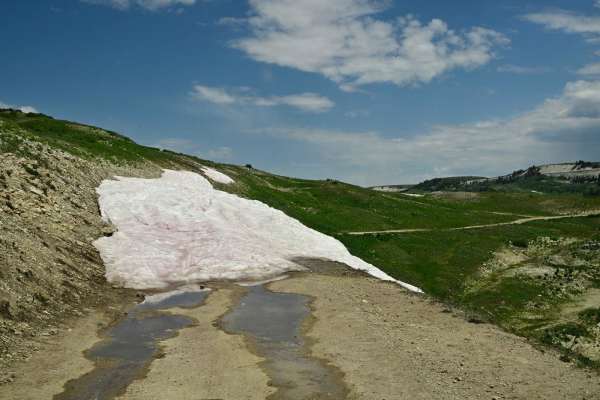
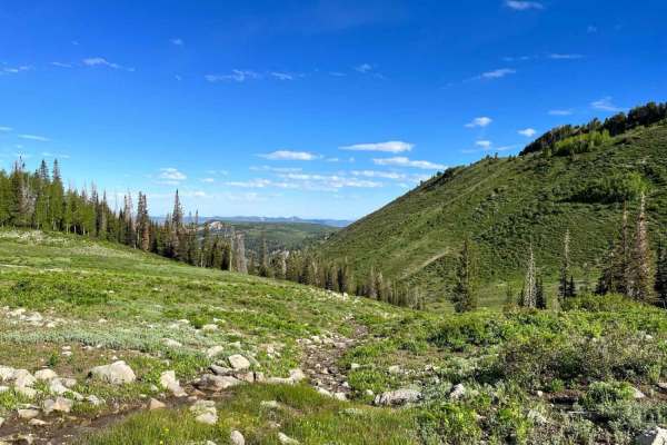
Arapeen Trail 01 - Manti Canyon to Fishlake
The route traverses south from Manti Canyon along mountain ridges and ends at Fishlake National Forest. From there you can continue on the Great Western Trail. There are scenic alpine meadows at 10,000 ft elevation throughout most of the route. Snow can be on the route through July. This route gene...
Learn more about Arapeen Trail 01 - Manti Canyon to Fishlake
Middle Fork
The closer this trail gets to the summit, the more serene, pastoral, and smooth it becomes. The closer it gets to Manti Canyon Road, the more gnarly, winding, rutted, and rocky it becomes. This can be falsely alluring if you are dropping in from Skyline Road. I passed a new suburban that was stuck i...
Learn more about Middle Fork
Beginner ATV trails near Fayette, Utah
Explore ATV-friendly trails near you. These trails are accessible for vehicles up to 50 inches wide, perfect for ATVs and smaller off-road machines.
Mellor Canyon Road
Private land holdings and BLM trail closures make the connector from Fayetteville to Manti partially inaccessible. This connector is important for the Arapeen Trail system because it allows access to Manti trails from the Fayette/Yuba Lake area. There is a nice mix of canyons and ridges that make th...
Learn more about Mellor Canyon Road
Mayfield-Gunnison Road
This is the main access road to Mayfield Canyon. The well maintained wide gravel road allows two way traffic and plenty of primitive camping spots along the way. There are multiple bathrooms at many of the camping locations which are maintained by the forest service.Pine, Aspen, and Cedar trees, alo...
Learn more about Mayfield-Gunnison Road
Heaven and Earth
In the beginning, God created Heaven and Earth. As this is the first starting point into the Arapeen trail system that you'll encounter in Manti Canyon, and because you'll soon be scanning heavenly vistas, I thought this would be an appropriate name. This trail will be your portal into hundreds of m...
Learn more about Heaven and Earth
Willow Creek Road
Willow Creek Road provides access to Fishlake and Manti-La Sal national forests from the north end of Sevier County and the south end of Sanpete County. Over its nearly 17-mile stretch, it gains nearly 4,000 feet of elevation. The vegetation is diverse, from cedar trees and scrub oak on the low end ...
Learn more about Willow Creek Road
Beginner UTV/side-by-side trails near Fayette, Utah
Find UTV and side-by-side trails near you. These trails accommodate vehicles up to 60 inches wide, ideal for UTVs, side-by-sides, and wider off-road rigs.
Mellor Canyon Road
Private land holdings and BLM trail closures make the connector from Fayetteville to Manti partially inaccessible. This connector is important for the Arapeen Trail system because it allows access to Manti trails from the Fayette/Yuba Lake area. There is a nice mix of canyons and ridges that make th...
Learn more about Mellor Canyon Road
Mayfield-Gunnison Road
This is the main access road to Mayfield Canyon. The well maintained wide gravel road allows two way traffic and plenty of primitive camping spots along the way. There are multiple bathrooms at many of the camping locations which are maintained by the forest service.Pine, Aspen, and Cedar trees, alo...
Learn more about Mayfield-Gunnison Road
Heaven and Earth
In the beginning, God created Heaven and Earth. As this is the first starting point into the Arapeen trail system that you'll encounter in Manti Canyon, and because you'll soon be scanning heavenly vistas, I thought this would be an appropriate name. This trail will be your portal into hundreds of m...
Learn more about Heaven and Earth
Willow Creek Road
Willow Creek Road provides access to Fishlake and Manti-La Sal national forests from the north end of Sevier County and the south end of Sanpete County. Over its nearly 17-mile stretch, it gains nearly 4,000 feet of elevation. The vegetation is diverse, from cedar trees and scrub oak on the low end ...
Learn more about Willow Creek Road
The onX Offroad Difference
onX Offroad combines trail photos, descriptions, difficulty ratings, width restrictions, seasonality, and more in a user-friendly interface. Available on all devices, with offline access and full compatibility with CarPlay and Android Auto. Discover what you're missing today!
Open Trail Map