
Beginner Off-Road Trails
Near Sandy Valley, Nevada
Explore All Beginner Trails Near Sandy Valley, Nevada
Beginner Off-Road Trails Near Sandy Valley, Nevada
Discover the best beginner-friendly off-road trails near you. These easier, lower-rated trails are a great place to start — browse trail maps, check difficulty ratings, and find your next adventure.
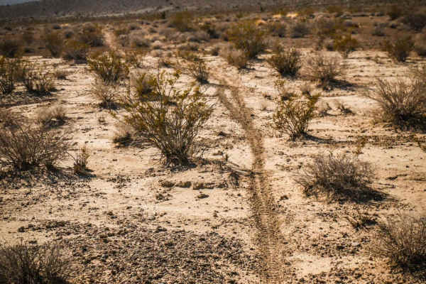
Ridge Connector
This is a short connector trail used to connect the Ridge Trail to the Pants Loop. Although only 3 miles long, it runs through a variety of terrain, including a mix of soft dirt, sandier dirt, and hard-packed dirt with loose rock. It dips in and out of rocky ravines and washes and also runs elevated...
Learn more about Ridge Connector
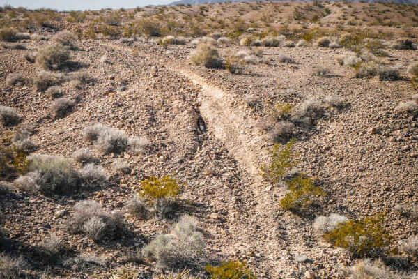
Shorts Trail
Ride this fun short single track to connect the Ridge Trail to the Pants Trail and make a fun day ride in this trail system southeast of Pahrump, NV. This is a narrow single track with a mix of soft dirt and hard-packed dirt covered in small loose sharp rocks. Some sections of the trail are smooth a...
Learn more about Shorts Trail

Potosi Tower Road
The Potosi Tower Road is a 14.6 out and back trail that goes to a great overlook of the Las Vegas Strip and Potosi Mountain. Built as a service road for the multiple communication towers on the ridge line, this trail is suitable for any 4WD vehicles. Many switchbacks and sweeping views of the high d...
Learn more about Potosi Tower Road
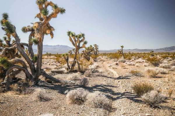
Pants Connector
The Pants Connector Trail is an 8.6-mile single-track connection between the Pants Loop Trail and the Ridge Trail. Riding NE to SW, it departs from the east end of the Pants Loop at an intersection marked with a cairn and heads southwest. The beginning of the trail is hardpacked dirt with small loos...
Learn more about Pants Connector
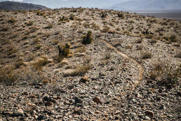
Ridge Trail
The Ridge Trail is a single-track trail starting off of Sandy Valley Fwy, a jeep road that starts off of Tecopa Road, in the BLM area southeast of Pahrump, NV. The northern trailhead starts on soft bentonite dirt with a few whoops. It turns into a rocky wash and steadily starts to gain some elevatio...
Learn more about Ridge Trail
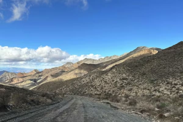
Excelsior Mine Road
This route begins at Kingston Wash Road and ends at Mesquite Valley Road, following a mix of aging, broken pavement, gravel stretches, and sections of loose rock. Much of the drive is easy, making it an enjoyable run across varied terrain. Sweeping desert vistas are the norm on this route as you cli...
Learn more about Excelsior Mine Road
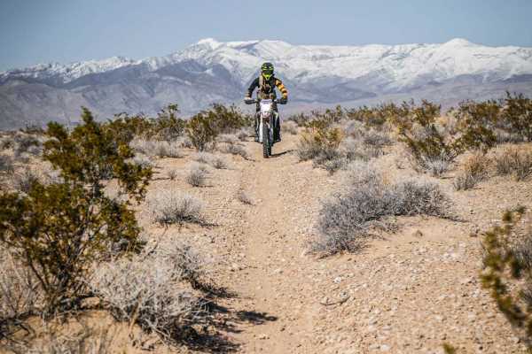
Pants Trail
The Pants Trail is probably one of the more popular trails in this trail system SE of Pahrump, NV. It's a fun and flowy 6-mile trail that has fewer loose rocks than the rest of the trails in the area. This is a faster trail because it's mostly smooth, straight, and flat. From the south trailhead, it...
Learn more about Pants Trail
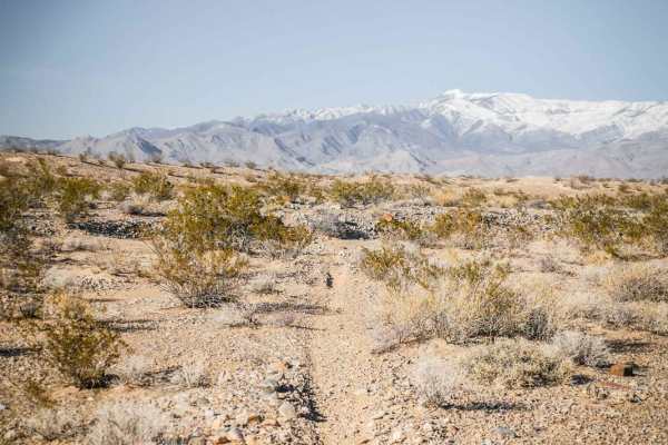
Andy Tk3
This short single track is a fun ride in the Pahrump BLM through a wide-open desert landscape full of Yucca and Joshua Trees. It's a fast and flowy single track that is mostly smooth and easy. It crosses several sudden dips into ravines that you have to watch out for. The south end of this trail com...
Learn more about Andy Tk3
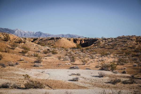
Pants Trail East
Pants Trail East is one of several fast and fun desert single tracks in this trail system SE of Pahrump, NV accessed off of Tecopa Road. This one is very similar to Pants Trail and can be ridden in connection with the Pants Loop and Andys TK2 and 3 for a fun loop. From the north end of the trail, it...
Learn more about Pants Trail East
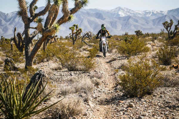
Pants Loop
The Pant's Loop is one of the longer trails in this trail system, starting off of Cathedral Canyon Road and ending on Pahrump Road. It's a fast desert trail running through a Joshua Tree Forest with rugged desert mountains on all sides of you. The trail is narrow; only a foot wide or tire wide at pa...
Learn more about Pants Loop
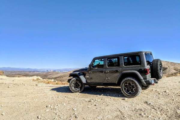
Cottonwood Pass
Cottonwood Pass runs north and south through the Spring Mountain and Red Rock conservation areas just west of Las Vegas, NV. From Blue Diamond Road, you can take Cottonwood Pass all the way to Goodsprings, NV. Once you get down there, stop at the Pioneer Saloon for a good burger or visit some old hi...
Learn more about Cottonwood Pass
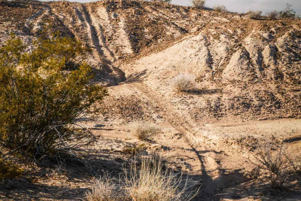
Andy Tk2
The Andy Tk2 trail is a fast and flowy ride through a mix of soft bentonite dirt hills and hardpack single track. The trail flows up and over these hills and into ravines, through a wide open desert landscape full of small bushes and cacti. The south end of the trail begins at the intersection with ...
Learn more about Andy Tk2
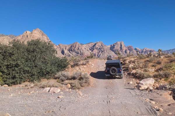
Black Velvet Road
This is an easy trail from the highway onto the Black Velvet Road. Head in a short distance to an area to air down. After airing down, the trail has a few small obstacles with easy bypasses. Most of the trail is easy gravel with a few sections of rock gardens, a few wash crossings, and some washboar...
Learn more about Black Velvet Road
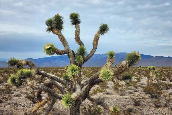
Hafen Spanish to Old Spanish
This trail is between Mountain Springs and Pahrump, just outside of Las Vegas a quick 45-minute drive west on N-160 Blue Diamond Highway. Which will turn into the Pahrump Valley Highway. Turning Left off the highway onto Tecopa we drove about a mile and the trailhead come up on your left. If you con...
Learn more about Hafen Spanish to Old Spanish
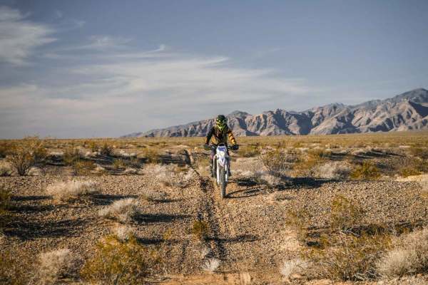
Al's Street
Al's Street is a 5-mile single track on the north side of Tecopa Road in the BLM land southeast of Pahrump, NV. The south end of the trail is accessed off of Front Site Road and starts right at the edge of the pavement. There isn't a staging area right at the trailhead, so you'll most likely want to...
Learn more about Al's Street
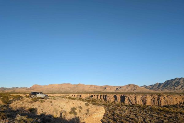
Lovell Wash Road
This short trail runs from Lovell Canyon Road to Highway 160. You can go in either direction, though I went from Highway 160 to Lovell Canyon. You turn off the highway right onto this trail, and there are no gates or barriers to entry at the time of this writing. If you are headed towards Vegas from...
Learn more about Lovell Wash Road
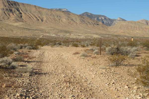
Blue Diamond Cut-off
This is just a cut-off route from Blue Diamond BLM Access to Restless Road that takes you back to State Highway 160 or over to Cottonwood Pass Trail. It's only a bit over half a mile with pleasant desert views. A high-clearance vehicle is needed for this cut-off.
Learn more about Blue Diamond Cut-off

Snore 250 Start Course
This trail marks the starting course for the SNORE 250, delivering a true off-road racing experience. Expect classic racecourse conditions, including loose rocks, deep whoops, and fast, flowing sections that invite full-send moments. The terrain constantly challenges both driver and machine, making ...
Learn more about Snore 250 Start Course
Old Spanish Trail
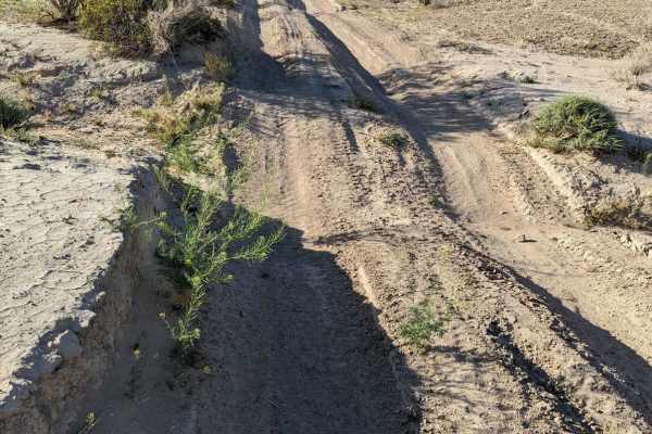
This is a fun trail from the south end of Pahrump out to Prairie Fire, formerly known as Front Sight Road. From Front Sight Rd you can go right and head towards Prairie Fire, head left towards Tecopa Highway, or go straight across the road to Cathedral Canyon. This is mostly an easy desert trail wit...
Learn more about Old Spanish Trail
5 Horsepower Trail
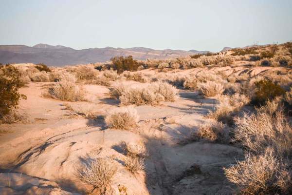
This short single track is located in the BLM land southeast of Pahrump, NV as part of a bigger trail system full of fast, fun, and flowy single tracks. Starting from the west end of this trail, the trail departs from a graded jeep road where there is an abandoned red 5 horsepower lawnmower thing wi...
Learn more about 5 Horsepower Trail
Beginner ATV trails near Sandy Valley, Nevada
Explore ATV-friendly trails near you. These trails are accessible for vehicles up to 50 inches wide, perfect for ATVs and smaller off-road machines.
Potosi Tower Road
The Potosi Tower Road is a 14.6 out and back trail that goes to a great overlook of the Las Vegas Strip and Potosi Mountain. Built as a service road for the multiple communication towers on the ridge line, this trail is suitable for any 4WD vehicles. Many switchbacks and sweeping views of the high d...
Learn more about Potosi Tower Road
Excelsior Mine Road
This route begins at Kingston Wash Road and ends at Mesquite Valley Road, following a mix of aging, broken pavement, gravel stretches, and sections of loose rock. Much of the drive is easy, making it an enjoyable run across varied terrain. Sweeping desert vistas are the norm on this route as you cli...
Learn more about Excelsior Mine Road
Cottonwood Pass
Cottonwood Pass runs north and south through the Spring Mountain and Red Rock conservation areas just west of Las Vegas, NV. From Blue Diamond Road, you can take Cottonwood Pass all the way to Goodsprings, NV. Once you get down there, stop at the Pioneer Saloon for a good burger or visit some old hi...
Learn more about Cottonwood Pass
Hafen Spanish to Old Spanish
This trail is between Mountain Springs and Pahrump, just outside of Las Vegas a quick 45-minute drive west on N-160 Blue Diamond Highway. Which will turn into the Pahrump Valley Highway. Turning Left off the highway onto Tecopa we drove about a mile and the trailhead come up on your left. If you con...
Learn more about Hafen Spanish to Old Spanish
Beginner UTV/side-by-side trails near Sandy Valley, Nevada
Find UTV and side-by-side trails near you. These trails accommodate vehicles up to 60 inches wide, ideal for UTVs, side-by-sides, and wider off-road rigs.
Potosi Tower Road
The Potosi Tower Road is a 14.6 out and back trail that goes to a great overlook of the Las Vegas Strip and Potosi Mountain. Built as a service road for the multiple communication towers on the ridge line, this trail is suitable for any 4WD vehicles. Many switchbacks and sweeping views of the high d...
Learn more about Potosi Tower Road
Excelsior Mine Road
This route begins at Kingston Wash Road and ends at Mesquite Valley Road, following a mix of aging, broken pavement, gravel stretches, and sections of loose rock. Much of the drive is easy, making it an enjoyable run across varied terrain. Sweeping desert vistas are the norm on this route as you cli...
Learn more about Excelsior Mine Road
Hafen Spanish to Old Spanish
This trail is between Mountain Springs and Pahrump, just outside of Las Vegas a quick 45-minute drive west on N-160 Blue Diamond Highway. Which will turn into the Pahrump Valley Highway. Turning Left off the highway onto Tecopa we drove about a mile and the trailhead come up on your left. If you con...
Learn more about Hafen Spanish to Old Spanish
Lovell Wash Road
This short trail runs from Lovell Canyon Road to Highway 160. You can go in either direction, though I went from Highway 160 to Lovell Canyon. You turn off the highway right onto this trail, and there are no gates or barriers to entry at the time of this writing. If you are headed towards Vegas from...
Learn more about Lovell Wash Road
The onX Offroad Difference
onX Offroad combines trail photos, descriptions, difficulty ratings, width restrictions, seasonality, and more in a user-friendly interface. Available on all devices, with offline access and full compatibility with CarPlay and Android Auto. Discover what you're missing today!
Open Trail Map