
Beginner Off-Road Trails
Near Ruidoso, New Mexico
Explore All Beginner Trails Near Ruidoso, New Mexico
Beginner Off-Road Trails Near Ruidoso, New Mexico
Discover the best beginner-friendly off-road trails near you. These easier, lower-rated trails are a great place to start — browse trail maps, check difficulty ratings, and find your next adventure.
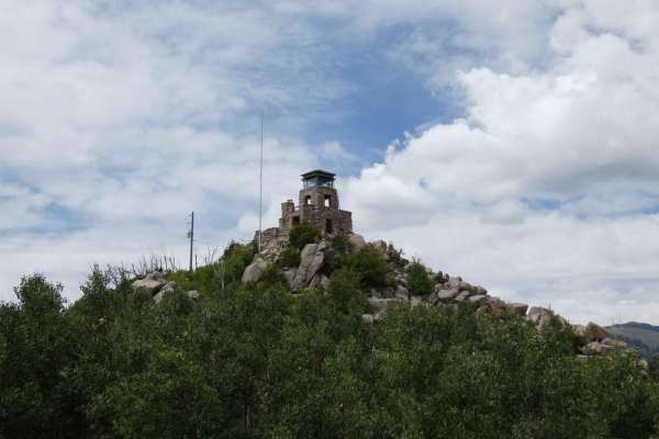
Monjeau Peak Lookout
The Monjeau Peak Lookout is a historical location of the Smokey Bear District that was originally built in 1936 and gives spectacular views of the Ruidoso, NM area, the Mescalero Reserve, and open views from the tower itself. The road is decently maintained and will be accessible for most vehicles i...
Learn more about Monjeau Peak Lookout
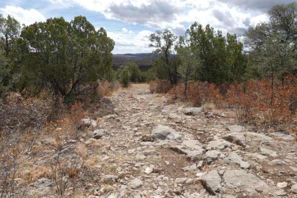
Cactus Canyon
Cactus Canyon is an out-and-back spur trail that kicks off at Eagle Lakes. Starting higher in elevation on a smoother dirt surface, the trail changes quickly after passing through the one gate roughly 1 mile from the beginning. The trail is single-vehicle wide, with room to pass within the first mil...
Learn more about Cactus Canyon
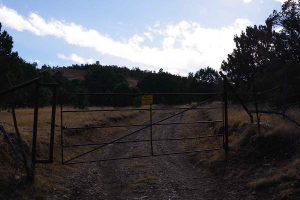
Five Mile Pass
Five Mile Pass is an unmaintained trail that tracks one of several valleys in the area with some changes in elevation and great views. The road is primarily dirt and rock, with some rock gardens towards the eastern portion. Signs of light maintenance at the middle of the trail, possibly by local ran...
Learn more about Five Mile Pass
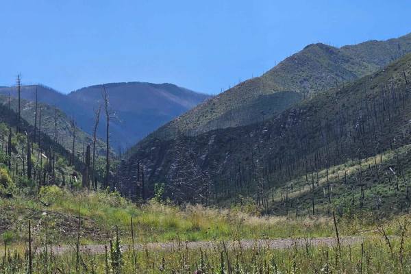
Bonita Lake South Fork Road
This is Forest Road 107C, a very short run-up to a campground that can be used while the Bonita Lake Campground is closed. This area was affected about 11 years ago by a wildfire and is recovering slowly. The campground does have toilets and water in the bathroom areas. There are no water hookups at...
Learn more about Bonita Lake South Fork Road
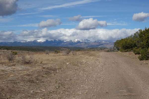
Eagle Lakes
Eagle Lakes is a canyon-to-ridge trail that can be accessed and completed from its east or west entrance. From the east entrance, the trail starts lower in a valley and ascends to its ridge line before dropping back down on the west end. The surface starts differently on each end, with a primarily r...
Learn more about Eagle Lakes
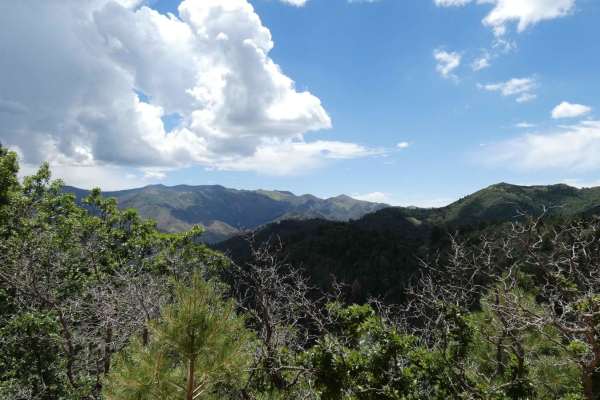
Parsons - FSR108
Parsons is a connecting spur that runs from the end of Nogal Canyon/FSR-400 to Bonito Canyon to the south. The surface is a combination of dirt and rock and appears to be very well maintained. The trail should be easily accessible by most vehicles as there are no large obstacles, however, any 2WD ve...
Learn more about Parsons - FSR108
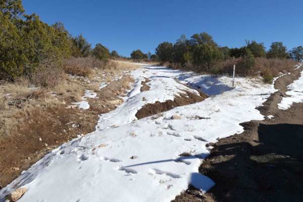
North Coe
North Coe is located just south of the Fort Stanton NCA and Fort Stanton historical site and is an out-and-back trail. The trail provides amazing views in every direction and is passable by most 4x4 with a majority of the obstacles being under 12". The trail has two entryways, the northern entry (fi...
Learn more about North Coe
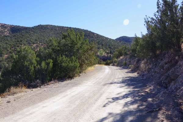
Hale Lake Trail
The trail is well maintained and easily accessible by most vehicles, however, 2WD passenger vehicles may find some of the rocky areas difficult. The road is primarily dirt and gravel mixed with some rock gardens and minor rutting. While dry, the road provides a very easy and scenic drive with views ...
Learn more about Hale Lake Trail
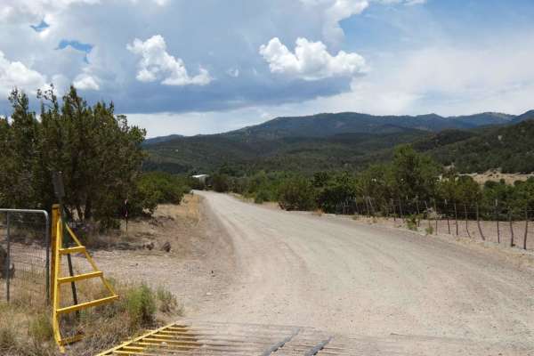
Nogal Canyon FSR-400
Nogal Canyon is a very easy trail to traverse, accessible by most vehicles, and is well maintained. If the road is accessed from its entry off Highway 37, the first 4.7 miles is primarily private land on either side. Drivers should check speeds through this area and no dispersed camping is permitted...
Learn more about Nogal Canyon FSR-400
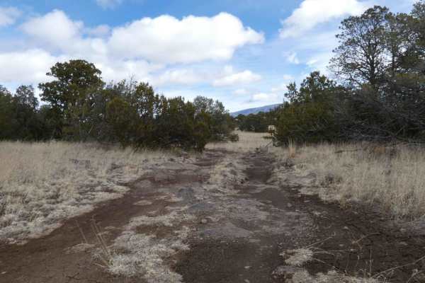
Campesino
Campesino is overall an easy-to-traverse dirt road, that has some rock gardens along the route. There are signs of some rutting and washouts and can become very muddy and slick during or after rain or snow melt. Some areas of the trail show signs of heavy rutting with no maintenance, but do offer by...
Learn more about Campesino
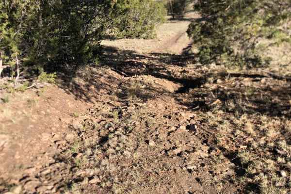
Granger
Dispersed camping with a beautiful view of the Sacramento Mountains. There are three trails that disperse out. Easy terrain for beginners riders. The trail is mainly dirt and loose rock, with a few rutted-out places. It can be very windy and dry in these mountains, be aware of a potential fire ban.
Learn more about Granger
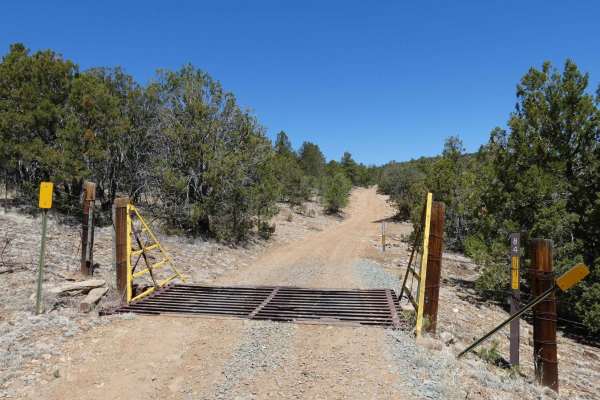
Indian Divide
Indian Divide is located northwest of Capitan, NM, and is nestled between the larger mountains in this area. The trail gives a great combination of surface types from dirt to larger rocky obstacles, light rutting, and some minor off-camber sections, as well as some steeper grades and some low-lying ...
Learn more about Indian Divide
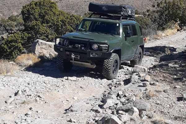
Cottonwood Flat
This trail is a through trail beginning at Virden Road off Hwy 70 N, 15 min past Tularosa, and ending on La Luz Canyon Road. Elevation ranges from 5,900 to 7,825, and in winter months expect a snowy and muddy trail requiring 4WD in some areas. There are various dispersed camp sites closer to the La ...
Learn more about Cottonwood Flat
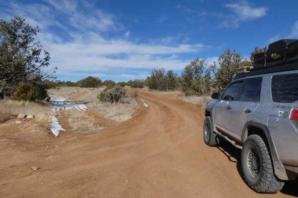
West Mountain
West Mountain is located just to the west of the Capitan Mountains and north of the town of Capitan, NM, and is a narrow, mostly single-vehicle wide, out-and-back trail with several spurs available to explore. The trail appears to have had some recent maintenance completed towards the entrance, howe...
Learn more about West Mountain
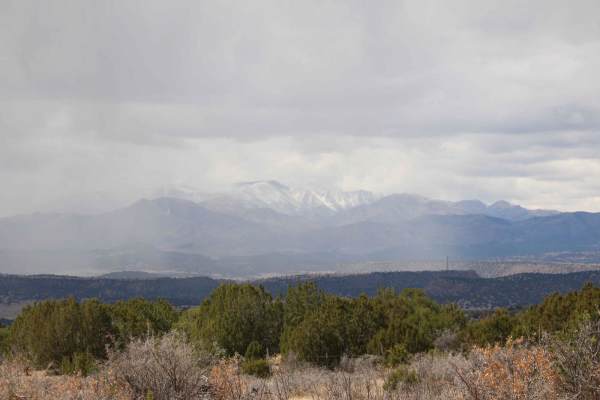
South Base
Trail starts off of a grated gravel road but quickly becomes rocky and sandy terrain. Multiple areas where rocks are up to 12 inches in height with loose rock gardens. There are heavy rutted areas that are off camber with multiple washouts. There are dispersed camping lots off the trail with rock fi...
Learn more about South Base
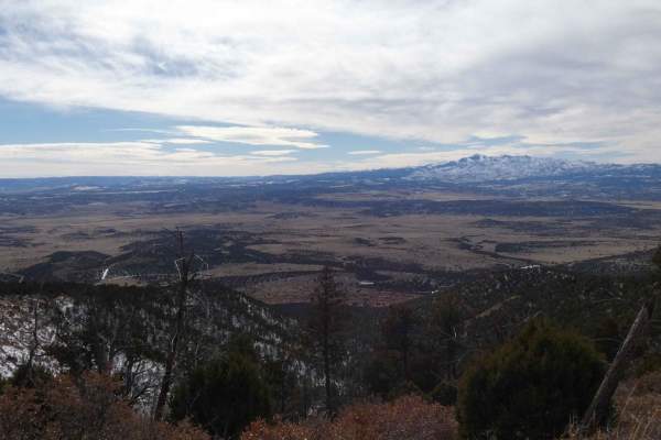
Capitan Gap
Capitan Gap is a locally well-known and well-traversed out-and-back trail with wide open views, steep grades, and many dispersed camp sites. While the burn scar is still very visible, the trail features an abundance of foliage and wildlife. The trail starts out at the base of the foothills with sign...
Learn more about Capitan Gap
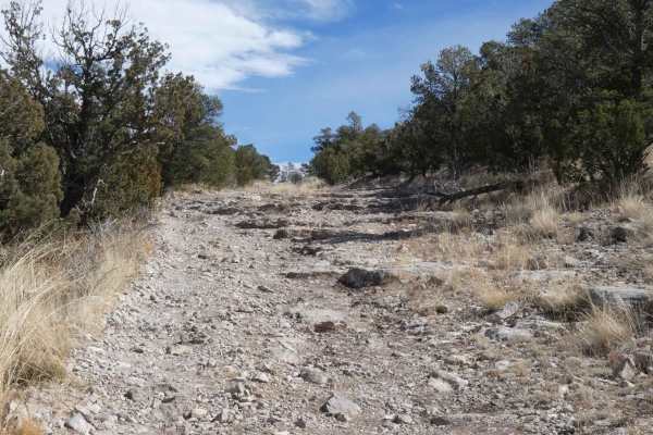
Baca Traverse
Baca Traverse sits in the foothills of the Capitan Mountains and starts out with some minor off-camber rutted areas that are a combination of rocks and dirt. The initial ascent opens up to a more rocky surface and provides a rock garden with some steps and the option of several different lines to ch...
Learn more about Baca Traverse
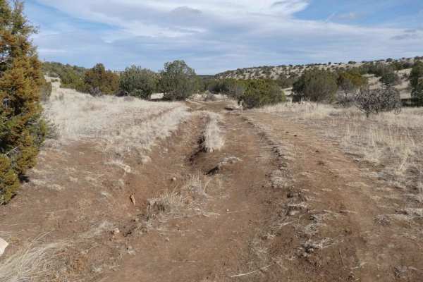
Calf Crossing
Calf Crossing starts and ends at gated private property lines, and intersects off Baca Traverse. This trail has the potential to be very muddy, with signs of rutting and washes, as well as multiple small water crossings after rain or snow melt. The trail surface is primarily dirt and rocks with some...
Learn more about Calf Crossing
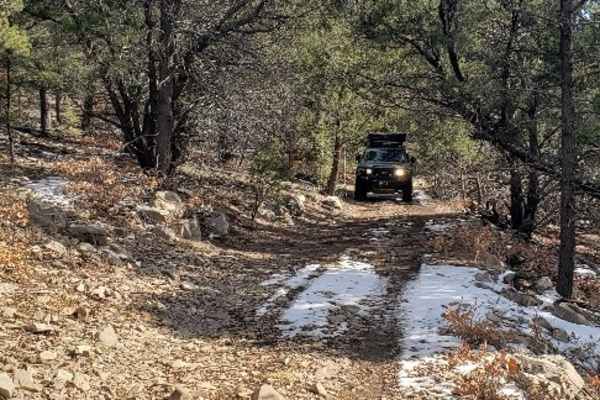
Laborcita Canyon
Laborcita Canyon Road is located in Lincoln National Forest, just Northeast of La Luz, NM. This trail runs North-South through the National Forest. The trail starts on pavement then turns to dirt about a mile in. Cottonwood Flat trail intersects with Laborcita Canyon at about 3.7 miles. Laborcita Ca...
Learn more about Laborcita Canyon
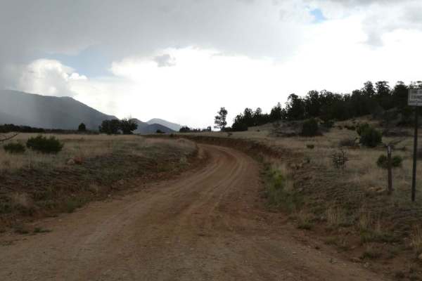
Salazar Canyon East
Salazar Canyon East begins just east of Baca campground inside a private land boundary before returning to USFS. The surface is a combination of rock and dirt with some small rock gardens, low-lying areas that have the potential to be shallow water crossings, and some spots being primarily rocks. Th...
Learn more about Salazar Canyon East
Beginner ATV trails near Ruidoso, New Mexico
Explore ATV-friendly trails near you. These trails are accessible for vehicles up to 50 inches wide, perfect for ATVs and smaller off-road machines.
Monjeau Peak Lookout
The Monjeau Peak Lookout is a historical location of the Smokey Bear District that was originally built in 1936 and gives spectacular views of the Ruidoso, NM area, the Mescalero Reserve, and open views from the tower itself. The road is decently maintained and will be accessible for most vehicles i...
Learn more about Monjeau Peak Lookout
Cactus Canyon
Cactus Canyon is an out-and-back spur trail that kicks off at Eagle Lakes. Starting higher in elevation on a smoother dirt surface, the trail changes quickly after passing through the one gate roughly 1 mile from the beginning. The trail is single-vehicle wide, with room to pass within the first mil...
Learn more about Cactus Canyon
Five Mile Pass
Five Mile Pass is an unmaintained trail that tracks one of several valleys in the area with some changes in elevation and great views. The road is primarily dirt and rock, with some rock gardens towards the eastern portion. Signs of light maintenance at the middle of the trail, possibly by local ran...
Learn more about Five Mile Pass
Bonita Lake South Fork Road
This is Forest Road 107C, a very short run-up to a campground that can be used while the Bonita Lake Campground is closed. This area was affected about 11 years ago by a wildfire and is recovering slowly. The campground does have toilets and water in the bathroom areas. There are no water hookups at...
Learn more about Bonita Lake South Fork Road
Beginner UTV/side-by-side trails near Ruidoso, New Mexico
Find UTV and side-by-side trails near you. These trails accommodate vehicles up to 60 inches wide, ideal for UTVs, side-by-sides, and wider off-road rigs.
Monjeau Peak Lookout
The Monjeau Peak Lookout is a historical location of the Smokey Bear District that was originally built in 1936 and gives spectacular views of the Ruidoso, NM area, the Mescalero Reserve, and open views from the tower itself. The road is decently maintained and will be accessible for most vehicles i...
Learn more about Monjeau Peak Lookout
Cactus Canyon
Cactus Canyon is an out-and-back spur trail that kicks off at Eagle Lakes. Starting higher in elevation on a smoother dirt surface, the trail changes quickly after passing through the one gate roughly 1 mile from the beginning. The trail is single-vehicle wide, with room to pass within the first mil...
Learn more about Cactus Canyon
Five Mile Pass
Five Mile Pass is an unmaintained trail that tracks one of several valleys in the area with some changes in elevation and great views. The road is primarily dirt and rock, with some rock gardens towards the eastern portion. Signs of light maintenance at the middle of the trail, possibly by local ran...
Learn more about Five Mile Pass
Bonita Lake South Fork Road
This is Forest Road 107C, a very short run-up to a campground that can be used while the Bonita Lake Campground is closed. This area was affected about 11 years ago by a wildfire and is recovering slowly. The campground does have toilets and water in the bathroom areas. There are no water hookups at...
Learn more about Bonita Lake South Fork Road
The onX Offroad Difference
onX Offroad combines trail photos, descriptions, difficulty ratings, width restrictions, seasonality, and more in a user-friendly interface. Available on all devices, with offline access and full compatibility with CarPlay and Android Auto. Discover what you're missing today!
Open Trail Map