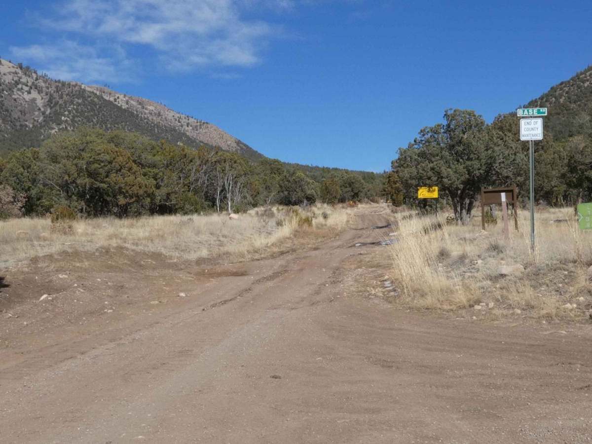
Capitan Gap

Total Miles 10.7
Technical Rating
3 Easy
Best Time Summer, Fall
Trail Type Full-Width Road
Accessible By
Open Trail Map

Trail Overview

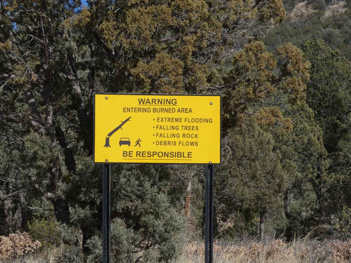
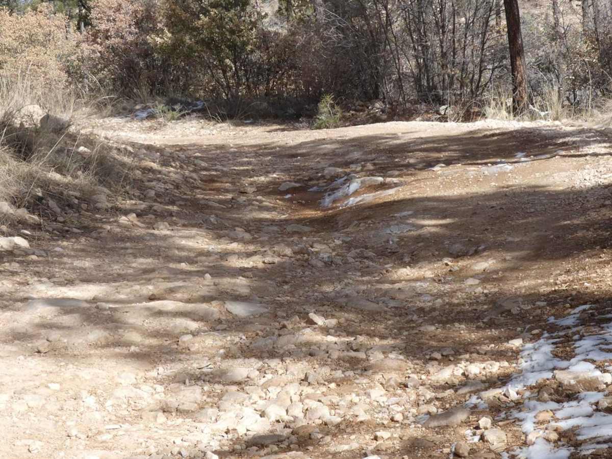
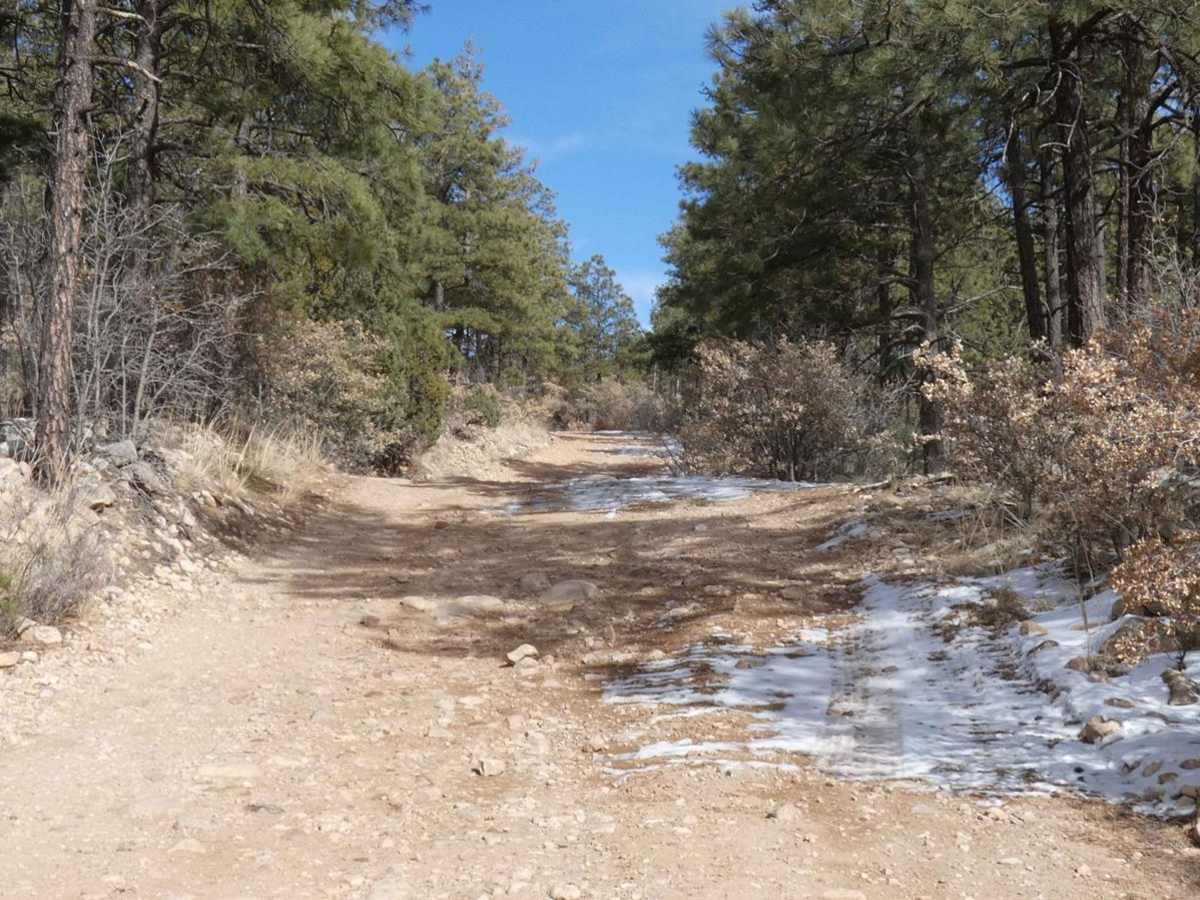
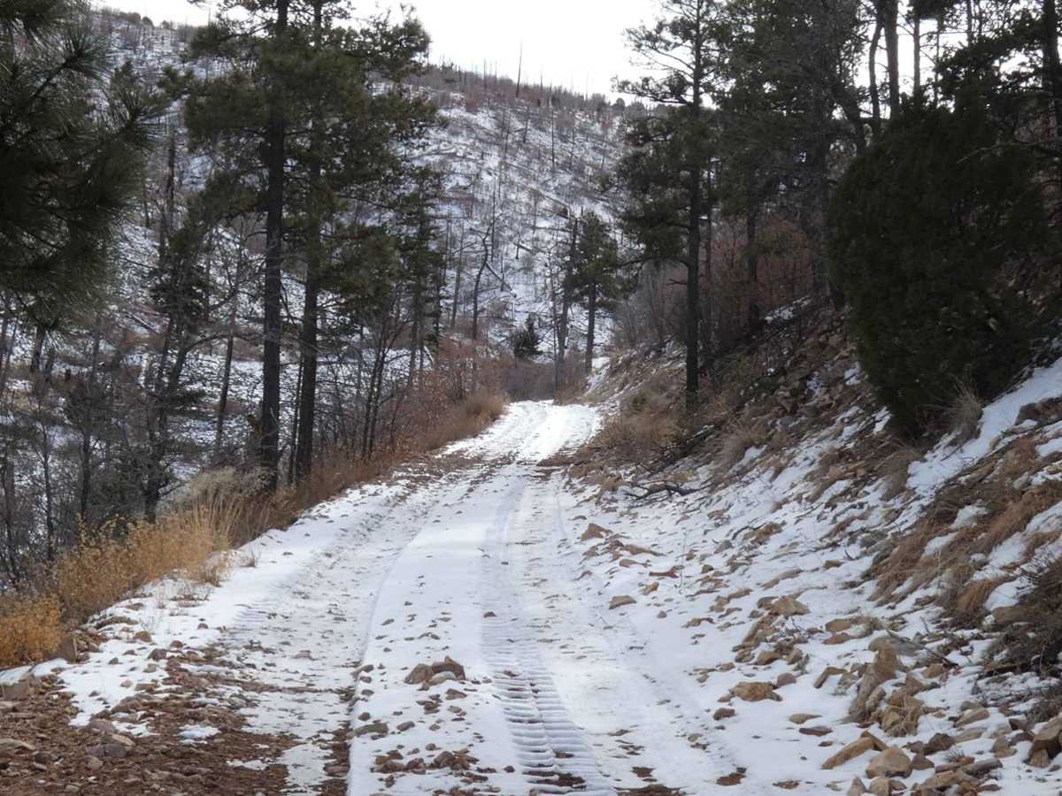
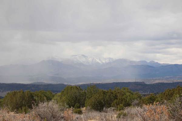
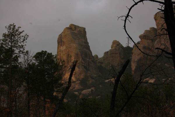
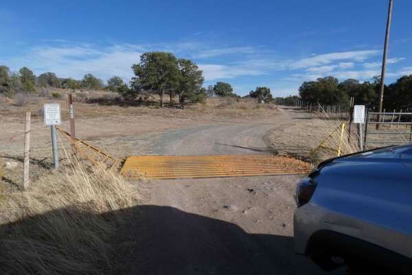
Capitan Gap is a locally well-known and well-traversed out-and-back trail with wide open views, steep grades, and many dispersed camp sites. While the burn scar is still very visible, the trail features an abundance of foliage and wildlife. The trail starts out at the base of the foothills with signage notifying of the possible dangers caused by previous fires in the area. The trail is a combination of rock and dirt that may be slippery during wet or winter seasons, with some obstacles up to 12". While maintained fairly well, expect loose rocks or larger rocks in the center of the trail path, rutted areas, and some slightly off-camber areas. There are several steeper rocky climbs along the trail, however, most 4x4's with good tires will be able to make the trail without issue. During winter months, these rocky climbs do become slippery and should be taken slowly with caution and attention to the trail conditions. As the trail winds and ascends, views to the north and south are wide open and clearly visible before becoming more covered by trees where the trail becomes more level and smooths to a split of dirt and rock surface. There are several motorized spurs and hiking trails along the main trail that are designated with signs. Large portions of the trail are single vehicle wide with no room to pass. Some rutting is present towards the summit where the surface is more dirt than rock, expect these areas to become slippery mud during rain or snow melt. Cell service was excellent until the last 1/2 mile. High wind and downed trees are frequent, snow can become substantially deep, be sure to take note of the weather and surroundings. The trail ends at just over 10,000 feet at a communications array with plenty of room to turn around.

Photos of Capitan Gap

Difficulty

Steep rocky grades, some loose rocks. The abundance of snow and ice in the winter. Some rutting and muddy areas. Some obstacles up to 12".

Technical Rating

3

Status Reports

Add Status Report
Layne Marlow
Aug 19, 2025
Open
Rated easy with no obstacles, but real rocky, rough and bumpy. Average 1mph.
Liam Lowe
Jul 09, 2025
Open
jojo Martínez
Apr 06, 2025
Open
Nice trail to clear the mind. Not a soul in sight heading up. Plenty of spots to park & walk around
Rodrigo Diaz
Feb 02, 2025
Open
Kevin Price
Jan 05, 2025
Open
Trail was in decent shape. Some snow and ice near top in shady areas. 4x4 is a must but trail is not hard. Enjoyed the journey. Several places to stop for a rest or to eat.
Gabriel Saavedra
Jan 02, 2025
Open
A steep, Rocky climb. Straight to the top of the mountain. narrow trail, very few spots to pass to oncoming traffic. Small amount of snow at the top in shaded areas.
Alex Messer
Nov 15, 2024
Open
Awesome trail that works its way up Capitan mountain. Nothing technical, but decent tires and ground clearance would be recommended. There are several existing campsites along the trail but the last mile or so had no campsites that I could find.
Maddox Williams
Aug 10, 2024
Open
Chris Carrasco
Aug 01, 2024
Open
Pete Cortes
Jul 06, 2024
Open
Really nice Trail that’s worth the trip. Some steep rocky sections about 2-3 miles into the trail, and Views for days from higher elevations. Some potential campsites for groups or just by yourself. No big obstacles to crawl over but you’ll definitely want to air down to soak up the rough.
Kevin Price
Jun 09, 2024
Open
Great ride. Beautiful views. Worth it.
Matt Eiben
May 18, 2024
Open
Curtis Seebeck
Aug 04, 2023
Open

Capitan Gap Trail can be accessed by the following ride types:

  • Single Track
  • 50 Inch
  • 60 Inch
  • High Clearance
  • Full Width

Capitan Gap Map

The onX Offroad Difference

onX Offroad combines trail photos, descriptions, difficulty ratings, width restrictions, seasonality, and more in a user-friendly interface. Available on all devices, with offline access and full compatibility with CarPlay and Android Auto. Discover what you're missing today!

Open Trail Map