
Beginner Off-Road Trails
Near Paonia, Colorado
Explore All Beginner Trails Near Paonia, Colorado
Beginner Off-Road Trails Near Paonia, Colorado
Discover the best beginner-friendly off-road trails near you. These easier, lower-rated trails are a great place to start — browse trail maps, check difficulty ratings, and find your next adventure.
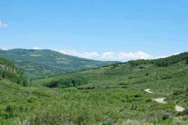
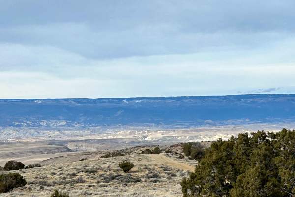
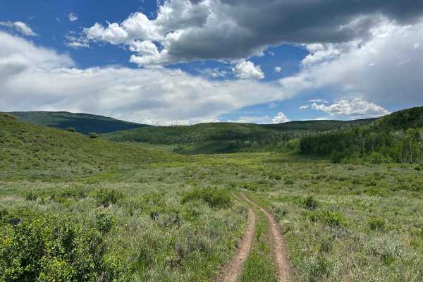
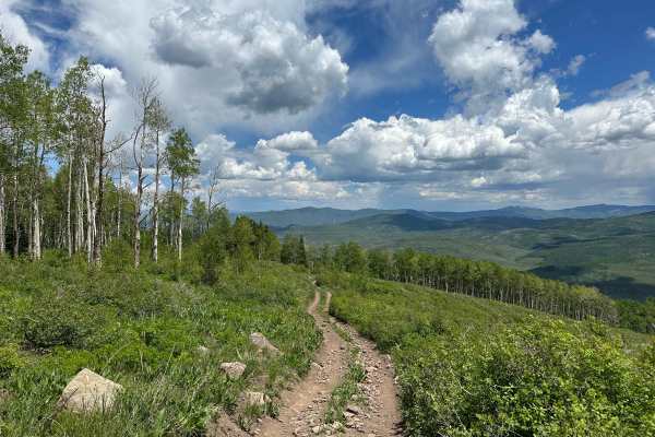
Overland Reservoir
This is a scenic graded road over Grand Mesa between Paonia and Collbran, easy enough to be done in a passenger car. Overland Reservoir is owned by Overland Ditch and Reservoir Company, founded in 1903 as a mutual ditch company to serve agricultural farmers primarily in the Redlands Mesa area of Del...
Learn more about Overland Reservoir
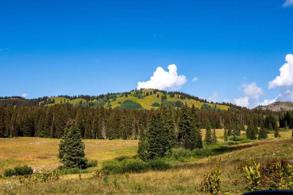
Leroux Creek Road - FS 128
Easy Forest service road that winds up at the lower elevations through gamble oaks then as you climb up in elevation into aspen groves and as you reach the top of the Grand Mesa you will be in Pine/Aspens/meadows with several small lakes that can be fished. There are also many dispersed camping spot...
Learn more about Leroux Creek Road - FS 128
Kebler Pass
This is a graded gravel road that runs between Crested Butte and Hwy 133. Kebler Pass is well known for its beautiful aspen trees in the fall and is located between the Raggeds Wilderness to the North and the West Elk Wilderness to the south. It is an easy stretch of road that offers lots of dispers...
Learn more about Kebler Pass
Hunter Reservoir Trail
This trail is a spur that begins and ends at the Upper East Leon Trailhead. While most of the trails in the area have cattle guards, this one does not. We found the gate closed, so we left it that way after passing through. The first couple of miles meander through a wide, shallow valley with severa...
Learn more about Hunter Reservoir Trail
Sunnyside Cutoff
This well-established cutoff provides an alternative option from the Sidewinder Trail to the Smith Mountain Trail. Terrain is easy, but it offers different views to create more of a loop experience in this area. This trail and this area are very accessible, even during the winter months, and make fo...
Learn more about Sunnyside Cutoff

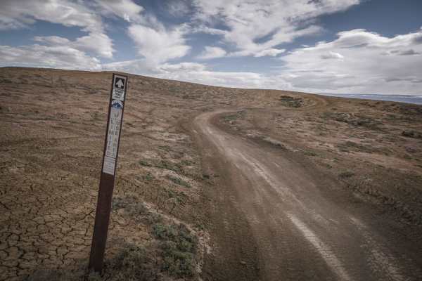
Gunnison Gorge South River Road
Just outside of Delta Colorado, inside Gunnison Gorge National Conservation Area you'll find a beat up gravel road that leads you down to the Gunnison river. Most SUV's and trucks will not have an issue navigating the narrow steep road down to the river floor. Once down on the river, you'll have a v...
Learn more about Gunnison Gorge South River Road

Smith Mountain Jeep Road Overlook
Just outside of Delta, Colorado, inside Gunnison Gorge National Conservation Area, you'll find an unmaintained jeep trail that leads you out onto a peninsula with spectacular views of the Gunnison Gorge. The trail overall is relatively easy to navigate with the occasional steep grade, loose rocks, a...
Learn more about Smith Mountain Jeep Road Overlook
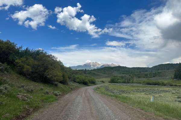
Buzzard Divide Road - FS#265
Buzzard Divide Road is a graded gravel road that provides easy access from CO-133 to the Grand Mesa and eventually to the town of Collbran. The road begins with a short easement through private land, and then winds through open meadows and aspen forests before reaching other accessible forest roads....
Learn more about Buzzard Divide Road - FS#265
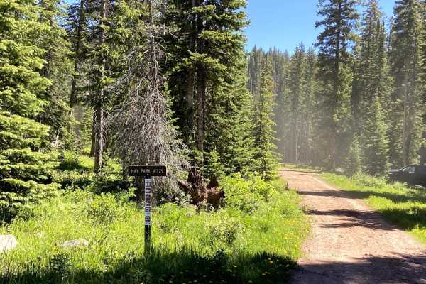
Hay Park (#729)
Hay Park is a fun 50-inch trail that connects Eureka and Hay Park Road. It offers nice views of several lakes. The trail does not change much in elevation and lacks many technical sections but is pretty heavily rutted in spots. The trail passes through many tall and sometimes thick pines rather than...
Learn more about Hay Park (#729)
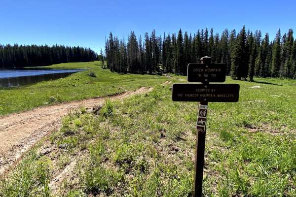
West Green Mountain Trail (#719)
This trail is generally accessed from the West Green Mountain Trailhead off of Surface Creek Road. The trail climbs approximately 1400 feet to the Northwest. The trail is rutted and washed out in spots initially but improves as the climb gets steeper. There are 2-3 stream crossings that are 6-12 inc...
Learn more about West Green Mountain Trail (#719)
Porter Cutoff - FS 535
Porter Cutoff is an alternate route that makes its way up to Porter Mountain while following the rolling foothills and low sagebrush rather than aspen trees. It is a very easy trail, especially in the downhill direction. It is just a fun trail to cruise along, as it follows the contours of the land ...
Learn more about Porter Cutoff - FS 535
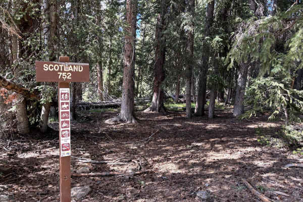
Scotland
This is a scenic and fun trail on the Mesa with thick trees and meadows of wildflowers. The trail climbs East to West. Obstacles are 12 inches or less. The East side is generally looser with tight turns between trees. The West side opens up and is faster while still featuring loose rocks, though mos...
Learn more about Scotland
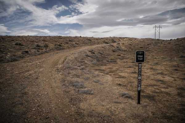
Edge Trail
The Edge Trail is an adobe ridgeline trail in the Peach Valley Recreation Area that goes through an adobe clay badlands landscape. Starting from the northern trailhead, it starts wide but narrows up on the first adobe ridge lines. While on the ridge, you can see straight down to the steep grey fins ...
Learn more about Edge Trail
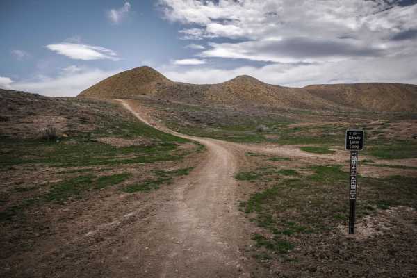
Candy Cane Loop
Candy Cane Loop is an adobe ridge line loop for 50" vehicles in Peach Valley, but has some spots that may be quite narrow for an ATV. Going clockwise, it starts as a winding and whooped out two tracks that meanders on the tops of the adobe clay hills. It has several off camber banked corners in the ...
Learn more about Candy Cane Loop
Mystery Ditch
Mystery Ditch is a fun twisty ditch trail with very tight curves and banked corners. The trail rides through the bottom of a dirt arroyo with dirt walls several feet high. The trail is overall easy with no obstacles and barely any rocks. You can get going fast in the ditch if you can keep up with th...
Learn more about Mystery Ditch
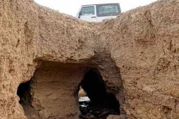
Elephant Skin Road
Elephant Skin Road is an easy Jeep trail between Montrose and Olathe. There are a few shallow gullies across the road, but can be done with any vehicle with a bit of clearance. There is a very strange occurrence in the middle of the trail. There is an area where gullies are joined by underground n...
Learn more about Elephant Skin Road
Dump Ridge
Dump Ridge is a single track in the adobe badlands of the Flat Top - Peach Valley Recreation Area. The trail follows a ridge line on top of the adobe clay hills with lots of ups and downs. It is very similar to the other ridge trails in the area, but Dump Ridge ends at a bit higher elevation where t...
Learn more about Dump Ridge
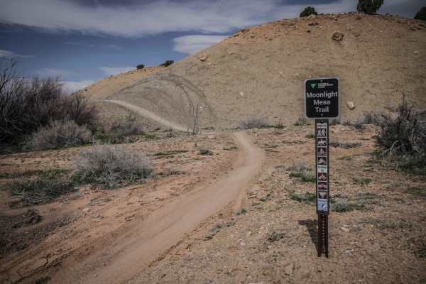
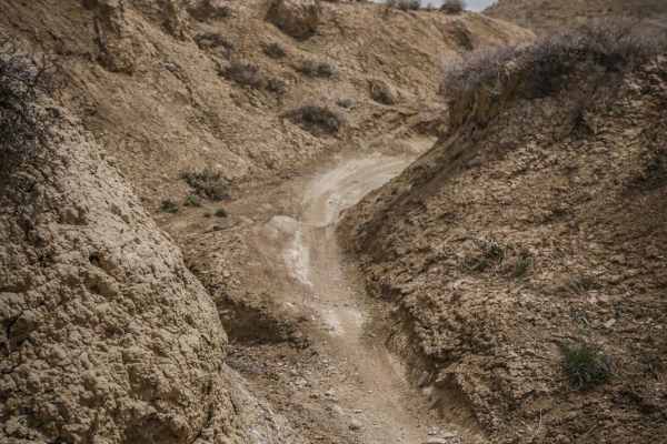
Moonlight Mesa
Moonlight Mesa is one of the longer single tracks in the adobe badlands of the Peach Valley Recreation Area. The SE trailhead on Elephant Skin Road is in the back of the adobe badlands where the hills are made up of more dirt and rocks in addition to the adobe clay. The trail drops back down into th...
Learn more about Moonlight Mesa
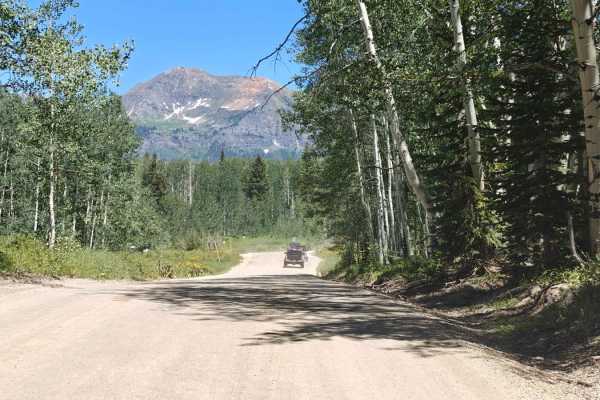
Porter Mountain - FS 534
Porter Mountain is located on the east side of Grand Mesa, the largest mesa in the world. This ATV trail winds its way up the mountain and has a fantastic 270° view of the surrounding area. The southern edge of the peak is a cliff, which leads to great prominence and exposure. Access to the trail ca...
Learn more about Porter Mountain - FS 534
Snake ATV Trail
The Snake ATV trail is a fun ATV trail accessed from the Peach Valley Staging Area that winds at the bottom of the flat valley between the adobe hills. It mostly covers the flat ground and winds back and forth between two hills. There are two narrower sections, and it crosses the Highway One ATV tra...
Learn more about Snake ATV Trail
Beginner ATV trails near Paonia, Colorado
Explore ATV-friendly trails near you. These trails are accessible for vehicles up to 50 inches wide, perfect for ATVs and smaller off-road machines.
Overland Reservoir
This is a scenic graded road over Grand Mesa between Paonia and Collbran, easy enough to be done in a passenger car. Overland Reservoir is owned by Overland Ditch and Reservoir Company, founded in 1903 as a mutual ditch company to serve agricultural farmers primarily in the Redlands Mesa area of Del...
Learn more about Overland Reservoir
Leroux Creek Road - FS 128
Easy Forest service road that winds up at the lower elevations through gamble oaks then as you climb up in elevation into aspen groves and as you reach the top of the Grand Mesa you will be in Pine/Aspens/meadows with several small lakes that can be fished. There are also many dispersed camping spot...
Learn more about Leroux Creek Road - FS 128
Sunnyside Cutoff
This well-established cutoff provides an alternative option from the Sidewinder Trail to the Smith Mountain Trail. Terrain is easy, but it offers different views to create more of a loop experience in this area. This trail and this area are very accessible, even during the winter months, and make fo...
Learn more about Sunnyside Cutoff
Gunnison Gorge South River Road
Just outside of Delta Colorado, inside Gunnison Gorge National Conservation Area you'll find a beat up gravel road that leads you down to the Gunnison river. Most SUV's and trucks will not have an issue navigating the narrow steep road down to the river floor. Once down on the river, you'll have a v...
Learn more about Gunnison Gorge South River Road
Beginner UTV/side-by-side trails near Paonia, Colorado
Find UTV and side-by-side trails near you. These trails accommodate vehicles up to 60 inches wide, ideal for UTVs, side-by-sides, and wider off-road rigs.
Overland Reservoir
This is a scenic graded road over Grand Mesa between Paonia and Collbran, easy enough to be done in a passenger car. Overland Reservoir is owned by Overland Ditch and Reservoir Company, founded in 1903 as a mutual ditch company to serve agricultural farmers primarily in the Redlands Mesa area of Del...
Learn more about Overland Reservoir
Leroux Creek Road - FS 128
Easy Forest service road that winds up at the lower elevations through gamble oaks then as you climb up in elevation into aspen groves and as you reach the top of the Grand Mesa you will be in Pine/Aspens/meadows with several small lakes that can be fished. There are also many dispersed camping spot...
Learn more about Leroux Creek Road - FS 128
Sunnyside Cutoff
This well-established cutoff provides an alternative option from the Sidewinder Trail to the Smith Mountain Trail. Terrain is easy, but it offers different views to create more of a loop experience in this area. This trail and this area are very accessible, even during the winter months, and make fo...
Learn more about Sunnyside Cutoff
Gunnison Gorge South River Road
Just outside of Delta Colorado, inside Gunnison Gorge National Conservation Area you'll find a beat up gravel road that leads you down to the Gunnison river. Most SUV's and trucks will not have an issue navigating the narrow steep road down to the river floor. Once down on the river, you'll have a v...
Learn more about Gunnison Gorge South River Road
The onX Offroad Difference
onX Offroad combines trail photos, descriptions, difficulty ratings, width restrictions, seasonality, and more in a user-friendly interface. Available on all devices, with offline access and full compatibility with CarPlay and Android Auto. Discover what you're missing today!
Open Trail Map