
Beginner Off-Road Trails
Near Palo Verde, California
Explore All Beginner Trails Near Palo Verde, California
Beginner Off-Road Trails Near Palo Verde, California
Discover the best beginner-friendly off-road trails near you. These easier, lower-rated trails are a great place to start — browse trail maps, check difficulty ratings, and find your next adventure.
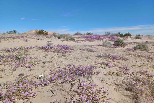
Flower Hill
During the blooming season, this road offers beautiful views of multiple different flowers. This road runs through Bureau Land Management, a mixed surface of gravel, rock, and sand, with some sections more rutted, rocky, and washed out. One section will be difficult for a long wheelbase. Be aware th...
Learn more about Flower Hill
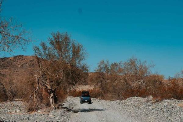
Bradshaw's Trail
Bradshaw's Trail is roughly a 70-mile-long trail stretching from Blythe, CA, to the eastern side of the Salton Sea. The trail runs east to west although it can be traveled from either end, and goes through the Chuckwalla Mountains and the Chocolate Mountain Aerial Gunnery Range. The main trail is a ...
Learn more about Bradshaw's Trail
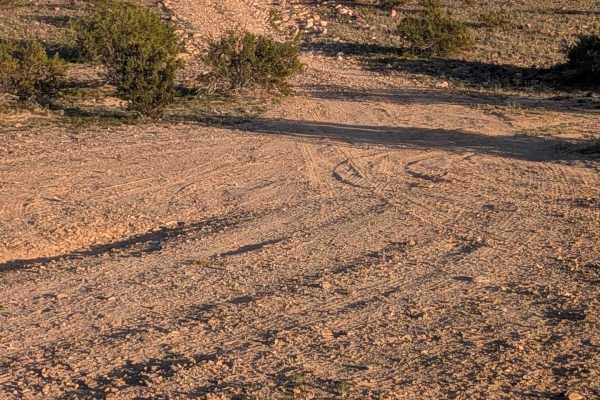
EC1152
This trail starts on EC1146 with a surface of hard pack dirt and sand with some rocks in the beginning before turning to mostly soft sand. The route offers great views of the surrounding mountains, including views of the Trigo Mountains throughout. The trail is lined with creosote bushes as it cross...
Learn more about EC1152
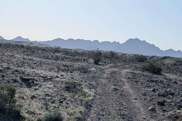
EC1141
This 4-mile trail starts on EC1146 and ends on EC1131, featuring hard-packed sand with embedded rocks ranging from pebble to softball sizes. The route immediately climbs up onto a ridgeline, giving dramatic 360-degree views of the surrounding area. You'll enjoy great views of the surrounding mountai...
Learn more about EC1141
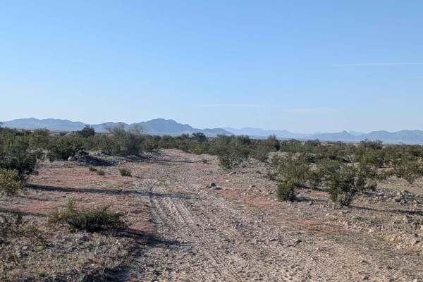
EC1171
This trail starts on Levee Road and ends on EC1146, featuring mostly hard-packed dirt with small rocks. The trail is about one vehicle wide and relatively flat as it crosses the terrain. The route is lined with lots of desert brush on both sides and offers views of mountains in all directions as you...
Learn more about EC1171
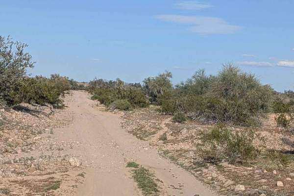
EC1146
This 1.5 vehicle-wide trail features mostly sand and gravel surface with some rocks throughout. It serves as a main access trail for many other trails in the area, making it an important connector route. The trail is lined with creosote brush on both sides as you navigate through. You'll encounter l...
Learn more about EC1146
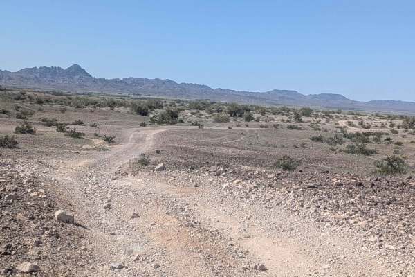
EC1131
This can be run as a one-way or out-and-back trail. It features packed sand with embedded gravel and small rocks, winding up and down a series of hills that create a rolling terrain. You'll enjoy nice views of the Trigo Mountains on the west side as you navigate the route. The trail goes in and out ...
Learn more about EC1131

EC1124
This trail starts off South Cibola Lake Road from EC1125 in a popular RV camping area. The surface is packed sand with embedded rocks throughout as you navigate the terrain. There's sparse vegetation, including very small desert bushes and seasonal wildflowers, adding occasional color. The trail win...
Learn more about EC1124
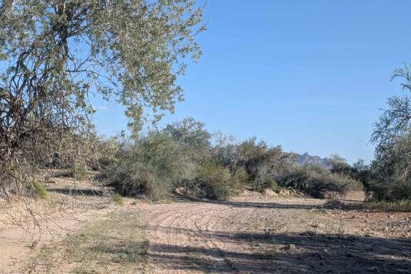
EC1164
This out-and-back trail is a small wash cutting through various trees and brush, starting and ending at EC1146. The surface features sections of soft sand, packed sand, and rocks, creating varied terrain. You'll encounter step-ups and step-downs all less than 12 inches scattered throughout the route...
Learn more about EC1164
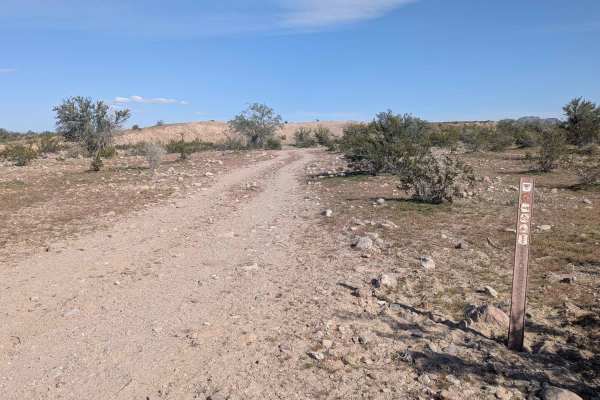
EC1165
This relatively flat 3-mile trail (6 miles out-and-back) starts and returns to EC1146. The surface is hard-packed sand that weaves through creosote bushes before eventually dropping into a small wash with fine sand. The route goes in and out of small washes with lots of uneven surfaces and some off-...
Learn more about EC1165
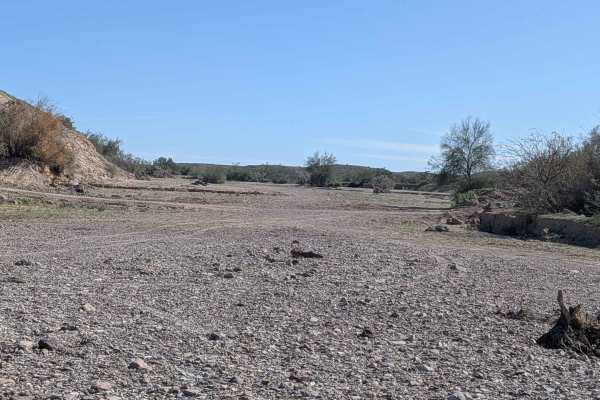
EC164
This trail starts at Levee Road and connects to EC1177, beginning in a large sandy wash. A quarter mile in, it exits the wash on a steep incline and winds its way through a very deep sandy area filled with lots of brush and trees. You'll encounter some steep inclines into and out of small washes as ...
Learn more about EC164
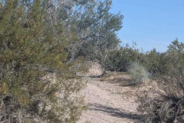
EC1168
This 2-mile trail (4 miles out-and-back) starts off EC1146. The surface is sandy with lots of little rocks and is lined with various desert trees and brush. The wash gets more and more narrow as you progress before the trail comes out and travels on hard-pack sand in the main area. The trail runs al...
Learn more about EC1168
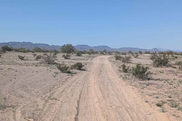
EC135
This trail starts and ends on EC1131. The surface is sandy and winding as it navigates through sparse desert brush scattered across the landscape. The trail is flat overall but has some uneven sections that create minor bumps and require attention. The route winds through some small hills on the edg...
Learn more about EC135
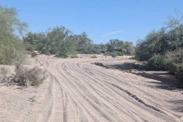
EC1179
This 1.6-mile out-and-back trail climbs 100 feet through a deep sandy wash with mostly soft sand throughout. There are alternate branches you can take to reach the same spot, giving you options for navigation through the wash. You'll encounter quite a few large trees to maneuver around as you work y...
Learn more about EC1179
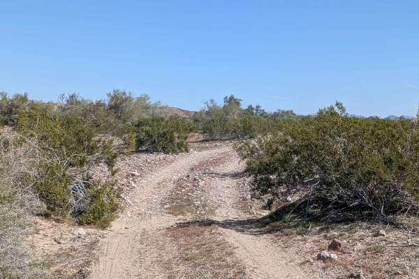
EC1177
This 1.64-mile out-and-back trail climbs 155 feet and is located on BLM land, ending at the Yuma Proving Grounds, which is part of the Department of Defense, where no entry is allowed. The surface is hard-packed sand with some gravel and rocks, and the trail is lined with creosote bushes throughout....
Learn more about EC1177
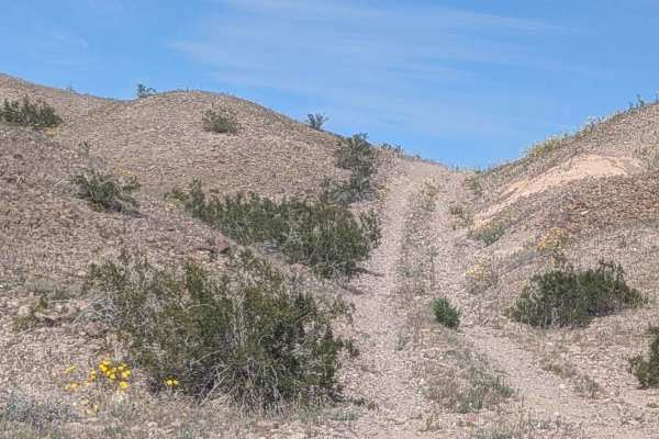
EC1181
This 1.5-mile out-and-back trail climbs 130 feet, starting on EC1179 in a soft and sandy wash surrounded by trees and brush. The route quickly climbs out and runs along the lower level edges between the wash and hills, where the surface transitions to hard-packed sand. The trail heads to and through...
Learn more about EC1181
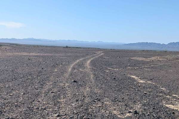
EC1112 North
This trail starts on South Cibola Lake Road and ends at trail EC1131 at the base of the Trigo Mountains. The west side of the trail is very flat on a really wide plateau, providing easy navigation across open terrain. The east side slowly climbs the hills as it gains elevation toward the mountains, ...
Learn more about EC1112 North
EC1187
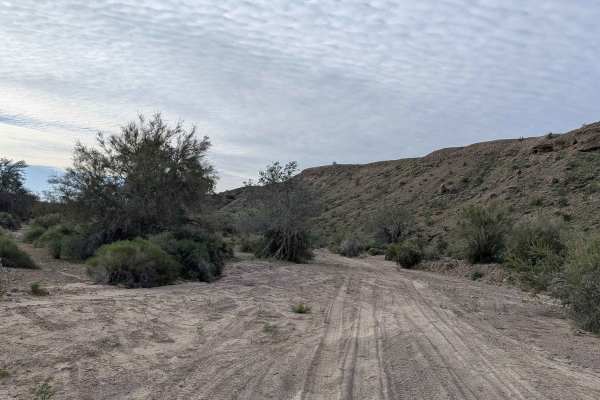
This two-mile trail climbs over 200 feet, starting just off Levee Road in a large, wide sandy area. The trail quickly drops into a very fine sandy wash that alternates between a very wide wash and one vehicle-wide sections filled with lots of vegetation. The wash runs through a canyon with tall mud ...
Learn more about EC1187
EC1184
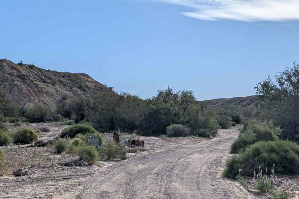
This 1.5-mile trail (3 miles out and back) climbs over 200 feet, starting on Levee Road. The surface is sandy and features lots of trees and brush to maneuver around, with some sections pretty tight that may pinstripe wider vehicles. The trail gets less and less used as you go on and becomes narrowe...
Learn more about EC1184
EC1102
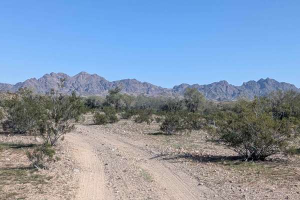
This trail starts off South Cibola Lake Road with a surface that alternates between hard-packed and soft sand with some gravel throughout. The route slowly climbs toward the mountains, gaining elevation gradually as you approach. Seasonal wildflowers can make the landscape pop with vibrant colors wh...
Learn more about EC1102
Beginner ATV trails near Palo Verde, California
Explore ATV-friendly trails near you. These trails are accessible for vehicles up to 50 inches wide, perfect for ATVs and smaller off-road machines.
Flower Hill
During the blooming season, this road offers beautiful views of multiple different flowers. This road runs through Bureau Land Management, a mixed surface of gravel, rock, and sand, with some sections more rutted, rocky, and washed out. One section will be difficult for a long wheelbase. Be aware th...
Learn more about Flower Hill
EC1152
This trail starts on EC1146 with a surface of hard pack dirt and sand with some rocks in the beginning before turning to mostly soft sand. The route offers great views of the surrounding mountains, including views of the Trigo Mountains throughout. The trail is lined with creosote bushes as it cross...
Learn more about EC1152
EC1141
This 4-mile trail starts on EC1146 and ends on EC1131, featuring hard-packed sand with embedded rocks ranging from pebble to softball sizes. The route immediately climbs up onto a ridgeline, giving dramatic 360-degree views of the surrounding area. You'll enjoy great views of the surrounding mountai...
Learn more about EC1141
EC1171
This trail starts on Levee Road and ends on EC1146, featuring mostly hard-packed dirt with small rocks. The trail is about one vehicle wide and relatively flat as it crosses the terrain. The route is lined with lots of desert brush on both sides and offers views of mountains in all directions as you...
Learn more about EC1171
Beginner UTV/side-by-side trails near Palo Verde, California
Find UTV and side-by-side trails near you. These trails accommodate vehicles up to 60 inches wide, ideal for UTVs, side-by-sides, and wider off-road rigs.
Flower Hill
During the blooming season, this road offers beautiful views of multiple different flowers. This road runs through Bureau Land Management, a mixed surface of gravel, rock, and sand, with some sections more rutted, rocky, and washed out. One section will be difficult for a long wheelbase. Be aware th...
Learn more about Flower Hill
EC1152
This trail starts on EC1146 with a surface of hard pack dirt and sand with some rocks in the beginning before turning to mostly soft sand. The route offers great views of the surrounding mountains, including views of the Trigo Mountains throughout. The trail is lined with creosote bushes as it cross...
Learn more about EC1152
EC1141
This 4-mile trail starts on EC1146 and ends on EC1131, featuring hard-packed sand with embedded rocks ranging from pebble to softball sizes. The route immediately climbs up onto a ridgeline, giving dramatic 360-degree views of the surrounding area. You'll enjoy great views of the surrounding mountai...
Learn more about EC1141
EC1171
This trail starts on Levee Road and ends on EC1146, featuring mostly hard-packed dirt with small rocks. The trail is about one vehicle wide and relatively flat as it crosses the terrain. The route is lined with lots of desert brush on both sides and offers views of mountains in all directions as you...
Learn more about EC1171
The onX Offroad Difference
onX Offroad combines trail photos, descriptions, difficulty ratings, width restrictions, seasonality, and more in a user-friendly interface. Available on all devices, with offline access and full compatibility with CarPlay and Android Auto. Discover what you're missing today!
Open Trail Map