
Beginner Off-Road Trails
Near Ozark, Missouri
Explore All Beginner Trails Near Ozark, Missouri
Beginner Off-Road Trails Near Ozark, Missouri
Discover the best beginner-friendly off-road trails near you. These easier, lower-rated trails are a great place to start — browse trail maps, check difficulty ratings, and find your next adventure.
129
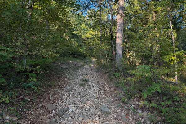
Chadwick Trail 129 is mostly a gradual climb from north to south, gaining about 260 feet in elevation over .8 miles. It’s a very narrow trail traversing up a hillside, with lots of chunky loose rock and slabs of rock. There are roots sticking out and tree gaps that would likely be quite narrow for a...
Learn more about 129
130
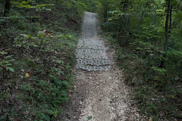
Chadwick Trail 130 makes a 1.2-mile loop off of Lookout Road in the Chadwick Motorized Trail System. Going clockwise, it starts off as a narrow ATV trail weaving through a tight forest above a ravine. It enters the ravine, riding on packed-down small loose rocks. This will likely be very tight for A...
Learn more about 130
132a
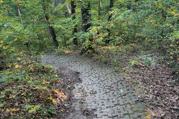
Chadwick Trail 132a is a 1.1-mile-long ATV trail that connects Trail 130 to the intersection with Trails 131 and 132. It mostly weaves through a tight forest on a narrow dirt path with minor loose rock and roots. There are cinder blocks reinforcing the path at times to prevent erosion, and the trail...
Learn more about 132a
FS 324
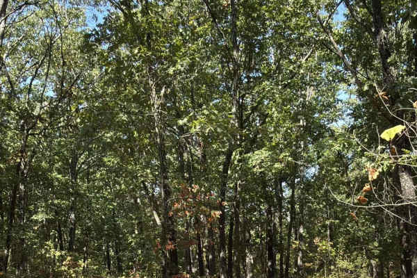
A 1-mile spur off of Center - FS 553. This is a very easy trail, but expect to not make it to the end due to a large downed tree blocking the trail. Near the end, there is an illegal trail that goes off to the left. Expect some hanging limbs along the trail.
Learn more about FS 324
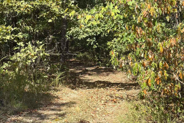
Central - FS 553
The trail is a 1.3 mile in and out trail. Single vehicle wide, mainly dirt with overgrowth. The trail itself is easy but be prepared for downed trees and hanging limbs in your path. You will see several illegal trails and campsite areas along the trail. There is a split about a 1/4 of the way in, th...
Learn more about Central - FS 553

Beachler Ridge - FS 549
The terrain is fairly easy to drive; most of it is dirt or gravel, with weeds and grass in the middle. Be prepared to encounter downed trees and limbs. In several places, the brush and trees are tight, so expect to get some scratches as you travel this trail. It is an in-and-back-out trail, with a...
Learn more about Beachler Ridge - FS 549
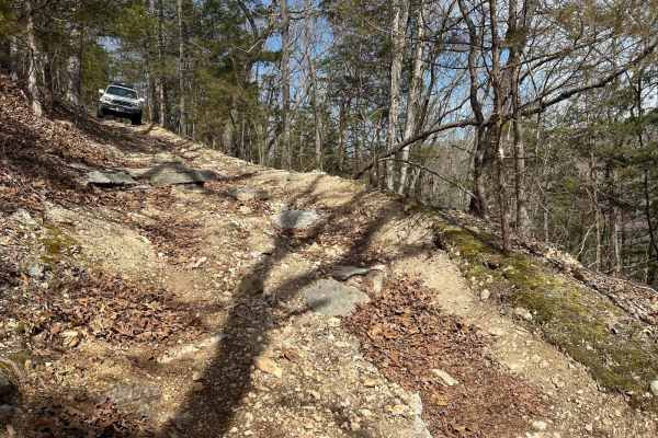
Devreaux Ridge Road Cave
This is a short trail that branches off the Devreaux Ridge Road trail. It starts pretty smooth, but soon approaches a few drops (approximately 10 inches). It will then lead to a small cave that sits on a hill. Make sure you stop to check it out. After that, you will go through some tight turns, and ...
Learn more about Devreaux Ridge Road Cave
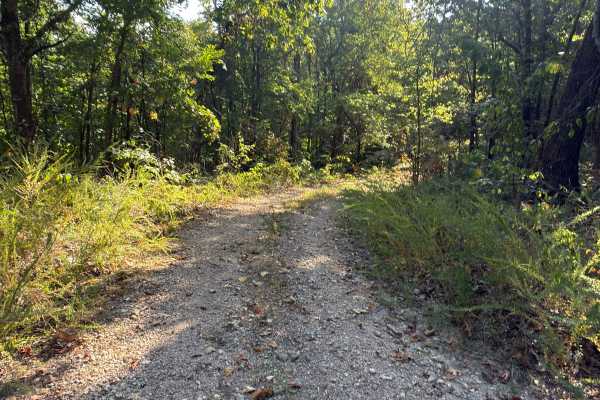
Bright Ridge - FS 548
This is an easy in-and-out trail that can become rutted after a hard rain; expect to encounter fallen limbs and heavy brush. Watch where you are going, as there are a lot of illegal trails that branch off of this trail. At the end of the trail, it appears to keep going, but this is a Forrest Servi...
Learn more about Bright Ridge - FS 548

Baldknobber - FS 623
This is an easy trail in and back out trail, but doesn't appear to be frequently traveled, the majority of the trail is packed gravel with weeds growing up to 2ft tall in the middle of the trail. There is dense brush on both sides of the trail; expect scratches to the vehicle. If traveling after a...
Learn more about Baldknobber - FS 623

Round Mountain Road
Round Mountain Road is a gravel route in the Mark Twain National Forest. It is an excellent way to access the forest when coming from, or heading to the Branson area. This route is mostly gravel along a ridge through a very dense section of forest. Great views to the south occur in early spring, win...
Learn more about Round Mountain Road

Devreaux Ridge Road
A point-to-point trail providing access to ample camping, OHV, and hunting opportunities inside Mark Twain National Forest. Primarily gravel road with multiple optional connections to primitive trails throughout. Rolling and turning hills with one creek bed crossing approximately halfway. Can be tra...
Learn more about Devreaux Ridge Road
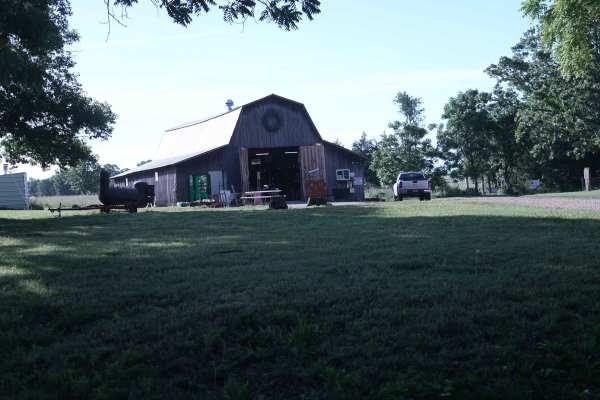
Bohmont Road
This is the main road into Soggy Bottoms MX Park and provides access to the main check-in barn, MX track parking lot, SxS flat track, camping area, and park trailhead. This road is primarily used for entering and exiting the MX and camping areas. A smaller rock trail runs alongside this road and is ...
Learn more about Bohmont Road
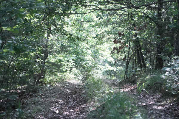
East Ridge Loop
This trail features a steep climb with loose rocks and small rock ledges, along with tight, off-camber turns and deep ruts. The trail is heavily overgrown in several areas, making the route difficult to follow at times. A 74-inch-wide machine can make it through, but some sections are very tight and...
Learn more about East Ridge Loop
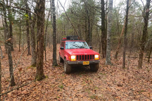
Surrott School - FS 591
Surrott School FS 591, featuring part of Prairie Dog Road, is a natural-terrain forest service road within the Mark Twain National Forest Ava Unit, which is part of the greater Glade Top area. The road leans into the identity of being a long-lost hunting track, featuring narrow widths amongst tight ...
Learn more about Surrott School - FS 591
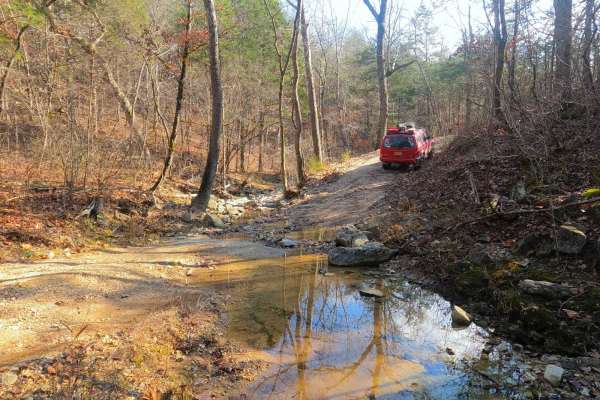
Fort Bald - FS 612
Fort Bald FS 612 is a gravel forest service road within the Mark Twain National Forest Ava Unit, as part of the greater Glade Top area. The road is meager in offroad prowess, with the track following up and down the ridge line, featuring mild coarse gravel terrain over mild-moderate graded hills, on...
Learn more about Fort Bald - FS 612
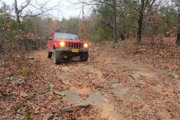
Fort Bald Spur - FS 612A
Fort Bald Spur FS 612A is the natural terrain Forest Service road within the Mark Twain National Forest Ava Unit, part of the greater Glade Top area. The road fits right in with the main road of Fort Bald FS 612, showing that its main purpose is in the hunting arena through the many offshoots, tight...
Learn more about Fort Bald Spur - FS 612A
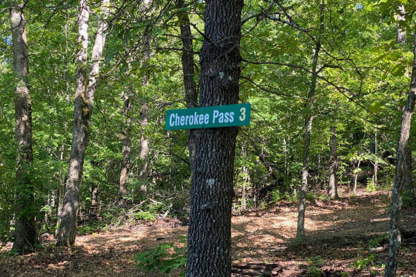
Cherokee Pass
Cherokee Pass is an offshoot trail towards the top of Brixey Hill. This is a scenic drive through the winding trees, with some spots being tighter to navigate for longer wheelbases. This trail does have areas that are rutted and will have mud puddles. You wil also encounter a few spots with steep gr...
Learn more about Cherokee Pass
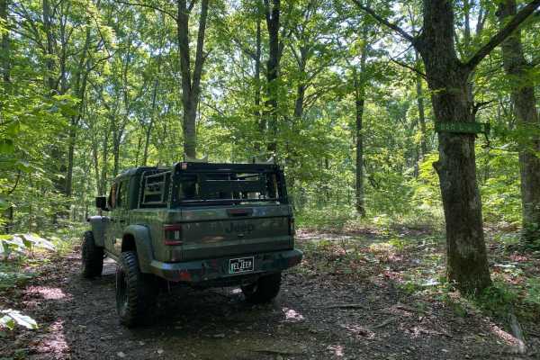
Bar-B-Q
This is a side trail you can take from Cherokee Pass back up to High Mountain Road, or you can take this trail from High Mountain Road and drop onto Cherokee Pass. From High Mountain Road, this is a nice easy trail. This trail is not traveled all that much, so there is plenty of overgrowth from tree...
Learn more about Bar-B-Q
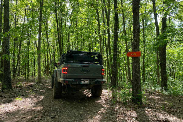
Big Oak
This is a very short bypass trail from Dead Beat back to Turkey Trot. There are no obstacles. This is more of a dirt or gravel road. There is a decently large oak tree at the end of the trail where it connects to Dead Beat. This trail is so short you will think you were never on it.
Learn more about Big Oak
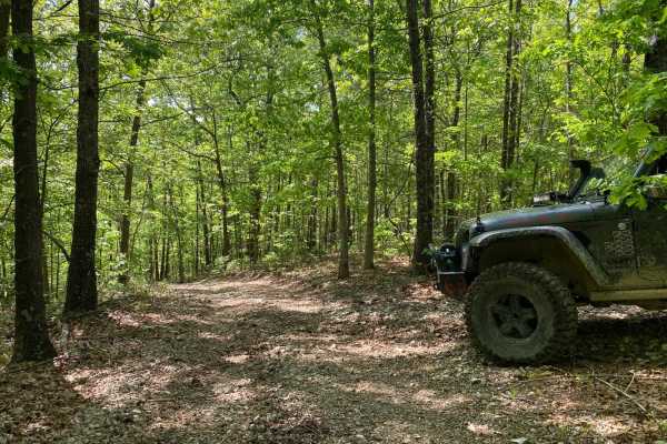
Old Crow
This is a short and sweet non-directional offshoot of Lone Wolf. There are some tight corners;some spots will be muddy. There is also a steep downhill if coming from where it meets Lone Wolf. This trail will reconnect you to Lone Wolf at the bottom or you can get onto a trail called Deadbeat.
Learn more about Old Crow
Beginner ATV trails near Ozark, Missouri
Explore ATV-friendly trails near you. These trails are accessible for vehicles up to 50 inches wide, perfect for ATVs and smaller off-road machines.
129
Chadwick Trail 129 is mostly a gradual climb from north to south, gaining about 260 feet in elevation over .8 miles. It’s a very narrow trail traversing up a hillside, with lots of chunky loose rock and slabs of rock. There are roots sticking out and tree gaps that would likely be quite narrow for a...
Learn more about 129
130
Chadwick Trail 130 makes a 1.2-mile loop off of Lookout Road in the Chadwick Motorized Trail System. Going clockwise, it starts off as a narrow ATV trail weaving through a tight forest above a ravine. It enters the ravine, riding on packed-down small loose rocks. This will likely be very tight for A...
Learn more about 130
132a
Chadwick Trail 132a is a 1.1-mile-long ATV trail that connects Trail 130 to the intersection with Trails 131 and 132. It mostly weaves through a tight forest on a narrow dirt path with minor loose rock and roots. There are cinder blocks reinforcing the path at times to prevent erosion, and the trail...
Learn more about 132a
Devreaux Ridge Road Cave
This is a short trail that branches off the Devreaux Ridge Road trail. It starts pretty smooth, but soon approaches a few drops (approximately 10 inches). It will then lead to a small cave that sits on a hill. Make sure you stop to check it out. After that, you will go through some tight turns, and ...
Learn more about Devreaux Ridge Road Cave
Beginner UTV/side-by-side trails near Ozark, Missouri
Find UTV and side-by-side trails near you. These trails accommodate vehicles up to 60 inches wide, ideal for UTVs, side-by-sides, and wider off-road rigs.
Devreaux Ridge Road Cave
This is a short trail that branches off the Devreaux Ridge Road trail. It starts pretty smooth, but soon approaches a few drops (approximately 10 inches). It will then lead to a small cave that sits on a hill. Make sure you stop to check it out. After that, you will go through some tight turns, and ...
Learn more about Devreaux Ridge Road Cave
Bright Ridge - FS 548
This is an easy in-and-out trail that can become rutted after a hard rain; expect to encounter fallen limbs and heavy brush. Watch where you are going, as there are a lot of illegal trails that branch off of this trail. At the end of the trail, it appears to keep going, but this is a Forrest Servi...
Learn more about Bright Ridge - FS 548
Baldknobber - FS 623
This is an easy trail in and back out trail, but doesn't appear to be frequently traveled, the majority of the trail is packed gravel with weeds growing up to 2ft tall in the middle of the trail. There is dense brush on both sides of the trail; expect scratches to the vehicle. If traveling after a...
Learn more about Baldknobber - FS 623
East Ridge Loop
This trail features a steep climb with loose rocks and small rock ledges, along with tight, off-camber turns and deep ruts. The trail is heavily overgrown in several areas, making the route difficult to follow at times. A 74-inch-wide machine can make it through, but some sections are very tight and...
Learn more about East Ridge Loop
The onX Offroad Difference
onX Offroad combines trail photos, descriptions, difficulty ratings, width restrictions, seasonality, and more in a user-friendly interface. Available on all devices, with offline access and full compatibility with CarPlay and Android Auto. Discover what you're missing today!
Open Trail Map