
Beginner Off-Road Trails
Near On Top of the World, Florida
Explore All Beginner Trails Near On Top of the World, Florida
Beginner Off-Road Trails Near On Top of the World, Florida
Discover the best beginner-friendly off-road trails near you. These easier, lower-rated trails are a great place to start — browse trail maps, check difficulty ratings, and find your next adventure.
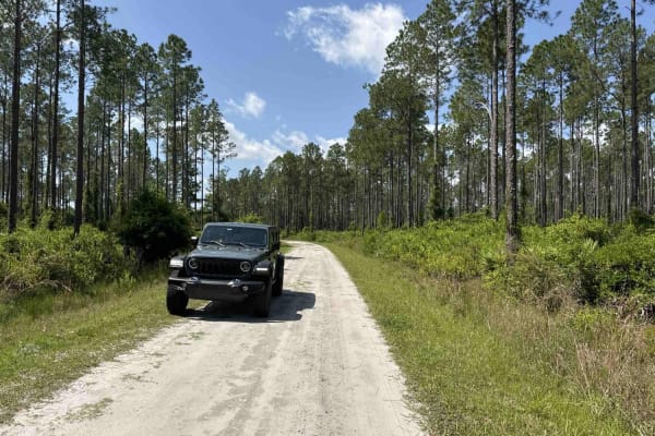
Goethe Circle
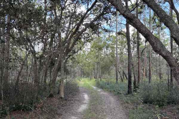
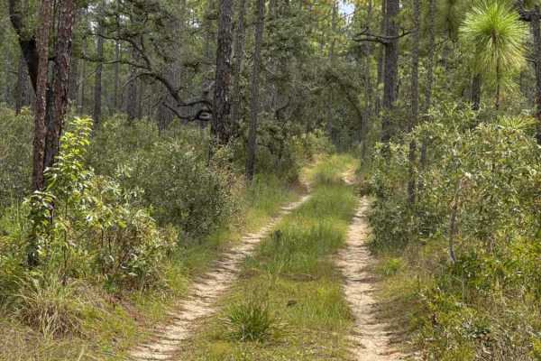
Goethe Circle is a beautiful ride through some open land combined with some heavily wooded areas. It is surrounded by some amazing views and many different types of wildlife. The terrain will vary from sand to mud. It is a nice drive for a variety of vehicles
Learn more about Goethe Circle
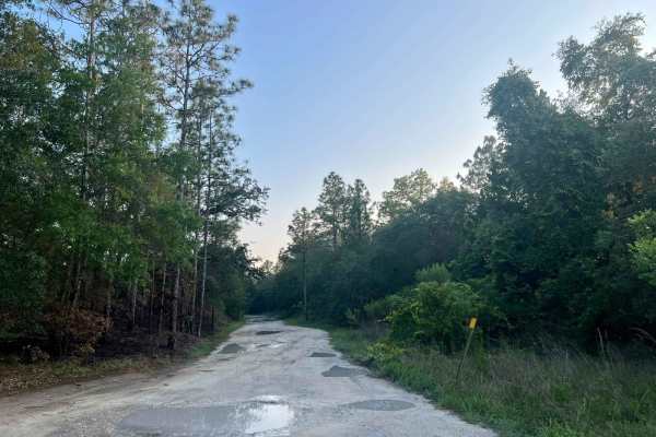
Ocklawaha Trail - ONF SE24ST
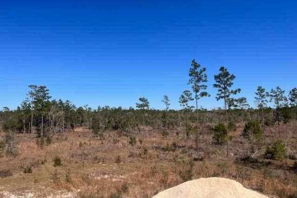
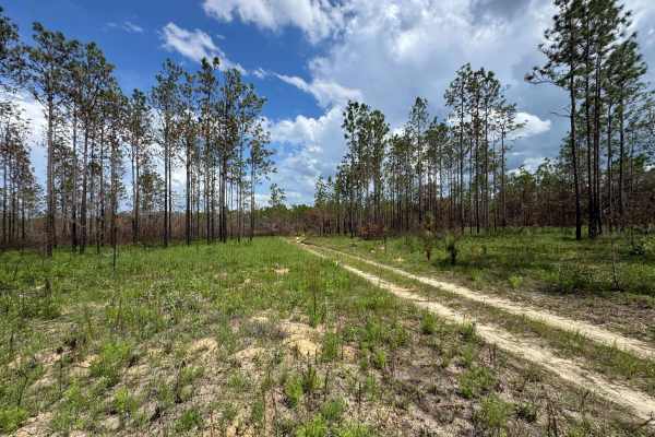
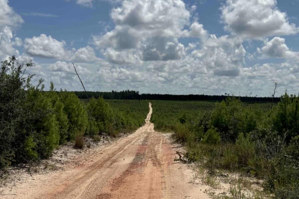
The Ocklawaha Trail, also known as Ocala National Forest Road SE24ST, connects SE 1st Road at the west end and Highway 314A at the east end in the southwest of the Ocala National Forest. The trail gives you access to some dirt roads that will take you to the Ocklawaha River. The road conditions are ...
Learn more about Ocklawaha Trail - ONF SE24ST
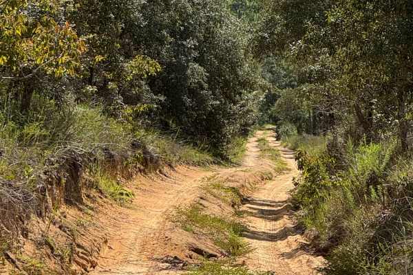
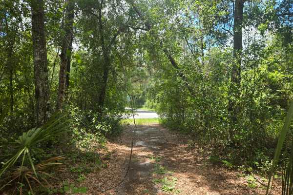
Trail 6 - Citrus WMA
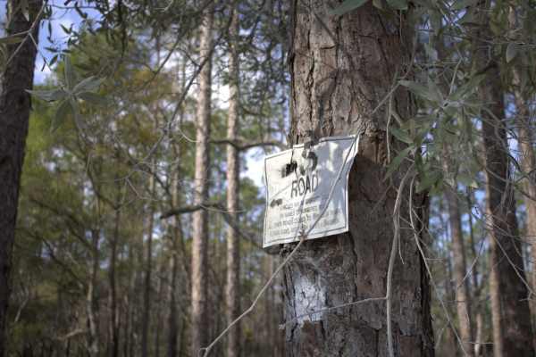
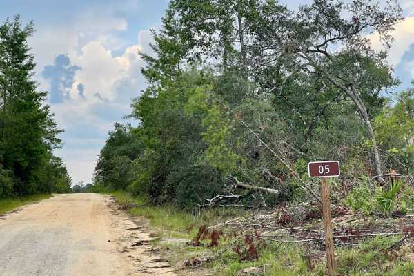
Trail 6 takes you from East Haven Street at the east end to Trail 19 at the west end of the trail in the north part of the Citrus Wildlife Management Area. The road conditions are a mixture of packed sand, loose sand, and some deep holes that can turn into 2-foot deep mud holes after rainy days. The...
Learn more about Trail 6 - Citrus WMA
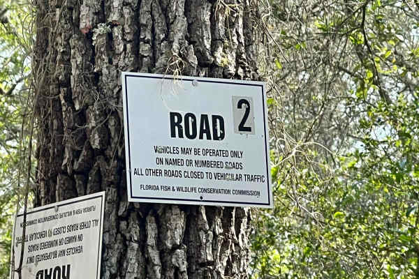
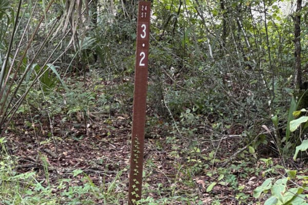
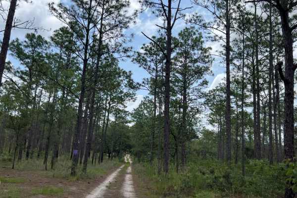
Citrus Wildlife Management | Trail 2
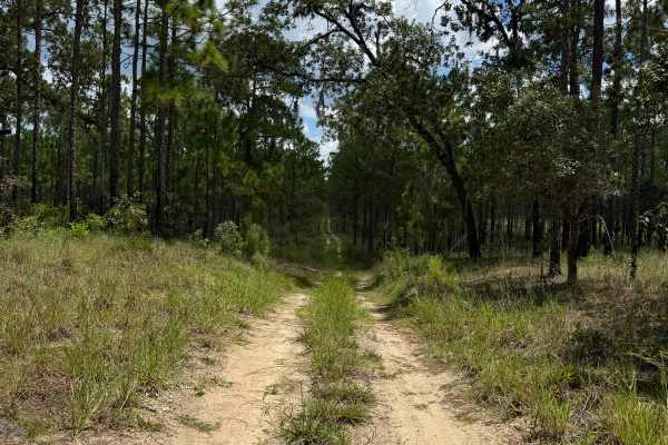
Trail 2 is a tight trail so be careful for pinstriping from tree limbs, and down trees after a storm. The terrain is mainly dirt and sand patches. This trail is not highly maintained due to it leading to closed trails. The phone signal on this trail was okay enough to send texts & make phone calls.
Learn more about Citrus Wildlife Management | Trail 2
Trail 4 - Citrus WMA
Trail 4 takes you from Trail 11a at the east end to Trail 19 at the west end of the trail in the north part of the Citrus Wildlife Management Area. The road conditions are a mixture of packed sand, loose sand, and some deep holes that can turn into 2-foot deep mud holes after rainy days. The road is...
Learn more about Trail 4 - Citrus WMA
Trail 10A - Citrus WMA
Trail 10a takes you from Trail 9 at the east end to Trail 19 at the west end of the trail in the central part of the Citrus Wildlife Management Area. The road conditions are a mixture of packed sand, loose sand, and some deep holes that can turn into 2-foot deep mud holes after rainy days. The road ...
Learn more about Trail 10A - Citrus WMA
Citrus Wildlife Management | Trail 5
Trail 5 has a variety of trail riding fun. It has sugar sand as well as built-up walls and steep grades. There is a plethora of pine trees as well as winding oak trees. We saw quite a few Fox Squirrels on this trail and Turkeys as well, so wildlife is plentiful on this trail. This is an awesome trai...
Learn more about Citrus Wildlife Management | Trail 5
Trail 12 - Citrus WMA
Trail 12 takes you from County Road 581 at the east end to Trail 15 at the west end of the trail in the central part of the Citrus Wildlife Management Area. The road conditions are a mixture of packed sand, loose sand, and some deep holes that can turn into 2-foot deep mud holes after rainy days. Th...
Learn more about Trail 12 - Citrus WMA
Trail 10 - Citrus WMA
Trail 10 takes you from Trail 9 at the east end to Trail 17 at the west end of the trail in the central part of the Citrus WMA. The road conditions are a mixture of packed sand, loose sand, and some deep holes that can turn into 2-foot deep mud holes after rainy days. The road is not always wide eno...
Learn more about Trail 10 - Citrus WMA
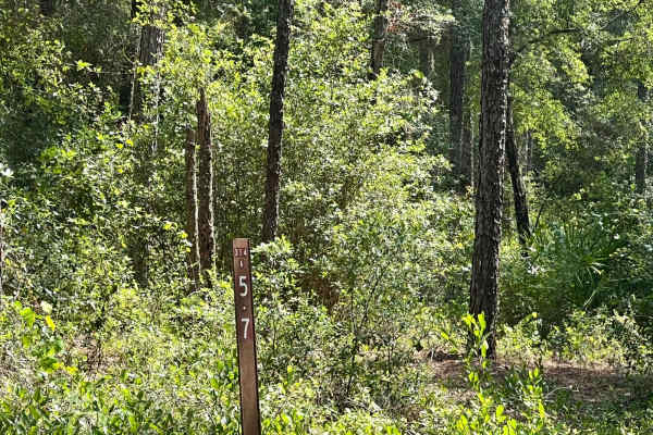
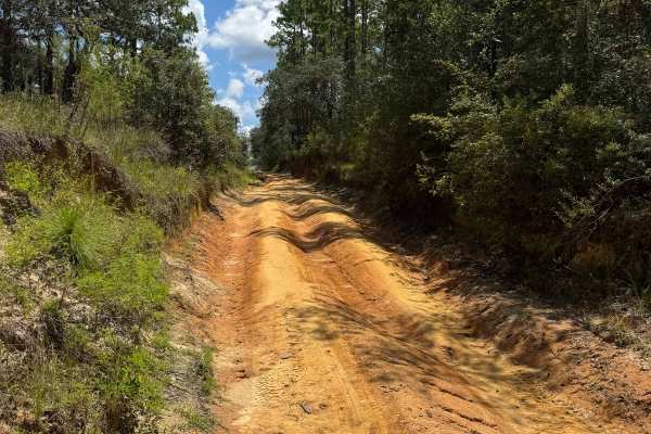
Ocala National Forest | Trail 314A-5.7
This trail consists of mud and dirt and is very wet during raining season. You can expect thick brush that can cause pinstriping so be careful, but also includes patches of pine forest. The cell phone service is okay enough to send messages & make phone calls in an emergency with Verizon.
Learn more about Ocala National Forest | Trail 314A-5.7
Ocala National Forest SE 13th Avenue
The Ocala National Forest SE 13th Avenue connects Ocklawaha Trail at the north end and State Route 314A at the south end of the trail at the west boundary of the Ocala National Forest. The trail gives you access to some dirt roads around the Tomahawk Lake and the Ocklawaha Prairie. The road conditio...
Learn more about Ocala National Forest SE 13th Avenue

Trail 14 East
Easy to medium trail with lots of opportunities to play in soft sand. Multiple trails also intertwine with state park trail roads, so be sure to read posted signs on trees before entering an area--otherwise, some great spots to get some articulation. If you choose to go when it rains, you'll be happ...
Learn more about Trail 14 East
Lake Charles Way
This trail features lots of soft sand and low-hanging tree branches. Guaranteed for vehicle scratches. Some small open areas are available to pull over and rest, and allow other vehicles to go by. There are also several camping spots along this trail, located in proximity to the lake. Be aware of ve...
Learn more about Lake Charles Way
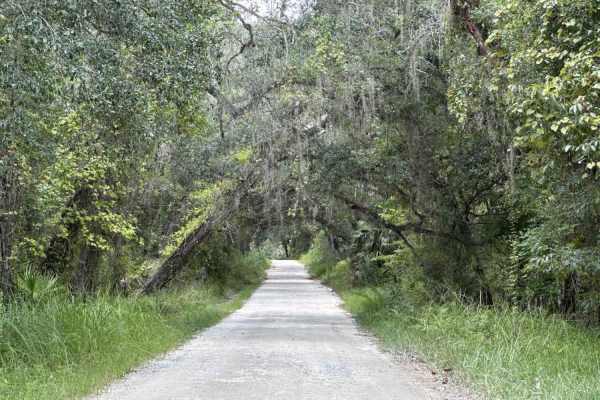
Lochloosa WMA South Trail
Lochloosa WMA South Trail connects CR-325 and the Burnt Island Trail. It allows you access to the Lochloosa Water Management Area with plenty of trails that are only accessible during hunting season. The Lochloosa WMA South Trail is open year-round. The road is mostly packed sand and wide enough for...
Learn more about Lochloosa WMA South Trail
Citrus Wildlife Management | Trail 9
Trail 9 has limestone, gravel, dirt, clay, and long sand patches. In the rainy seasons of Florida, this trail can become wet and muddy. Trail 9 will also lead you through the Holder Mine campground, which is a gated campground that you could stay at. This trail intersects at multiple trails if you d...
Learn more about Citrus Wildlife Management | Trail 9
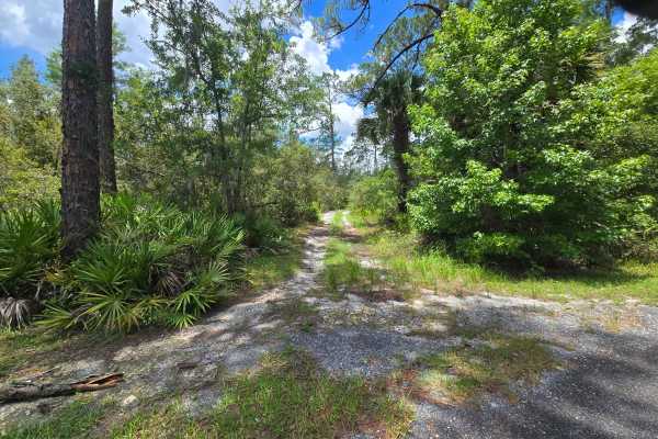
Lake Eaton Way
This trail will lead you to Lake Eaton. A combination of flat white sand and mud, and small water crossings after a rainfall. Halfway through the trail, you can leave the route to view Lake Eaton, where there will be a small pier and an area to launch a boat into the water. Several camping spots are...
Learn more about Lake Eaton Way
Citrus Wildlife Management | Trail 18
On this trail, you will be riding through a pine forest. You will encounter things such as mud holes, sandy patches, and built-up clay walls. There are water holes but they have bypasses if you need to go around them, especially in raining season. The cell phone service is good enough to make phone ...
Learn more about Citrus Wildlife Management | Trail 18
Trail 18a - Citrus WMA
Trail 18a takes you from Trail 16 at the east end to Trail 15 at the west end of the trail in the southern part of the Citrus Wildlife Management Area. The road conditions are a mixture of packed sand, loose sand, and some deep holes that can turn into 2-foot deep mud holes after rainy days. The roa...
Learn more about Trail 18a - Citrus WMA
Lam Horse Trail - ONF 22-0.3A
The Lam Horse Trail, also known as Ocala National Forest Road 22-0.3A, connects High Tension Road at the west end and Green Bear Hole / Lam Horse Trail at the east end in the south part of the ONF. The trail gives you access to several trails including 'Tread Lightly! Four Wheel Drive Way' (Florida'...
Learn more about Lam Horse Trail - ONF 22-0.3A
Ocala National Forest | Trail 5
This trail is an easier trail consisting of hard clay roads and gravel/rock. This is the perfect trail to ride around and just enjoy nature around you without crazy obstacles. We did encounter a rattlesnake while driving around this area so be mindful of that. The cell phone service is good enough t...
Learn more about Ocala National Forest | Trail 5
Beginner ATV trails near On Top of the World, Florida
Explore ATV-friendly trails near you. These trails are accessible for vehicles up to 50 inches wide, perfect for ATVs and smaller off-road machines.
Ocklawaha Trail - ONF SE24ST
The Ocklawaha Trail, also known as Ocala National Forest Road SE24ST, connects SE 1st Road at the west end and Highway 314A at the east end in the southwest of the Ocala National Forest. The trail gives you access to some dirt roads that will take you to the Ocklawaha River. The road conditions are ...
Learn more about Ocklawaha Trail - ONF SE24ST
Trail 6 - Citrus WMA
Trail 6 takes you from East Haven Street at the east end to Trail 19 at the west end of the trail in the north part of the Citrus Wildlife Management Area. The road conditions are a mixture of packed sand, loose sand, and some deep holes that can turn into 2-foot deep mud holes after rainy days. The...
Learn more about Trail 6 - Citrus WMA
Ocala National Forest SE 13th Avenue
The Ocala National Forest SE 13th Avenue connects Ocklawaha Trail at the north end and State Route 314A at the south end of the trail at the west boundary of the Ocala National Forest. The trail gives you access to some dirt roads around the Tomahawk Lake and the Ocklawaha Prairie. The road conditio...
Learn more about Ocala National Forest SE 13th Avenue
Trail 14 East
Easy to medium trail with lots of opportunities to play in soft sand. Multiple trails also intertwine with state park trail roads, so be sure to read posted signs on trees before entering an area--otherwise, some great spots to get some articulation. If you choose to go when it rains, you'll be happ...
Learn more about Trail 14 East
Beginner UTV/side-by-side trails near On Top of the World, Florida
Find UTV and side-by-side trails near you. These trails accommodate vehicles up to 60 inches wide, ideal for UTVs, side-by-sides, and wider off-road rigs.
Ocklawaha Trail - ONF SE24ST
The Ocklawaha Trail, also known as Ocala National Forest Road SE24ST, connects SE 1st Road at the west end and Highway 314A at the east end in the southwest of the Ocala National Forest. The trail gives you access to some dirt roads that will take you to the Ocklawaha River. The road conditions are ...
Learn more about Ocklawaha Trail - ONF SE24ST
Trail 4 - Citrus WMA
Trail 4 takes you from Trail 11a at the east end to Trail 19 at the west end of the trail in the north part of the Citrus Wildlife Management Area. The road conditions are a mixture of packed sand, loose sand, and some deep holes that can turn into 2-foot deep mud holes after rainy days. The road is...
Learn more about Trail 4 - Citrus WMA
Trail 10A - Citrus WMA
Trail 10a takes you from Trail 9 at the east end to Trail 19 at the west end of the trail in the central part of the Citrus Wildlife Management Area. The road conditions are a mixture of packed sand, loose sand, and some deep holes that can turn into 2-foot deep mud holes after rainy days. The road ...
Learn more about Trail 10A - Citrus WMA
Trail 12 - Citrus WMA
Trail 12 takes you from County Road 581 at the east end to Trail 15 at the west end of the trail in the central part of the Citrus Wildlife Management Area. The road conditions are a mixture of packed sand, loose sand, and some deep holes that can turn into 2-foot deep mud holes after rainy days. Th...
Learn more about Trail 12 - Citrus WMA
The onX Offroad Difference
onX Offroad combines trail photos, descriptions, difficulty ratings, width restrictions, seasonality, and more in a user-friendly interface. Available on all devices, with offline access and full compatibility with CarPlay and Android Auto. Discover what you're missing today!
Open Trail Map